

ATL: DORIAN - Post-Tropical - Discussion
Moderator: S2k Moderators
-
Ian2401
- Category 1

- Posts: 321
- Joined: Thu Sep 14, 2017 5:55 pm
- Location: Tallahassee, Florida
- Contact:
Re: ATL: DORIAN - Hurricane - Discussion
recon cant get to this storm fast enough
3 likes
B.S. Meteorology from Florida State '24 // Current M.S. Meteorology student at Florida State
Research Interests: Rapid Intensification, TC Climatology, TC Modeling
Consult the NHC for official information
Research Interests: Rapid Intensification, TC Climatology, TC Modeling
Consult the NHC for official information
-
Blown Away

- S2K Supporter

- Posts: 10253
- Joined: Wed May 26, 2004 6:17 am
Re: ATL: DORIAN - Hurricane - Discussion

Back to due W @270, was a hair N of W most of day... Riding the N side of 26N...
2 likes
Hurricane Eye Experience: David 79, Irene 99, Frances 04, Jeanne 04, Wilma 05… Hurricane Brush Experience: Andrew 92, Erin 95, Floyd 99, Matthew 16, Irma 17, Ian 22, Nicole 22…
-
Aric Dunn
- Category 5

- Posts: 21238
- Age: 43
- Joined: Sun Sep 19, 2004 9:58 pm
- Location: Ready for the Chase.
- Contact:
Re: ATL: DORIAN - Hurricane - Discussion
yep i have been watching that 250 mb feature all day. very interesting.
0 likes
Note: If I make a post that is brief. Please refer back to previous posts for the analysis or reasoning. I do not re-write/qoute what my initial post said each time.
If there is nothing before... then just ask
Space & Atmospheric Physicist, Embry-Riddle Aeronautical University,
I believe the sky is falling...
If there is nothing before... then just ask
Space & Atmospheric Physicist, Embry-Riddle Aeronautical University,
I believe the sky is falling...

Re: ATL: DORIAN - Hurricane - Discussion
Blown Away wrote:https://i.imgur.com/BN5MvlF.gif
Back to due W @270, was a hair N of W most of day... Riding the N side of 26N...
hate to use the "other" over used hated A word...but is it gonna go annular?
2 likes
Just like Jon Snow..."I know nothing" except what I know, and most of what I know is gathered by the fine people of the NHC
-
Ian2401
- Category 1
- Posts: 321
- Joined: Thu Sep 14, 2017 5:55 pm
- Location: Tallahassee, Florida
- Contact:
Re: ATL: DORIAN - Hurricane - Discussion
def the most due west its ever been. pretty much dead 270 for the past twoish hours
1 likes
B.S. Meteorology from Florida State '24 // Current M.S. Meteorology student at Florida State
Research Interests: Rapid Intensification, TC Climatology, TC Modeling
Consult the NHC for official information
Research Interests: Rapid Intensification, TC Climatology, TC Modeling
Consult the NHC for official information
Re: ATL: DORIAN - Hurricane - Discussion
Blown Away wrote:Back to due W @270, was a hair N of W most of day... Riding the N side of 26N...
It is going to keep chugging alone that away until Monday morning, enjoy the show
2 likes
Re: ATL: DORIAN - Hurricane - Discussion
Northjaxpro
To your post on the models thread.
I am debating whether to stay or evacuate
So the proximity to the shore is paramount
To your post on the models thread.
I am debating whether to stay or evacuate
So the proximity to the shore is paramount
0 likes

-
northjaxpro

- S2K Supporter
- Posts: 8900
- Joined: Mon Sep 27, 2010 11:21 am
- Location: Jacksonville, FL
Re: ATL: DORIAN - Hurricane - Discussion
JDJaguar,
The latest projection by the GFS 18Z run does have the eyewall of Dorian passing about 60 miles offshore of Mayport. If this verifies, yeah hurricane force wind confitions einds will definitely be likely experienced at the coast with potential of winds 60-70 mph at least about 20-25 miles inland from the ciast. This would invlude areas along I-95 corrifor into Downtown metro Jax on Wednesday evening, based on the 18Z GFS.
Now, remember, and you should be we aware of to this juncyure, this can change. The disturbing thing is the last 3 GFS run packages has shown a shift to the southwest.
NO ONE SHOULD BE TAKING THEIR EYES OFF OF THIS MONSTER ALL ALONG THE EAST COAST OF FLORIDA!!
Last edited by northjaxpro on Sat Aug 31, 2019 5:40 pm, edited 1 time in total.
6 likes
NEVER, EVER SAY NEVER in the tropics and weather in general, and most importantly, with life itself!!
________________________________________________________________________________________
Fay 2008 Beryl 2012 Debby 2012 Colin 2016 Hermine 2016 Julia 2016 Matthew 2016 Irma 2017 Dorian 2019
________________________________________________________________________________________
Fay 2008 Beryl 2012 Debby 2012 Colin 2016 Hermine 2016 Julia 2016 Matthew 2016 Irma 2017 Dorian 2019
Re: ATL: DORIAN - Hurricane - Discussion
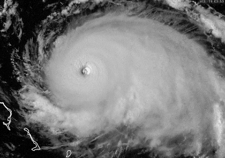
Could be the light form the time of day but looks like some new mesos are forming around the eyewall
0 likes

Re: ATL: DORIAN - Hurricane - Discussion
Blown Away wrote:https://i.imgur.com/BN5MvlF.gif
Back to due W @270, was a hair N of W most of day... Riding the N side of 26N...
Its done that twice before, gained no latitude between 3 hr observations, the first time after gaining .5 degrees the second time after just .2 so we will be due for another jog wnw. With the slower average forward speed it might not be very noticeable.
0 likes
-
storm_in_a_teacup

- Category 2

- Posts: 500
- Age: 33
- Joined: Wed Aug 16, 2017 5:01 pm
- Location: Huntsville, Alabama (originally from Houston)
- Contact:
Re: ATL: DORIAN - Hurricane - Discussion
Evenstar wrote:storm_in_a_teacup wrote:Nederlander wrote:https://media.giphy.com/media/f6hKr4msnJLsRleK8X/giphy.gif
This is literally... The Picture of Dorian [in] Grey.
...okay I will see myself out now.
Bravo. I've been trying to come up with a way to work that into the conversation (meaning The Portrait of Dorian Grey), but you beat me to it AND it was funny.
I saw someone say this on Tumblr so don’t be too impressed with me.
(Perhaps The Potrait of Dorian [in] Cold Medium Gray?)
Last edited by storm_in_a_teacup on Sat Aug 31, 2019 5:43 pm, edited 1 time in total.
3 likes
I know I can't straddle the atmosphere...just a tiny storm in your teacup, girl.


Re: ATL: DORIAN - Hurricane - Discussion
Eric Webb just pointed out something on Twitter that I also learned recently: operational models do not initialize “fresh” every time from observations. They are a compromise between new observations and the previous forecast, i.e the 18z GFS = 12z GFS + obs between 12z and 18z (roughly). So adjustments due to new obs should be immediately evident in a new run, but may take several cycles to reach their full effect.
1 likes
-
HurricaneFrances04
- Category 2
- Posts: 597
- Joined: Mon Jun 25, 2012 8:09 am
- Location: Fort Lauderdale, Florida
Re: ATL: DORIAN - Hurricane - Discussion
Western eye wall is becoming visible on radar - http://smartmet.bahamasweather.org.bs/radarcomposite/
1 likes
-
JtSmarts

- S2K Supporter
- Posts: 1442
- Age: 40
- Joined: Thu Jul 10, 2003 1:29 pm
- Location: Columbia, South Carolina
Re: ATL: DORIAN - Hurricane - Discussion
I've been watching the evolution of Dorian's size and comparing it to other notable hurricanes of past. According to the latest NHC advisory, Dorian's H-winds extend 30 miles from the center and ts winds extend 105 miles from the center. The best comparisons right now are Andrew while he was between South Florida and the Bahamas, and Charley (2004) near landfall in Punta Gorda. Both had similar wind field expansion.
https://www.nhc.noaa.gov/archive/2004/p ... .018.shtml?
https://www.nhc.noaa.gov/archive/storm_ ... al0492.031
https://www.nhc.noaa.gov/archive/2004/p ... .018.shtml?
https://www.nhc.noaa.gov/archive/storm_ ... al0492.031
0 likes
-
Aric Dunn
- Category 5
- Posts: 21238
- Age: 43
- Joined: Sun Sep 19, 2004 9:58 pm
- Location: Ready for the Chase.
- Contact:
Re: ATL: DORIAN - Hurricane - Discussion
And the real story with the steering ...

8 likes
Note: If I make a post that is brief. Please refer back to previous posts for the analysis or reasoning. I do not re-write/qoute what my initial post said each time.
If there is nothing before... then just ask
Space & Atmospheric Physicist, Embry-Riddle Aeronautical University,
I believe the sky is falling...
If there is nothing before... then just ask
Space & Atmospheric Physicist, Embry-Riddle Aeronautical University,
I believe the sky is falling...
-
tolakram
- Admin

- Posts: 20185
- Age: 62
- Joined: Sun Aug 27, 2006 8:23 pm
- Location: Florence, KY (name is Mark)
Re: ATL: DORIAN - Hurricane - Discussion
Dorian over on Mesoscale1 now. Here's some links.
visible
https://rammb-slider.cira.colostate.edu/?sat=goes-16&z=2&im=12&ts=1&st=0&et=0&speed=130&motion=loop&map=1&lat=0&opacity%5B0%5D=1&hidden%5B0%5D=0&pause=0&slider=-1&hide_controls=0&mouse_draw=0&follow_feature=0&follow_hide=0&s=rammb-slider&sec=mesoscale_01&p%5B0%5D=band_02&x=1045&y=984.5
IR
https://rammb-slider.cira.colostate.edu/?sat=goes-16&z=1&im=12&ts=1&st=0&et=0&speed=130&motion=loop&map=1&lat=0&opacity%5B0%5D=1&hidden%5B0%5D=0&pause=0&slider=-1&hide_controls=0&mouse_draw=0&follow_feature=0&follow_hide=0&s=rammb-slider&sec=mesoscale_01&p%5B0%5D=band_13&x=1017&y=1021
2 likes
M a r k
- - - - -
Join us in chat: Storm2K Chatroom Invite. Android and IOS apps also available.
The posts in this forum are NOT official forecasts and should not be used as such. Posts are NOT endorsed by any professional institution or STORM2K.org. For official information and forecasts, please refer to NHC and NWS products.

Re: ATL: DORIAN - Hurricane - Discussion
Just because they say it’s going to turn. Doesn’t mean it will.
Sent from my iPad using Tapatalk
Sent from my iPad using Tapatalk
2 likes
Re: ATL: DORIAN - Hurricane - Discussion
Just finished a day down in the Crescent Beach/Marineland/Flagler Beach area (NE Florida)
It’s dead, especially for Labor Day weekend. Virtually no one is here.
Lots of boarded up windows.
To me it looks like people are taking this seriously thank god.
It’s dead, especially for Labor Day weekend. Virtually no one is here.
Lots of boarded up windows.
To me it looks like people are taking this seriously thank god.
2 likes
Who is online
Users browsing this forum: No registered users and 8 guests