igoldfish wrote:Hey All, faithful lurker here.
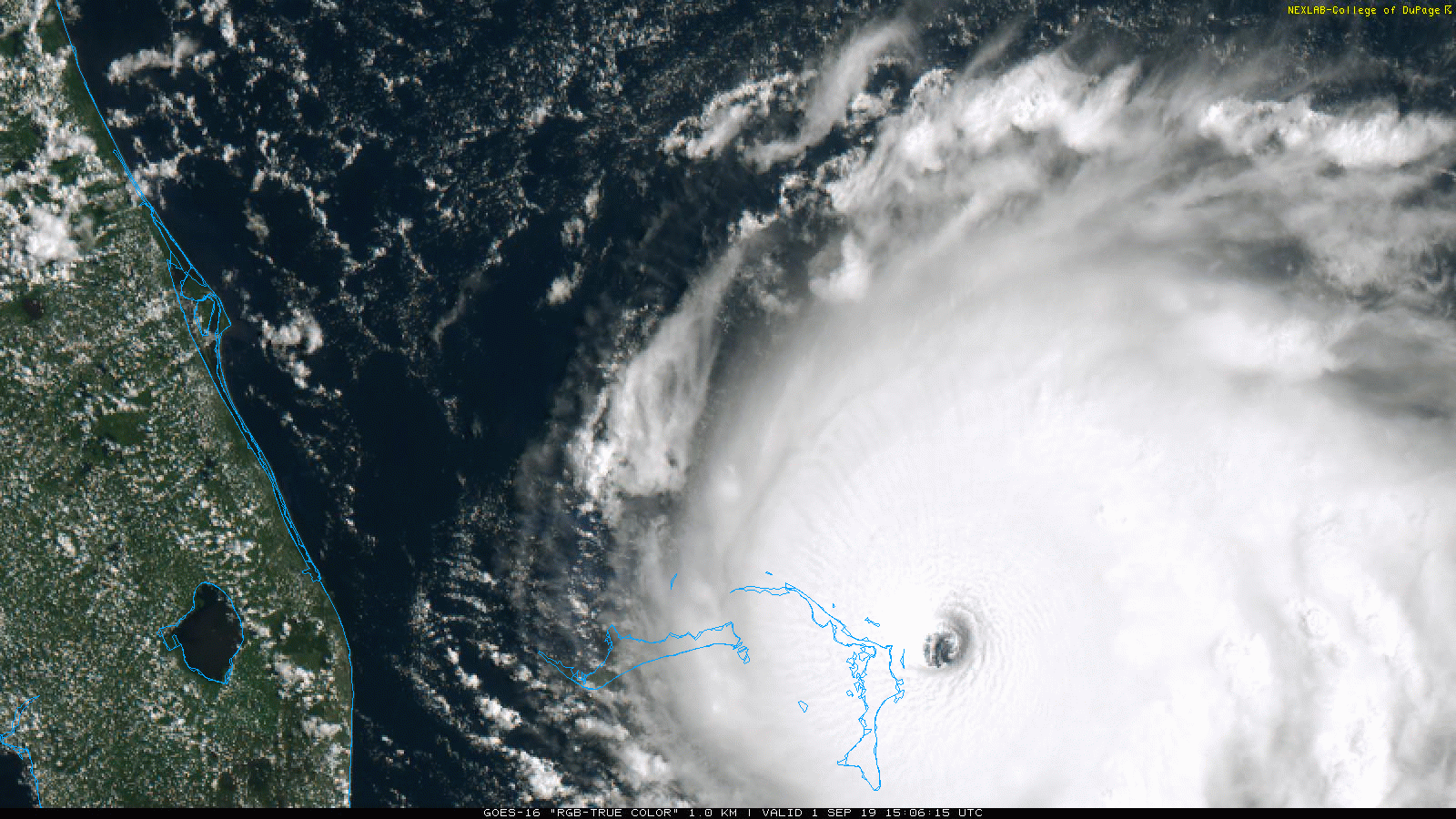
I'm in Ft Myers, inside of Sanibel Island, in a flood zone. Haven't seen any mention of what to expect for the SW Fl Coast. Given current conditions, is there any chance Dorian will come across the peninsula before heading north or go out into the Gulf? My home can take a possible Cat 2. Some of the latest spaghetti models are making me nervous again.
And thank you all for your good work. It was only because of some some, last minute, courageous forecasting that many of us survived Hurricane Charley.
That's where I am too 300 yards from the beach in an A Zone...The town announced that they were dropping any hurricane watches yesterday and did not expect it to come here...
I myself am staying because Dorian's eye is due East of us right now on the same latitude and with the National Hurricane Center saying it is almost certainly going to turn north we should be OK...
If this current cyclone tracked over Sanibel from the Keys it would be guaranteed to smash my house to splinters and send 20 feet of surge across the island...
The posts in this forum are NOT official forecast and should not be used as such. They are just the opinion of the poster and may or may not be backed by sound meteorological data. They are NOT endorsed by any professional institution or STORM2K. For official information, please refer to products from the National Hurricane Center and National Weather Service.


