ATL: DORIAN - Post-Tropical - Discussion

Moderator: S2k Moderators

Message
Author
User avatar
DestinHurricane
Category 4
Category 4
Posts: 935
Joined: Tue May 01, 2018 8:05 am
Location: New York, NY

Re: ATL: DORIAN - Hurricane - Discussion

#7461 Postby DestinHurricane » Mon Sep 02, 2019 2:39 pm

Image

Will West End even exist after this is all said and done?
0 likes   
Michael 2018

User avatar
wxman57
Moderator-Pro Met
Moderator-Pro Met
Posts: 22984
Age: 67
Joined: Sat Jun 21, 2003 8:06 pm
Location: Houston, TX (southwest)

Re: ATL: DORIAN - Hurricane - Discussion

#7462 Postby wxman57 » Mon Sep 02, 2019 2:39 pm

CrazyC83 wrote:
wxman57 wrote:Looks like it's down to a Cat 3 now. Not even 105 kts in the NE quadrant. I would think it has churned up lots of cooler water over the past 24 hours.


That is likely, along with land interaction. I'd probably go with 105 kt for the current intensity - make no mistake though, it's still an extremely dangerous storm, and much larger. The SFMR is useless while it's near land.


I'm not measuring much difference in size on my workstation as far as the core. There are some spiral bands extending out farther, but the wind field is still below-average in size.
2 likes   

CrazyC83
Professional-Met
Professional-Met
Posts: 34002
Joined: Tue Mar 07, 2006 11:57 pm
Location: Deep South, for the first time!

Re: ATL: DORIAN - Hurricane - Discussion

#7463 Postby CrazyC83 » Mon Sep 02, 2019 2:42 pm

wxman57 wrote:
CrazyC83 wrote:
wxman57 wrote:Looks like it's down to a Cat 3 now. Not even 105 kts in the NE quadrant. I would think it has churned up lots of cooler water over the past 24 hours.


That is likely, along with land interaction. I'd probably go with 105 kt for the current intensity - make no mistake though, it's still an extremely dangerous storm, and much larger. The SFMR is useless while it's near land.


I'm not measuring much difference in size on my workstation as far as the core. There are some spiral bands extending out farther, but the wind field is still below-average in size.


The RMW is about twice the size it was before it hit Abaco and I think the hurricane wind field is larger too.
4 likes   

hipshot
Category 2
Category 2
Posts: 591
Joined: Tue Jul 06, 2010 9:18 pm
Location: Dallas, Texas

Re: ATL: DORIAN - Hurricane - Discussion

#7464 Postby hipshot » Mon Sep 02, 2019 2:51 pm

Smurfwicked wrote:IR presentation looking better over past couple hours. Looks like a NNE wobble at the end of the loop.

https://weather.cod.edu/satrad/?parms=s ... =undefined

Must be a wobble because it looks almost stationary to me.
1 likes   

Rail Dawg
S2K Supporter
S2K Supporter
Posts: 326
Joined: Mon Aug 27, 2012 5:02 pm
Location: Where the eye makes landfall.

Re: ATL: DORIAN - Hurricane - Discussion

#7465 Postby Rail Dawg » Mon Sep 02, 2019 2:51 pm

Guys this may not be the time nor the place but I just clicked on the "Donate Now" PayPal button and sent Storm2k some bucks.

This site is incredible and is the best place to catch up-to-the-minute updates.

It's worth a donation to those who work so hard for us.

Mods if I'm out of line delete away!

Thanks.

Chuck
21 likes   
Although I have been a hurricane forecaster since 1980 that only means I've been wrong lots of times.

User avatar
ronjon
Category 5
Category 5
Posts: 4824
Joined: Fri Aug 19, 2005 5:17 pm
Location: Hernando Beach, FL

Re: ATL: DORIAN - Hurricane - Discussion

#7466 Postby ronjon » Mon Sep 02, 2019 2:54 pm

Just had our first squall come in from the north here in Hernando Beach on the west coast. Enhanced no doubt from daytime heating but had a 40 mph gust. Enough to move patio furniture on the outside deck. Picked up a quick 0.3 inch of rain.
2 likes   

User avatar
Jr0d
S2K Supporter
S2K Supporter
Posts: 1409
Joined: Tue Aug 27, 2019 10:52 am
Location: Cayo Hueso

Re: ATL: DORIAN - Hurricane - Discussion

#7467 Postby Jr0d » Mon Sep 02, 2019 2:56 pm

plasticup wrote:
Jr0d wrote:


I cant imagine a worse case scenario for Grand Bahama.

Quite a few sailors in Key West are hoping to bring boats full of relief supplies plus man power as soon as weather permits.

Anyone planning to do this ought to coordinate with local authorities. Those sorts of efforts, while well-intentioned, often create as many problems as they solve.

Those involved know the Bahamas and the affected areas well.
1 likes   

User avatar
tronbunny
S2K Supporter
S2K Supporter
Posts: 1558
Joined: Wed Sep 01, 2004 1:18 am
Location: Central FL

Re: ATL: DORIAN - Hurricane - Discussion

#7468 Postby tronbunny » Mon Sep 02, 2019 2:59 pm

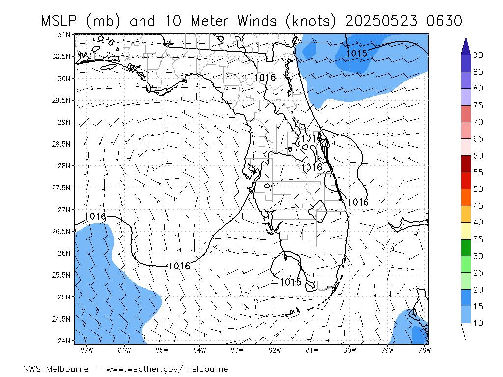
This is only surface level pressures. How might these data help?
Image
1 likes   

User avatar
wxman57
Moderator-Pro Met
Moderator-Pro Met
Posts: 22984
Age: 67
Joined: Sat Jun 21, 2003 8:06 pm
Location: Houston, TX (southwest)

Re: ATL: DORIAN - Hurricane - Discussion

#7469 Postby wxman57 » Mon Sep 02, 2019 2:59 pm

CrazyC83 wrote:
wxman57 wrote:
CrazyC83 wrote:
That is likely, along with land interaction. I'd probably go with 105 kt for the current intensity - make no mistake though, it's still an extremely dangerous storm, and much larger. The SFMR is useless while it's near land.


I'm not measuring much difference in size on my workstation as far as the core. There are some spiral bands extending out farther, but the wind field is still below-average in size.


The RMW is about twice the size it was before it hit Abaco and I think the hurricane wind field is larger too.


Twice the size would still be below average. It was a small hurricane. Not quite as small as Charley, but small. I see the NHC update still lists 125 kt winds, about the highest speed measured so far by the plane at flight level. NHC won't indicate significant weakening so that FL residents don't relax.
1 likes   

User avatar
sbcc
S2K Supporter
S2K Supporter
Posts: 206
Joined: Mon Sep 08, 2008 11:07 pm

Re: ATL: DORIAN - Hurricane - Discussion

#7470 Postby sbcc » Mon Sep 02, 2019 3:00 pm

Rail Dawg wrote:Guys this may not be the time nor the place but I just clicked on the "Donate Now" PayPal button and sent Storm2k some bucks.

This site is incredible and is the best place to catch up-to-the-minute updates.

It's worth a donation to those who work so hard for us.

Mods if I'm out of line delete away!

Thanks.

Chuck


  Help support Storm2K!
Help Support Storm2K


Here's the magic button, fellow S2K'ers. Thanks for the reminder, RailDawg. Donation inbound.
4 likes   

User avatar
tropicwatch
Category 5
Category 5
Posts: 3391
Age: 61
Joined: Sat Jun 02, 2007 10:01 am
Location: Panama City Florida
Contact:

Re: ATL: DORIAN - Hurricane - Discussion

#7471 Postby tropicwatch » Mon Sep 02, 2019 3:02 pm

Looks like it is just sitting there with its thumb out trying to hitch a ride. 8-)
4 likes   
Tropicwatch


Agnes 72', Eloise 75, Elena 85', Kate 85', Charley 86', Florence 88', Beryl 94', Dean 95', Erin 95', Opal 95', Earl 98', Georges 98', Ivan 2004', Arlene 2005', Dennis 2005', Ida 2009' Debby 2012' Irma 2017' Michael 2018'

User avatar
TheDreamTraveler
Category 2
Category 2
Posts: 641
Joined: Sun Aug 22, 2010 3:10 am
Location: PA

Re: ATL: DORIAN - Hurricane - Discussion

#7472 Postby TheDreamTraveler » Mon Sep 02, 2019 3:10 pm

A florida landfall still can't be completely ruled out but it's not looking very likely at this point. It's just insane how close this came. Any little tiny changes could have changed the entire outcome of this. Obviously now we need to start worrying about how this impacts North Carolina now.
6 likes   

Ronel2020
Tropical Low
Tropical Low
Posts: 10
Joined: Sun Sep 10, 2017 7:54 am

Re: ATL: DORIAN - Hurricane - Discussion

#7473 Postby Ronel2020 » Mon Sep 02, 2019 3:15 pm

The closest weather station (a NOAA C-MAN station - https://www.ndbc.noaa.gov/station_page.php?station=spgf1 does not show hurricane force winds. It is possible that it went under water, but the anemometer is approx. 25' above sea level. The station is very close to the eye. Why does it not show hurricane force winds?
0 likes   

User avatar
gatorcane
S2K Supporter
S2K Supporter
Posts: 23692
Age: 47
Joined: Sun Mar 13, 2005 3:54 pm
Location: Boca Raton, FL

Re: ATL: DORIAN - Hurricane - Discussion

#7474 Postby gatorcane » Mon Sep 02, 2019 3:23 pm

It really looked like Florida was going to take a direct hit from a major hurricane either Central or South Florida. Just 4 days out models showed this. The question was Central or South Florida. Even folks on TWC gave recurve east of Florida a low probability outcome. Fast-forward a few days and the track looks a lot different. Still a chance Dorian landfalls or gets close enough to cause major issues for Central and North Florida but the trend is looking better today with the models, As we can see there is a reason why the Florida east coast from Stuart north has not seen a major hurricane landfall on record. The coastline is from SSE to NNW. It takes the perfect setup and all stars need to align. Everything was there but the ridge was just a bit too weak. One thing that is not so comforting - the waters off of South Florida have just shown they can support a monster with the right conditions. All of us in South Florida can breathe a sigh of relief but the question remains when it will be our turn and the luck run out?
Last edited by gatorcane on Mon Sep 02, 2019 3:25 pm, edited 1 time in total.
4 likes   

User avatar
AdamFirst
S2K Supporter
S2K Supporter
Posts: 2491
Age: 36
Joined: Thu Aug 14, 2008 10:54 am
Location: Port Saint Lucie, FL

Re: ATL: DORIAN - Hurricane - Discussion

#7475 Postby AdamFirst » Mon Sep 02, 2019 3:24 pm

Florida has yet to "luck out" on anything...

Tired of these all clear posts when the storm hasn't even cleared the state.
19 likes   
Dolphins Marlins Canes Golden Panthers HEAT
Andrew 1992 - Irene 1999 - Frances 2004 - Jeanne 2004 - Wilma 2005 - Fay 2008 - Isaac 2012 - Matthew 2016 - Irma 2017 - Dorian 2019 - Ian 2022 - Nicole 2022 - Milton 2024

sikkar
Category 1
Category 1
Posts: 326
Joined: Sun Aug 26, 2012 1:44 am
Location: Florida

Re: ATL: DORIAN - Hurricane - Discussion

#7476 Postby sikkar » Mon Sep 02, 2019 3:25 pm

Is that a bigger eye forming on radar or just a dry slot?
3 likes   
Personal Forecast Disclaimer:
The posts in this forum are NOT official forecast and should not be used as such. They are just the opinion of the poster and may or may not be backed by sound meteorological data. For official information, please refer to the NHC and NWS products.

User avatar
Blown Away
S2K Supporter
S2K Supporter
Posts: 10152
Joined: Wed May 26, 2004 6:17 am

Re: ATL: DORIAN - Hurricane - Discussion

#7477 Postby Blown Away » Mon Sep 02, 2019 3:27 pm

wxman57 wrote:Looks like it's down to a Cat 3 now. Not even 105 kts in the NE quadrant. I would think it has churned up lots of cooler water over the past 24 hours.


This extended stalling and missing NHC pointsshould keep Dorian farther off Fl coast??
1 likes   
Hurricane Eye Experience: David 79, Irene 99, Frances 04, Jeanne 04, Wilma 05... EYE COMING MY WAY IN 2024…
Hurricane Brush Experience: Andrew 92, Erin 95, Floyd 99, Matthew 16, Irma 17, Ian 22, Nicole 22…

bigGbear
Tropical Depression
Tropical Depression
Posts: 62
Joined: Wed Aug 01, 2007 8:24 pm

Re: ATL: DORIAN - Hurricane - Discussion

#7478 Postby bigGbear » Mon Sep 02, 2019 3:27 pm

Eye has been very irregular - is this an ERC?
2 likes   

User avatar
HDGator
S2K Supporter
S2K Supporter
Posts: 242
Joined: Fri Sep 17, 2004 3:03 pm
Location: Lewisville, NC

Re: ATL: DORIAN - Hurricane - Discussion

#7479 Postby HDGator » Mon Sep 02, 2019 3:35 pm

sikkar wrote:Is that a bigger eye forming on radar or just a dry slot?

Inner eyewall not looking so hot on doppler right now.
0 likes   
Personal Forecast Disclaimer:
The posts in this forum are NOT official forecast and should not be used as such. They are just the opinion of the poster and may or may not be backed by sound meteorological data. They are NOT endorsed by any professional institution or storm2k.org. For official information, please refer to the NHC and NWS products.

O Town
S2K Supporter
S2K Supporter
Posts: 5205
Age: 52
Joined: Wed Sep 07, 2005 9:37 pm
Location: Orlando, Florida 28°35'35"N 81°22'55"W

Re: ATL: DORIAN - Hurricane - Discussion

#7480 Postby O Town » Mon Sep 02, 2019 3:35 pm

wxman57 wrote:Looks like it's down to a Cat 3 now. Not even 105 kts in the NE quadrant. I would think it has churned up lots of cooler water over the past 24 hours.

Wouldn’t that allow for slightly more westerly movement? It being weaker.
Would this be the correct steering map at that intensity?

Image
1 likes   

#ORLANDOSTRONG


Return to “2019”

Who is online

Users browsing this forum: No registered users and 1 guest