EP, 10, 2019082112, , BEST, 0, 152N, 1065W, 30, 1007, DB, 34, NEQ, 0, 0, 0, 0, 1010, 180, 60, 0, 0, E, 0, , 0, 0, TEN, M, 0, , 0, 0, 0, 0, genesis-num, 023, TRANSITIONED, epB52019 to ep102019,
EPAC: IVO - Remnants
Moderator: S2k Moderators
-
Nancy Smar

- Category 5

- Posts: 1081
- Age: 23
- Joined: Wed Aug 16, 2017 10:03 pm
-
Yellow Evan

- Professional-Met

- Posts: 15952
- Age: 25
- Joined: Fri Jul 15, 2011 12:48 pm
- Location: Henderson, Nevada/Honolulu, HI
- Contact:
Re: EPAC: TEN-E - Tropical Depression
* EAST PACIFIC 2019 SHIPS INTENSITY FORECAST *
* IR SAT DATA AVAILABLE, OHC AVAILABLE *
* INVEST EP952019 08/21/19 12 UTC *
TIME (HR) 0 6 12 18 24 36 48 60 72 84 96 108 120
V (KT) NO LAND 30 35 41 47 54 64 69 68 67 60 53 45 35
V (KT) LAND 30 35 41 47 54 64 69 68 67 60 53 45 35
V (KT) LGEM 30 33 37 41 46 53 56 54 49 43 37 30 23
Storm Type TROP TROP TROP TROP TROP TROP TROP TROP TROP TROP TROP TROP TROP
SHEAR (KT) 13 11 13 17 19 17 17 10 7 9 10 17 18
SHEAR ADJ (KT) -1 -2 -2 0 1 5 7 2 1 0 0 1 3
SHEAR DIR 34 38 61 42 39 42 45 65 77 176 202 170 170
SST (C) 30.2 29.7 29.9 29.9 29.7 29.3 28.6 27.0 26.0 24.9 22.9 21.2 20.2
POT. INT. (KT) 169 163 165 165 163 158 150 133 122 112 91 73 62
200 MB T (C) -52.5 -52.1 -51.6 -51.8 -51.7 -50.9 -51.4 -51.1 -51.7 -51.6 -51.9 -51.7 -51.6
200 MB VXT (C) 0.4 0.4 0.4 0.6 0.6 0.5 0.6 0.5 0.9 0.8 0.9 0.8 0.5
TH_E DEV (C) 6 7 7 6 6 5 4 3 2 1 0 0 0
700-500 MB RH 80 76 76 73 73 72 68 64 64 63 62 57 50
MODEL VTX (KT) 13 16 19 20 21 25 24 23 24 21 19 16 13
850 MB ENV VOR 81 88 105 106 90 81 76 54 26 6 -22 -8 -12
200 MB DIV 86 76 81 62 45 32 24 13 -19 -29 -23 -2 -5
700-850 TADV -10 -10 -9 -12 -7 -8 -10 0 -4 1 0 0 -4
LAND (KM) 478 517 585 654 677 685 691 625 595 555 445 458 591
LAT (DEG N) 15.2 xx.x xx.x xx.x xx.x xx.x xx.x xx.x xx.x xx.x xx.x xx.x xx.x
LONG(DEG W) 106.5 xxx.x xxx.x xxx.x xxx.x xxx.x xxx.x xxx.x xxx.x xxx.x xxx.x xxx.x xxx.x
STM SPEED (KT) 15 14 13 13 12 9 8 7 7 10 11 8 8
HEAT CONTENT 29 22 21 21 19 18 12 3 0 0 0 0 0
FORECAST TRACK FROM OFPI INITIAL HEADING/SPEED (DEG/KT):280/ 16 CX,CY: -15/ 3
T-12 MAX WIND: 25 PRESSURE OF STEERING LEVEL (MB): 427 (MEAN=587)
GOES IR BRIGHTNESS TEMP. STD DEV. 50-200 KM RAD: 16.1 (MEAN=14.5)
% GOES IR PIXELS WITH T < -20 C 50-200 KM RAD: 88.0 (MEAN=65.0)
PRELIM RI PROB (DV .GE. 35 KT IN 36 HR): 41.9
INDIVIDUAL CONTRIBUTIONS TO INTENSITY CHANGE
6 12 18 24 36 48 60 72 84 96 108 120
----------------------------------------------------------
SAMPLE MEAN CHANGE 0. 0. 1. 1. 1. 2. 1. 1. 1. 0. -1. -1.
SST POTENTIAL 0. -1. -1. 1. 5. 11. 17. 22. 25. 26. 25. 22.
VERTICAL SHEAR MAG 1. 1. 2. 2. 2. 1. 0. -2. -2. -3. -4. -5.
VERTICAL SHEAR ADJ 0. 0. 1. 1. 0. -1. -1. -1. 0. 0. 0. 0.
VERTICAL SHEAR DIR 0. 1. 1. 1. 2. 2. 2. 1. 1. 1. 1. 0.
PERSISTENCE 1. 1. 1. 1. 1. 1. 1. 1. 1. 1. 1. 1.
200/250 MB TEMP. 0. 0. 0. -1. -1. -1. -1. -1. 0. 1. 1. 2.
THETA_E EXCESS 0. 0. 0. 0. 0. -1. -2. -3. -5. -6. -7. -8.
700-500 MB RH 0. 0. 0. 1. 1. 1. 1. 1. 1. 1. 1. 1.
MODEL VTX TENDENCY 1. 3. 4. 6. 8. 10. 11. 14. 11. 8. 4. -1.
850 MB ENV VORTICITY 0. 0. 0. 0. 0. 0. -1. -1. -1. -1. -1. -1.
200 MB DIVERGENCE 0. 0. 1. 1. 1. 1. 1. 0. -1. -2. -2. -2.
850-700 T ADVEC 0. 0. 0. 0. 0. 0. 0. 0. 0. 0. 0. 0.
ZONAL STORM MOTION 0. 1. 1. 1. 2. 3. 4. 3. 2. 2. 2. 2.
STEERING LEVEL PRES 0. 0. -1. -1. -2. -2. -2. -3. -3. -3. -3. -3.
DAYS FROM CLIM. PEAK 0. 0. 0. 0. 0. 1. 1. 1. 2. 2. 2. 3.
GOES PREDICTORS 1. 2. 2. 2. 2. 1. 1. 1. 1. 1. 1. 1.
OCEAN HEAT CONTENT 0. 0. 0. 0. 0. 0. 0. 0. 0. 0. 0. 0.
RI POTENTIAL 1. 3. 5. 7. 11. 10. 6. 1. -1. -3. -5. -6.
----------------------------------------------------------
TOTAL CHANGE 5. 11. 17. 24. 34. 39. 38. 37. 30. 23. 15. 5.
CURRENT MAX WIND (KT): 30. LAT, LON: 15.2 106.5
** 2019 E. Pacific RI INDEX EP952019 INVEST 08/21/19 12 UTC **
(SHIPS-RII PREDICTOR TABLE for 30 KT OR MORE MAXIMUM WIND INCREASE IN NEXT 24-h)
Predictor Value RI Predictor Range Scaled Value(0-1) % Contribution
POT = MPI-VMAX (KT) : 135.1 40.5 to 149.3 0.87 5.5
12 HR PERSISTENCE (KT) : 5.0 -22.0 to 44.0 0.41 3.8
850-200 MB SHEAR (KT) : 14.8 19.6 to 1.6 0.27 2.1
D200 (10**7s-1) : 70.0 -33.0 to 156.2 0.54 3.4
MAXIMUM WIND (KT) : 30.0 22.5 to 132.0 0.21 1.3
HEAT CONTENT (KJ/CM2) : 22.4 2.7 to 106.7 0.19 0.9
STD DEV OF IR BR TEMP : 16.1 37.8 to 2.1 0.61 3.3
BL DRY-AIR FLUX (W/M2) : 59.0 800.8 to -82.5 0.84 0.0
2nd PC OF IR BR TEMP : -0.9 2.2 to -1.9 0.75 0.5
%area of TPW <45 mm upshear : 0.0 62.3 to 0.0 1.00 -0.2
SHIPS Prob RI for 20kt/ 12hr RI threshold= 12% is 2.0 times climatological mean ( 6.1%)
SHIPS Prob RI for 25kt/ 24hr RI threshold= 24% is 1.9 times climatological mean (12.5%)
SHIPS Prob RI for 30kt/ 24hr RI threshold= 21% is 2.5 times climatological mean ( 8.4%)
SHIPS Prob RI for 35kt/ 24hr RI threshold= 16% is 2.6 times climatological mean ( 6.0%)
SHIPS Prob RI for 40kt/ 24hr RI threshold= 0% is 0.0 times climatological mean ( 4.0%)
SHIPS Prob RI for 45kt/ 36hr RI threshold= 18% is 2.8 times climatological mean ( 6.5%)
SHIPS Prob RI for 55kt/ 48hr RI threshold= 19% is 3.2 times climatological mean ( 5.9%)
SHIPS Prob RI for 65kt/ 72hr RI threshold= 11% is 2.2 times climatological mean ( 4.8%)
Matrix of RI probabilities
------------------------------------------------------------------------------
RI (kt / h) | 20/12 | 25/24 | 30/24 | 35/24 | 40/24 | 45/36 | 55/48 |65/72
------------------------------------------------------------------------------
SHIPS-RII: 12.1% 23.7% 20.6% 15.7% 0.0% 18.4% 18.8% 10.5%
Logistic: 5.5% 24.7% 9.5% 4.9% 3.2% 9.8% 12.6% 5.8%
Bayesian: 2.0% 6.4% 1.8% 0.3% 0.1% 1.2% 0.4% 0.1%
Consensus: 6.5% 18.3% 10.6% 7.0% 1.1% 9.8% 10.6% 5.5%
DTOPS: 5.0% 31.0% 20.0% 14.0% 5.0% 19.0% 18.0% 6.0%
## ANNULAR HURRICANE INDEX (AHI) EP952019 INVEST 08/21/19 12 UTC ##
## STORM NOT ANNULAR, SCREENING STEP FAILED, NPASS=3 NFAIL=4 ##
## AHI= 0 (AHI OF 100 IS BEST FIT TO ANN. STRUC., 1 IS MARGINAL, 0 IS NOT ANNULAR) ##
0 likes
-
cycloneye

- Admin

- Posts: 139081
- Age: 67
- Joined: Thu Oct 10, 2002 10:54 am
- Location: San Juan, Puerto Rico
Re: EPAC: TEN-E - Tropical Depression
Tropical Depression Ten-E Discussion Number 1
NWS National Hurricane Center Miami FL EP102019
900 AM MDT Wed Aug 21 2019
Satellite imagery and microwave data indicate that the disturbance
that has been tracked to the south of Mexico for the past several
days has become much better organized since yesterday. An early
morning scatterometer pass showed a nearly closed surface low with
peak winds of 30 kt. Since that time, the appearance of the
disturbance has continued to improve, suggesting that the low has
most likely closed at the surface. Based on this data, advisories
are being initiated for Tropical Depression 10-E. Subjective Dvorak
estimates from both TAFB and SAB suggest a 30 kt intensity, which
will be the initial intensity for this advisory.
The depression's initial motion is 285/16 kt. The cyclone is being
steered to the south of a mid-level ridge that extends from
northwestern Mexico across much of the eastern Pacific. Model
guidance is in good agreement that a weakness will develop in this
ridge over the next day or so to the northwest of the depression.
This should cause the system to make a turn to the northwest with a
decrease in forward speed in about 24 hours. The depression is
then forecast to continue to move northwest through the remainder
of the forecast period.
The cyclone is expected to move over very warm waters of around 30
C, through a moist environment, and with 10-15 kt of northeasterly
shear over the next 48 hours. With these conditions, steady
strengthening is forecast during that time frame, and the depression
is expected to become a tropical storm later today, and a minimal
hurricane in 48 hours. The official forecast is close to the
model intensity guidance consensus through 24 hours, and is then on
the higher end of the guidance from 24 to 72 hours out of respect
for a possible decrease in shear. In a few days the cyclone will
move over much cooler waters and into a stable air mass while
undergoing increasing shear. This will cause the cyclone to weaken
and it is expected to become a convection-free post-tropical
cyclone by day 5.
FORECAST POSITIONS AND MAX WINDS
INIT 21/1500Z 15.4N 107.3W 30 KT 35 MPH
12H 22/0000Z 15.9N 109.6W 40 KT 45 MPH
24H 22/1200Z 16.6N 112.0W 50 KT 60 MPH
36H 23/0000Z 17.5N 114.0W 60 KT 70 MPH
48H 23/1200Z 18.5N 115.4W 65 KT 75 MPH
72H 24/1200Z 21.0N 117.1W 60 KT 70 MPH
96H 25/1200Z 24.4N 118.7W 45 KT 50 MPH
120H 26/1200Z 27.6N 120.9W 35 KT 40 MPH...POST-TROPICAL
$$
Forecaster Latto/Pasch
0 likes
Visit the Caribbean-Central America Weather Thread where you can find at first post web cams,radars
and observations from Caribbean basin members Click Here
and observations from Caribbean basin members Click Here


Re: EPAC: TEN-E - Tropical Depression
A. 10E (NONAME)
B. 21/1800Z
C. 15.5N
D. 108.8W
E. THREE/GOES-W
F. T3.0/3.0/D1.5/24HRS
G. IR/EIR/VIS/WINDSAT
H. REMARKS...RECENT MICROWAVE DATA INCLUDING 1616Z GMI DATA SHOW TIGHTLY
WRAPPED CURVED BANDING. 6/10 BANDING IN VISIBLE IMAGERY RESULTS IN A DT
OF 3.0. PT AGREES WHILE MET IS 2.5. FT IS BASED ON DT.
I. ADDL POSITIONS
21/1334Z 15.8N 107.5W WINDSAT
0 likes
-
Yellow Evan
- Professional-Met
- Posts: 15952
- Age: 25
- Joined: Fri Jul 15, 2011 12:48 pm
- Location: Henderson, Nevada/Honolulu, HI
- Contact:
-
Yellow Evan
- Professional-Met
- Posts: 15952
- Age: 25
- Joined: Fri Jul 15, 2011 12:48 pm
- Location: Henderson, Nevada/Honolulu, HI
- Contact:
Re: EPAC: TEN-E - Tropical Depression
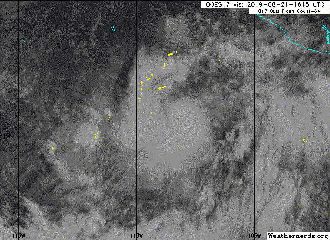
I'm still somewhat concerned about shear and was a little surprised to see a hurricane forecast when I woke up. This has about 60 hours left to deepen (basically until Friday night), but moderate wind shear could be a hindrance, suggested by CMISS and SHIPS respectively, as it's been for recent systems. Still, this looks great today, and wind shear is likely to relax in a day or so. If this can get an inner core together fairly soon, this could get stronger than I initially expected.
2 likes
-
Yellow Evan
- Professional-Met
- Posts: 15952
- Age: 25
- Joined: Fri Jul 15, 2011 12:48 pm
- Location: Henderson, Nevada/Honolulu, HI
- Contact:
Re: EPAC: TEN-E - Tropical Depression
EP, 10, 2019082118, , BEST, 0, 156N, 1088W, 40, 1004, TS, 34, NEQ, 30, 0, 0, 30, 1010, 200, 30, 0, 0, E, 0, , 0, 0, TEN, M, 0, , 0, 0, 0, 0, genesis-num, 023,
0 likes
-
Sciencerocks
- Category 5
- Posts: 7286
- Age: 38
- Joined: Thu Jul 06, 2017 1:51 am
-
SconnieCane
- Category 4

- Posts: 913
- Joined: Thu Aug 02, 2018 5:29 pm
- Location: Madison, WI
-
AnnularCane

- S2K Supporter

- Posts: 2634
- Joined: Thu Jun 08, 2006 9:18 am
- Location: Wytheville, VA
Re: EPAC: TEN-E - Tropical Depression
SconnieCane wrote::uarrow: Looks way more TC-like than C******.
Hey, no dissing Chantal!
4 likes
-
cycloneye
- Admin
- Posts: 139081
- Age: 67
- Joined: Thu Oct 10, 2002 10:54 am
- Location: San Juan, Puerto Rico
Re: EPAC: IVO - Tropical Storm
Tropical Storm Ivo Discussion Number 2
NWS National Hurricane Center Miami FL EP102014
300 PM MDT Wed Aug 21 2019
Over the past several hours the cyclone has exhibited an ongoing
increase in organization, with a curved band wrapping around the
low level center apparent in both satellite imagery and microwave
data. The initial intensity has been increased to 40 kt and this
is a blend of the subjective Dvorak intensity estimates from TAFB
and SAB.
Ivo's initial motion is 285/17 kt. A mid-level ridge to the north of
the cyclone will continue to steer it to the west-northwest through
much of tonight. By Thursday, a weakness is expected to develop to
the northwest of the cyclone which will result in a turn to the
northwest with a decrease in forward speed. The cyclone is then
forecast to continue to move northwest through the remainder of the
forecast period.
Ivo will be over warm SSTs near 30C and in a moist environment for
the next 48 hours, which should favor intensification. And,
although the SHIPS guidance suggests 15 kt of northeasterly shear
may be affecting the cyclone, the satellite appearance does not
suggest that this shear is having much of impact at this time. Based
on the favorable environment, steady strengthening is forecast,
and Ivo is expected to become a hurricane by Friday. By 72 hours,
the cyclone will begin to move over much cooler waters and into a
stable air mass while undergoing increasing southwesterly shear.
This should cause the cyclone to weaken and it is expected to become
a convection-free post-tropical cyclone by day 5. The official
forecast has been increased slightly from the previous one and is
close to the corrected consensus HCCA.
FORECAST POSITIONS AND MAX WINDS
INIT 21/2100Z 15.8N 109.5W 40 KT 45 MPH
12H 22/0600Z 16.4N 111.6W 50 KT 60 MPH
24H 22/1800Z 17.2N 113.8W 60 KT 70 MPH
36H 23/0600Z 18.2N 115.3W 70 KT 80 MPH
48H 23/1800Z 19.5N 116.4W 70 KT 80 MPH
72H 24/1800Z 22.5N 117.9W 55 KT 65 MPH
96H 25/1800Z 25.8N 119.9W 40 KT 45 MPH
120H 26/1800Z 28.8N 121.9W 30 KT 35 MPH...POST-TROPICAL
$$
Forecaster Latto/Pasch
0 likes
Visit the Caribbean-Central America Weather Thread where you can find at first post web cams,radars
and observations from Caribbean basin members Click Here
and observations from Caribbean basin members Click Here

Re: EPAC: TEN-E - Tropical Depression
AnnularCane wrote:SconnieCane wrote::uarrow: Looks way more TC-like than C******.
Hey, no dissing Chantal!But yes, this is a good-looking little guy. Very cute!
...until he faces Erick of course
2 likes
blonde stacey (xe/xem/xir)
-
1900hurricane

- Category 5
- Posts: 6044
- Age: 32
- Joined: Fri Feb 06, 2015 12:04 pm
- Location: Houston, TX
- Contact:
Re: EPAC: IVO - Tropical Storm
Looks like it has managed to settle in just south of the ridge shear for now.

4 likes
Contract Meteorologist. TAMU & MSST. Fiercely authentic, one of a kind. We are all given free will, so choose a life meant to be lived. We are the Masters of our own Stories.
Opinions expressed are mine alone.
Follow me on Twitter at @1900hurricane : Read blogs at https://1900hurricane.wordpress.com/
Opinions expressed are mine alone.
Follow me on Twitter at @1900hurricane : Read blogs at https://1900hurricane.wordpress.com/

Re: EPAC: IVO - Tropical Storm
Is there any way you can present a synopsis of all this data. Some or most of us don't have a clue what all of this is and does take up a lot of space. I'm
sure there is good info buried in the data but it is hard to get it out.
Thanks
sure there is good info buried in the data but it is hard to get it out.
Thanks
0 likes
-
NotSparta

- Professional-Met
- Posts: 1648
- Age: 22
- Joined: Fri Aug 18, 2017 8:24 am
- Location: Naples, FL
- Contact:
Re: EPAC: IVO - Tropical Storm
1900hurricane wrote:Looks like it has managed to settle in just south of the ridge shear for now.
https://i.imgur.com/i57hWO8.gif
Looks like an area of upper divergence/upper anticyclonic flow, which allows for less easterlies. Just south, there are shredding NElies. Ivo is in the sweet spot
2 likes
This post was probably an opinion of mine, and in no way is official. Please refer to http://www.hurricanes.gov for official tropical analysis and advisories.
My website, with lots of tropical wx graphics, including satellite and recon: http://cyclonicwx.com
My website, with lots of tropical wx graphics, including satellite and recon: http://cyclonicwx.com
-
cycloneye
- Admin
- Posts: 139081
- Age: 67
- Joined: Thu Oct 10, 2002 10:54 am
- Location: San Juan, Puerto Rico
Re: EPAC: IVO - Tropical Storm
Tropical Storm Ivo Discussion Number 3
NWS National Hurricane Center Miami FL EP102019
900 PM MDT Wed Aug 21 2019
An earlier GMI microwave overpass that arrived after the release of
the previous advisory revealed a tightly coiled band of convection
that wrapped around the southern and southeastern portion of the
circulation. More recent microwave imagery, however, shows that
the system is being impacted by northeasterly shear with the center
now located near the northeast portion of the primary convective
mass. Objective and subjective Dvorak intensity estimates
unanimously supported an intensity of 45 kt, and the initial
intensity has been increased accordingly.
Ivo is expected to remain over warm SSTs and in a moist environment
during the next 36 h or so. These conditions favor strengthening
however the aforementioned moderate northeasterly shear is likely
to temper the rate of intensification during that time. The NHC
forecast calls for steady strengthening and again brings Ivo to
hurricane status within 36 h. After that time, cooler waters and a
drier and more stable air mass should cause weakening, and Ivo is
forecast to become post-tropical by day 4. The official intensity
forecast shows a peak a little higher than most of the guidance but
otherwise is close to the model consensus.
Ivo is moving west-northwestward or 285/16 kt. The storm should
slow down later tonight or Thursday as it begins to move around the
southwestern portion of a subtropical ridge. In about 24 hours, a
weakness is expected to develop in the ridge which is expected to
cause Ivo to turn northwestward. A general northwestward motion
should then continue through the remainder of the forecast period.
An additional reduction in forward speed is likely late in the
forecast period as the system weakens and becomes vertically
shallow. The track guidance as trended toward a slower motion
after 72 hours, and the updated NHC track has been adjusted a little
southward.
FORECAST POSITIONS AND MAX WINDS
INIT 22/0300Z 16.1N 111.3W 45 KT 50 MPH
12H 22/1200Z 16.5N 113.2W 55 KT 65 MPH
24H 23/0000Z 17.6N 114.9W 60 KT 70 MPH
36H 23/1200Z 18.8N 116.0W 70 KT 80 MPH
48H 24/0000Z 20.0N 116.9W 65 KT 75 MPH
72H 25/0000Z 23.2N 118.5W 50 KT 60 MPH
96H 26/0000Z 26.4N 120.4W 35 KT 40 MPH...POST-TROPICAL
120H 27/0000Z 28.8N 121.8W 25 KT 30 MPH...POST-TROP/REMNT LOW
$$
Forecaster Brown
0 likes
Visit the Caribbean-Central America Weather Thread where you can find at first post web cams,radars
and observations from Caribbean basin members Click Here
and observations from Caribbean basin members Click Here
-
cycloneye
- Admin
- Posts: 139081
- Age: 67
- Joined: Thu Oct 10, 2002 10:54 am
- Location: San Juan, Puerto Rico
Re: EPAC: IVO - Tropical Storm
Tropical Storm Ivo Discussion Number 4
NWS National Hurricane Center Miami FL EP102019
300 AM MDT Thu Aug 22 2019
The cloud pattern associated with Ivo is a little better organized
and consists of a circular mass of convection surrounded by a well-
defined cyclonically curved band. The center appears to be more
embedded under the canopy than several hours ago. Despite the
improvement, recent scatterometer data show that the winds have not
increased yet and are between 40 and 45 kt. Because the cloud
pattern has improved since then, the initial intensity has been
increased to 50 kt, which is the consensus among TAFB, SAB and
SATCON estimates.
The environment during the next 36 hours should favor Ivo to
strengthen a little more and reach hurricane status. Thereafter,
Ivo should begin to encounter dry air and cooler waters, resulting
in gradual weakening. By day 4, Ivo should be over 20 degree Celsius
waters and become a remnant low void of deep convection. The
intensity forecast follows very closely the HCCA solution and is a
little higher than the consensus.
Satellite data suggest that the center of Ivo has either moved a
little bit south of due west or it has reformed closer to the
convection with a decrease in forward speed. However, an average of
the past 6 to 12 hours gives a motion toward the west or 270 degrees
at 11 kt. Ivo should be reaching the southwestern edge of a
subtropical ridge in 12 to 24 hours, and this flow pattern should
steer the cyclone more toward the west-northwest and northwest. This
general motion should then continue until the end of the forecast
period. The NHC forecast is a little to the right of the previous
one, but it is still on the western edge of the guidance envelope
and in between the HFIP corrected consensus HCCA and the multi-model
average TVCE.
FORECAST POSITIONS AND MAX WINDS
INIT 22/0900Z 15.8N 112.5W 50 KT 60 MPH
12H 22/1800Z 16.2N 114.1W 55 KT 65 MPH
24H 23/0600Z 17.4N 115.3W 60 KT 70 MPH
36H 23/1800Z 19.0N 116.3W 65 KT 75 MPH
48H 24/0600Z 20.7N 117.1W 55 KT 65 MPH
72H 25/0600Z 24.6N 119.2W 35 KT 40 MPH
96H 26/0600Z 28.0N 121.5W 30 KT 35 MPH...POST-TROP/REMNT LOW
120H 27/0600Z 30.5N 123.5W 25 KT 30 MPH...POST-TROP/REMNT LOW
$$
Forecaster Avila
0 likes
Visit the Caribbean-Central America Weather Thread where you can find at first post web cams,radars
and observations from Caribbean basin members Click Here
and observations from Caribbean basin members Click Here
Re: EPAC: IVO - Tropical Storm
Besides the two majors, Barbara and Erick, this is the best looking tropical storm in this basin this year. It's been consistently producing very cold cloud tops for a few hours now and it's been rounding out nicely. I'm feeling slightly more bullish on this now, and I could see it possibly peaking at 80-85kts before it encounters those cooler waters and dry, stable air.
1 likes
Solar Aquarian
Lunar Cancerian
 Sagittarian
Lunar Cancerian
-
Yellow Evan
- Professional-Met
- Posts: 15952
- Age: 25
- Joined: Fri Jul 15, 2011 12:48 pm
- Location: Henderson, Nevada/Honolulu, HI
- Contact:
-
Yellow Evan
- Professional-Met
- Posts: 15952
- Age: 25
- Joined: Fri Jul 15, 2011 12:48 pm
- Location: Henderson, Nevada/Honolulu, HI
- Contact:
Re: EPAC: IVO - Tropical Storm
* EAST PACIFIC 2019 SHIPS INTENSITY FORECAST *
* IR SAT DATA AVAILABLE, OHC AVAILABLE *
* IVO EP102019 08/22/19 12 UTC *
TIME (HR) 0 6 12 18 24 36 48 60 72 84 96 108 120
V (KT) NO LAND 55 59 62 63 63 61 58 53 47 38 27 17 DIS
V (KT) LAND 55 59 62 63 63 61 58 53 47 38 27 17 DIS
V (KT) LGEM 55 59 62 63 62 57 50 41 34 28 22 17 DIS
Storm Type TROP TROP TROP TROP TROP TROP TROP TROP TROP TROP TROP TROP TROP
SHEAR (KT) 17 20 24 27 24 14 4 4 8 15 15 18 14
SHEAR ADJ (KT) 2 7 5 9 10 4 6 2 1 2 2 3 0
SHEAR DIR 37 37 38 48 50 48 42 205 198 162 155 153 161
SST (C) 29.3 29.3 29.3 29.0 28.6 27.1 26.0 23.8 22.7 21.1 21.3 21.0 20.5
POT. INT. (KT) 158 157 157 154 150 135 124 101 89 72 74 70 64
200 MB T (C) -51.7 -51.4 -50.9 -51.2 -51.5 -51.2 -51.9 -51.6 -51.8 -51.7 -51.6 -51.7 -51.7
200 MB VXT (C) 0.5 0.4 0.6 0.7 0.6 0.5 1.0 1.1 1.2 1.0 0.9 0.6 0.6
TH_E DEV (C) 6 5 5 5 5 4 2 1 0 0 0 0 0
700-500 MB RH 75 73 70 68 66 60 59 55 56 50 45 38 32
MODEL VTX (KT) 22 25 26 26 26 26 25 23 20 17 13 11 7
850 MB ENV VOR 110 118 98 83 67 44 9 -9 -20 4 11 16 24
200 MB DIV 65 63 60 38 33 4 -36 -10 -14 -4 -10 2 -1
700-850 TADV -9 -16 -21 -29 -22 -1 -1 0 5 0 -6 -11 -12
LAND (KM) 888 881 883 850 828 743 659 627 541 581 625 615 543
LAT (DEG N) 15.5 15.9 16.3 17.1 17.8 19.5 21.3 23.2 25.2 26.9 28.3 29.6 30.7
LONG(DEG W) 113.2 114.0 114.7 115.3 115.8 116.7 117.5 118.7 119.6 120.8 122.1 123.1 123.8
STM SPEED (KT) 10 8 9 9 9 9 11 11 11 9 9 7 6
HEAT CONTENT 23 22 23 19 14 4 0 0 0 0 0 0 0
FORECAST TRACK FROM OFCI INITIAL HEADING/SPEED (DEG/KT):270/ 12 CX,CY: -11/ 0
T-12 MAX WIND: 45 PRESSURE OF STEERING LEVEL (MB): 385 (MEAN=587)
GOES IR BRIGHTNESS TEMP. STD DEV. 50-200 KM RAD: 12.2 (MEAN=14.5)
% GOES IR PIXELS WITH T < -20 C 50-200 KM RAD: 87.0 (MEAN=65.0)
PRELIM RI PROB (DV .GE. 35 KT IN 36 HR): 18.9
INDIVIDUAL CONTRIBUTIONS TO INTENSITY CHANGE
6 12 18 24 36 48 60 72 84 96 108 120
----------------------------------------------------------
SAMPLE MEAN CHANGE 0. 0. 1. 1. 1. 2. 1. 1. 1. 0. -1. -1.
SST POTENTIAL 1. 2. 3. 4. 5. 6. 5. 3. 1. -2. -6. -12.
VERTICAL SHEAR MAG -1. -2. -3. -4. -4. -3. -2. -1. -2. -4. -5. -6.
VERTICAL SHEAR ADJ 0. -1. -1. -2. -3. -4. -3. -2. -1. -1. 0. 0.
VERTICAL SHEAR DIR 0. 1. 1. 1. 1. 1. 1. 1. 1. 1. 0. -1.
PERSISTENCE 2. 3. 3. 3. 2. 2. 1. 1. 1. 1. 1. 1.
200/250 MB TEMP. 0. 0. -1. -1. -2. -1. -1. 0. 2. 3. 3. 4.
THETA_E EXCESS 0. 0. 0. -1. -1. -3. -4. -6. -8. -9. -10. -11.
700-500 MB RH 0. 0. 0. 0. 0. 0. 0. 0. 0. 0. -1. -1.
MODEL VTX TENDENCY 1. 2. 2. 3. 3. 3. 0. -3. -7. -12. -16. -19.
850 MB ENV VORTICITY 0. 0. 0. 0. 0. 0. 0. 0. 0. 0. 0. 0.
200 MB DIVERGENCE 0. 0. 0. 0. 0. -1. -1. -2. -3. -3. -3. -3.
850-700 T ADVEC 0. 0. 0. 1. 0. 0. 0. 0. 0. 0. 0. 0.
ZONAL STORM MOTION 0. 0. 1. 1. 1. 2. 2. 2. 1. 1. 1. 1.
STEERING LEVEL PRES 0. -1. -1. -2. -2. -3. -3. -3. -3. -4. -4. -4.
DAYS FROM CLIM. PEAK 0. 0. 0. 0. 0. 1. 1. 1. 2. 2. 3. 3.
GOES PREDICTORS 1. 1. 1. 1. 1. 1. 1. 1. 1. 1. 1. 1.
OCEAN HEAT CONTENT 0. 0. 0. 0. 0. 0. -1. -1. 0. 0. 0. 1.
RI POTENTIAL 0. 1. 1. 2. 2. 2. 1. 0. 0. 0. 0. 0.
----------------------------------------------------------
TOTAL CHANGE 4. 7. 8. 8. 6. 3. -1. -8. -17. -28. -38. -47.
CURRENT MAX WIND (KT): 55. LAT, LON: 15.5 113.2
** 2019 E. Pacific RI INDEX EP102019 IVO 08/22/19 12 UTC **
(SHIPS-RII PREDICTOR TABLE for 30 KT OR MORE MAXIMUM WIND INCREASE IN NEXT 24-h)
Predictor Value RI Predictor Range Scaled Value(0-1) % Contribution
POT = MPI-VMAX (KT) : 100.4 40.5 to 149.3 0.55 999.0
12 HR PERSISTENCE (KT) : 10.0 -22.0 to 44.0 0.48 999.0
850-200 MB SHEAR (KT) : 22.3 19.6 to 1.6 0.00 0.0
D200 (10**7s-1) : 51.8 -33.0 to 156.2 0.45 999.0
MAXIMUM WIND (KT) : 55.0 22.5 to 132.0 0.93 999.0
HEAT CONTENT (KJ/CM2) : 20.2 2.7 to 106.7 0.17 999.0
STD DEV OF IR BR TEMP : 12.2 37.8 to 2.1 0.72 999.0
BL DRY-AIR FLUX (W/M2) : 197.8 800.8 to -82.5 0.68 999.0
2nd PC OF IR BR TEMP : -1.4 2.2 to -1.9 0.87 999.0
%area of TPW <45 mm upshear : 0.0 62.3 to 0.0 1.00 999.0
SHIPS Prob RI for 20kt/ 12hr RI threshold= 0% is 0.0 times climatological mean ( 6.1%)
SHIPS Prob RI for 25kt/ 24hr RI threshold= 24% is 1.9 times climatological mean (12.5%)
SHIPS Prob RI for 30kt/ 24hr RI threshold= 0% is 0.0 times climatological mean ( 8.4%)
SHIPS Prob RI for 35kt/ 24hr RI threshold= 0% is 0.0 times climatological mean ( 6.0%)
SHIPS Prob RI for 40kt/ 24hr RI threshold= 0% is 0.0 times climatological mean ( 4.0%)
SHIPS Prob RI for 45kt/ 36hr RI threshold= 0% is 0.0 times climatological mean ( 6.5%)
SHIPS Prob RI for 55kt/ 48hr RI threshold= 15% is 2.5 times climatological mean ( 5.9%)
SHIPS Prob RI for 65kt/ 72hr RI threshold= 4% is 0.8 times climatological mean ( 4.8%)
Matrix of RI probabilities
------------------------------------------------------------------------------
RI (kt / h) | 20/12 | 25/24 | 30/24 | 35/24 | 40/24 | 45/36 | 55/48 |65/72
------------------------------------------------------------------------------
SHIPS-RII: 0.0% 24.3% 0.0% 0.0% 0.0% 0.0% 15.0% 3.9%
Logistic: 1.5% 4.1% 0.8% 0.5% 0.1% 0.5% 0.2% 0.1%
Bayesian: 0.2% 0.6% 0.0% 0.0% 0.0% 0.0% 0.0% 0.0%
Consensus: 0.6% 9.7% 0.3% 0.2% 0.0% 0.2% 5.1% 1.3%
DTOPS: 15.0% 29.0% 20.0% 12.0% 6.0% 2.0% 2.0% 0.0%
## ANNULAR HURRICANE INDEX (AHI) EP102019 IVO 08/22/19 12 UTC ##
## STORM NOT ANNULAR, SCREENING STEP FAILED, NPASS=3 NFAIL=4 ##
## AHI= 0 (AHI OF 100 IS BEST FIT TO ANN. STRUC., 1 IS MARGINAL, 0 IS NOT ANNULAR) ##
0 likes
Who is online
Users browsing this forum: No registered users and 97 guests