ATL: ISAIAS - Models

Moderator: S2k Moderators

Message
Author
User avatar
Blown Away
S2K Supporter
S2K Supporter
Posts: 10147
Joined: Wed May 26, 2004 6:17 am

Re: ATL: NINE - Models

#1201 Postby Blown Away » Wed Jul 29, 2020 11:00 am

Image
12z GFS through 96 hours... LLC seems to develop N of Hispaniola and turns E of SFL
0 likes   
Hurricane Eye Experience: David 79, Irene 99, Frances 04, Jeanne 04, Wilma 05... EYE COMING MY WAY IN 2024…
Hurricane Brush Experience: Andrew 92, Erin 95, Floyd 99, Matthew 16, Irma 17, Ian 22, Nicole 22…

User avatar
MississippiWx
S2K Supporter
S2K Supporter
Posts: 1699
Joined: Sat Aug 14, 2010 1:44 pm
Location: Hattiesburg, Mississippi

Re: ATL: NINE - Models

#1202 Postby MississippiWx » Wed Jul 29, 2020 11:02 am

You can never be 100% sure in weather, but most (if not all) of the Gulf Coast should be closed for business with the trof over the Lower MS Valley. It could possibly sneak in just west of the FL coastline. If so, would probably be a weaker system according to models. Just my hunch.

Models will continue to flip flop depending on strength of system.
1 likes   
This post is not an official forecast and should not be used as such. It is just the opinion of MississippiWx and may or may not be backed by sound meteorological data. It is not endorsed by any professional institution including storm2k.org. For Official Information please refer to the NHC and NWS products.

User avatar
Emmett_Brown
Category 5
Category 5
Posts: 1432
Joined: Wed Aug 24, 2005 9:10 pm
Location: Sarasota FL

Re: ATL: NINE - Models

#1203 Postby Emmett_Brown » Wed Jul 29, 2020 11:25 am

Just going by memory, but when Dorian formed last year, I remember the GFS showing a lot of the energy being shunted to the NE, similar to how it is handling PT9. Dorian ended up grazing PR to the NE and going to the right of the official forecast track. So the idea that the energy in the eastern lobe of PT9 might pull the storm to the right might be plausible.
1 likes   

HurricaneFrances04
Category 2
Category 2
Posts: 597
Joined: Mon Jun 25, 2012 8:09 am
Location: Fort Lauderdale, Florida

Re: ATL: NINE - Models

#1204 Postby HurricaneFrances04 » Wed Jul 29, 2020 11:37 am

CMC seems to indicate that we might not get consolidation until after interaction with Hispaniola

Image
0 likes   

User avatar
SFLcane
S2K Supporter
S2K Supporter
Posts: 10163
Age: 47
Joined: Sat Jun 05, 2010 1:44 pm
Location: Lake Worth Florida

Re: ATL: NINE - Models

#1205 Postby SFLcane » Wed Jul 29, 2020 11:43 am

12z CMC a little stronger up the spine of the FL peninsula. Also East of 00z run

Image
0 likes   

User avatar
wxman57
Moderator-Pro Met
Moderator-Pro Met
Posts: 22980
Age: 67
Joined: Sat Jun 21, 2003 8:06 pm
Location: Houston, TX (southwest)

Re: ATL: NINE - Models

#1206 Postby wxman57 » Wed Jul 29, 2020 11:46 am

I plotted every model we get. Took out the statistical and climatology plots, along with the extrapolated plot, and this is what I get. They seem to all like Florida. Major battle coming up - PTC Nine vs. wind shear and dry air as it nears Florida.

Image
10 likes   

plasticup

Re: ATL: NINE - Models

#1207 Postby plasticup » Wed Jul 29, 2020 11:49 am

wxman57 wrote:I plotted every model we get. Took out the statistical and climatology plots, along with the extrapolated plot, and this is what I get. They seem to all like Florida. Major battle coming up - PTC Nine vs. wind shear and dry air as it nears Florida.

http://wxman57.com/images/Models.JPG


But first: PTC9 vs the mountains of Hispaniola and Eastern Cuba
3 likes   

Lance
Tropical Low
Tropical Low
Posts: 26
Joined: Fri Jul 24, 2020 11:35 am
Location: Kissimmee, FL

Re: ATL: NINE - Models

#1208 Postby Lance » Wed Jul 29, 2020 11:50 am

wxman57 wrote:I plotted every model we get. Took out the statistical and climatology plots, along with the extrapolated plot, and this is what I get. They seem to all like Florida. Major battle coming up - PTC Nine vs. wind shear and dry air as it nears Florida.

http://wxman57.com/images/Models.JPG


PTC9 wants to go to Florida. Sorry, we're closed and I'm sure it won't abide by social distancing. Hopefully it will not be strong at all, just a little more rain and some wind.
0 likes   

FixySLN
Tropical Storm
Tropical Storm
Posts: 136
Joined: Wed Oct 05, 2016 3:22 pm
Location: Ocean Springs, MS

Re: ATL: NINE - Models

#1209 Postby FixySLN » Wed Jul 29, 2020 11:52 am

I'm thinking a few hundred miles further west. Maybe between New Orleans and Panama City Beach. The tracks have been moving that way for a few days and that's a pretty drastic turn to get into Tampa. A few southern jogs and we're there. I dunno...this one has thrown too many curve balls to make sense of it. Thursday evening should be fruitful.
0 likes   

User avatar
SFLcane
S2K Supporter
S2K Supporter
Posts: 10163
Age: 47
Joined: Sat Jun 05, 2010 1:44 pm
Location: Lake Worth Florida

Re: ATL: NINE - Models

#1210 Postby SFLcane » Wed Jul 29, 2020 11:59 am

12 HWRF threads the needle at misses DR. Much stronger 985 through 42hrs..
0 likes   

caneseddy
Category 5
Category 5
Posts: 1172
Joined: Fri Sep 03, 2004 9:31 pm
Location: Plantation, FL

Re: ATL: NINE - Models

#1211 Postby caneseddy » Wed Jul 29, 2020 11:59 am

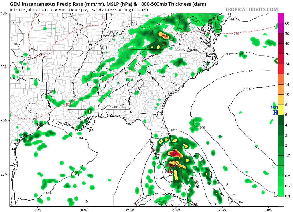
HurricaneFrances04 wrote:CMC seems to indicate that we might not get consolidation until after interaction with Hispaniola

https://i.imgur.com/g9OQmea.gif


HWRF, HMON and HWRF-Para also show consolidation after interacting with Hispaniola
0 likes   

User avatar
DestinHurricane
Category 4
Category 4
Posts: 935
Joined: Tue May 01, 2018 8:05 am
Location: New York, NY

Re: ATL: NINE - Models

#1212 Postby DestinHurricane » Wed Jul 29, 2020 12:10 pm

HWRF on crack. 985 at hour 54. :lol:
0 likes   
Michael 2018

User avatar
wxman57
Moderator-Pro Met
Moderator-Pro Met
Posts: 22980
Age: 67
Joined: Sat Jun 21, 2003 8:06 pm
Location: Houston, TX (southwest)

Re: ATL: NINE - Models

#1213 Postby wxman57 » Wed Jul 29, 2020 12:13 pm

DestinHurricane wrote:HWRF on crack. 985 at hour 54. :lol:


Didn't do so well with Gonzalo which it predicted to move across the eastern Caribbean as nearly a Cat 3...
3 likes   

User avatar
SFLcane
S2K Supporter
S2K Supporter
Posts: 10163
Age: 47
Joined: Sat Jun 05, 2010 1:44 pm
Location: Lake Worth Florida

Re: ATL: NINE - Models

#1214 Postby SFLcane » Wed Jul 29, 2020 12:13 pm

DestinHurricane wrote:HWRF on crack. 985 at hour 54. :lol:


Guess HMON, HWRF Para, HWRF P, are all on crack... The all intensify PT9 into a hurricane in the Bahamas.
0 likes   

BobHarlem
Category 5
Category 5
Posts: 2123
Joined: Thu Oct 20, 2005 6:11 pm

Re: ATL: NINE - Models

#1215 Postby BobHarlem » Wed Jul 29, 2020 12:15 pm

SFLcane wrote:
DestinHurricane wrote:HWRF on crack. 985 at hour 54. :lol:


Guess HMON, HWRF Para, HWRF P, are all on crack... The all intensify PT9 into a hurricane in the Bahamas.


The first 24 hours of those model runs are like throwing darts for a center.
0 likes   

User avatar
DestinHurricane
Category 4
Category 4
Posts: 935
Joined: Tue May 01, 2018 8:05 am
Location: New York, NY

Re: ATL: NINE - Models

#1216 Postby DestinHurricane » Wed Jul 29, 2020 12:18 pm

SFLcane wrote:
DestinHurricane wrote:HWRF on crack. 985 at hour 54. :lol:


Guess HMON, HWRF Para, HWRF P, are all on crack... The all intensify PT9 into a hurricane in the Bahamas.


Yes, they are all on crack. Should not be used as reliable scientific information. Not even sure why they continue to run the HWRF/HMON after years of them calling for every storm to become a major hurricane.
0 likes   
Michael 2018

User avatar
Blown Away
S2K Supporter
S2K Supporter
Posts: 10147
Joined: Wed May 26, 2004 6:17 am

Re: ATL: NINE - Models

#1217 Postby Blown Away » Wed Jul 29, 2020 12:29 pm

The right biased GFS/HWRF/HMON etc all shifting N & E to the E of Fl now, I sniff an NHC track shift E at 5pm...
1 likes   
Hurricane Eye Experience: David 79, Irene 99, Frances 04, Jeanne 04, Wilma 05... EYE COMING MY WAY IN 2024…
Hurricane Brush Experience: Andrew 92, Erin 95, Floyd 99, Matthew 16, Irma 17, Ian 22, Nicole 22…

HurricaneFrances04
Category 2
Category 2
Posts: 597
Joined: Mon Jun 25, 2012 8:09 am
Location: Fort Lauderdale, Florida

Re: ATL: NINE - Models

#1218 Postby HurricaneFrances04 » Wed Jul 29, 2020 12:33 pm

GFS Ensemble mean now off Florida

Image
0 likes   

jlauderdal
S2K Supporter
S2K Supporter
Posts: 7183
Joined: Wed May 19, 2004 5:46 am
Location: NE Fort Lauderdale
Contact:

Re: ATL: NINE - Models

#1219 Postby jlauderdal » Wed Jul 29, 2020 12:36 pm

Blown Away wrote:The right biased GFS/HWRF/HMON etc all shifting N & E to the E of Fl now, I sniff an NHC track shift E at 5pm...
Not unless the NHC increase intensity..they have been clear on their track reasoning
0 likes   

HurricaneFrances04
Category 2
Category 2
Posts: 597
Joined: Mon Jun 25, 2012 8:09 am
Location: Fort Lauderdale, Florida

Re: ATL: NINE - Models

#1220 Postby HurricaneFrances04 » Wed Jul 29, 2020 1:01 pm

Euro is a bit....different lol

Image
1 likes   


Return to “2020”

Who is online

Users browsing this forum: No registered users and 9 guests