

*probaby should have a Best If Used By: 06z Expiration date.
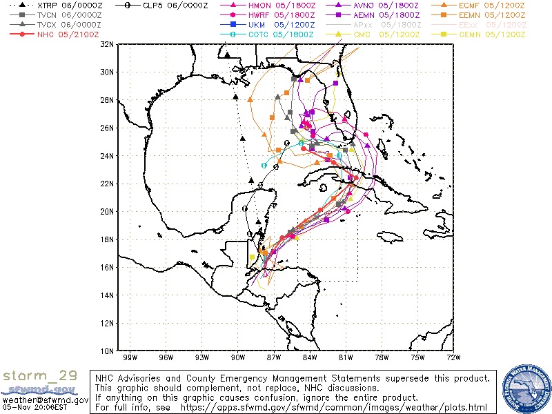
FWIW, AVNI (GFS Op - red) pushes into MIA @ 72 hrs+. Should make TVCN & OFCL also move N (closer to Miami) later tonight.

0Z Intensity guidance shows Basically Tropical Storm intensities,
except for COTI (NRL-COAMPS) which shows CAT2, due to lack of land interaction of it's track:


