ATL: ETA - Models
Moderator: S2k Moderators
-
AutoPenalti
- Category 5

- Posts: 4091
- Age: 29
- Joined: Mon Aug 17, 2015 4:16 pm
- Location: Ft. Lauderdale, Florida
Re: ATL: ETA - Models
gatorcane wrote:12Z Euro saved loop through 96 hours
https://i.postimg.cc/9f34Jc79/ecmwf-uv850-vort-watl-fh0-96-2.gif
What the heck kind of WSW bend is that...?
0 likes
The posts in this forum are NOT official forecasts and should not be used as such. They are just the opinion of the poster and may or may not be backed by sound meteorological data. They are NOT endorsed by any professional institution or STORM2K. For official information, please refer to products from the NHC and NWS.
Model Runs Cheat Sheet:
GFS (5:30 AM/PM, 11:30 AM/PM)
HWRF, GFDL, UKMET, NAVGEM (6:30-8:00 AM/PM, 12:30-2:00 AM/PM)
ECMWF (1:45 AM/PM)
TCVN is a weighted averaged
-
Weatherboy1

- Category 5
- Posts: 1190
- Age: 50
- Joined: Mon Jul 05, 2004 1:50 pm
- Location: Jupiter/Sarasota, FL
Re: ATL: ETA - Models
Euro looks to be about 70-80 miles NNE of last run. Almost landfalling in the Everglades on turn to the NW vs. last run down between Cuba and lower Keys. NHC almost guaranteed to shift track into far southern mainland FL at next update now
Last edited by Weatherboy1 on Fri Nov 06, 2020 1:42 pm, edited 1 time in total.
0 likes
-
Spacecoast

- Category 2

- Posts: 773
- Joined: Thu Aug 31, 2017 2:03 pm

Re: ATL: ETA - Models
NAVGEM also South Florida landfall heading NNW.. exiting just north of Tampa Bay and then doing a loop and second landfall in Big Bend area
NAM also has landfall in South Florida heading NNW and exiting out over Tampa Bay
NAM also has landfall in South Florida heading NNW and exiting out over Tampa Bay
0 likes
-
TheStormExpert
Re: ATL: ETA - Models
Weatherboy1 wrote:Euro looks to be about 70-80 miles NNE of last run. Almost landfalling in the Everglades on turn to the NW vs. last run down by lower Keys. NHC almost guaranteed to shift track into far southern mainland FL at next update now
Compared to 06z I believe it’s the same.
0 likes

Re: ATL: ETA - Models
Salute!
From an experienced 'cane vet, looks like a ridge over east coast could help steer the storm more westerly and not back to The Big Easy or here to Redneck Riviera/Baja Alabama.
I remember Kate in November of 85, and we dodged the bullet over west of PC. But no forecast cold front to help with this puppy. Getting gas, poptarts and beer now. Least a break from the election circus on TV, huh?
Gums sends...
3 likes

Re: ATL: ETA - Models

fci wrote:Blown Away wrote:chaser1 wrote:
Right, good luck finding THAT in the 'ol history books LOL
Hurricane King almost perfect analog. Happened late October...
Funny, that was the discussion we had on S2K about 3 days ago; the slingshot from NW Carib to the Fl Straits and then a hard left into SE Fl.
King is definitely the analog.
Correct, King would be the perfect analogue although I should have been more clear because I assumed we were speaking in terms of "November".
0 likes
Andy D
(For official information, please refer to the NHC and NWS products.)
(For official information, please refer to the NHC and NWS products.)
Re: ATL: ETA - Models
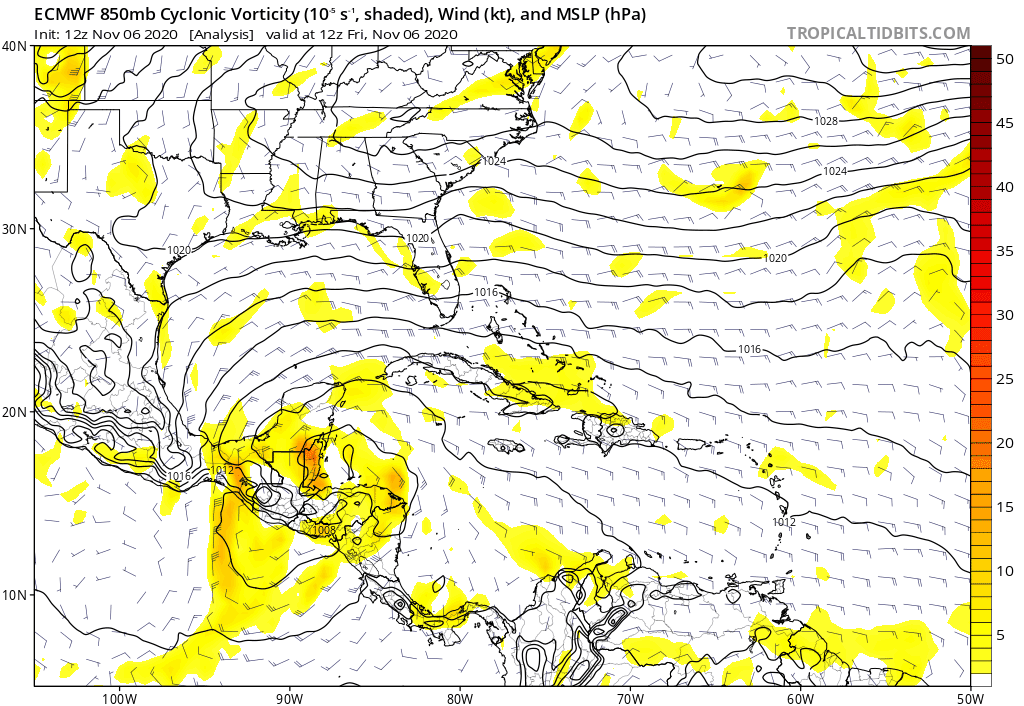
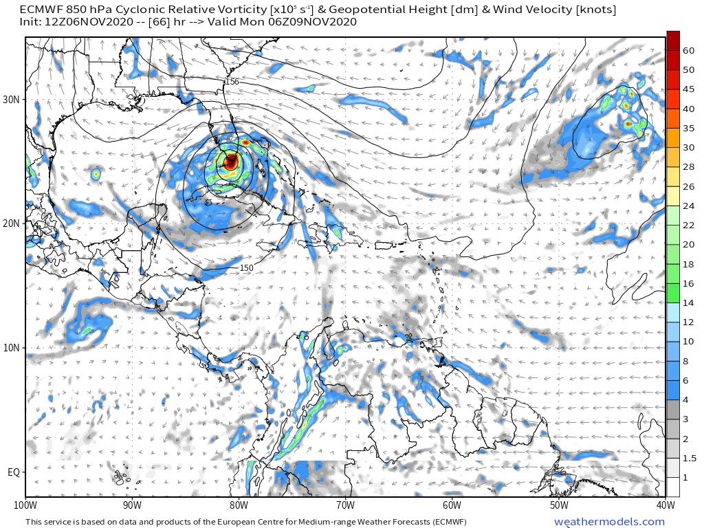
Spacecoast wrote:Very windy for Central Florida...
https://i.ibb.co/cv3QNYT/Capture115a.jpg
Nope, you're looking at wind barbs from an 850mb map (not a surface map or forecast)
4 likes
Andy D
(For official information, please refer to the NHC and NWS products.)
(For official information, please refer to the NHC and NWS products.)
-
wzrgirl1

- S2K Supporter

- Posts: 1360
- Joined: Sat Sep 04, 2004 6:44 am
- Location: Pembroke Pines, Florida
Re: RE: Re: ATL: ETA - Models
Nuno wrote:jlauderdal wrote:Lets not get like those crazy TexansBlown Away wrote:
We are an emotional group., keep your cool Floridians, we can handle an ETA. Don't lose your focus, the election is over, time to prep.
Went to Publix last night, it was a ghost town.
So did I. But they did have extra water out.
0 likes
Re: ATL: ETA - Models
Was I correct in seeing the EURO depicting a 993 mb? Also FWIW, the 12Z GFS appeared weaker then prior runs. I'm just not overly impressed with present sat appearance or seeing enough from the models to feel confident that Eta "will" be a hurricane on approach to S. Florida. Could happen but to me that seems less then 50/50 atm. I would agree that a potential track does appear increasingly likely to landfall some part of Florida or the Keys though.
2 likes
Andy D
(For official information, please refer to the NHC and NWS products.)
(For official information, please refer to the NHC and NWS products.)
-
Spacecoast
- Category 2
- Posts: 773
- Joined: Thu Aug 31, 2017 2:03 pm
Re: ATL: ETA - Models
chaser1 wrote:Spacecoast wrote:Very windy for Central Florida...
https://i.ibb.co/cv3QNYT/Capture115a.jpg
Nope, you're looking at wind barbs from an 850mb map (not a surface map or forecast)
Oops, sorry about that.
Yes, you are correct. Thank you for the clarifcation.
0 likes
-
Blown Away

- S2K Supporter
- Posts: 10253
- Joined: Wed May 26, 2004 6:17 am
Re: ATL: ETA - Models

12z Guidance... At 12:00 the NHC had Eta at 26.9N/86.9W moving NNE... I see (2) camps, the NHC track/Euro more N now and W near FL and GFS group track more S now and E with SFL E side landfall... I think recon confirming where the developing center is now will give us a better idea down the road...
0 likes
Hurricane Eye Experience: David 79, Irene 99, Frances 04, Jeanne 04, Wilma 05… Hurricane Brush Experience: Andrew 92, Erin 95, Floyd 99, Matthew 16, Irma 17, Ian 22, Nicole 22…
Re: ATL: ETA - Models
Spacecoast wrote:chaser1 wrote:Spacecoast wrote:Very windy for Central Florida...
https://i.ibb.co/cv3QNYT/Capture115a.jpg
Nope, you're looking at wind barbs from an 850mb map (not a surface map or forecast)
Oops, sorry about that.
Yes, you are correct. Thank you for the clarifcation.
That would still translate to windy weather at the surface.
0 likes
-
gatorcane

- S2K Supporter
- Posts: 23708
- Age: 48
- Joined: Sun Mar 13, 2005 3:54 pm
- Location: Boca Raton, FL
Re: ATL: ETA - Models
18Z guidance.
Not one model shows a hurricane and nearly all track south and west of the peninsula. But given the subtropical structure of the storm, and the tight pressure gradient with building high pressure, effects would be felt far from the center.
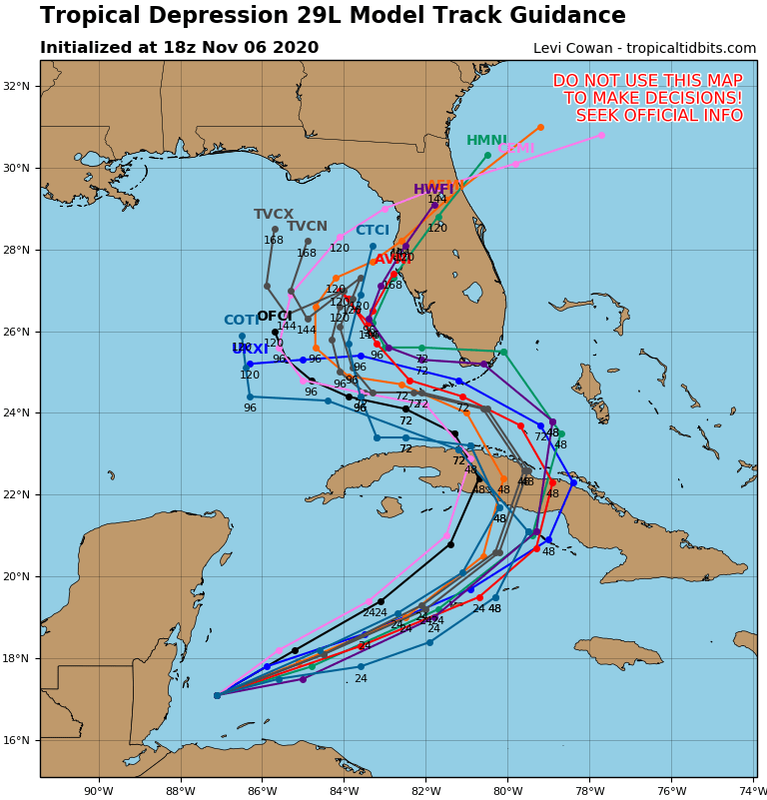
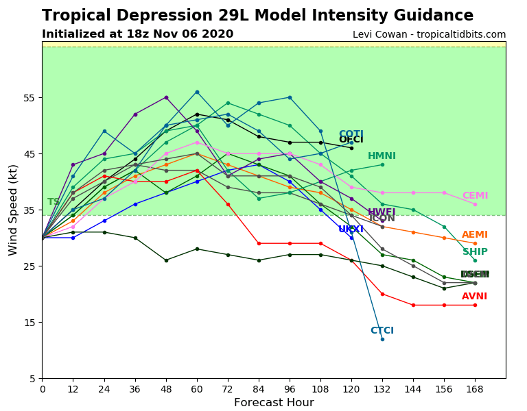
Not one model shows a hurricane and nearly all track south and west of the peninsula. But given the subtropical structure of the storm, and the tight pressure gradient with building high pressure, effects would be felt far from the center.
0 likes

Re: ATL: ETA - Models
It was always unlikely Florida would escape this hellacious season without any significant impacts. Its fun to talk about Florida shields but the law of averages always wins out.
0 likes
-
Blown Away
- S2K Supporter
- Posts: 10253
- Joined: Wed May 26, 2004 6:17 am
Re: ATL: ETA - Models
gatorcane wrote:18Z guidance.
Not one model shows a hurricane and nearly all track south and west of the peninsula. But given the subtropical structure of the storm, and the tight pressure gradient with building high pressure, effects would be felt far from the center.
https://i.postimg.cc/RF65ZJd6/29-L-tracks-18z.png
https://i.postimg.cc/fynFW2kp/29-L-intensity-18z.png
Current NHC advisory has Eta through the northern Keys... This map has OFCL way south? I don't think the next advisory has come out? Little puzzled by this map...
2 likes
Hurricane Eye Experience: David 79, Irene 99, Frances 04, Jeanne 04, Wilma 05… Hurricane Brush Experience: Andrew 92, Erin 95, Floyd 99, Matthew 16, Irma 17, Ian 22, Nicole 22…
-
SFLcane

- S2K Supporter
- Posts: 10281
- Age: 48
- Joined: Sat Jun 05, 2010 1:44 pm
- Location: Lake Worth Florida
Re: ATL: ETA - Models
gatorcane wrote:18Z guidance.
Not one model shows a hurricane and nearly all track south and west of the peninsula. But given the subtropical structure of the storm, and the tight pressure gradient with building high pressure, effects would be felt far from the center.
https://i.postimg.cc/RF65ZJd6/29-L-tracks-18z.png
https://i.postimg.cc/fynFW2kp/29-L-intensity-18z.png
Oof... lol there goes your hurricane watches.
0 likes
Re: ATL: ETA - Models
Blown Away wrote:gatorcane wrote:18Z guidance.
Not one model shows a hurricane and nearly all track south and west of the peninsula. But given the subtropical structure of the storm, and the tight pressure gradient with building high pressure, effects would be felt far from the center.
https://i.postimg.cc/RF65ZJd6/29-L-tracks-18z.png
https://i.postimg.cc/fynFW2kp/29-L-intensity-18z.png
Current NHC advisory has Eta through the northern Keys... This map has OFCL way south? I don't think the next advisory has come out? Little puzzled by this map...
I’m confused as well because it has the GFS down by the middle/lower Keys when the last run was further north with the HWRF also more north.. don’t see how the OFCL track shifted south...
3 likes
Who is online
Users browsing this forum: No registered users and 57 guests