

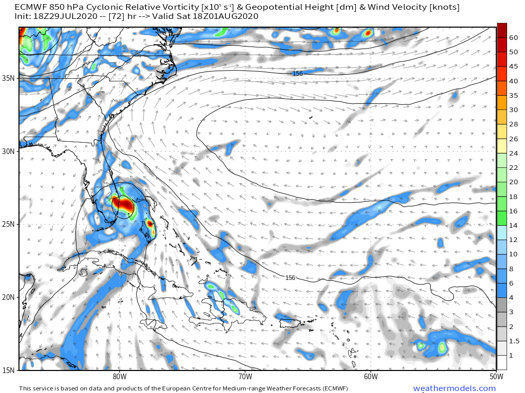
SFLcane wrote:18z Euro into SFL...intensity probably a weak to moderate TS.
https://iili.io/dR7uNR.png
Are we allowed to post from this site? Or was this posted by them on social?
Moderator: S2k Moderators
SFLcane wrote:18z Euro into SFL...intensity probably a weak to moderate TS.
https://iili.io/dR7uNR.png


Cant say this is entirely surprising. Clouds have been getting sheared to the northeast while clear skies to the west of the system. That’s kind of a sign right there that it’s about to run into some resistance.TheStormExpert wrote:SFLcane wrote:Lol Is thing thing poofing? Convection has degreased dramatically. I just don’t know about that upgrade by tonight.
Again it looks like crap tonight! This thing just doesn’t want to get named.


TheStormExpert wrote:https://twitter.com/derekortt/status/1288619350488948736

jlauderdal wrote:True, its not a default that there is major disruption, every storm is different and even deep systems pass over with minimal disruption...also, storms do their best to avoid landAnnularCane wrote:Hispaniola isn't necessarily a death sentence for storms.


SFLcane wrote:HurricaneFrances04 wrote:SUMMARY OF 800 PM AST...0000 UTC...INFORMATION
----------------------------------------------
LOCATION...16.0N 66.3W
ABOUT 140 MI...225 KM S OF PONCE PUERTO RICO
ABOUT 280 MI...450 KM SE OF SANTO DOMINGO DOMINICAN REPUBLIC
MAXIMUM SUSTAINED WINDS...45 MPH...75 KM/H
PRESENT MOVEMENT...WNW OR 285 DEGREES AT 18 MPH...30 KM/H
MINIMUM CENTRAL PRESSURE...1004 MB...29.65 INCHES
Slowing down..
SFLcane wrote:Lol Is thing thing poofing? Convection has decreased dramatically. I just don’t know about that upgrade by tonight.
 You're right, barring some immaculate conception there's just no reason to think an upgrade could occur before morning.


Users browsing this forum: No registered users and 49 guests


