SPC just issued a new MD
Tornado Watch soon??

Mesoscale Discussion 1336
NWS Storm Prediction Center Norman OK
0118 PM CDT Sat Jul 25 2020
Areas affected...Texas coastal area
Concerning...Severe potential...Watch possible
Valid 251818Z - 252045Z
Probability of Watch Issuance...40 percent
SUMMARY...Threat for a few brief tornadoes is expected to undergo a
gradual increase this afternoon into the early evening. Convective
trends will continue to be monitored for a possible tornado watch.
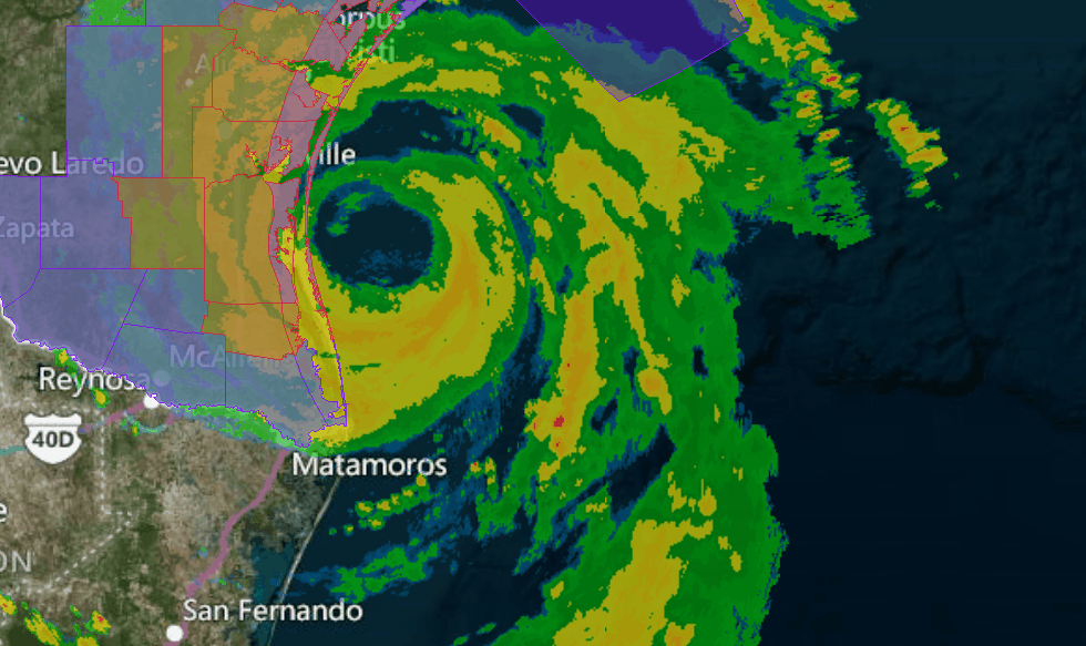
DISCUSSION...As of early afternoon the center of Hurricane Hanna was
located just off the south Texas coast, moving slowly west. See the
latest discussions from the National Hurricane center for more
specifics on Hanna. North of the center, shallow convection
(including a few thunderstorms) within the outer rainbands are
moving inland from the western Gulf. Low-level hodograph size has
increased in corridor between Corpus Christi and Houston with 0-1 km
storm relative helicity from 300-500+ m2/s2, and modest updraft
rotation has been observed with a few of the discrete cells. The
warm core nature of the Hurricane and widespread clouds are
resulting in marginal instability. However, some cloud breaks are
evident between bands, especially along the central Texas coast, and
this might result in sufficient boundary layer destabilization to
support slightly more robust updrafts. As the center continues
westward and eventually moves inland, hodographs will remain
favorable for low-topped supercells capable of a few brief
tornadoes.
..Dial/Hart.. 07/25/2020