#2067 Postby Kazmit » Mon Nov 02, 2020 9:39 pm
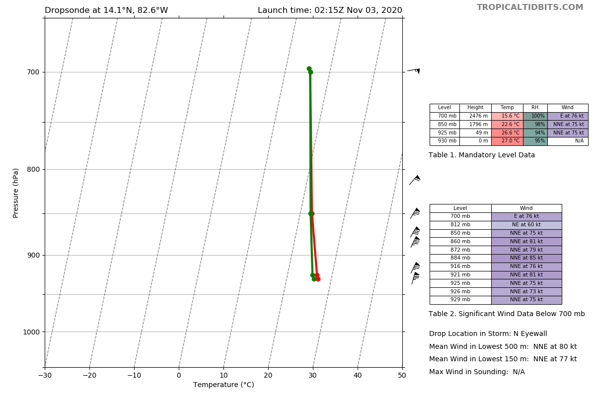
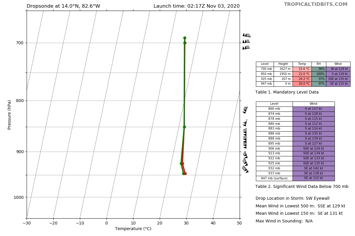
aspen wrote:The big question is: what will the NHC do? Will they pull the Cat 5 trigger or not? The highest winds have yet to be sampled and the pressure is low enough for a Cat 5, but the next pass won’t be until after the 10pm advisory comes out.
Knowing the NHC, no.
1 likes
Igor 2010, Sandy 2012, Fay 2014, Gonzalo 2014, Joaquin 2015, Nicole 2016, Humberto 2019, Imelda 2025
I am only a tropical weather enthusiast. My predictions are not official and may or may not be backed by sound meteorological data. For official information, please refer to the NHC and NWS products.