

Anyway, very quick weakening trend from not much but rain up in North Mississippi.

Moderator: S2k Moderators


Steve wrote:Canadian ends up with the hurricane hit in Tamaulipas.
https://i.imgur.com/HQ3SUyl.png
Steve wrote:06Z
GFS - Brings a weak and weakening 97L up toward SETX and washes it out. Brings 98L around Apalachicola.
https://www.tropicaltidbits.com/analysi ... 006&fh=126
https://www.tropicaltidbits.com/analysi ... 006&fh=144
ICON - Brings a fairly weak and weakening low toward the SC LA Coast. Brings an also weak 98L through the Keys
https://www.tropicaltidbits.com/analysi ... 006&fh=120
Navgem - Brings a strong TD #13 to a Cat-1 or low-end 2 (982mb) to Miami and comes up the western side of the state. Meanwhile it leaves 97L in the western Gulf which strengthens and is moving NNW or so toward the upper TX Coast also at 982mb.
https://www.tropicaltidbits.com/analysi ... 006&fh=144
HWRF is weak & off the SWLA Coast
https://www.tropicaltidbits.com/analysi ... 006&fh=126
HMON ends up East of Brownsville as not much
https://www.tropicaltidbits.com/analysi ... 006&fh=126
^^ These are mostly all in the 5 day range.

SoupBone wrote:Steve wrote:06Z
GFS - Brings a weak and weakening 97L up toward SETX and washes it out. Brings 98L around Apalachicola.
https://www.tropicaltidbits.com/analysi ... 006&fh=126
https://www.tropicaltidbits.com/analysi ... 006&fh=144
ICON - Brings a fairly weak and weakening low toward the SC LA Coast. Brings an also weak 98L through the Keys
https://www.tropicaltidbits.com/analysi ... 006&fh=120
Navgem - Brings a strong TD #13 to a Cat-1 or low-end 2 (982mb) to Miami and comes up the western side of the state. Meanwhile it leaves 97L in the western Gulf which strengthens and is moving NNW or so toward the upper TX Coast also at 982mb.
https://www.tropicaltidbits.com/analysi ... 006&fh=144
HWRF is weak & off the SWLA Coast
https://www.tropicaltidbits.com/analysi ... 006&fh=126
HMON ends up East of Brownsville as not much
https://www.tropicaltidbits.com/analysi ... 006&fh=126
^^ These are mostly all in the 5 day range.
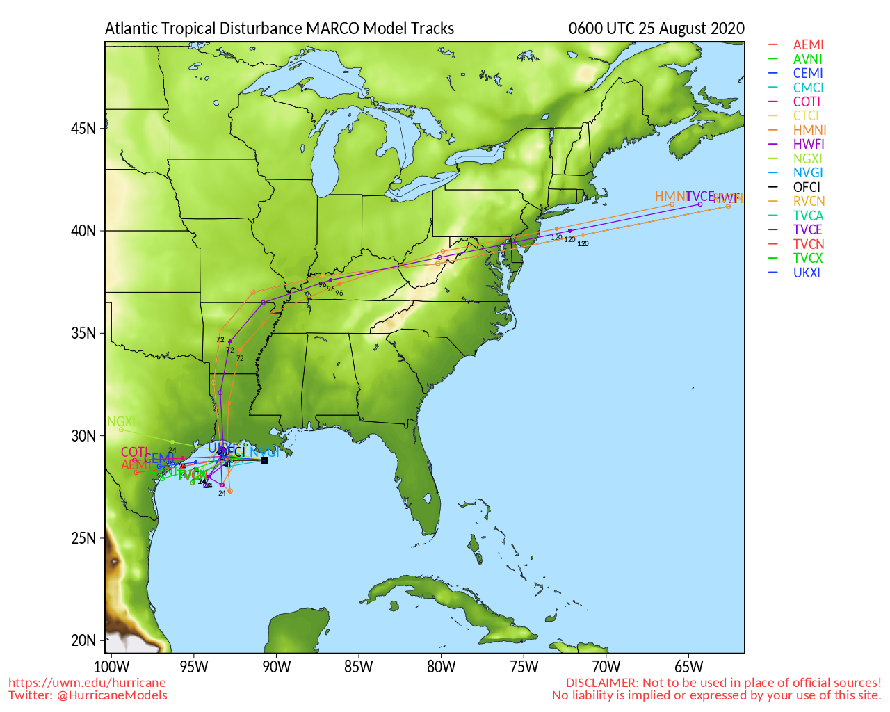
I'm gonna say this again, but for the models to be all over the place for 97L still and within 5 days is unreal. From Northern Mexico to Biloxi, MS? Yeah that's only 1000 miles between the two places.


Users browsing this forum: No registered users and 12 guests


