
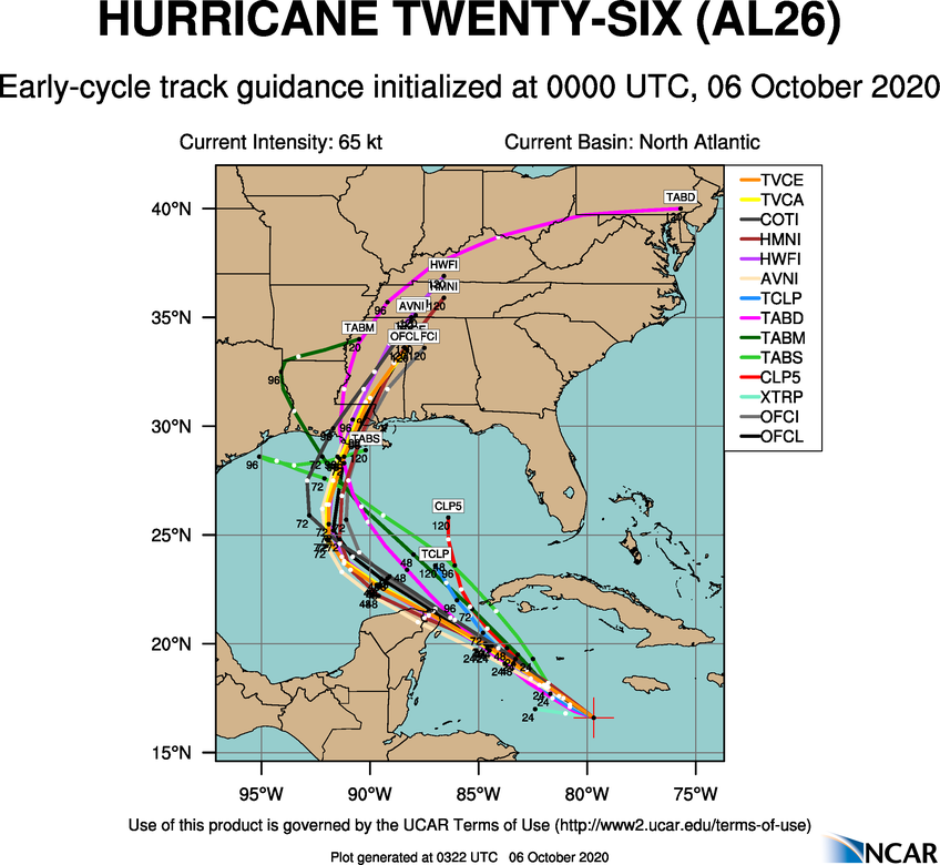
Despite this, I wouldn't move the track farther west YET since the caveat about the slower track is involved.
Moderator: S2k Moderators

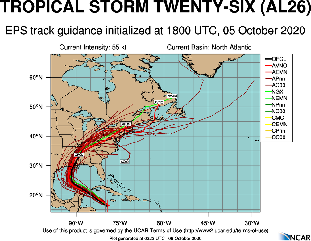
CrazyC83 wrote:https://my.sfwmd.gov/sfwmd/common/images/weather/plots/storm_26_ens.gif
Despite this, I wouldn't move the track farther west YET since the caveat about the slower track is involved.


Bamagirl2408 wrote:My elementary question is if Gamma is on life support, while I understand the steering influence it has on Delta, why do the HWRF and HMON models still redevelop it and send into Gulf coast a day later than the Delta models? Are the models confusing the interaction of the 2? Old runs? Or will it come back to life?

Fancy1001 wrote:Icon model run is trash, starts off 20 mb too weak at 1001mb.
Steve wrote:NAM 12km (which is an 84 hour run) gets an eastern component before the end. It’s not reliable and can have a right bias but it’s 969 and looks to be hooking toward SELA for landfall at 84 hours.
https://www.tropicaltidbits.com/analysi ... 0600&fh=84
More importantly on the NAM is the trough that opens up across Oklahoma, Dallas and into parts of eastern Texas. Look at the yellow drip.
https://www.tropicaltidbits.com/analysi ... 0600&fh=84
LarryWx wrote:0Z GFS early maps are tracking a bit east of the prior run for a change. Let’s see where Delta goes.


Users browsing this forum: No registered users and 7 guests


