EPAC: ONE-E - Remnants

Moderator: S2k Moderators

Message
Author
User avatar
Nancy Smar
Category 5
Category 5
Posts: 1081
Age: 23
Joined: Wed Aug 16, 2017 10:03 pm

EPAC: ONE-E - Remnants

#1 Postby Nancy Smar » Thu Apr 23, 2020 8:20 am

EP, 90, 2020042212, , BEST, 0, 97N, 1077W, 20, 1009, DB, 0, , 0, 0, 0, 0, 1010, 300, 60, 0, 0, , 0, , 0, 0, GENESIS001, , 0, , 0, 0, 0, 0, genesis-num, 001,
EP, 90, 2020042218, , BEST, 0, 98N, 1085W, 20, 1009, DB, 0, , 0, 0, 0, 0, 1010, 300, 60, 0, 0, , 0, , 0, 0, GENESIS001, , 0, , 0, 0, 0, 0, genesis-num, 001,
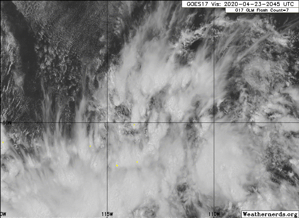
EP, 90, 2020042300, , BEST, 0, 99N, 1094W, 20, 1009, DB, 0, , 0, 0, 0, 0, 1010, 300, 60, 0, 0, , 0, , 0, 0, GENESIS001, , 0, , 0, 0, 0, 0, genesis-num, 001,
EP, 90, 2020042306, , BEST, 0, 99N, 1102W, 20, 1009, DB, 0, , 0, 0, 0, 0, 1010, 300, 60, 0, 0, , 0, , 0, 0, GENESIS001, , 0, , 0, 0, 0, 0, genesis-num, 001,
EP, 90, 2020042312, , BEST, 0, 100N, 1110W, 25, 1008, DB, 34, NEQ, 0, 0, 0, 0, 1010, 300, 60, 0, 0, E, 0, , 0, 0, INVEST, S, 0, , 0, 0, 0, 0, genesis-num, 001, SPAWNINVEST, ep712020 to ep902020,
Last edited by Nancy Smar on Sat Apr 25, 2020 10:02 am, edited 2 times in total.
3 likes   

User avatar
Nancy Smar
Category 5
Category 5
Posts: 1081
Age: 23
Joined: Wed Aug 16, 2017 10:03 pm

Re: EPAC: INVEST 90E

#2 Postby Nancy Smar » Thu Apr 23, 2020 8:39 am

Weak low pressure may form in the vicinity of 12N112W today, then meander
slowly N or W into the weekend. This low may serve as a focus
for showers and thunderstorms, with some locally gusty winds
associated with them.
0 likes   

User avatar
Nancy Smar
Category 5
Category 5
Posts: 1081
Age: 23
Joined: Wed Aug 16, 2017 10:03 pm

Re: EPAC: INVEST 90E

#3 Postby Nancy Smar » Thu Apr 23, 2020 9:10 am

000
ABPZ20 KNHC 231405
TWOEP

Special Tropical Weather Outlook
NWS National Hurricane Center Miami FL
705 AM PDT Thu Apr 23 2020

For the eastern North Pacific...east of 140 degrees west longitude:

Special Tropical Weather Outlook issued to discuss the area of
disturbed weather located several hundred miles south of the
southern tip of the Baja California Peninsula.

1. A large area of disturbed weather associated with a trough of
low pressure has formed several hundred miles south of the
southern tip of the Baja California peninsula. Environmental
conditions are favorable for some gradual development for the next
couple of days as the disturbance moves slowly northwestward. By
late this weekend, conditions will become less conducive for
development. The next Special Tropical Weather Outlook on this
system will be issued by 2 PM PDT Friday, or earlier, if necessary.
* Formation chance through 48 hours...low...30 percent.
* Formation chance through 5 days...medium...40 percent.

$$
Forecaster Latto/Brown
2 likes   

User avatar
Yellow Evan
Professional-Met
Professional-Met
Posts: 15952
Age: 25
Joined: Fri Jul 15, 2011 12:48 pm
Location: Henderson, Nevada/Honolulu, HI
Contact:

Re: EPAC: INVEST 90E

#4 Postby Yellow Evan » Thu Apr 23, 2020 10:07 am

* EAST PACIFIC 2019 SHIPS INTENSITY FORECAST *
* IR SAT DATA AVAILABLE, OHC AVAILABLE *
* INVEST EP902020 04/23/20 12 UTC *

TIME (HR) 0 6 12 18 24 36 48 60 72 84 96 108 120
V (KT) NO LAND 25 29 34 39 43 54 59 57 49 39 29 20 DIS
V (KT) LAND 25 29 34 39 43 54 59 57 49 39 29 20 DIS
V (KT) LGEM 25 27 29 30 31 32 33 34 32 28 23 18 DIS
Storm Type TROP TROP TROP TROP TROP TROP TROP TROP TROP TROP TROP TROP TROP

SHEAR (KT) 9 10 8 8 4 3 7 12 18 22 27 37 36
SHEAR ADJ (KT) -1 1 4 8 5 2 2 0 0 1 3 -2 1
SHEAR DIR 204 212 230 248 224 111 236 261 263 260 253 248 263
SST (C) 29.0 29.0 29.0 29.0 29.0 29.0 28.6 28.0 27.6 27.3 26.1 24.9 23.8
POT. INT. (KT) 153 152 152 152 153 153 149 143 138 135 123 110 99
200 MB T (C) -53.2 -53.1 -52.6 -53.1 -53.6 -52.7 -53.5 -53.1 -53.6 -53.5 -54.0 -54.0 -54.7
200 MB VXT (C) 0.0 0.0 0.0 0.0 0.0 0.0 -0.1 -0.1 -0.1 -0.1 0.0 -0.1 0.4
TH_E DEV (C) 4 4 4 4 4 4 3 3 2 2 1 2 1
700-500 MB RH 71 70 68 67 66 62 57 54 53 51 49 45 40
MODEL VTX (KT) 5 6 7 8 8 8 8 8 7 6 5 4 3
850 MB ENV VOR -19 -18 -23 -22 -28 -30 -44 -54 -52 -45 -33 -28 -37
200 MB DIV 110 122 166 202 179 113 66 -15 -3 -12 0 -4 14
700-850 TADV 0 -1 0 -2 -2 -2 0 0 0 6 4 9 9
LAND (KM) 1224 1250 1267 1267 1269 1249 1228 1156 1110 1075 1090 1113 1111
LAT (DEG N) 10.0 10.1 10.2 10.5 10.8 11.7 12.6 13.6 14.5 15.5 16.1 16.7 17.4
LONG(DEG W) 111.0 111.6 112.0 112.4 112.8 113.5 114.2 114.9 115.7 116.6 117.5 118.6 119.5
STM SPEED (KT) 7 5 4 5 5 5 6 6 6 6 6 6 6
HEAT CONTENT 54 60 63 70 71 65 46 30 13 7 0 0 0

FORECAST TRACK FROM TABM INITIAL HEADING/SPEED (DEG/KT):275/ 8 CX,CY: -7/ 1
T-12 MAX WIND: 20 PRESSURE OF STEERING LEVEL (MB): 680 (MEAN=587)
GOES IR BRIGHTNESS TEMP. STD DEV. 50-200 KM RAD: 16.6 (MEAN=14.5)
% GOES IR PIXELS WITH T < -20 C 50-200 KM RAD: 89.0 (MEAN=65.0)
PRELIM RI PROB (DV .GE. 35 KT IN 36 HR): 60.9

INDIVIDUAL CONTRIBUTIONS TO INTENSITY CHANGE
6 12 18 24 36 48 60 72 84 96 108 120
----------------------------------------------------------
SAMPLE MEAN CHANGE 0. 0. 1. 1. 1. 2. 1. 1. 1. -0. -1. -1.
SST POTENTIAL -0. -0. 0. 1. 6. 12. 18. 24. 28. 30. 31. 31.
VERTICAL SHEAR MAG 1. 1. 2. 3. 5. 6. 6. 4. 2. -1. -5. -8.
VERTICAL SHEAR ADJ 0. -0. -1. -1. -2. -2. -1. -1. -1. -0. -0. -0.
VERTICAL SHEAR DIR -1. -2. -3. -4. -5. -8. -11. -13. -14. -14. -14. -14.
PERSISTENCE 1. 1. 1. 1. 1. 1. 1. 1. 1. 1. 1. 1.
200/250 MB TEMP. 0. -0. -0. -0. -1. -1. -2. -3. -3. -3. -3. -3.
THETA_E EXCESS -0. -1. -1. -2. -3. -4. -5. -6. -7. -8. -9. -9.
700-500 MB RH 0. 0. 0. 0. 0. 0. 0. -0. -0. -0. -1. -1.
MODEL VTX TENDENCY 0. 1. 2. 2. 2. 3. 4. 2. 2. -0. -2. -4.
850 MB ENV VORTICITY -0. -0. -0. -0. -0. 0. 1. 1. 2. 2. 2. 2.
200 MB DIVERGENCE 0. 1. 2. 2. 3. 4. 5. 5. 4. 3. 3. 2.
850-700 T ADVEC 0. -0. -0. 0. 0. 0. 0. -0. -0. 0. 0. 0.
ZONAL STORM MOTION 0. 0. 0. 0. 0. 0. 0. 0. 0. -0. -0. -0.
STEERING LEVEL PRES 0. 0. 1. 1. 1. 2. 2. 2. 2. 2. 2. 2.
DAYS FROM CLIM. PEAK -0. -0. -0. -0. -0. -0. -0. -1. -1. -2. -2. -2.
GOES PREDICTORS 1. 2. 2. 2. 2. 2. 2. 2. 1. 1. 1. 1.
OCEAN HEAT CONTENT -0. 0. 0. 0. 0. 2. 3. 2. 1. 0. -0. -1.
RI POTENTIAL 2. 4. 8. 12. 18. 17. 10. 3. -2. -6. -9. -11.
----------------------------------------------------------
TOTAL CHANGE 4. 9. 14. 18. 29. 34. 32. 24. 14. 4. -5. -13.

CURRENT MAX WIND (KT): 25. LAT, LON: 10.0 111.0

** 2019 E. Pacific RI INDEX EP902020 INVEST 04/23/20 12 UTC **
(SHIPS-RII PREDICTOR TABLE for 30 KT OR MORE MAXIMUM WIND INCREASE IN NEXT 24-h)

Predictor Value RI Predictor Range Scaled Value(0-1) % Contribution
POT = MPI-VMAX (KT) : 127.6 40.5 to 149.3 0.80 7.4
12 HR PERSISTENCE (KT) : 5.0 -22.0 to 44.0 0.41 5.6
850-200 MB SHEAR (KT) : 8.0 19.6 to 1.6 0.64 7.3
D200 (10**7s-1) : 155.8 -33.0 to 156.2 1.00 9.1
MAXIMUM WIND (KT) : 25.0 22.5 to 132.0 0.07 0.6
HEAT CONTENT (KJ/CM2) : 63.6 2.7 to 106.7 0.59 4.3
STD DEV OF IR BR TEMP : 16.6 37.8 to 2.1 0.59 4.7
BL DRY-AIR FLUX (W/M2) : 86.6 800.8 to -82.5 0.81 0.0
2nd PC OF IR BR TEMP : 0.2 2.2 to -1.9 0.48 0.4
%area of TPW <45 mm upshear : 0.0 62.3 to 0.0 1.00 -0.3

SHIPS Prob RI for 20kt/ 12hr RI threshold= 0% is 0.0 times climatological mean ( 6.1%)
SHIPS Prob RI for 25kt/ 24hr RI threshold= 54% is 4.3 times climatological mean (12.5%)
SHIPS Prob RI for 30kt/ 24hr RI threshold= 39% is 4.7 times climatological mean ( 8.4%)
SHIPS Prob RI for 35kt/ 24hr RI threshold= 0% is 0.0 times climatological mean ( 6.0%)
SHIPS Prob RI for 40kt/ 24hr RI threshold= 0% is 0.0 times climatological mean ( 4.0%)
SHIPS Prob RI for 45kt/ 36hr RI threshold= 62% is 9.6 times climatological mean ( 6.5%)
SHIPS Prob RI for 55kt/ 48hr RI threshold= 67% is 11.3 times climatological mean ( 5.9%)
SHIPS Prob RI for 65kt/ 72hr RI threshold= 0% is 0.0 times climatological mean ( 4.8%)

Matrix of RI probabilities
------------------------------------------------------------------------------
RI (kt / h) | 20/12 | 25/24 | 30/24 | 35/24 | 40/24 | 45/36 | 55/48 |65/72
------------------------------------------------------------------------------
SHIPS-RII: 0.0% 53.7% 39.1% 0.0% 0.0% 62.5% 66.6% 0.0%
Logistic: 8.1% 42.8% 35.1% 16.3% 2.7% 17.1% 4.0% 9.0%
Bayesian: 10.2% 8.9% 8.8% 3.5% 0.1% 2.3% 4.3% 0.4%
Consensus: 6.1% 35.2% 27.7% 6.6% 1.0% 27.3% 24.9% 3.2%
DTOPS: 999.0% 999.0% 999.0% 999.0% 999.0% 999.0% 999.0% 999.0%

## ANNULAR HURRICANE INDEX (AHI) EP902020 INVEST 04/23/20 12 UTC ##
## STORM NOT ANNULAR, SCREENING STEP FAILED, NPASS=4 NFAIL=3 ##
## AHI= 0 (AHI OF 100 IS BEST FIT TO ANN. STRUC., 1 IS MARGINAL, 0 IS NOT ANNULAR) ##
0 likes   

User avatar
wxman57
Moderator-Pro Met
Moderator-Pro Met
Posts: 22482
Age: 66
Joined: Sat Jun 21, 2003 8:06 pm
Location: Houston, TX (southwest)

Re: EPAC: INVEST 90E

#5 Postby wxman57 » Thu Apr 23, 2020 10:40 am

ScatSat from last evening indicated 35-40 kts and an elongated circulation.
0 likes   

User avatar
TheStormExpert
Category 5
Category 5
Posts: 8487
Age: 30
Joined: Wed Feb 16, 2011 5:38 pm
Location: Palm Beach Gardens, FL

Re: EPAC: INVEST 90E

#6 Postby TheStormExpert » Thu Apr 23, 2020 10:40 am

Here we go! Our first East Pacific Invest in April in what will likely be a below average season.
5 likes   
The following post is NOT an official forecast and should not be used as such. It is just the opinion of the poster and may or may not be backed by sound meteorological data. It is NOT endorsed by storm2k.org.

User avatar
DorkyMcDorkface
Category 2
Category 2
Posts: 698
Age: 26
Joined: Mon Sep 30, 2019 1:32 pm
Location: Mid-Atlantic

Re: EPAC: INVEST 90E

#7 Postby DorkyMcDorkface » Thu Apr 23, 2020 12:20 pm

Funny that we could be getting the earliest-forming EPAC system less than a year removed from the basin's latest start in recorded history...
1 likes   
Floyd 1999 | Isabel 2003 | Hanna 2008 | Irene 2011 | Sandy 2012 | Isaias 2020

User avatar
Yellow Evan
Professional-Met
Professional-Met
Posts: 15952
Age: 25
Joined: Fri Jul 15, 2011 12:48 pm
Location: Henderson, Nevada/Honolulu, HI
Contact:

Re: EPAC: INVEST 90E

#8 Postby Yellow Evan » Thu Apr 23, 2020 1:16 pm

This has an outside chance but I don’t think the environment is as favorable as the SHIPS output suggests.
0 likes   

User avatar
cycloneye
Admin
Admin
Posts: 139086
Age: 67
Joined: Thu Oct 10, 2002 10:54 am
Location: San Juan, Puerto Rico

Re: EPAC: INVEST 90E

#9 Postby cycloneye » Thu Apr 23, 2020 1:43 pm

1 likes   
Visit the Caribbean-Central America Weather Thread where you can find at first post web cams,radars
and observations from Caribbean basin members Click Here

User avatar
Yellow Evan
Professional-Met
Professional-Met
Posts: 15952
Age: 25
Joined: Fri Jul 15, 2011 12:48 pm
Location: Henderson, Nevada/Honolulu, HI
Contact:

Re: EPAC: INVEST 90E

#10 Postby Yellow Evan » Thu Apr 23, 2020 2:10 pm

0 likes   

User avatar
Kingarabian
S2K Supporter
S2K Supporter
Posts: 15435
Joined: Sat Aug 08, 2009 3:06 am
Location: Honolulu, Hawaii

Re: EPAC: INVEST 90E

#11 Postby Kingarabian » Thu Apr 23, 2020 2:55 pm

wxman57 wrote:ScatSat from last evening indicated 35-40 kts and an elongated circulation.

So it pretty much needs a well defined LCC (big if) and it will likely go straight to TS status.
0 likes   
RIP Kobe Bryant

User avatar
TheStormExpert
Category 5
Category 5
Posts: 8487
Age: 30
Joined: Wed Feb 16, 2011 5:38 pm
Location: Palm Beach Gardens, FL

Re: EPAC: INVEST 90E

#12 Postby TheStormExpert » Thu Apr 23, 2020 2:57 pm

Kingarabian wrote:
wxman57 wrote:ScatSat from last evening indicated 35-40 kts and an elongated circulation.

So it pretty much needs a well defined LCC (big if) and it will likely go straight to TS status.

It’s in a harsh environment now so it may never obtain neither.
1 likes   
The following post is NOT an official forecast and should not be used as such. It is just the opinion of the poster and may or may not be backed by sound meteorological data. It is NOT endorsed by storm2k.org.

User avatar
Yellow Evan
Professional-Met
Professional-Met
Posts: 15952
Age: 25
Joined: Fri Jul 15, 2011 12:48 pm
Location: Henderson, Nevada/Honolulu, HI
Contact:

Re: EPAC: INVEST 90E

#13 Postby Yellow Evan » Thu Apr 23, 2020 3:43 pm

Kingarabian wrote:
wxman57 wrote:ScatSat from last evening indicated 35-40 kts and an elongated circulation.

So it pretty much needs a well defined LCC (big if) and it will likely go straight to TS status.


NHC ATCF is at 25 knots.

I don’t think ScatSat is reliable.
0 likes   

User avatar
Yellow Evan
Professional-Met
Professional-Met
Posts: 15952
Age: 25
Joined: Fri Jul 15, 2011 12:48 pm
Location: Henderson, Nevada/Honolulu, HI
Contact:

Re: EPAC: INVEST 90E

#14 Postby Yellow Evan » Thu Apr 23, 2020 4:02 pm

2 likes   

Chris90
Category 2
Category 2
Posts: 637
Age: 34
Joined: Thu Jun 01, 2017 9:36 pm

Re: EPAC: INVEST 90E

#15 Postby Chris90 » Thu Apr 23, 2020 4:56 pm

I'd love to see the record broken and for this to get classified, but I'm currently in the no classification camp. I just don't think this will ever manage to get a well defined LLC. It is a fun feature to track though and it'll be interesting to see it's evolution over the next few days before it's killed off. Might also be an early indicator that this season will in fact get started a lot faster than last year.
It's also taught me a little about DCAPE thanks to the tweet posted above so there's my new thing for today!

If this does manage to get classified I think it would be perfect for it to happen in a couple days on the 25th. It's the perfect date, it's not too hot, not too cold, all you need is a light jacket. :wink:
0 likes   
Solar Aquarian
Lunar Cancerian
:uarrow: Sagittarian

User avatar
Yellow Evan
Professional-Met
Professional-Met
Posts: 15952
Age: 25
Joined: Fri Jul 15, 2011 12:48 pm
Location: Henderson, Nevada/Honolulu, HI
Contact:

Re: EPAC: INVEST 90E

#16 Postby Yellow Evan » Thu Apr 23, 2020 7:32 pm

* EAST PACIFIC 2019 SHIPS INTENSITY FORECAST *
* IR SAT DATA AVAILABLE, OHC AVAILABLE *
* INVEST EP902020 04/23/20 18 UTC *

TIME (HR) 0 6 12 18 24 36 48 60 72 84 96 108 120
V (KT) NO LAND 25 28 31 34 36 43 46 45 38 29 20 DIS DIS
V (KT) LAND 25 28 31 34 36 43 46 45 38 29 20 DIS DIS
V (KT) LGEM 25 27 28 28 28 27 27 26 23 19 15 DIS DIS
Storm Type TROP TROP TROP TROP TROP TROP TROP TROP TROP TROP TROP TROP TROP

SHEAR (KT) 17 17 14 7 1 4 10 14 21 28 34 36 29
SHEAR ADJ (KT) 2 4 7 9 8 6 -1 0 3 4 2 1 4
SHEAR DIR 202 200 218 210 187 147 246 266 263 257 252 268 271
SST (C) 29.0 29.0 29.0 29.0 28.9 28.2 27.6 27.1 26.5 25.5 24.3 23.4 23.1
POT. INT. (KT) 154 153 152 152 152 145 138 133 127 116 104 94 91
200 MB T (C) -52.9 -52.3 -52.9 -53.5 -53.4 -53.1 -53.3 -53.3 -53.5 -53.5 -53.9 -54.0 -54.8
200 MB VXT (C) 0.0 0.0 0.0 0.0 0.0 0.0 -0.1 -0.1 0.0 0.2 0.0 0.4 0.1
TH_E DEV (C) 4 3 3 3 3 4 3 2 1 1 1 1 1
700-500 MB RH 69 67 65 64 61 57 55 54 51 50 43 38 33
MODEL VTX (KT) 6 7 8 8 8 8 7 8 6 5 3 3 2
850 MB ENV VOR -3 0 0 -9 -16 -26 -40 -48 -54 -32 -23 -20 -32
200 MB DIV 138 213 223 182 140 79 0 -13 -12 0 -5 -5 -11
700-850 TADV 0 1 0 -3 -5 0 1 1 1 7 8 12 8
LAND (KM) 1309 1344 1374 1406 1408 1353 1278 1238 1207 1174 1170 1176 1176
LAT (DEG N) 10.5 10.7 10.8 10.9 11.2 12.1 13.2 14.1 15.1 16.1 16.7 17.3 18.1
LONG(DEG W) 113.0 113.7 114.2 114.7 115.1 115.9 116.5 117.2 118.0 118.7 119.5 120.3 121.1
STM SPEED (KT) 9 6 5 5 6 6 6 6 6 5 5 5 6
HEAT CONTENT 61 51 46 44 42 32 16 7 2 0 0 0 0

FORECAST TRACK FROM TABM INITIAL HEADING/SPEED (DEG/KT):280/ 10 CX,CY: -9/ 2
T-12 MAX WIND: 20 PRESSURE OF STEERING LEVEL (MB): 719 (MEAN=587)
GOES IR BRIGHTNESS TEMP. STD DEV. 50-200 KM RAD: 17.7 (MEAN=14.5)
% GOES IR PIXELS WITH T < -20 C 50-200 KM RAD: 79.0 (MEAN=65.0)
PRELIM RI PROB (DV .GE. 35 KT IN 36 HR): 37.0

INDIVIDUAL CONTRIBUTIONS TO INTENSITY CHANGE
6 12 18 24 36 48 60 72 84 96 108 120
----------------------------------------------------------
SAMPLE MEAN CHANGE 0. 0. 1. 1. 1. 2. 1. 1. 1. -0. -1. -1.
SST POTENTIAL -0. -0. 0. 1. 6. 12. 18. 23. 26. 28. 28. 26.
VERTICAL SHEAR MAG 1. 1. 2. 2. 3. 4. 3. 1. -3. -7. -10. -13.
VERTICAL SHEAR ADJ -0. -1. -1. -2. -3. -3. -2. -1. -1. -0. -0. -0.
VERTICAL SHEAR DIR -1. -1. -2. -3. -3. -6. -9. -11. -12. -13. -12. -12.
PERSISTENCE 1. 1. 1. 1. 1. 1. 1. 1. 1. 1. 1. 1.
200/250 MB TEMP. -0. -0. -0. -0. -1. -1. -2. -2. -3. -2. -2. -2.
THETA_E EXCESS -0. -1. -1. -2. -3. -4. -6. -7. -8. -9. -10. -10.
700-500 MB RH 0. 0. 0. 0. 0. -0. -0. -0. -1. -1. -1. -1.
MODEL VTX TENDENCY 0. 1. 1. 1. 1. 1. 1. -1. -2. -5. -5. -6.
850 MB ENV VORTICITY -0. -0. -0. -0. -0. 0. 0. 1. 1. 2. 2. 2.
200 MB DIVERGENCE 0. 1. 2. 3. 3. 3. 4. 4. 3. 3. 2. 1.
850-700 T ADVEC 0. -0. -0. 0. 0. -0. 0. -0. -0. 0. 0. 0.
ZONAL STORM MOTION 0. 0. 0. 0. 1. 1. 1. 1. 1. 1. 0. 0.
STEERING LEVEL PRES 0. 0. 1. 1. 2. 2. 2. 2. 3. 3. 3. 3.
DAYS FROM CLIM. PEAK -0. -0. -0. -0. -0. -0. -0. -1. -1. -2. -2. -2.
GOES PREDICTORS 1. 1. 2. 2. 1. 1. 1. 0. -0. -0. -0. -1.
OCEAN HEAT CONTENT -0. 0. 0. 0. 0. 1. 1. 1. 0. 0. -0. 0.
RI POTENTIAL 1. 2. 4. 6. 9. 8. 5. 1. -1. -3. -4. -5.
----------------------------------------------------------
TOTAL CHANGE 3. 6. 9. 11. 18. 21. 20. 13. 4. -5. -12. -18.

CURRENT MAX WIND (KT): 25. LAT, LON: 10.5 113.0

** 2019 E. Pacific RI INDEX EP902020 INVEST 04/23/20 18 UTC **
(SHIPS-RII PREDICTOR TABLE for 30 KT OR MORE MAXIMUM WIND INCREASE IN NEXT 24-h)

Predictor Value RI Predictor Range Scaled Value(0-1) % Contribution
POT = MPI-VMAX (KT) : 127.7 40.5 to 149.3 0.80 5.8
12 HR PERSISTENCE (KT) : 5.0 -22.0 to 44.0 0.41 4.3
850-200 MB SHEAR (KT) : 11.3 19.6 to 1.6 0.46 4.0
D200 (10**7s-1) : 179.2 -33.0 to 156.2 1.00 7.0
MAXIMUM WIND (KT) : 25.0 22.5 to 132.0 0.07 0.5
HEAT CONTENT (KJ/CM2) : 48.8 2.7 to 106.7 0.44 2.5
STD DEV OF IR BR TEMP : 17.7 37.8 to 2.1 0.56 3.4
BL DRY-AIR FLUX (W/M2) : 108.6 800.8 to -82.5 0.78 0.0
2nd PC OF IR BR TEMP : 0.7 2.2 to -1.9 0.37 0.3
%area of TPW <45 mm upshear : 0.0 62.3 to 0.0 1.00 -0.3

SHIPS Prob RI for 20kt/ 12hr RI threshold= 0% is 0.0 times climatological mean ( 6.1%)
SHIPS Prob RI for 25kt/ 24hr RI threshold= 35% is 2.8 times climatological mean (12.5%)
SHIPS Prob RI for 30kt/ 24hr RI threshold= 28% is 3.3 times climatological mean ( 8.4%)
SHIPS Prob RI for 35kt/ 24hr RI threshold= 0% is 0.0 times climatological mean ( 6.0%)
SHIPS Prob RI for 40kt/ 24hr RI threshold= 0% is 0.0 times climatological mean ( 4.0%)
SHIPS Prob RI for 45kt/ 36hr RI threshold= 40% is 6.1 times climatological mean ( 6.5%)
SHIPS Prob RI for 55kt/ 48hr RI threshold= 33% is 5.7 times climatological mean ( 5.9%)
SHIPS Prob RI for 65kt/ 72hr RI threshold= 0% is 0.0 times climatological mean ( 4.8%)

Matrix of RI probabilities
------------------------------------------------------------------------------
RI (kt / h) | 20/12 | 25/24 | 30/24 | 35/24 | 40/24 | 45/36 | 55/48 |65/72
------------------------------------------------------------------------------
SHIPS-RII: 0.0% 35.2% 27.5% 0.0% 0.0% 39.8% 33.5% 0.0%
Logistic: 0.8% 7.9% 9.3% 2.3% 0.3% 0.9% 0.2% 2.8%
Bayesian: 0.8% 2.1% 2.4% 0.9% 0.0% 0.1% 0.1% 0.1%
Consensus: 0.5% 15.1% 13.1% 1.1% 0.1% 13.6% 11.3% 1.0%
DTOPS: 999.0% 999.0% 999.0% 999.0% 999.0% 999.0% 999.0% 999.0%

## ANNULAR HURRICANE INDEX (AHI) EP902020 INVEST 04/23/20 18 UTC ##
## STORM NOT ANNULAR, SCREENING STEP FAILED, NPASS=5 NFAIL=2 ##
## AHI= 0 (AHI OF 100 IS BEST FIT TO ANN. STRUC., 1 IS MARGINAL, 0 IS NOT ANNULAR) ##
1 likes   

Sciencerocks
Category 5
Category 5
Posts: 7286
Age: 38
Joined: Thu Jul 06, 2017 1:51 am

Re: EPAC: INVEST 90E

#17 Postby Sciencerocks » Thu Apr 23, 2020 7:39 pm

Looks to be getting better organized over the past few hours...Chances of formation should be going up!
Image
5 likes   

User avatar
Yellow Evan
Professional-Met
Professional-Met
Posts: 15952
Age: 25
Joined: Fri Jul 15, 2011 12:48 pm
Location: Henderson, Nevada/Honolulu, HI
Contact:

Re: EPAC: INVEST 90E

#18 Postby Yellow Evan » Thu Apr 23, 2020 8:06 pm

This has 2 main things going for it:
-upper level anticyclone more or less over it
-model support that's been at least somewhat consistent for some time


SHIPS suggests 2-3 days of serviceable conditions and warm waters despite the high shear nearby indicated by CMISS. Yet, it's circulation is elongated and even if this does form it'll probably be quite ugly. Tonight/early tomorrow will be quite telling.
3 likes   

User avatar
cycloneye
Admin
Admin
Posts: 139086
Age: 67
Joined: Thu Oct 10, 2002 10:54 am
Location: San Juan, Puerto Rico

Re: EPAC: INVEST 90E

#19 Postby cycloneye » Thu Apr 23, 2020 8:31 pm

2 likes   
Visit the Caribbean-Central America Weather Thread where you can find at first post web cams,radars
and observations from Caribbean basin members Click Here

hurricanes1234
Category 5
Category 5
Posts: 2903
Joined: Sat Jul 28, 2012 6:19 pm
Location: Trinidad and Tobago

Re: EPAC: INVEST 90E

#20 Postby hurricanes1234 » Thu Apr 23, 2020 8:34 pm

Like many others, one reason I'm especially hoping this will be classified is so that the EPAC will join the April league.

I mean after all, the second most active basin in the world should at least have one storm behind its name which forms more than merely a few days before the official start of the season right?
;-)
3 likes   
PLEASE NOTE: With the exception of information from weather agencies that I may copy and paste here, my posts will NEVER be official, since I am NOT a meteorologist. They are solely my amateur opinion, and may or may not be accurate. Therefore, please DO NOT use them as official details, particularly when making important decisions. Thank you.


Return to “2020”

Who is online

Users browsing this forum: No registered users and 90 guests