ATL: MARCO - Remnants - Discussion
Moderator: S2k Moderators
-
tolakram
- Admin

- Posts: 19165
- Age: 60
- Joined: Sun Aug 27, 2006 8:23 pm
- Location: Florence, KY (name is Mark)
Re: ATL: MARCO - Tropical Storm - Discussion
6 likes
M a r k
- - - - -
Join us in chat: Storm2K Chatroom Invite. Android and IOS apps also available.
The posts in this forum are NOT official forecasts and should not be used as such. Posts are NOT endorsed by any professional institution or STORM2K.org. For official information and forecasts, please refer to NHC and NWS products.

Re: ATL: MARCO - Tropical Storm - Discussion
Looks like it but there really isn’t that much land down there anymore. They never redrew the maps but there are a couple of strips of land that have roads on them. Once you get up to Venice there is wider strips of dry land. I should have held up the glass but this is an inner band. With any luck we will get a few more. It’s overhead and slightly breezy and drizzling. It’s something.
7 likes
-
Hurricane Mike
- Category 2

- Posts: 562
- Joined: Tue Apr 10, 2018 7:44 am
Re: ATL: MARCO - Tropical Storm - Discussion
The heaviest impacts seem to be rain and flooding in the Florida Panhandle
5 likes
Re: ATL: MARCO - Tropical Storm - Discussion
wx98 wrote:This storm is just about pathetic. Expect a downgrade to TD pretty soon when the LLC makes landfall and the rest of the convection blows on into Mobile/Pensacola.
People were saying it was less than a TD 24 hrs ago. For fun I am looking for it to dive south as Laura starts to influence things.
3 likes
Re: ATL: MARCO - Tropical Storm - Discussion
xironman wrote:wx98 wrote:This storm is just about pathetic. Expect a downgrade to TD pretty soon when the LLC makes landfall and the rest of the convection blows on into Mobile/Pensacola.
People were saying it was less than a TD 24 hrs ago. For fun I am looking for it to dive south as Laura starts to influence things.
Yeah, recon has confirmed otherwise until here lately. They didn’t find much last time out to confirm it still is at this point however. If Marco pokes around and Laura catches up it might get swallowed like Wilma swallowed Alpha in 2005.
0 likes
-
MarioProtVI
- Category 2
- Posts: 670
- Age: 22
- Joined: Sun Sep 29, 2019 7:33 pm
- Location: New Jersey
Re: ATL: MARCO - Tropical Storm - Discussion
Yes, but barely:
000
WTNT64 KNHC 242301
TCUAT4
Tropical Storm Marco Tropical Cyclone Update
NWS National Hurricane Center Miami FL AL142020
600 PM CDT Mon Aug 24 2020
...MARCO MAKES LANDFALL NEAR THE MOUTH OF THE MISSISSIPPI...
...EXPECTED TO BECOME A TROPICAL DEPRESSION LATER TONIGHT...
Visible satellite imagery and surface observations indicate that
Marco made landfall near the mouth of the Mississippi River around
600 PM CDT. Data from an Air Force Reserve Hurricane Hunter Aircraft
indicate that Marco is producing a small area of
tropical-storm-force winds over water to the northeast of the
center. These winds will likely subside during the next few hours as
Marco moves along the coast of Louisiana. Heavy rain will continue
along portions of the north-central Gulf Coast through tonight.
The estimated minimum pressure at the time of landfall was 1006 mb
(29.71 inches).
2 likes
-
AnnularCane

- S2K Supporter

- Posts: 2635
- Joined: Thu Jun 08, 2006 9:18 am
- Location: Wytheville, VA
Re: ATL: MARCO - Tropical Storm - Discussion
Poor Marco. Maybe landfall will put a quicker end to his misery. 
3 likes
Re: ATL: MARCO - Tropical Storm - Discussion
AnnularCane wrote:Poor Marco. Maybe landfall will put a quicker end to his misery.
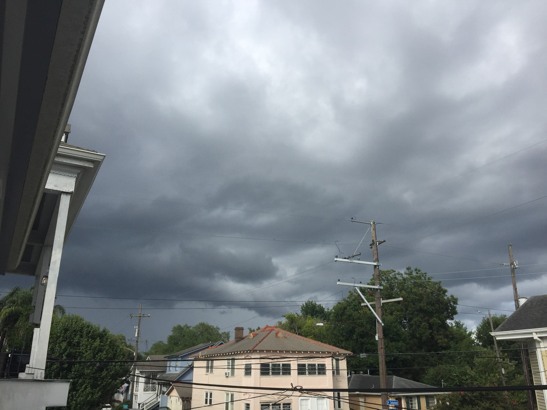
Haha. Always good to see you Annular. I’m proud to say I’m sitting through my second band. It wasn’t going to take much for me to get my moneys worth at this point. Tropical rains, not super heavy or anything. Winds gusted to about 20 so you could hear people’s wind chimes and leaves rustling in the trees but no whistling. Hopefully as the center passes to our south it will bring us more until I go to bed tonight.
Oh ****. I didn’t see the blue flash but I just heard a transformer pop in the distance. No tropical porch sitting is complete without one.
9:10 edit. Got some sideways bands coming across soon. Time for a refill and a shot of caffeine. https://www.weather.gov/lix/
3 likes
Re: ATL: MARCO - Tropical Storm - Discussion
Depression just offshore west of the mouth of the Mississippi:
10:00 PM CDT Mon Aug 24
Location: 29.0°N 89.8°W
Moving: W at 9 mph
Min pressure: 1007 mb
Max sustained: 35 mph
Location: 29.0°N 89.8°W
Moving: W at 9 mph
Min pressure: 1007 mb
Max sustained: 35 mph
2 likes
Re: ATL: MARCO - Tropical Depression - Discussion
Just did a shot of coffee. I got to work tomorrow so I’m going to try to watch models nap get up middle of the night and sleep after that. Meanwhile we have some special marine warnings to our east. So I guess I’m going to get a taste of what might have been.
https://www.weather.gov/lix/
https://www.weather.gov/lix/
0 likes
Re: ATL: MARCO - Remnants - Discussion
Poor little Marco met a dismal end.
Post-Tropical Cyclone Marco Advisory Number 21
NWS National Hurricane Center Miami FL AL142020
400 AM CDT Tue Aug 25 2020
...MARCO BECOMES A REMNANT LOW JUST SOUTH OF LOUISIANA...
...THIS IS THE LAST ADVISORY...
SUMMARY OF 400 AM CDT...0900 UTC...INFORMATION
----------------------------------------------
LOCATION...28.8N 91.2W
ABOUT 60 MI...100 KM S OF MORGAN CITY LOUISIANA
ABOUT 110 MI...175 KM SSE OF LAFAYETTE LOUISIANA
MAXIMUM SUSTAINED WINDS...30 MPH...45 KM/H
PRESENT MOVEMENT...W OR 270 DEGREES AT 10 MPH...17 KM/H
MINIMUM CENTRAL PRESSURE...1008 MB...29.77 INCHES
0 likes
Re: ATL: MARCO - Remnants - Discussion
wx98 wrote:Poor little Marco met a dismal end.Post-Tropical Cyclone Marco Advisory Number 21
NWS National Hurricane Center Miami FL AL142020
400 AM CDT Tue Aug 25 2020
...MARCO BECOMES A REMNANT LOW JUST SOUTH OF LOUISIANA...
...THIS IS THE LAST ADVISORY...
SUMMARY OF 400 AM CDT...0900 UTC...INFORMATION
----------------------------------------------
LOCATION...28.8N 91.2W
ABOUT 60 MI...100 KM S OF MORGAN CITY LOUISIANA
ABOUT 110 MI...175 KM SSE OF LAFAYETTE LOUISIANA
MAXIMUM SUSTAINED WINDS...30 MPH...45 KM/H
PRESENT MOVEMENT...W OR 270 DEGREES AT 10 MPH...17 KM/H
MINIMUM CENTRAL PRESSURE...1008 MB...29.77 INCHES
He was a fun storm to track. The naked swirl is moving as forecast toward SWLA. I still want to see if the low pressure center can survive until Laura gets there and see what happens. He was in the no man's land between the shear zone coming up from the SW and the high pressure bulging in from the E. You can see that setup clearly on IR this morning. There is some ongoing flooding in MS.
https://www.tropicaltidbits.com/sat/sat ... product=ir
3 likes
-
EquusStorm

- Category 5

- Posts: 1649
- Age: 33
- Joined: Thu Nov 07, 2013 1:04 pm
- Location: Jasper, AL
- Contact:
Re: ATL: MARCO - Remnants - Discussion
Marco may be dead but his tropical moisture chunk and disconnected mid-level remnants are bringing an overcast, rainy day to the central Gulf states; really low LCLs and extremely humid.

3 likes
Colors of lost purpose on the canvas of irrelevance
Not a meteorologist, in fact more of an idiot than anything. You should probably check with the NHC or a local NWS office for official information.
Not a meteorologist, in fact more of an idiot than anything. You should probably check with the NHC or a local NWS office for official information.
-
longhorn2004
- Tropical Low

- Posts: 30
- Joined: Fri Oct 06, 2017 1:49 pm
Re: ATL: MARCO - Remnants - Discussion
So will the rain on the NE side follow Marco to Texas? Central Texas in particular.
0 likes
Re: ATL: MARCO - Remnants - Discussion
Probably not much of it. It's windy today here in New Orleans. SE wins in the teens with gusts into the 20's and 30's down in Boothville and at the Airport.
0 likes
Re: ATL: MARCO - Remnants - Discussion
I just checked the progress of the swirl on IR and it is currently westbound south of Pecan Island. It’s been firing intermittent small convection blobs which immediately get blown off the the northeast at high speed. You can actually see the LLC on Lake Charles Radar now and rain across SW LA is broadly rotating around the center. Pretty neat
1 likes

Re: ATL: MARCO - Remnants - Discussion
Getting some descent down pours from him.
0 likes
Personal Forecast Disclaimer:
The posts in this forum are NOT official forecast and should not be used as such. They are just the opinion of the poster and may or may not be backed by sound meteorological data. They are NOT endorsed by any professional institution or storm2k.org. For official information, please refer to the NHC and NWS products.
The posts in this forum are NOT official forecast and should not be used as such. They are just the opinion of the poster and may or may not be backed by sound meteorological data. They are NOT endorsed by any professional institution or storm2k.org. For official information, please refer to the NHC and NWS products.
-
tarheelprogrammer

- S2K Supporter
- Posts: 1793
- Joined: Mon Mar 28, 2016 9:25 pm
- Location: Raleigh, NC area (Garner, NC)
Re: ATL: MARCO - Remnants - Discussion
It is quite funny to see Laura producing all this convection. Then we will take a peak at Marco's naked dying swirl, seeing it spurt convection only to have it quickly be trimmed off. I mean it is quickly getting its hair cut. 
1 likes
My posts are not official forecasts. They are just my opinion and may or may not be backed by sound meteorological data. They are NOT endorsed by any professional institution or storm2k.org. For official information, please refer to the NHC and NWS products.
Re: ATL: MARCO - Remnants - Discussion
The remnant swirl just came in south of Freeport, Texas. Confirmed by infrared and radar. It skirted around to the northwest of Laura all day.
0 likes
Who is online
Users browsing this forum: Google Adsense [Bot] and 82 guests