
ATL: DELTA - Models
Moderator: S2k Moderators
-
Wx_Warrior
- Category 5

- Posts: 2718
- Joined: Thu Aug 03, 2006 3:58 pm
- Location: Beaumont, TX
-
HurricaneBrain

- S2K Supporter

- Posts: 430
- Joined: Thu Jun 30, 2011 2:07 pm
- Location: Beaumont, TX
-
PTrackerLA

- Category 5
- Posts: 5248
- Age: 40
- Joined: Thu Oct 10, 2002 8:40 pm
- Location: Lafayette, LA
Re: ATL: DELTA - Models
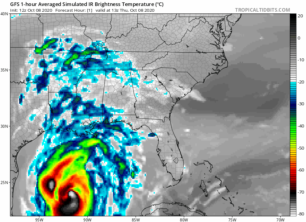
And yet on the 00z GFS, Vermilion/Acadia and Lafayette parishes still receive some of the highest winds with the heaviest precipitation to the west and north of the eye. The GRAF model which our local met keeps showing has a similar solution. It appears like Delta will become a very broad hurricane.
4 likes

Re: ATL: DELTA - Models
Can someone zoom in?
0 likes
Personal Forecast Disclaimer:
The posts in this forum are NOT official forecast and should not be used as such. They are just the opinion of the poster and may or may not be backed by sound meteorological data. They are NOT endorsed by any professional institution or storm2k.org. For official information, please refer to the NHC and NWS products.
The posts in this forum are NOT official forecast and should not be used as such. They are just the opinion of the poster and may or may not be backed by sound meteorological data. They are NOT endorsed by any professional institution or storm2k.org. For official information, please refer to the NHC and NWS products.
-
SconnieCane
- Category 4

- Posts: 913
- Joined: Thu Aug 02, 2018 5:29 pm
- Location: Madison, WI
Re: ATL: DELTA - Models
PTrackerLA wrote:And yet on the 00z GFS, Vermilion/Acadia and Lafayette parishes still receive some of the highest winds with the heaviest precipitation to the west and north of the eye. The GRAF model which our local met keeps showing has a similar solution. It appears like Delta will become a very broad hurricane.
https://imgur.com/TXO88XN
Ugh, a perfect bulls-eye on the spot previously hit by Laura.
0 likes
Re: ATL: DELTA - Models
The HWRF would be very bad for Lake Charles.

3 likes
Personal Forecast Disclaimer:
The posts in this forum are NOT official forecast and should not be used as such. They are just the opinion of the poster and may or may not be backed by sound meteorological data. They are NOT endorsed by any professional institution or storm2k.org. For official information, please refer to the NHC and NWS products.
The posts in this forum are NOT official forecast and should not be used as such. They are just the opinion of the poster and may or may not be backed by sound meteorological data. They are NOT endorsed by any professional institution or storm2k.org. For official information, please refer to the NHC and NWS products.
Re: ATL: DELTA - Models
Euro might be close to the last run. My eyes are tired.

0 likes
Personal Forecast Disclaimer:
The posts in this forum are NOT official forecast and should not be used as such. They are just the opinion of the poster and may or may not be backed by sound meteorological data. They are NOT endorsed by any professional institution or storm2k.org. For official information, please refer to the NHC and NWS products.
The posts in this forum are NOT official forecast and should not be used as such. They are just the opinion of the poster and may or may not be backed by sound meteorological data. They are NOT endorsed by any professional institution or storm2k.org. For official information, please refer to the NHC and NWS products.


-
stormlover2013
- Category 5
- Posts: 2312
- Joined: Thu Aug 22, 2013 12:06 pm
- Location: Lumberton, Texas
Re: ATL: DELTA - Models

10AM estimate based on NHC plot

7AM estimate based on NHC plot
I could be a little off here due to the 7AM update jumping from well offshore to well inland, but I extrapolated the data the best I could.
1 likes
-
PTrackerLA
- Category 5
- Posts: 5248
- Age: 40
- Joined: Thu Oct 10, 2002 8:40 pm
- Location: Lafayette, LA


Re: ATL: DELTA - Models
GFS with a pretty substantial west shift despite being only 36 hours out. I'm starting to wonder if a trend is establishing itself
0 likes

Re: ATL: DELTA - Models
Both HMON and HWRF look like they took a shift east?
0 likes
Personal Forecast Disclaimer:
The posts in this forum are NOT official forecast and should not be used as such. They are just the opinion of the poster and may or may not be backed by sound meteorological data. They are NOT endorsed by any professional institution or storm2k.org. For official information, please refer to the NHC and NWS products.
The posts in this forum are NOT official forecast and should not be used as such. They are just the opinion of the poster and may or may not be backed by sound meteorological data. They are NOT endorsed by any professional institution or storm2k.org. For official information, please refer to the NHC and NWS products.

Re: ATL: DELTA - Models
SoupBone wrote:Both HMON and HWRF look like they took a shift east?
HWRF looks to be back where it was for the 18Z run yesterday. Wobble watching time?
0 likes

Re: ATL: DELTA - Models
HMON

HWRF

HWRF IR - looks to be degrading pretty fast at landfall at least on IR
https://www.tropicaltidbits.com/analysi ... 0812&fh=36
HWRF
HWRF IR - looks to be degrading pretty fast at landfall at least on IR
https://www.tropicaltidbits.com/analysi ... 0812&fh=36
0 likes
-
PTrackerLA
- Category 5
- Posts: 5248
- Age: 40
- Joined: Thu Oct 10, 2002 8:40 pm
- Location: Lafayette, LA
Re: ATL: DELTA - Models
2 likes
Re: ATL: DELTA - Models
Anyone have the Euro? On Tidbits it jumps in time increments too much for me to see landfall.
0 likes
Personal Forecast Disclaimer:
The posts in this forum are NOT official forecast and should not be used as such. They are just the opinion of the poster and may or may not be backed by sound meteorological data. They are NOT endorsed by any professional institution or storm2k.org. For official information, please refer to the NHC and NWS products.
The posts in this forum are NOT official forecast and should not be used as such. They are just the opinion of the poster and may or may not be backed by sound meteorological data. They are NOT endorsed by any professional institution or storm2k.org. For official information, please refer to the NHC and NWS products.
-
HouTXmetro

- Category 5
- Posts: 3949
- Joined: Sun Jun 13, 2004 6:00 pm
- Location: District of Columbia, USA
Re: ATL: DELTA - Models
Is it safe to say the EURO finally scored a 2020 coup by sniffing out the Western landfall first?
0 likes
[Disclaimer: My Amateur Opinion, please defer to your local authorities or the NHC for Guidance.]
-
HurricaneBrain
- S2K Supporter
- Posts: 430
- Joined: Thu Jun 30, 2011 2:07 pm
- Location: Beaumont, TX
Re: ATL: DELTA - Models
Euro with a slight shift west. HI RES: https://www.pivotalweather.com/model.ph ... &dpdt=&mc=
0 likes
Who is online
Users browsing this forum: No registered users and 23 guests