Moderator: S2k Moderators


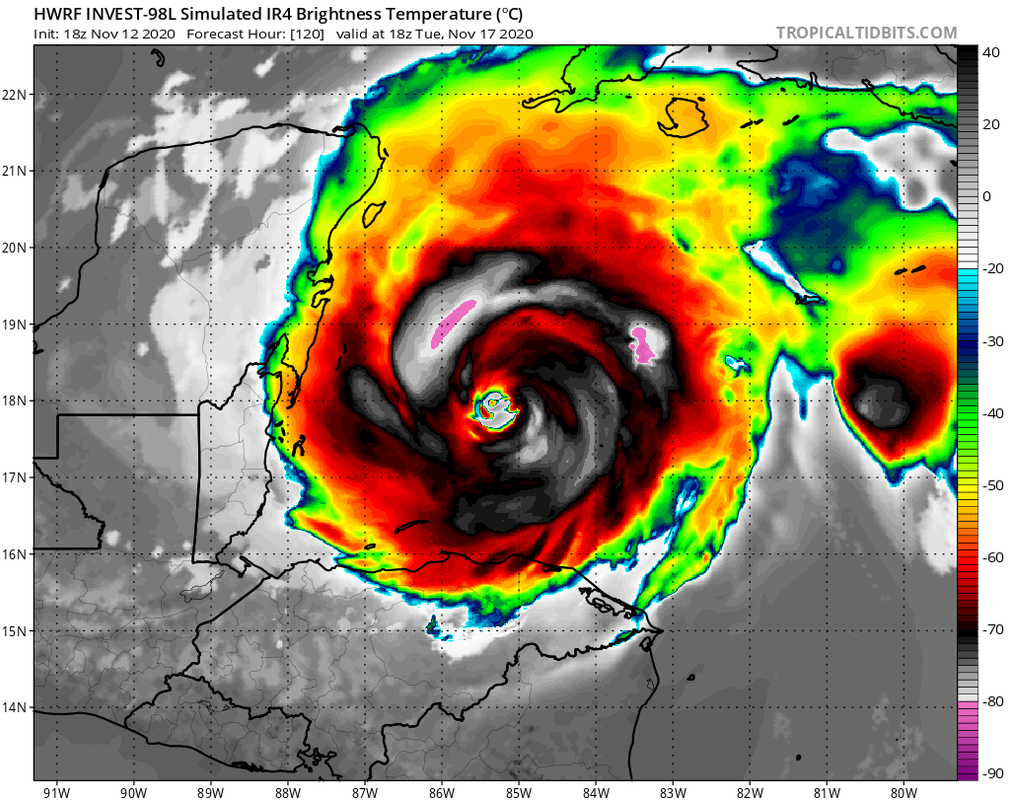
LarryWx wrote:The Happy Hour King and his ensembles say the HWRF and HMON are on crack:
https://i.imgur.com/vuhWSdB.png
https://i.imgur.com/VTguyBv.png


SFLcane wrote:LarryWx wrote:The Happy Hour King and his ensembles say the HWRF and HMON are on crack:
https://i.imgur.com/vuhWSdB.png
https://i.imgur.com/VTguyBv.png
Makes perfect sense to me conditions are very favorable as long as it stays south. HWRF gave up the idea to head NW unfortunately looks pretty bad for those in CA once again.


blp wrote:Less of a SW bend on 18z Euro ensembles compared to 12z now most reach Belize instead of EPAC.
18z
https://i.ibb.co/Mhhj49x/ecens-2020-11-12-18-Z-144-24-672-261-768-7-007-293-661-MSLP-Surface-tracks-lows.png
12z
https://i.ibb.co/qJNNfQ3/ecens-2020-11-12-12-Z-144-24-672-261-768-7-007-293-661-MSLP-Surface-tracks-lows.png


Users browsing this forum: No registered users and 17 guests