ATL: SAM - Remnants - Discussion
Moderator: S2k Moderators
Re: ATL: INVEST 98L - Discussion
It’ll really throw the models for a loop if 98L consolidates way quicker than forecast and further north than expected. The model consensus doesn’t show a TS until Friday, and the disturbance takes a SW dip during the next 24-36 hours before coming back north.
0 likes
Irene '11 Sandy '12 Hermine '16 5/15/2018 Derecho Fay '20 Isaias '20 Elsa '21 Henri '21 Ida '21
I am only a meteorology enthusiast who knows a decent amount about tropical cyclones. Look to the professional mets, the NHC, or your local weather office for the best information.
I am only a meteorology enthusiast who knows a decent amount about tropical cyclones. Look to the professional mets, the NHC, or your local weather office for the best information.
Re: ATL: INVEST 98L - Discussion
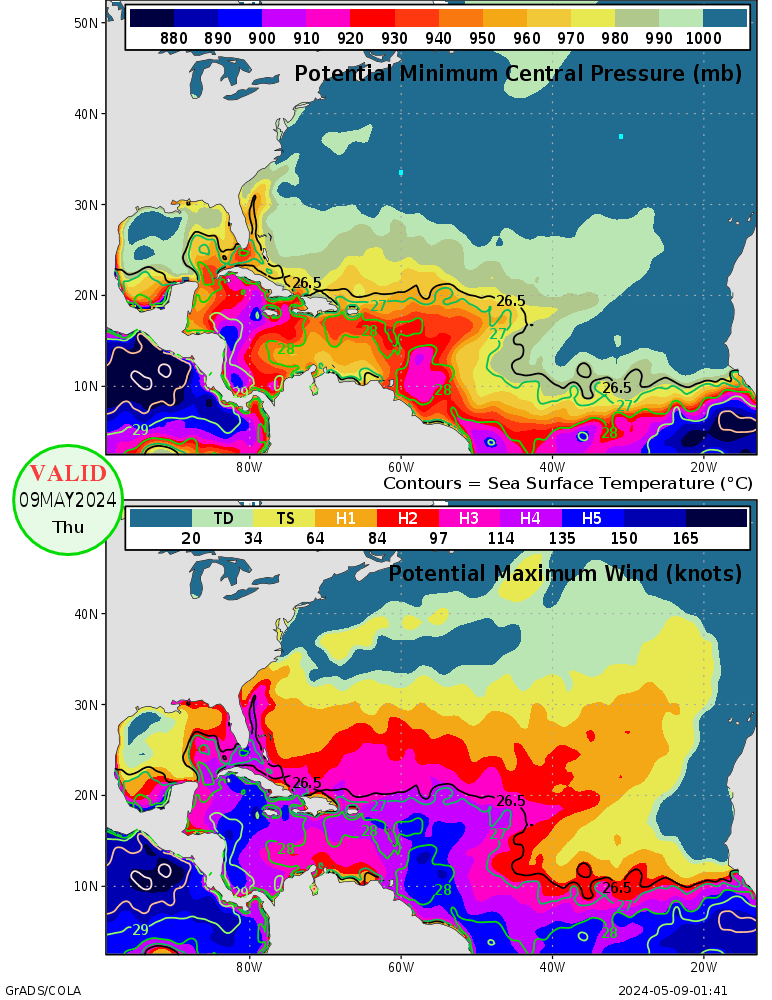
How does the GFS continuously handle the ridging this poorly?
1 likes
The above post is not official and should not be used as such. It is the opinion of the poster and may or may not be backed by sound meteorological data. It is not endorsed by any professional institution or storm2k.org. For official information, please refer to the NHC and NWS products.
- Category5Kaiju
- Category 5

- Posts: 4334
- Joined: Thu Dec 24, 2020 12:45 pm
- Location: Seattle and Phoenix
Re: ATL: INVEST 98L - Discussion
aspen wrote:It’ll really throw the models for a loop if 98L consolidates way quicker than forecast and further north than expected. The model consensus doesn’t show a TS until Friday, and the disturbance takes a SW dip during the next 24-36 hours before coming back north.
The way I imagine it is like a Douglas 2020-like path except in the Atlantic MDR.
2 likes
Unless explicitly stated, all info in my posts is based on my own opinions and observations. Tropical storms and hurricanes can be extremely dangerous. Refer to an accredited weather research agency or meteorologist if you need to make serious decisions regarding an approaching storm.
-
grapealcoholic
- Category 2

- Posts: 703
- Joined: Tue Aug 10, 2021 3:26 pm
Re: ATL: INVEST 98L - Discussion
aspen wrote:It’ll really throw the models for a loop if 98L consolidates way quicker than forecast and further north than expected. The model consensus doesn’t show a TS until Friday, and the disturbance takes a SW dip during the next 24-36 hours before coming back north.
A stronger storm would go further south and west

1 likes
- cycloneye
- Admin

- Posts: 149508
- Age: 69
- Joined: Thu Oct 10, 2002 10:54 am
- Location: San Juan, Puerto Rico
Re: ATL: INVEST 98L - Discussion
00z Best Track:
AL, 98, 2021092200, , BEST, 0, 96N, 296W, 25, 1010, DB
0 likes
Visit the Caribbean-Central America Weather Thread where you can find at first post web cams,radars
and observations from Caribbean basin members Click Here
and observations from Caribbean basin members Click Here
Re: ATL: INVEST 98L - Discussion
Looks like 98L is getting its act together fairly quickly. So much for the struggle calls or even Peter 2.0 calls earlier when it was devoid of convection.


0 likes
TC naming lists: retirements and intensity
Most aggressive Advisory #1's in North Atlantic (cr. kevin for starting the list)
Most aggressive Advisory #1's in North Atlantic (cr. kevin for starting the list)
- cycloneye
- Admin

- Posts: 149508
- Age: 69
- Joined: Thu Oct 10, 2002 10:54 am
- Location: San Juan, Puerto Rico
Re: ATL: INVEST 98L - Discussion
0 likes
Visit the Caribbean-Central America Weather Thread where you can find at first post web cams,radars
and observations from Caribbean basin members Click Here
and observations from Caribbean basin members Click Here
- ouragans
- Category 2

- Posts: 501
- Age: 54
- Joined: Sun Jun 12, 2011 12:09 pm
- Location: Abymes, Guadeloupe F.W.I
- Contact:
Re: ATL: INVEST 98L - Discussion
Invest 98L
As of 00:00 UTC Sep 22, 2021:
Location: 9.6°N 29.6°W
Maximum Winds: 25 kt Gusts: N/A
Minimum Central Pressure: 1010 mb
Environmental Pressure: N/A
Radius of Circulation: N/A
Radius of Maximum wind: 80 nm
As of 00:00 UTC Sep 22, 2021:
Location: 9.6°N 29.6°W
Maximum Winds: 25 kt Gusts: N/A
Minimum Central Pressure: 1010 mb
Environmental Pressure: N/A
Radius of Circulation: N/A
Radius of Maximum wind: 80 nm
0 likes
Personal forecast disclaimer
This post is a personal point of view, not an information. Please refer to official statements for life-threatening decisions.
David '79, Frederic '79, Hugo '89, Iris, Luis & Marilyn '95, Georges '98, Lenny '99, Dean '07, Irma '17, Maria '17, Fiona '22, Philippe '23, Tammy '23
16°13'33.3,"6N -61°36'39.5"W
- SFLcane
- S2K Supporter

- Posts: 10281
- Age: 48
- Joined: Sat Jun 05, 2010 1:44 pm
- Location: Lake Worth Florida
Re: ATL: INVEST 98L - Discussion
This is a go for development. Environment ahead looks quite favorable unlike previous Mdr waves
3 likes
-
jlauderdal
- S2K Supporter

- Posts: 7240
- Joined: Wed May 19, 2004 5:46 am
- Location: NE Fort Lauderdale
- Contact:
Re: RE: Re: ATL: INVEST 98L - Discussion
Its the same gfs that drives the system through the ridge down the roadHammy wrote:
How does the GFS continuously handle the ridging this poorly?
1 likes
- Category5Kaiju
- Category 5

- Posts: 4334
- Joined: Thu Dec 24, 2020 12:45 pm
- Location: Seattle and Phoenix
Re: ATL: INVEST 98L - Discussion

Assuming everything goes in favor for future Sam, a very strong Cat 4 or even a Cat 5 cannot be ruled out. Just saying...
3 likes
Unless explicitly stated, all info in my posts is based on my own opinions and observations. Tropical storms and hurricanes can be extremely dangerous. Refer to an accredited weather research agency or meteorologist if you need to make serious decisions regarding an approaching storm.
- Stormybajan
- Category 1

- Posts: 453
- Joined: Thu May 20, 2021 3:21 pm
- Location: Windward Islands
Re: ATL: INVEST 98L - Discussion
cycloneye wrote:https://twitter.com/AndyHazelton/status/1440478046012641290
I saw this and was like wow...thankfully someone else noticed it also, pretty cool feature like an umbilical cord
0 likes
Sad West Indies and Manchester United fan ⚽️
-
Sciencerocks
- Category 5

- Posts: 10186
- Age: 40
- Joined: Thu Jul 06, 2017 1:51 am
Re: ATL: INVEST 98L - Discussion
HWRF 00Z drops it. Could be a dud run, or maybe the beginning of the normal model drop off we have seen so much of lately?
0 likes
Re: ATL: INVEST 98L - Discussion
WiscoWx02 wrote:HWRF 00Z drops it. Could be a dud run, or maybe the beginning of the normal model drop off we have seen so much of lately?
Given the current organization trends, that seems extremely unlikely.
What you're seeing is the 18z HWRF, not 00z. As mentioned in the models thread, the 18z HWRF run was erroneous in that it focused on another random area of low pressure.
0 likes
TC naming lists: retirements and intensity
Most aggressive Advisory #1's in North Atlantic (cr. kevin for starting the list)
Most aggressive Advisory #1's in North Atlantic (cr. kevin for starting the list)
- ElectricStorm
- Category 5

- Posts: 5147
- Age: 25
- Joined: Tue Aug 13, 2019 11:23 pm
- Location: Norman, OK
Re: ATL: INVEST 98L - Discussion
Teban54 wrote:WiscoWx02 wrote:HWRF 00Z drops it. Could be a dud run, or maybe the beginning of the normal model drop off we have seen so much of lately?
Given the current organization trends, that seems extremely unlikely.
Yeah the 18z run was a dud, 0z hasn't ran yet. 98L is actually behaving similar to the 12z HWRF which showed a big blowup of convection today, which has happened. That run went on to have a Cat 4 approaching the islands.
0 likes
B.S Meteorology, University of Oklahoma '25
Please refer to the NHC, NWS, or SPC for official information.
Please refer to the NHC, NWS, or SPC for official information.
-
grapealcoholic
- Category 2

- Posts: 703
- Joined: Tue Aug 10, 2021 3:26 pm
Re: ATL: INVEST 98L - Discussion
Weather Dude wrote:Teban54 wrote:WiscoWx02 wrote:HWRF 00Z drops it. Could be a dud run, or maybe the beginning of the normal model drop off we have seen so much of lately?
Given the current organization trends, that seems extremely unlikely.
Yeah the 18z run was a dud, 0z hasn't ran yet. 98L is actually behaving similar to the 12z HWRF which showed a big blowup of convection today, which has happened. That run went on to have a Cat 4 approaching the islands.
Ohhhhhh. Wasn't aware of that yet oops. Thanks for that update guys!
0 likes
Re: ATL: INVEST 98L - Discussion
WiscoWx02 wrote:HWRF 00Z drops it. Could be a dud run, or maybe the beginning of the normal model drop off we have seen so much of lately?
If you look at the HWRF-Parent (same as HWRF expect it is a wider view) it still develops 98L. HWRF-Parent is a lower resolution than the HWRF so it would likely be stronger than what it is showing. HWRF sometimes has an issue with systems that haven't developed yet where it sometimes just loses the system and latches onto a seperate low pressure system that is not related to what it is supposed to be tracking. https://www.tropicaltidbits.com/analysi ... 92118&fh=3
2 likes
- ElectricStorm
- Category 5

- Posts: 5147
- Age: 25
- Joined: Tue Aug 13, 2019 11:23 pm
- Location: Norman, OK
Re: ATL: INVEST 98L - Discussion
WiscoWx02 wrote:Weather Dude wrote:Teban54 wrote:Given the current organization trends, that seems extremely unlikely.
Yeah the 18z run was a dud, 0z hasn't ran yet. 98L is actually behaving similar to the 12z HWRF which showed a big blowup of convection today, which has happened. That run went on to have a Cat 4 approaching the islands.
Ohhhhhh. Wasn't aware of that yet oops. Thanks for that update guys!
Yeah sometimes HWRF/HMON randomly lose a storm and then show nothing, which happened at 18z. They should be better once an actual center forms within the next few days.
0 likes
B.S Meteorology, University of Oklahoma '25
Please refer to the NHC, NWS, or SPC for official information.
Please refer to the NHC, NWS, or SPC for official information.
Who is online
Users browsing this forum: No registered users and 25 guests


