capNstorms wrote:Ida legit just jogged west.
The NHC term for that is wobbling lol
Moderator: S2k Moderators

capNstorms wrote:Ida legit just jogged west.


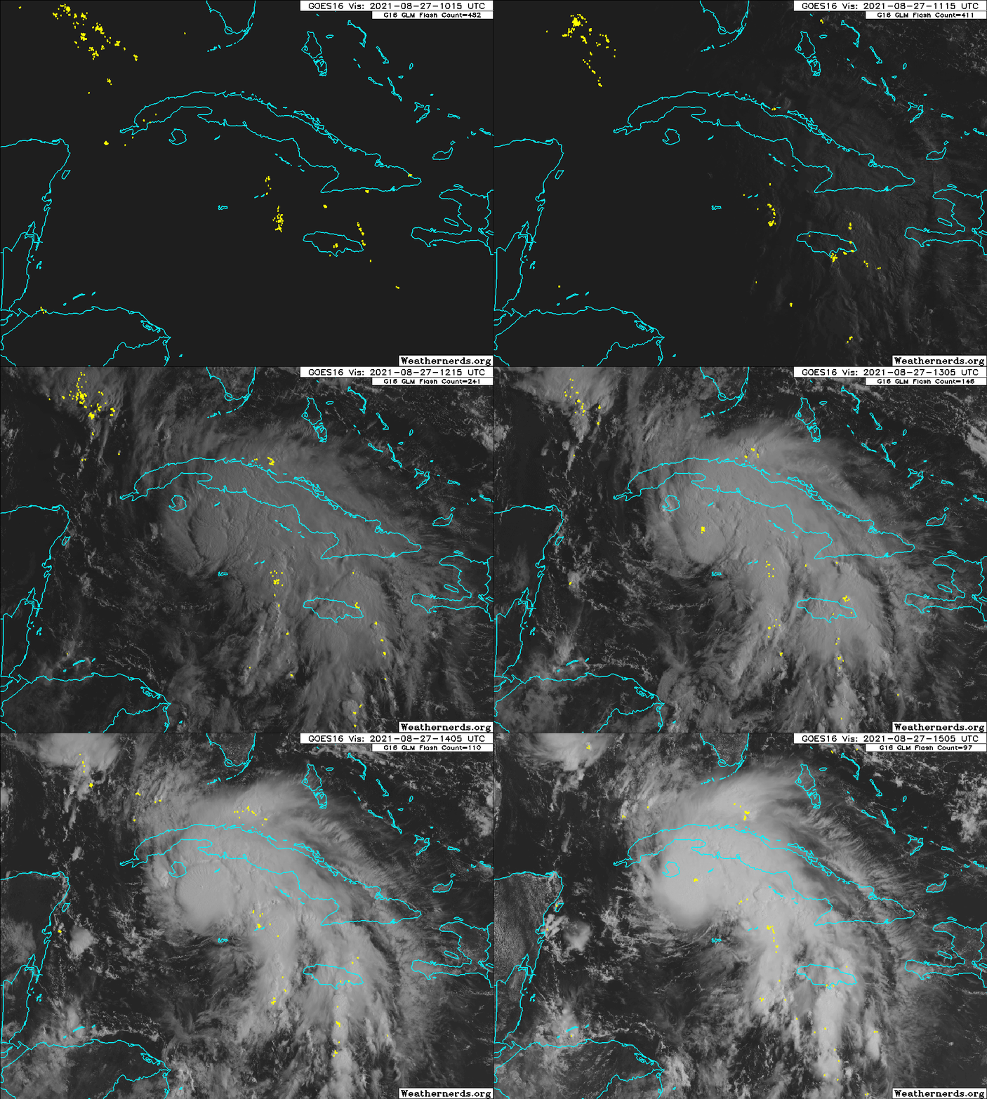
USTropics wrote:Saved visible loop from this morning when Ida underwent intense updrafts/hot towers, which can be seen with the lightning bursts near the center:
https://i.postimg.cc/65pPwRk6/44532476.gif
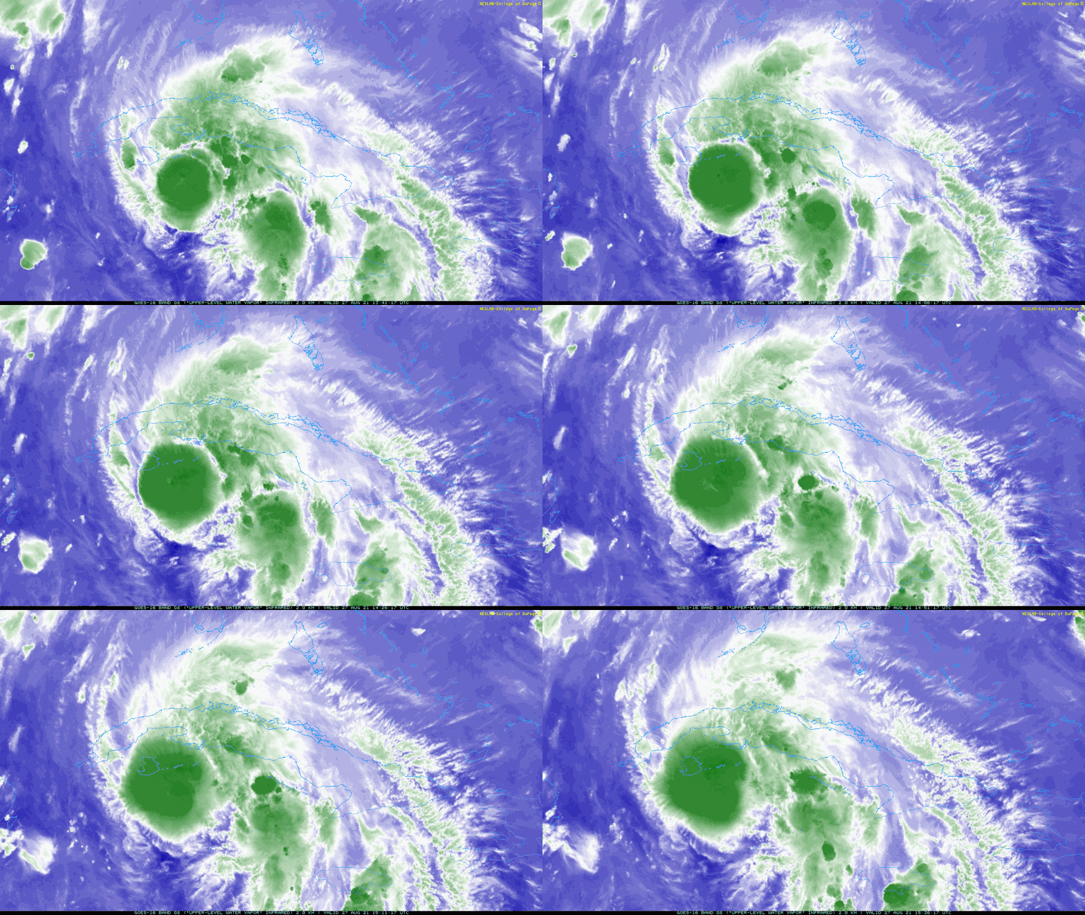
Another clue was the subtle atmospheric gravity waves in the tropopause that can be seen on the edge of the developing CDO. This is another sign that strong updrafts and deepening convection near the center were occurring (the upward-propagating gravity waves creates the expanding spirals that radiate from the center):
https://i.postimg.cc/tCvMgJb3/CODNEXLAB-GOES-East-subregional-Cuba-08-15-36-Z-20210827-map-24-1n-10-100.gif
Another fascinating feature with this storm has been the diabetic outflow. Over the past 24 hours, it has quite literally shoved the TUTT towards the west, with a noticeable fracture over Florida:
https://i.imgur.com/SrIWF1n.gif
AlabamaDave wrote:Are there any good analogs for a major hurricane on this track as far as impacts on the New Orleans area? I was kind of thinking Betsy, but she was on a sharper NW trajectory with no curve around to the north when she hit SE Louisiana, and also the center passed closer to the city. Then I thought about Andrew, and the angle of approach is pretty similar, but he made landfall a bit west of current projections. I don't recall Andrew causing dramatic impacts for NOLA. Certainly not trying to downplay, but am wondering whether the current track, with the center crossing over Baton Rouge, would likely spare NOLA from much beyond Cat-1 winds and storm surge outside the levees and sea walls. IF it follows the exact NHC track forecast right now. I know flooding in the city from excessive rainfall will also be a major problem no matter where this lands.


aspen wrote:xironman wrote:996 to 992 in one pass, and to think that once this gets the gulf conditions will be better for rapid strengthening.
It’s going to spend much of tomorrow over the Loop Current and might be a hurricane upon entering the Gulf…this is a very, very bad combination. I could see it reaching major hurricane intensity as early as tomorrow’s 2pm intermediate advisory.


Stormgodess wrote:WOW grabbed a couple hours sleep, and wake up to what feels like a gut punch looking at the the models. And I knew it would be a monster since yesterday, but dang this is so worse case!


xironman wrote:They start the continuous monitoring tomorrow.A. BEGIN 3-HRLY FIXES ON TROPICAL DEPRESSION NINE
AT 28/2330Z


grapealcoholic wrote:10 minutes ago people were discussing the storm going east of juventud lol


aspen wrote:Adios recon. Hopefully we have another plane arrive in time to provide data for the 5pm advisory.

aspen wrote:I thought recon was leaving earlier. Are they getting ready for a final center pass?
ScottNAtlanta wrote:Stormgodess wrote:WOW grabbed a couple hours sleep, and wake up to what feels like a gut punch looking at the the models. And I knew it would be a monster since yesterday, but dang this is so worse case!
Any news on them getting the pumps working in NOLA?
Users browsing this forum: No registered users and 22 guests