ATL: INVEST 90L - Discussion
Moderator: S2k Moderators
-
Weatherboy1

- Category 5

- Posts: 1190
- Age: 50
- Joined: Mon Jul 05, 2004 1:50 pm
- Location: Jupiter/Sarasota, FL
Re: ATL: INVEST 90L - Discussion
Definitely more interesting today … and of course we’re “Code Orange” now. Typical that something forming in that area would get swept N/NE eventually. But this one could come west based on a handful of early models. Will see
1 likes
-
tropicwatch

- Category 5
- Posts: 3426
- Age: 62
- Joined: Sat Jun 02, 2007 10:01 am
- Location: The Villages, Florida
- Contact:
Re: ATL: INVEST 90L - Discussion
Weatherboy1 wrote:Definitely more interesting today … and of course we’re “Code Orange” now. Typical that something forming in that area would get swept N/NE eventually. But this one could come west based on a handful of early models. Will see
The high over the Gulf of Mexico could certainly make that happen.
0 likes
Tropicwatch
Agnes 72', Eloise 75, Elena 85', Kate 85', Charley 86', Florence 88', Beryl 94', Dean 95', Erin 95', Opal 95', Earl 98', Georges 98', Ivan 2004', Arlene 2005', Dennis 2005', Ida 2009' Debby 2012' Irma 2017' Michael 2018'
Agnes 72', Eloise 75, Elena 85', Kate 85', Charley 86', Florence 88', Beryl 94', Dean 95', Erin 95', Opal 95', Earl 98', Georges 98', Ivan 2004', Arlene 2005', Dennis 2005', Ida 2009' Debby 2012' Irma 2017' Michael 2018'

Re: ATL: INVEST 90L - Discussion
Pretty strong NW shear...whole system looks to be dropping S-SE. CMC and ICON take into JAX/SE Georgia eventually. 12z GFS and Euro across central Florida west into the GOM and weak.
0 likes
-
Weatherboy1
- Category 5
- Posts: 1190
- Age: 50
- Joined: Mon Jul 05, 2004 1:50 pm
- Location: Jupiter/Sarasota, FL
Re: ATL: INVEST 90L - Discussion
Model map over at TT website has that “squashed spider” pattern to it  Hard to make a high confidence forecast here for now
0 likes
-
cycloneye

- Admin

- Posts: 149550
- Age: 69
- Joined: Thu Oct 10, 2002 10:54 am
- Location: San Juan, Puerto Rico
Re: ATL: INVEST 90L - Discussion
EP, 90, 2021050906, , BEST, 0, 136N, 1076W, 30, 1006, LO
0 likes
Visit the Caribbean-Central America Weather Thread where you can find at first post web cams,radars
and observations from Caribbean basin members Click Here
and observations from Caribbean basin members Click Here
-
Hypercane_Kyle

- Category 5
- Posts: 3465
- Joined: Sat Mar 07, 2015 7:58 pm
- Location: Cape Canaveral, FL
Re: ATL: INVEST 90L - Discussion
Certainly has the look of a developing tropical cyclone.

13 likes
My posts are my own personal opinion, defer to the National Hurricane Center (NHC) and other NOAA products for decision making during hurricane season.
Re: ATL: INVEST 90L - Discussion
I'm gonna wishcast some cooling showers from this. Yesterday's high of 97 and low of 80 @ tampa was a tad much.
1 likes
-
captainbarbossa19

- Professional-Met

- Posts: 1094
- Age: 27
- Joined: Wed Aug 21, 2019 11:09 pm
- Location: Beaumont, TX
Re: ATL: INVEST 90L - Discussion
So I see that some models are taking the vortex across the FL peninsula, but why does the NHC not show this on the TWO graph? Do they think it is not going to head west at all?
0 likes
-
lrak

- S2K Supporter

- Posts: 1770
- Age: 59
- Joined: Thu Jun 21, 2007 2:48 pm
- Location: Corpus Christi, TX
Re: ATL: INVEST 90L - Discussion
Winds are up and pressure is going DOWN 
https://www.ndbc.noaa.gov/station_page.php?station=41010
https://www.ndbc.noaa.gov/images/buoycam/Z48A_2021_07_23_1910.jpg
https://www.ndbc.noaa.gov/station_page.php?station=41009
https://www.ndbc.noaa.gov/station_page.php?station=41010
https://www.ndbc.noaa.gov/images/buoycam/Z48A_2021_07_23_1910.jpg
https://www.ndbc.noaa.gov/station_page.php?station=41009
0 likes
AKA karl
Also
Personal Forecast Disclaimer:
My posts on this forum are NOT official forecast and should not be used as such. My posts are my basic observations and are definitely not backed by any "well some" meteorological knowledge. For official information, please refer to the NHC and NWS products.
Also
Personal Forecast Disclaimer:
My posts on this forum are NOT official forecast and should not be used as such. My posts are my basic observations and are definitely not backed by any "well some" meteorological knowledge. For official information, please refer to the NHC and NWS products.
-
AlphaToOmega
- Category 5
- Posts: 1448
- Joined: Sat Jun 26, 2021 10:51 am
- Location: Somewhere in Massachusetts
Re: ATL: INVEST 90L - Discussion
From Tropical Tidbits:
Invest 90L
As of 18:00 UTC Jul 23, 2021:
Location: 30.8°N 78.9°W
Maximum Winds: 25 kt Gusts: nan kt
Minimum Central Pressure: 1016 mb
Environmental Pressure: 1019 mb
Radius of Circulation: 150 nm
Radius of Maximum Wind: 75 nm
As of 18:00 UTC Jul 23, 2021:
Location: 30.8°N 78.9°W
Maximum Winds: 25 kt Gusts: nan kt
Minimum Central Pressure: 1016 mb
Environmental Pressure: 1019 mb
Radius of Circulation: 150 nm
Radius of Maximum Wind: 75 nm
0 likes
-
captainbarbossa19
- Professional-Met
- Posts: 1094
- Age: 27
- Joined: Wed Aug 21, 2019 11:09 pm
- Location: Beaumont, TX
Re: ATL: INVEST 90L - Discussion
AlphaToOmega wrote:From Tropical Tidbits:Invest 90L
As of 18:00 UTC Jul 23, 2021:
Location: 30.8°N 78.9°W
Maximum Winds: 25 kt Gusts: nan kt
Minimum Central Pressure: 1016 mb
Environmental Pressure: 1019 mb
Radius of Circulation: 150 nm
Radius of Maximum Wind: 75 nm
I think that a big latitude adjustment south is going to be needed at 0z.
0 likes

Re: ATL: INVEST 90L - Discussion
From 5 hours ago, what was seen pushing to the south was nothing but the mid level circulation being sheared to the south, the broad surface low is well to the north of the convection.

1 likes
-
Iceresistance

- Category 5
- Posts: 9598
- Age: 22
- Joined: Sat Oct 10, 2020 9:45 am
- Location: Tecumseh, OK/Norman, OK
Re: ATL: INVEST 90L - Discussion
The uncertainty is high with this system, I hope it retrogrades towards (Like some models are showing.) Texas to push back the heat dome!
1 likes
Bill 2015 & Beta 2020
Winter 2020-2021
All observations are in Tecumseh, OK unless otherwise noted.
Winter posts are focused mainly for Oklahoma & Texas.
Take any of my forecasts with a grain of salt, refer to the NWS, SPC, and NHC for official information
Never say Never with weather! Because ANYTHING is possible!
Winter 2020-2021
All observations are in Tecumseh, OK unless otherwise noted.
Winter posts are focused mainly for Oklahoma & Texas.
Take any of my forecasts with a grain of salt, refer to the NWS, SPC, and NHC for official information
Never say Never with weather! Because ANYTHING is possible!

Re: ATL: INVEST 90L - Discussion
Iceresistance wrote:The uncertainty is high with this system, I hope it retrogrades towards (Like some models are showing.) Texas to push back the heat dome!
Yes please! No heat dome!!!
0 likes
Re: ATL: INVEST 90L - Discussion
captainbarbossa19 wrote:So I see that some models are taking the vortex across the FL peninsula, but why does the NHC not show this on the TWO graph? Do they think it is not going to head west at all?
My guess is the uncertainty with the models - best to just show meandering now off the coast for now until better guidance agreement.
0 likes
-
cycloneye
- Admin
- Posts: 149550
- Age: 69
- Joined: Thu Oct 10, 2002 10:54 am
- Location: San Juan, Puerto Rico
Re: ATL: INVEST 90L - Discussion
0 likes
Visit the Caribbean-Central America Weather Thread where you can find at first post web cams,radars
and observations from Caribbean basin members Click Here
and observations from Caribbean basin members Click Here
-
cycloneye
- Admin
- Posts: 149550
- Age: 69
- Joined: Thu Oct 10, 2002 10:54 am
- Location: San Juan, Puerto Rico
Re: ATL: INVEST 90L - Discussion
0 likes
Visit the Caribbean-Central America Weather Thread where you can find at first post web cams,radars
and observations from Caribbean basin members Click Here
and observations from Caribbean basin members Click Here

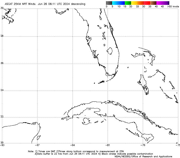
Re: ATL: INVEST 90L - Discussion
ASCAT from 20:12 UTC is showing 30knt winds. The models have winds no where near this and the one that does has 50 knot winds tomorrow, which I would consider the model been stupid.
1 likes

Re: ATL: INVEST 90L - Discussion
The tail end of the front is rolling southeast may be a closed circulation by tonight.
0 likes
-
jaxfladude
- Category 5
- Posts: 1249
- Joined: Wed Aug 24, 2005 9:36 pm
- Location: Jacksonville, Fla
Re: ATL: INVEST 90L - Discussion
No big surprise with this system, right? Just some heavy winds and rains for Northeastern Florida\Southeastern Georgia?
Last edited by jaxfladude on Fri Jul 23, 2021 5:14 pm, edited 1 time in total.
0 likes
Stay safe y'all
Who is online
Users browsing this forum: No registered users and 10 guests