AutoPenalti wrote:hurricane2025 wrote:Cmc is never right
Neither is any model past 48hrs.
That is so not true
Moderator: S2k Moderators

AutoPenalti wrote:hurricane2025 wrote:Cmc is never right
Neither is any model past 48hrs.


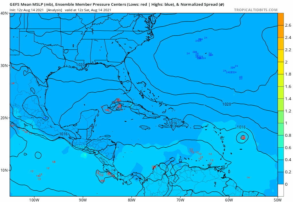
gatorcane wrote:lsuhurricane wrote:https://www.tropicaltidbits.com/analysis/models/gfs-ens/2021081412/gfs-ememb_lowlocs_us_29.png
For those harping on the GFS ensembles, they sure perked up on this run.
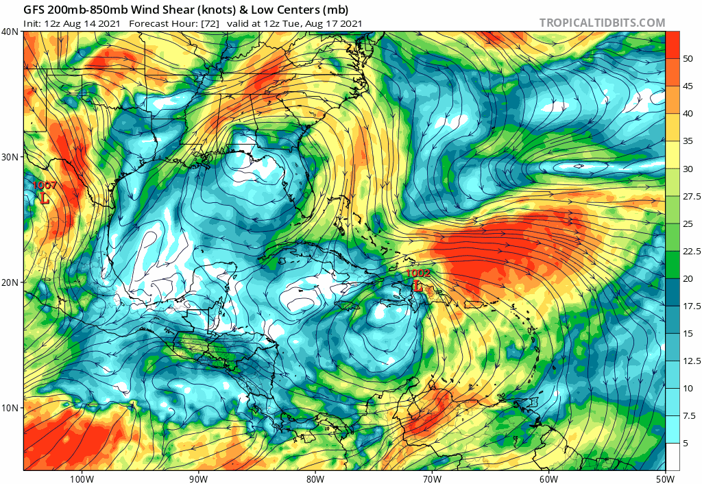


toad strangler wrote:This is a strong signal for a S FL hit from the East. One run doesn't make a trend but it's intriguing that multiple 12z models show something similar. 12z Euro should be interesting. BUT THAT TRACK .... which I'm ABSOLUTELY SURE will change and more than a few times N and or S is worrisome for the FL peninsula and points W in the GOM. And OF COURSE PR and Hispaniola ...
https://i.ibb.co/TgJRD2V/gfs-ememb-lowlocs-watl-22.png
eastcoastFL wrote:toad strangler wrote:This is a strong signal for a S FL hit from the East. One run doesn't make a trend but it's intriguing that multiple 12z models show something similar. 12z Euro should be interesting. BUT THAT TRACK .... which I'm ABSOLUTELY SURE will change and more than a few times N and or S is worrisome for the FL peninsula and points W in the GOM. And OF COURSE PR and Hispaniola ...
https://i.ibb.co/TgJRD2V/gfs-ememb-lowlocs-watl-22.png
A few models showing a Katrina type track for this with a potential for something big in the gulf. I hope the gulf states are prepared. I don’t think she will be much of an issue for us in Florida.
Shell Mound wrote:toad strangler wrote:This is a strong signal for a S FL hit from the East. One run doesn't make a trend but it's intriguing that multiple 12z models show something similar. 12z Euro should be interesting. BUT THAT TRACK .... which I'm ABSOLUTELY SURE will change and more than a few times N and or S is worrisome for the FL peninsula and points W in the GOM. And OF COURSE PR and Hispaniola ...
https://i.ibb.co/TgJRD2V/gfs-ememb-lowlocs-watl-22.png
Of the six members that show landfall on South Florida, four indicate a MSLP ranging between 973–986 mb, suggesting MSW between 70–80 kt at landfall.
toad strangler wrote:eastcoastFL wrote:toad strangler wrote:This is a strong signal for a S FL hit from the East. One run doesn't make a trend but it's intriguing that multiple 12z models show something similar. 12z Euro should be interesting. BUT THAT TRACK .... which I'm ABSOLUTELY SURE will change and more than a few times N and or S is worrisome for the FL peninsula and points W in the GOM. And OF COURSE PR and Hispaniola ...
https://i.ibb.co/TgJRD2V/gfs-ememb-lowlocs-watl-22.png
A few models showing a Katrina type track for this with a potential for something big in the gulf. I hope the gulf states are prepared. I don’t think she will be much of an issue for us in Florida.
Katrina formed just off the FL coast. Nothing like Katrina.
Category5Kaiju wrote:eastcoastFL wrote:toad strangler wrote:This is a strong signal for a S FL hit from the East. One run doesn't make a trend but it's intriguing that multiple 12z models show something similar. 12z Euro should be interesting. BUT THAT TRACK .... which I'm ABSOLUTELY SURE will change and more than a few times N and or S is worrisome for the FL peninsula and points W in the GOM. And OF COURSE PR and Hispaniola ...
https://i.ibb.co/TgJRD2V/gfs-ememb-lowlocs-watl-22.png
A few models showing a Katrina type track for this with a potential for something big in the gulf. I hope the gulf states are prepared. I don’t think she will be much of an issue for us in Florida.
Rita too
toad strangler wrote:Shell Mound wrote:toad strangler wrote:This is a strong signal for a S FL hit from the East. One run doesn't make a trend but it's intriguing that multiple 12z models show something similar. 12z Euro should be interesting. BUT THAT TRACK .... which I'm ABSOLUTELY SURE will change and more than a few times N and or S is worrisome for the FL peninsula and points W in the GOM. And OF COURSE PR and Hispaniola ...
https://i.ibb.co/TgJRD2V/gfs-ememb-lowlocs-watl-22.png
Of the six members that show landfall on South Florida, four indicate a MSLP ranging between 973–986 mb, suggesting MSW between 70–80 kt at landfall.
I don't really care to dissect each noodle at this range but to observe the overall signal. Intensity, as we all know, is a wildcard with island interaction for sure but even without it.
Users browsing this forum: No registered users and 6 guests
