EP, 02, 2021060212, , BEST, 0, 152N, 1120W, 40, 1003, TS, 34, NEQ, 40, 30, 0, 30, 1010, 150, 20, 0, 0, E, 0, , 0, 0, BLANCA, M
EPAC: BLANCA - Post-Tropical
Moderator: S2k Moderators
-
cycloneye

- Admin

- Posts: 139083
- Age: 67
- Joined: Thu Oct 10, 2002 10:54 am
- Location: San Juan, Puerto Rico
Re: EPAC: BLANCA - Tropical Storm
0 likes
Visit the Caribbean-Central America Weather Thread where you can find at first post web cams,radars
and observations from Caribbean basin members Click Here
and observations from Caribbean basin members Click Here
-
Sciencerocks
- Category 5

- Posts: 7286
- Age: 38
- Joined: Thu Jul 06, 2017 1:51 am
-
cycloneye
- Admin
- Posts: 139083
- Age: 67
- Joined: Thu Oct 10, 2002 10:54 am
- Location: San Juan, Puerto Rico
Re: EPAC: BLANCA - Tropical Storm
Tropical Storm Blanca Discussion Number 12
NWS National Hurricane Center Miami FL EP022021
900 AM MDT Wed Jun 02 2021
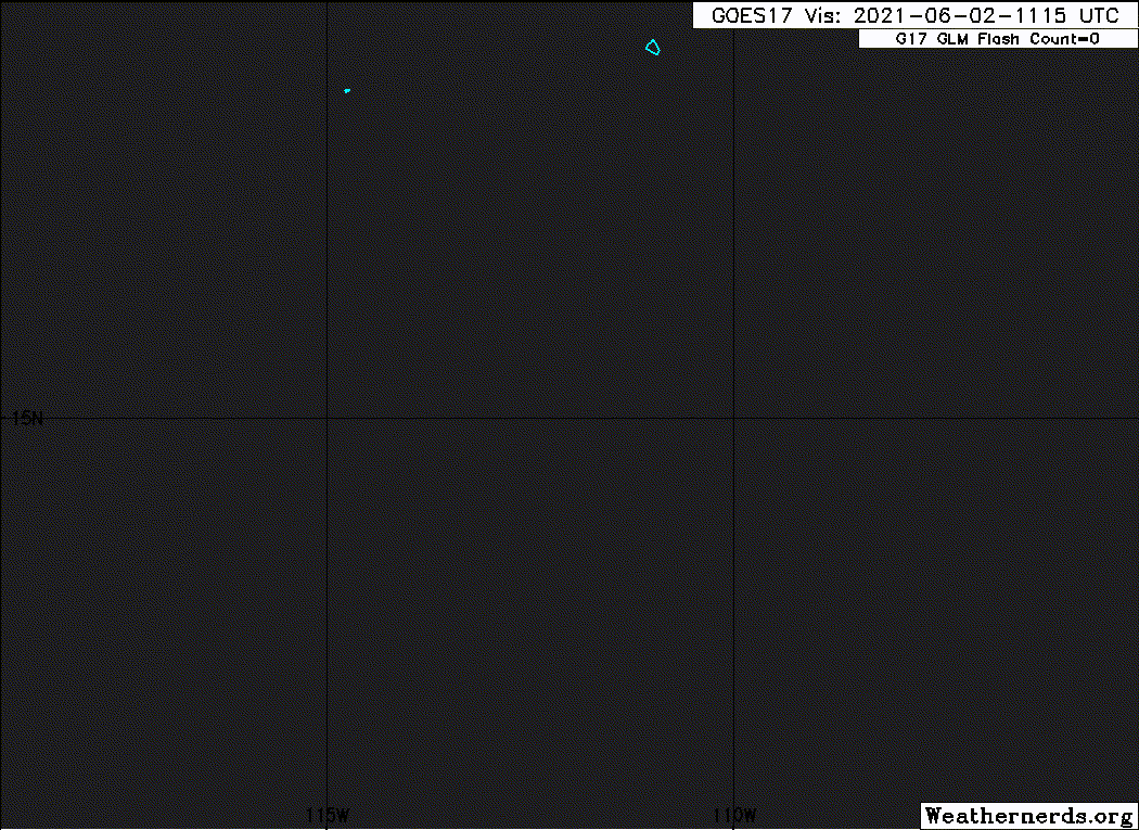
Similar to yesterday, deep convective activity has waned with Blanca
this morning as the cyclone continues to be impacted by dry-air
entrainment imported by high west-southwesterly vertical wind shear.
The low-level center is once again becoming exposed to the west of
the convective cloud mass. While there has not been any helpful
overnight scatterometer passes, an earlier 0844 UTC AMSR-2 microwave
pass suggested that the low-level circulation is gradually becoming
more diffuse, with several possible low level swirls embedded
within. The latest subjective Dvorak estimates are T2.0/35 kt from
SAB and T3.0/45 kt from TAFB, while the most recent UW-CIMSS
Advanced Dvorak Technique (ADT) estimate was 34 kt. The current
intensity estimate was held at 40 kt for this advisory.
Even though current sea surface temperatures remain sufficently warm
underneath the cyclone (27-28 C), low-level, cold-air stratocumulus
clouds can be seen on first-light visible imagery being entrained
into the low-level circulation of Blanca. Strong vertical wind shear
will continue over the next few days as sea surface temperatures
decrease and the environment aloft becomes drier and more stable.
While diurnal convective bursts are still likely to occur during
this time, they will become less organized and more intermittent as
the cyclone succumbs to the increasingly stable environment. The
official NHC intensity forecast still calls for Blanca to become a
tropical depression by Thursday and a remnant low by this weekend,
which is in close agreement with the intensity guidance.
After a minor northward position adjustment, Blanca appears to still
be on a west-northwestward heading, albeit somewhat slower than
earlier, at 300/4 kt. A westward turn is expected over the next 24
hours as Blanca becomes a shallow cyclone and is mainly steered by
the low-level easterly trade wind flow. The latest NHC track
forecast is somewhat further north than the previous forecast early
on, but by the end of the forecast period is very close to the
previous forecast track, and lies close to the HCCA consensus aid.
FORECAST POSITIONS AND MAX WINDS
INIT 02/1500Z 15.5N 112.2W 40 KT 45 MPH
12H 03/0000Z 15.6N 112.8W 35 KT 40 MPH
24H 03/1200Z 15.6N 113.5W 30 KT 35 MPH
36H 04/0000Z 15.4N 114.8W 30 KT 35 MPH
48H 04/1200Z 15.3N 116.0W 25 KT 30 MPH
60H 05/0000Z 15.3N 117.4W 25 KT 30 MPH
72H 05/1200Z 15.3N 118.8W 25 KT 30 MPH...POST-TROP/REMNT LOW
96H 06/1200Z 15.3N 120.7W 20 KT 25 MPH...POST-TROP/REMNT LOW
120H 07/1200Z...DISSIPATED
$$
Forecaster Papin/Stewart
NWS National Hurricane Center Miami FL EP022021
900 AM MDT Wed Jun 02 2021
Similar to yesterday, deep convective activity has waned with Blanca
this morning as the cyclone continues to be impacted by dry-air
entrainment imported by high west-southwesterly vertical wind shear.
The low-level center is once again becoming exposed to the west of
the convective cloud mass. While there has not been any helpful
overnight scatterometer passes, an earlier 0844 UTC AMSR-2 microwave
pass suggested that the low-level circulation is gradually becoming
more diffuse, with several possible low level swirls embedded
within. The latest subjective Dvorak estimates are T2.0/35 kt from
SAB and T3.0/45 kt from TAFB, while the most recent UW-CIMSS
Advanced Dvorak Technique (ADT) estimate was 34 kt. The current
intensity estimate was held at 40 kt for this advisory.
Even though current sea surface temperatures remain sufficently warm
underneath the cyclone (27-28 C), low-level, cold-air stratocumulus
clouds can be seen on first-light visible imagery being entrained
into the low-level circulation of Blanca. Strong vertical wind shear
will continue over the next few days as sea surface temperatures
decrease and the environment aloft becomes drier and more stable.
While diurnal convective bursts are still likely to occur during
this time, they will become less organized and more intermittent as
the cyclone succumbs to the increasingly stable environment. The
official NHC intensity forecast still calls for Blanca to become a
tropical depression by Thursday and a remnant low by this weekend,
which is in close agreement with the intensity guidance.
After a minor northward position adjustment, Blanca appears to still
be on a west-northwestward heading, albeit somewhat slower than
earlier, at 300/4 kt. A westward turn is expected over the next 24
hours as Blanca becomes a shallow cyclone and is mainly steered by
the low-level easterly trade wind flow. The latest NHC track
forecast is somewhat further north than the previous forecast early
on, but by the end of the forecast period is very close to the
previous forecast track, and lies close to the HCCA consensus aid.
FORECAST POSITIONS AND MAX WINDS
INIT 02/1500Z 15.5N 112.2W 40 KT 45 MPH
12H 03/0000Z 15.6N 112.8W 35 KT 40 MPH
24H 03/1200Z 15.6N 113.5W 30 KT 35 MPH
36H 04/0000Z 15.4N 114.8W 30 KT 35 MPH
48H 04/1200Z 15.3N 116.0W 25 KT 30 MPH
60H 05/0000Z 15.3N 117.4W 25 KT 30 MPH
72H 05/1200Z 15.3N 118.8W 25 KT 30 MPH...POST-TROP/REMNT LOW
96H 06/1200Z 15.3N 120.7W 20 KT 25 MPH...POST-TROP/REMNT LOW
120H 07/1200Z...DISSIPATED
$$
Forecaster Papin/Stewart
0 likes
Visit the Caribbean-Central America Weather Thread where you can find at first post web cams,radars
and observations from Caribbean basin members Click Here
and observations from Caribbean basin members Click Here
-
Sciencerocks
- Category 5
- Posts: 7286
- Age: 38
- Joined: Thu Jul 06, 2017 1:51 am
-
cycloneye
- Admin
- Posts: 139083
- Age: 67
- Joined: Thu Oct 10, 2002 10:54 am
- Location: San Juan, Puerto Rico
Re: EPAC: BLANCA - Tropical Storm
EP, 02, 2021060218, , BEST, 0, 155N, 1126W, 30, 1005, TD
0 likes
Visit the Caribbean-Central America Weather Thread where you can find at first post web cams,radars
and observations from Caribbean basin members Click Here
and observations from Caribbean basin members Click Here
-
cycloneye
- Admin
- Posts: 139083
- Age: 67
- Joined: Thu Oct 10, 2002 10:54 am
- Location: San Juan, Puerto Rico
Re: EPAC: BLANCA - Tropical Depression
Tropical Depression Blanca Discussion Number 13
NWS National Hurricane Center Miami FL EP022021
300 PM MDT Wed Jun 02 2021
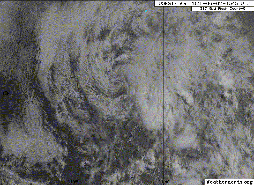
The satellite structure of Blanca has continued to deteriorate this
afternoon. Visible satellite imagery shows an exposed low-level
swirl, and that circulation is becoming increasingly elongated. The
nearest deep convection is now more than 100 nm southeast of the
circulation center. A fortuitous 1519 UTC ASCAT-A pass over Blanca
revealed that the tropical cyclone may have been weaker than earlier
assessed with a peak wind retrieval of only 28 kt in the
northeastern quadrant. Even after accounting for instrument
undersampling, the lack of significant convection near the wind
field since that time has likely resulted in further spin down of
the vortex. The latest subjective Dvorak estimates were also down
to 30 kt from SAB and 35 kt from TAFB. Given the deterioration of
the structure since then, Blanca is being downgraded to a 30-kt
tropical depression at this time.
As Blanca's low-level circulation has become increasingly detached
from the deep convection, the motion of the storm has turned more
westward at 280/4 kt. Now that Blanca appears to be a shallow
low-level feature, it will be primarily steered by the low-level
easterly trade wind flow. This will force Blanca westward over the
next several days as the circulation slowly spins down. The latest
NHC track forecast is largely an update from the previous one and
remains closest to the HCCA consensus model which is on the left
side of the guidance envelope.
Aside from the limited deep convection well separated from Blanca's
center, the storm already barely meets the criteria of a tropical
cyclone. It appears that dry, stable air that entered the
circulation from the northwest, aided by unfavorable vertical wind
shear, is winning the battle over sufficiently warm sea-surface
temperatures beneath the circulation. With the wind field spinning
down compared to 24 h ago, nocturnal re-formation of deep central
convection will find it more challenging to overcome the dry stable
airmass that the storm is embedded in. In addition, both the 12z
GFS- and ECMWF-model-forecast simulated IR brightness temperature
have trended towards less convective activity the last few cycles.
The current NHC forecast assumes occasional diurnal convective
bursts will help to maintain the status of the tropical cyclone for
another 24-36 h, but it is possible that Blanca could become a
remnant low as soon as tomorrow afternoon if convection does not
redevelop by then.
FORECAST POSITIONS AND MAX WINDS
INIT 02/2100Z 15.5N 112.8W 30 KT 35 MPH
12H 03/0600Z 15.5N 113.4W 30 KT 35 MPH
24H 03/1800Z 15.4N 114.2W 30 KT 35 MPH
36H 04/0600Z 15.3N 115.5W 25 KT 30 MPH
48H 04/1800Z 15.2N 117.0W 25 KT 30 MPH...POST-TROP/REMNT LOW
60H 05/0600Z 15.2N 118.5W 20 KT 25 MPH...POST-TROP/REMNT LOW
72H 05/1800Z 15.2N 119.8W 20 KT 25 MPH...POST-TROP/REMNT LOW
96H 06/1800Z...DISSIPATED
$$
Forecaster Papin/Stewart
NWS National Hurricane Center Miami FL EP022021
300 PM MDT Wed Jun 02 2021
The satellite structure of Blanca has continued to deteriorate this
afternoon. Visible satellite imagery shows an exposed low-level
swirl, and that circulation is becoming increasingly elongated. The
nearest deep convection is now more than 100 nm southeast of the
circulation center. A fortuitous 1519 UTC ASCAT-A pass over Blanca
revealed that the tropical cyclone may have been weaker than earlier
assessed with a peak wind retrieval of only 28 kt in the
northeastern quadrant. Even after accounting for instrument
undersampling, the lack of significant convection near the wind
field since that time has likely resulted in further spin down of
the vortex. The latest subjective Dvorak estimates were also down
to 30 kt from SAB and 35 kt from TAFB. Given the deterioration of
the structure since then, Blanca is being downgraded to a 30-kt
tropical depression at this time.
As Blanca's low-level circulation has become increasingly detached
from the deep convection, the motion of the storm has turned more
westward at 280/4 kt. Now that Blanca appears to be a shallow
low-level feature, it will be primarily steered by the low-level
easterly trade wind flow. This will force Blanca westward over the
next several days as the circulation slowly spins down. The latest
NHC track forecast is largely an update from the previous one and
remains closest to the HCCA consensus model which is on the left
side of the guidance envelope.
Aside from the limited deep convection well separated from Blanca's
center, the storm already barely meets the criteria of a tropical
cyclone. It appears that dry, stable air that entered the
circulation from the northwest, aided by unfavorable vertical wind
shear, is winning the battle over sufficiently warm sea-surface
temperatures beneath the circulation. With the wind field spinning
down compared to 24 h ago, nocturnal re-formation of deep central
convection will find it more challenging to overcome the dry stable
airmass that the storm is embedded in. In addition, both the 12z
GFS- and ECMWF-model-forecast simulated IR brightness temperature
have trended towards less convective activity the last few cycles.
The current NHC forecast assumes occasional diurnal convective
bursts will help to maintain the status of the tropical cyclone for
another 24-36 h, but it is possible that Blanca could become a
remnant low as soon as tomorrow afternoon if convection does not
redevelop by then.
FORECAST POSITIONS AND MAX WINDS
INIT 02/2100Z 15.5N 112.8W 30 KT 35 MPH
12H 03/0600Z 15.5N 113.4W 30 KT 35 MPH
24H 03/1800Z 15.4N 114.2W 30 KT 35 MPH
36H 04/0600Z 15.3N 115.5W 25 KT 30 MPH
48H 04/1800Z 15.2N 117.0W 25 KT 30 MPH...POST-TROP/REMNT LOW
60H 05/0600Z 15.2N 118.5W 20 KT 25 MPH...POST-TROP/REMNT LOW
72H 05/1800Z 15.2N 119.8W 20 KT 25 MPH...POST-TROP/REMNT LOW
96H 06/1800Z...DISSIPATED
$$
Forecaster Papin/Stewart
0 likes
Visit the Caribbean-Central America Weather Thread where you can find at first post web cams,radars
and observations from Caribbean basin members Click Here
and observations from Caribbean basin members Click Here
-
Yellow Evan

- Professional-Met

- Posts: 15952
- Age: 25
- Joined: Fri Jul 15, 2011 12:48 pm
- Location: Henderson, Nevada/Honolulu, HI
- Contact:
-
Sciencerocks
- Category 5
- Posts: 7286
- Age: 38
- Joined: Thu Jul 06, 2017 1:51 am
-
cycloneye
- Admin
- Posts: 139083
- Age: 67
- Joined: Thu Oct 10, 2002 10:54 am
- Location: San Juan, Puerto Rico
Re: EPAC: BLANCA - Tropical Depression
Tropical Depression Blanca Discussion Number 14
NWS National Hurricane Center Miami FL EP022021
900 PM MDT Wed Jun 02 2021
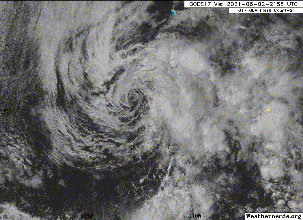
For the most part, Blanca consists of a swirl of low-level clouds
with shallow convection, and a few isolated deeper cells, located
at least 50 n mi east of the center of circulation. Based on that
structure alone, Blanca is close to becoming a remnant low.
Maximum winds are still estimated to be 30 kt as a blend of earlier
scatterometer data and the latest Dvorak CI numbers, which range
between 30 and 35 kt from TAFB and the UW-CIMSS ADT. Southwesterly
shear of about 20 kt is forecast to strengthen further during the
next 36 hours, and with Blanca moving into a drier and more
subsident environment, at best the cyclone will only be able to
produce occasional and temporary bursts of convection. Therefore,
Blanca is now expected to lose its tropical cyclone characteristics,
and become a remnant low, by this time tomorrow. Its winds will
continue to gradually diminish, and the remnant low is likely to
dissipate in 4 or 5 days.
Blanca appears to have lost some latitude, and is moving slowly
south-of-due-west (265/4 kt). Now a shallow cyclone, Blanca is
forecast to be steered slowly westward by a low-level ridge
to its north for the remainder of its existence. There have been
no significant changes to the track forecast reasoning, and the
updated NHC track forecast lies closest to the ECMWF and HCCA
models, and just a little south of the previous NHC forecast.
FORECAST POSITIONS AND MAX WINDS
INIT 03/0300Z 15.4N 113.2W 30 KT 35 MPH
12H 03/1200Z 15.3N 113.8W 25 KT 30 MPH
24H 04/0000Z 15.2N 114.8W 25 KT 30 MPH...POST-TROP/REMNT LOW
36H 04/1200Z 15.1N 116.1W 25 KT 30 MPH...POST-TROP/REMNT LOW
48H 05/0000Z 15.0N 117.5W 25 KT 30 MPH...POST-TROP/REMNT LOW
60H 05/1200Z 15.2N 119.0W 20 KT 25 MPH...POST-TROP/REMNT LOW
72H 06/0000Z 15.3N 120.3W 20 KT 25 MPH...POST-TROP/REMNT LOW
96H 07/0000Z...DISSIPATED
$$
Forecaster Berg
NWS National Hurricane Center Miami FL EP022021
900 PM MDT Wed Jun 02 2021
For the most part, Blanca consists of a swirl of low-level clouds
with shallow convection, and a few isolated deeper cells, located
at least 50 n mi east of the center of circulation. Based on that
structure alone, Blanca is close to becoming a remnant low.
Maximum winds are still estimated to be 30 kt as a blend of earlier
scatterometer data and the latest Dvorak CI numbers, which range
between 30 and 35 kt from TAFB and the UW-CIMSS ADT. Southwesterly
shear of about 20 kt is forecast to strengthen further during the
next 36 hours, and with Blanca moving into a drier and more
subsident environment, at best the cyclone will only be able to
produce occasional and temporary bursts of convection. Therefore,
Blanca is now expected to lose its tropical cyclone characteristics,
and become a remnant low, by this time tomorrow. Its winds will
continue to gradually diminish, and the remnant low is likely to
dissipate in 4 or 5 days.
Blanca appears to have lost some latitude, and is moving slowly
south-of-due-west (265/4 kt). Now a shallow cyclone, Blanca is
forecast to be steered slowly westward by a low-level ridge
to its north for the remainder of its existence. There have been
no significant changes to the track forecast reasoning, and the
updated NHC track forecast lies closest to the ECMWF and HCCA
models, and just a little south of the previous NHC forecast.
FORECAST POSITIONS AND MAX WINDS
INIT 03/0300Z 15.4N 113.2W 30 KT 35 MPH
12H 03/1200Z 15.3N 113.8W 25 KT 30 MPH
24H 04/0000Z 15.2N 114.8W 25 KT 30 MPH...POST-TROP/REMNT LOW
36H 04/1200Z 15.1N 116.1W 25 KT 30 MPH...POST-TROP/REMNT LOW
48H 05/0000Z 15.0N 117.5W 25 KT 30 MPH...POST-TROP/REMNT LOW
60H 05/1200Z 15.2N 119.0W 20 KT 25 MPH...POST-TROP/REMNT LOW
72H 06/0000Z 15.3N 120.3W 20 KT 25 MPH...POST-TROP/REMNT LOW
96H 07/0000Z...DISSIPATED
$$
Forecaster Berg
0 likes
Visit the Caribbean-Central America Weather Thread where you can find at first post web cams,radars
and observations from Caribbean basin members Click Here
and observations from Caribbean basin members Click Here
-
cycloneye
- Admin
- Posts: 139083
- Age: 67
- Joined: Thu Oct 10, 2002 10:54 am
- Location: San Juan, Puerto Rico
Re: EPAC: BLANCA - Tropical Depression
Tropical Depression Blanca Discussion Number 15
NWS National Hurricane Center Miami FL EP022021
300 AM MDT Thu Jun 03 2021
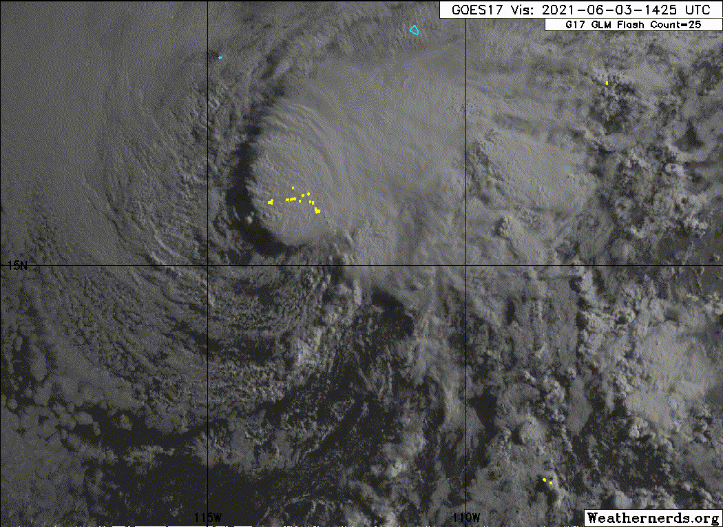
Satellite imagery indicates that a sheared convective burst is
occurring not far from the center of Blanca in the northeastern
quadrant, with additional convection in a ragged band farther from
the center in the eastern semicircle. Based on this, Blanca is
being maintained as a tropical depression on this advisory. Recent
scatterometer overpasses showed a large area of 25-30 kt winds, so
the initial intensity is being held at 30 kt. The convective
flare-up is expected to be short-lived, and Blanca is still
forecast to become a remnant low in about 24 h due to continued
shear and a drier environment. The global models suggest the
remnant low should dissipate between 72-96 h.
The center of Blanca is a little farther north than in the previous
advisory, possible due to re-formation from the convective burst.
Other than that, there is little change in the track forecast
philosophy. Since Blanca is now a shallow cyclone, it is forecast
to be steered slowly westward by a low-level ridge to its north for
the remainder of its existence. The track guidance has shifted a
bit northward since the previous advisory. Therefore, the new
forecast track is also shifted northward, but lies a bit to the
south of the consensus models.
FORECAST POSITIONS AND MAX WINDS
INIT 03/0900Z 15.6N 113.5W 30 KT 35 MPH
12H 03/1800Z 15.6N 114.2W 25 KT 30 MPH
24H 04/0600Z 15.5N 115.4W 25 KT 30 MPH...POST-TROP/REMNT LOW
36H 04/1800Z 15.5N 116.8W 25 KT 30 MPH...POST-TROP/REMNT LOW
48H 05/0600Z 15.6N 118.3W 25 KT 30 MPH...POST-TROP/REMNT LOW
60H 05/1800Z 15.8N 119.6W 20 KT 25 MPH...POST-TROP/REMNT LOW
72H 06/0600Z 16.0N 120.9W 20 KT 25 MPH...POST-TROP/REMNT LOW
96H 07/0600Z...DISSIPATED
$$
Forecaster Beven
NWS National Hurricane Center Miami FL EP022021
300 AM MDT Thu Jun 03 2021
Satellite imagery indicates that a sheared convective burst is
occurring not far from the center of Blanca in the northeastern
quadrant, with additional convection in a ragged band farther from
the center in the eastern semicircle. Based on this, Blanca is
being maintained as a tropical depression on this advisory. Recent
scatterometer overpasses showed a large area of 25-30 kt winds, so
the initial intensity is being held at 30 kt. The convective
flare-up is expected to be short-lived, and Blanca is still
forecast to become a remnant low in about 24 h due to continued
shear and a drier environment. The global models suggest the
remnant low should dissipate between 72-96 h.
The center of Blanca is a little farther north than in the previous
advisory, possible due to re-formation from the convective burst.
Other than that, there is little change in the track forecast
philosophy. Since Blanca is now a shallow cyclone, it is forecast
to be steered slowly westward by a low-level ridge to its north for
the remainder of its existence. The track guidance has shifted a
bit northward since the previous advisory. Therefore, the new
forecast track is also shifted northward, but lies a bit to the
south of the consensus models.
FORECAST POSITIONS AND MAX WINDS
INIT 03/0900Z 15.6N 113.5W 30 KT 35 MPH
12H 03/1800Z 15.6N 114.2W 25 KT 30 MPH
24H 04/0600Z 15.5N 115.4W 25 KT 30 MPH...POST-TROP/REMNT LOW
36H 04/1800Z 15.5N 116.8W 25 KT 30 MPH...POST-TROP/REMNT LOW
48H 05/0600Z 15.6N 118.3W 25 KT 30 MPH...POST-TROP/REMNT LOW
60H 05/1800Z 15.8N 119.6W 20 KT 25 MPH...POST-TROP/REMNT LOW
72H 06/0600Z 16.0N 120.9W 20 KT 25 MPH...POST-TROP/REMNT LOW
96H 07/0600Z...DISSIPATED
$$
Forecaster Beven
0 likes
Visit the Caribbean-Central America Weather Thread where you can find at first post web cams,radars
and observations from Caribbean basin members Click Here
and observations from Caribbean basin members Click Here
-
cycloneye
- Admin
- Posts: 139083
- Age: 67
- Joined: Thu Oct 10, 2002 10:54 am
- Location: San Juan, Puerto Rico
Re: EPAC: BLANCA - Tropical Depression
Tropical Depression Blanca Discussion Number 16
NWS National Hurricane Center Miami FL EP022021
900 AM MDT Thu Jun 03 2021
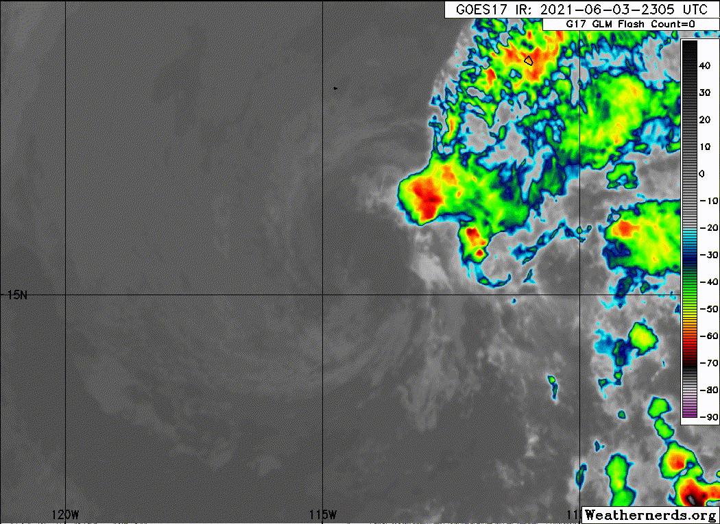
The satellite presentation of Blanca this morning is a bit better
organized with the diurnal convective maximum resulting in a region
of cold cloud tops between -75 to -80 C with some slight banding
near and to the northeast of the estimated center. Subjective Dvorak
intensity estimates were 30 kt from both SAB and TAFB, while the
most recent UW-CIMSS ADT intensity estimate was 33 kt. The initial
intensity was kept at 30 kt for this advisory.
The ongoing burst of convective activity has nudged the center of
Blanca slightly further north and slowed the system further, with an
average 12-h heading of 275/3 kt. Assuming that the convective
activity this morning is transient, the shallow cyclone should
remain steered westward for the foreseeable future by a poleward
low-level ridge. The latest forecast is similar to the previous
cycle, and lies just slightly south of the TVCE consensus guidance.
The ongoing convective activity near Blanca has given it at least
another 12-18 hours of life. In fact, it would not be out of the
question that Blanca could briefly regain tropical storm status if
the convection proves to be more persistent, especially since the
cyclone remains over 27 C sea-surface temperatures and these values
only slowly decrease as the forecast track parallels the 26-deg-C
isotherm. However, unfavorable strong vertical wind shear resulting
in entrainment of dry, stable air to the northwest should eventually
win out, with the latest NHC forecast still expecting Blanca to
become a remnant low in 24 h, followed by dissipation in 72-96 h.
FORECAST POSITIONS AND MAX WINDS
INIT 03/1500Z 15.7N 114.0W 30 KT 35 MPH
12H 04/0000Z 15.7N 115.0W 30 KT 35 MPH
24H 04/1200Z 15.7N 116.4W 25 KT 30 MPH...POST-TROP/REMNT LOW
36H 05/0000Z 15.8N 118.0W 25 KT 30 MPH...POST-TROP/REMNT LOW
48H 05/1200Z 16.0N 119.3W 25 KT 30 MPH...POST-TROP/REMNT LOW
60H 06/0000Z 16.2N 120.6W 20 KT 25 MPH...POST-TROP/REMNT LOW
72H 06/1200Z 16.4N 122.0W 20 KT 25 MPH...POST-TROP/REMNT LOW
96H 07/1200Z...DISSIPATED
$$
Forecaster Papin/Stewart
NWS National Hurricane Center Miami FL EP022021
900 AM MDT Thu Jun 03 2021
The satellite presentation of Blanca this morning is a bit better
organized with the diurnal convective maximum resulting in a region
of cold cloud tops between -75 to -80 C with some slight banding
near and to the northeast of the estimated center. Subjective Dvorak
intensity estimates were 30 kt from both SAB and TAFB, while the
most recent UW-CIMSS ADT intensity estimate was 33 kt. The initial
intensity was kept at 30 kt for this advisory.
The ongoing burst of convective activity has nudged the center of
Blanca slightly further north and slowed the system further, with an
average 12-h heading of 275/3 kt. Assuming that the convective
activity this morning is transient, the shallow cyclone should
remain steered westward for the foreseeable future by a poleward
low-level ridge. The latest forecast is similar to the previous
cycle, and lies just slightly south of the TVCE consensus guidance.
The ongoing convective activity near Blanca has given it at least
another 12-18 hours of life. In fact, it would not be out of the
question that Blanca could briefly regain tropical storm status if
the convection proves to be more persistent, especially since the
cyclone remains over 27 C sea-surface temperatures and these values
only slowly decrease as the forecast track parallels the 26-deg-C
isotherm. However, unfavorable strong vertical wind shear resulting
in entrainment of dry, stable air to the northwest should eventually
win out, with the latest NHC forecast still expecting Blanca to
become a remnant low in 24 h, followed by dissipation in 72-96 h.
FORECAST POSITIONS AND MAX WINDS
INIT 03/1500Z 15.7N 114.0W 30 KT 35 MPH
12H 04/0000Z 15.7N 115.0W 30 KT 35 MPH
24H 04/1200Z 15.7N 116.4W 25 KT 30 MPH...POST-TROP/REMNT LOW
36H 05/0000Z 15.8N 118.0W 25 KT 30 MPH...POST-TROP/REMNT LOW
48H 05/1200Z 16.0N 119.3W 25 KT 30 MPH...POST-TROP/REMNT LOW
60H 06/0000Z 16.2N 120.6W 20 KT 25 MPH...POST-TROP/REMNT LOW
72H 06/1200Z 16.4N 122.0W 20 KT 25 MPH...POST-TROP/REMNT LOW
96H 07/1200Z...DISSIPATED
$$
Forecaster Papin/Stewart
0 likes
Visit the Caribbean-Central America Weather Thread where you can find at first post web cams,radars
and observations from Caribbean basin members Click Here
and observations from Caribbean basin members Click Here
-
Sciencerocks
- Category 5
- Posts: 7286
- Age: 38
- Joined: Thu Jul 06, 2017 1:51 am
-
cycloneye
- Admin
- Posts: 139083
- Age: 67
- Joined: Thu Oct 10, 2002 10:54 am
- Location: San Juan, Puerto Rico
Re: EPAC: BLANCA - Tropical Depression
Hanging on.
EP, 02, 2021060318, , BEST, 0, 155N, 1141W, 30, 1005, TD
0 likes
Visit the Caribbean-Central America Weather Thread where you can find at first post web cams,radars
and observations from Caribbean basin members Click Here
and observations from Caribbean basin members Click Here
-
cycloneye
- Admin
- Posts: 139083
- Age: 67
- Joined: Thu Oct 10, 2002 10:54 am
- Location: San Juan, Puerto Rico
Re: EPAC: BLANCA - Tropical Depression
Tropical Depression Blanca Discussion Number 17
NWS National Hurricane Center Miami FL EP022021
300 PM MDT Thu Jun 03 2021
Like the past two days, deep convection that had been present near
Blanca this morning has sheared away and collapsed this afternoon,
revealing an increasingly diffuse structure with multiple low-level
swirls. Subjective Dvorak estimates at 1800Z were 30 kt from TAFB
and too weak to classify by SAB. The most recent UW-CIMSS ADT
objective estimate was a little higher at 35 kt. Unfortunately,
Blanca was missed by all three scatterometer overpasses this
afternoon. However, assuming little change in the wind field has
occurred from last night, the current intensity has been held at 30
kt for this advisory.
Blanca's mean circulation center has resumed a slow due west motion
at 270/3 kt, though some uncertainty exists since multiple low-level
swirls are evident on visible satellite imagery. Now that convection
has weakened once again, the steering currents will be dominated by
the flow around a poleward low-level ridge. This flow is expected to
keep Blanca on a westward heading for the remainder of its lifespan.
The latest track forecast is largely an update from the previous
forecast cycle and is in close agreement between the TCVE and HCCA
consensus aids.
Now that convection near the center of Blanca has largely
dissipated, the clock has been reset for its remaining lifespan as a
tropical cyclone. While the current NHC forecast does not preclude
the possibility that another convective burst could occur over the
next 24 h, increasingly dry, stable air from the northwest and
continued unfavorable southwesterly vertical wind shear should limit
any significant convective organization near Blanca's center. The
latest NHC intensity forecast expects Blanca to become a remnant low
on Friday, with the remnant low likely opening up into a trough by
the end of the weekend.
FORECAST POSITIONS AND MAX WINDS
INIT 03/2100Z 15.5N 114.3W 30 KT 35 MPH
12H 04/0600Z 15.5N 115.5W 25 KT 30 MPH
24H 04/1800Z 15.6N 117.1W 25 KT 30 MPH...POST-TROP/REMNT LOW
36H 05/0600Z 15.7N 118.7W 25 KT 30 MPH...POST-TROP/REMNT LOW
48H 05/1800Z 15.8N 120.3W 25 KT 30 MPH...POST-TROP/REMNT LOW
60H 06/0600Z 15.9N 121.4W 20 KT 25 MPH...POST-TROP/REMNT LOW
72H 06/1800Z...DISSIPATED
$$
Forecaster Papin/Stewart
0 likes
Visit the Caribbean-Central America Weather Thread where you can find at first post web cams,radars
and observations from Caribbean basin members Click Here
and observations from Caribbean basin members Click Here
-
Sciencerocks
- Category 5
- Posts: 7286
- Age: 38
- Joined: Thu Jul 06, 2017 1:51 am
-
cycloneye
- Admin
- Posts: 139083
- Age: 67
- Joined: Thu Oct 10, 2002 10:54 am
- Location: San Juan, Puerto Rico
Re: EPAC: BLANCA - Tropical Depression
Tropical Depression Blanca Discussion Number 18
NWS National Hurricane Center Miami FL EP022021
900 PM MDT Thu Jun 03 2021
Blanca is producing a few convective cells about 120 n mi to the
east-northeast of its center, but the last significant deep
convective bursts near the center stopped about 10 to 11 hours ago.
With not much convective organization, the Dvorak classification
from TAFB decreased to T1.0/2.0, and Blanca's initial intensity is
therefore lowered to 25 kt. Various analyses indicate that
west-southwesterly shear has increased to between 25-30 kt, and
the ambient environment is quite dry and subsident. In addition,
Blanca is close to reaching waters cooler than 26 degrees Celsius.
Due to these conditions, Blanca is expected to gradually spin down
over the next few days, and if deep convection does not redevelop
soon, Blanca would be declared a remnant low overnight or Friday
morning. The remnant low is then likely to dissipate in about 3
days.
Blanca has been meandering a bit for much of the day, but the
12-hour average motion is westward (275 degrees) at 3 kt. A
low-level ridge to the north should continue steering Blanca
generally westward but a little faster during the next few days.
The updated NHC track forecast is very close to the previous
forecast and is a blend of the TVCE model consensus and the HFIP
Corrected Consensus aid.
FORECAST POSITIONS AND MAX WINDS
INIT 04/0300Z 15.7N 114.6W 25 KT 30 MPH
12H 04/1200Z 15.7N 115.7W 25 KT 30 MPH...POST-TROP/REMNT LOW
24H 05/0000Z 15.7N 117.3W 25 KT 30 MPH...POST-TROP/REMNT LOW
36H 05/1200Z 15.8N 118.9W 25 KT 30 MPH...POST-TROP/REMNT LOW
48H 06/0000Z 15.9N 120.3W 20 KT 25 MPH...POST-TROP/REMNT LOW
60H 06/1200Z 16.0N 121.7W 20 KT 25 MPH...POST-TROP/REMNT LOW
72H 07/0000Z...DISSIPATED
$$
Forecaster Berg
0 likes
Visit the Caribbean-Central America Weather Thread where you can find at first post web cams,radars
and observations from Caribbean basin members Click Here
and observations from Caribbean basin members Click Here
-
Shell Mound
- Category 5
- Posts: 2434
- Age: 31
- Joined: Thu Sep 07, 2017 3:39 pm
- Location: St. Petersburg, FL → Scandinavia
Re: EPAC: BLANCA - Tropical Depression
0 likes
CVW / MiamiensisWx / Shell Mound
The posts in this forum are NOT official forecasts and should not be used as such. They are just the opinion of the poster and may or may not be backed by sound meteorological data. They are NOT endorsed by any professional institution or STORM2K. For official information, please refer to products from the NHC and NWS.
-
cycloneye
- Admin
- Posts: 139083
- Age: 67
- Joined: Thu Oct 10, 2002 10:54 am
- Location: San Juan, Puerto Rico
Re: EPAC: BLANCA - Post-Tropical
Post-Tropical Cyclone Blanca Discussion Number 19
NWS National Hurricane Center Miami FL EP022021
200 AM PDT Fri Jun 04 2021
Blanca has been devoid of organized deep convection since midday
yesterday, with the last convective burst near the center ceasing
over 15 hours ago. Since that time there have been a few convective
cells noted 120 to 150 n mi east-northeast of the center, but these
have been short lived. This is a big change from this time
yesterday, when a large burst of deep convection developed during
the diurnal maximum close the center of the cyclone. This trend is
indicative of the strong west-southwesterly shear and the dry and
stable atmospheric environment taking their toll on the system.
These hostile environmental factors are not expected to improve,
while the forward path of the cyclone takes it over progressively
cooler waters. Therefore, it is anticipated that persistent deep
convection will not redevelop near the center of the system, and
Blanca is being designated as a remnant low. The low is expected to
gradually spin down and is likely to dissipate within the next few
days. The overnight ASCAT overpasses did not sample the center of
the system, so a blend of the T/CI numbers of 1.0/2.0 from the most
recent satellite intensity estimate from TAFB supports maintaining
the advisory intensity at 25 kt.
Over the past 12 hours Blanca has been moving west-northwestward, or
300/06 kt. A turn to the west is expected later this morning as the
shallow system gets caught up in the flow around a low-level ridge
to the north. This westward motion should continue until the system
dissipates. The latest NHC track forecast is little changed from the
previous one and is near the multi-model consensus.
This is the last NHC advisory on Blanca. For additional information
on the remnant low please see High Seas Forecasts issued by the
National Weather Service, under AWIPS header NFDHSFEPI, WMO header
FZPN02 KWBC, and on the web at ocean.weather.gov/shtml/NFDHSFEPI.php
FORECAST POSITIONS AND MAX WINDS
INIT 04/0900Z 16.3N 115.6W 25 KT 30 MPH...POST-TROPICAL
12H 04/1800Z 16.4N 116.8W 25 KT 30 MPH...POST-TROP/REMNT LOW
24H 05/0600Z 16.4N 118.3W 25 KT 30 MPH...POST-TROP/REMNT LOW
36H 05/1800Z 16.4N 119.7W 20 KT 25 MPH...POST-TROP/REMNT LOW
48H 06/0600Z 16.4N 121.1W 20 KT 25 MPH...POST-TROP/REMNT LOW
60H 06/1800Z 16.4N 122.5W 20 KT 25 MPH...POST-TROP/REMNT LOW
72H 07/0600Z...DISSIPATED
$$
Forecaster Latto
0 likes
Visit the Caribbean-Central America Weather Thread where you can find at first post web cams,radars
and observations from Caribbean basin members Click Here
and observations from Caribbean basin members Click Here
Who is online
Users browsing this forum: No registered users and 74 guests