Since 2013 having two before June 1.
https://twitter.com/philklotzbach/status/1399511365916758018
EPAC: BLANCA - Post-Tropical
Moderator: S2k Moderators
-
cycloneye

- Admin

- Posts: 139083
- Age: 67
- Joined: Thu Oct 10, 2002 10:54 am
- Location: San Juan, Puerto Rico
Re: EPAC: BLANCA - Tropical Storm
0 likes
Visit the Caribbean-Central America Weather Thread where you can find at first post web cams,radars
and observations from Caribbean basin members Click Here
and observations from Caribbean basin members Click Here
-
cycloneye
- Admin
- Posts: 139083
- Age: 67
- Joined: Thu Oct 10, 2002 10:54 am
- Location: San Juan, Puerto Rico
Re: EPAC: BLANCA - Tropical Storm
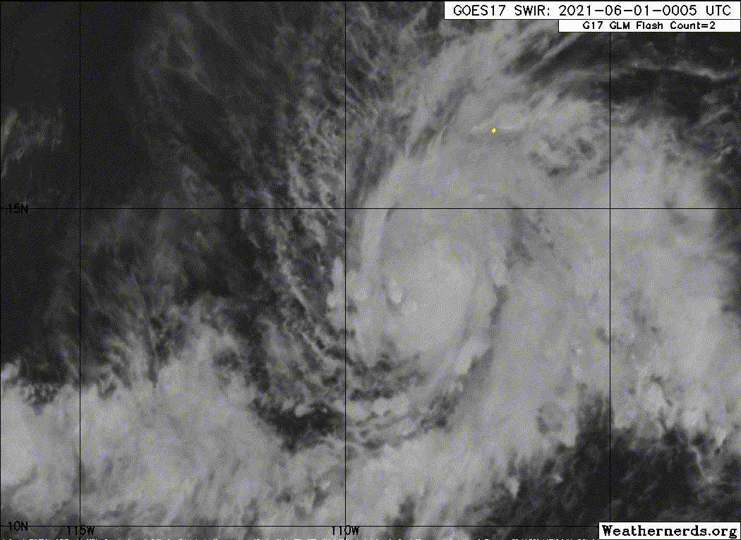
3.5.
A. 02E (BLANCA)
B. 31/2330Z
C. 14.0N
D. 108.3W
E. THREE/GOES-W
F. T3.5/3.5
G. IR/EIR/VIS/SSMI
H. REMARKS....8 BANDING ON LOG10 SPIRAL GIVES A DT 3.5. MET AND PT ALSO
3.5. FT IS BASED ON DT.
I. ADDL POSITIONS
31/2257Z 13.8N 109.0W SSMI
...KONON
B. 31/2330Z
C. 14.0N
D. 108.3W
E. THREE/GOES-W
F. T3.5/3.5
G. IR/EIR/VIS/SSMI
H. REMARKS....8 BANDING ON LOG10 SPIRAL GIVES A DT 3.5. MET AND PT ALSO
3.5. FT IS BASED ON DT.
I. ADDL POSITIONS
31/2257Z 13.8N 109.0W SSMI
...KONON
0 likes
Visit the Caribbean-Central America Weather Thread where you can find at first post web cams,radars
and observations from Caribbean basin members Click Here
and observations from Caribbean basin members Click Here
-
DorkyMcDorkface

- Category 2

- Posts: 698
- Age: 26
- Joined: Mon Sep 30, 2019 1:32 pm
- Location: Mid-Atlantic
Re: EPAC: BLANCA - Tropical Storm
4 likes
Floyd 1999 | Isabel 2003 | Hanna 2008 | Irene 2011 | Sandy 2012 | Isaias 2020
-
Yellow Evan

- Professional-Met

- Posts: 15952
- Age: 25
- Joined: Fri Jul 15, 2011 12:48 pm
- Location: Henderson, Nevada/Honolulu, HI
- Contact:
Re: EPAC: BLANCA - Tropical Storm
EP, 02, 2021060100, , BEST, 0, 137N, 1091W, 45, 1001, TS, 34, NEQ, 30, 20, 0, 30, 1009, 150, 15, 0, 0, E, 0, , 0, 0, BLANCA, D, 0, , 0, 0, 0, 0, genesis-num, 004,
0 likes
-
SconnieCane
- Category 4

- Posts: 913
- Joined: Thu Aug 02, 2018 5:29 pm
- Location: Madison, WI
Re: EPAC: BLANCA - Tropical Storm
cycloneye wrote:Since 2013 having two before June 1.
https://twitter.com/philklotzbach/status/1399511365916758018
Since we all know what else happened (or rather, didn't) that year, any implications for the NATL season and its anticipated "above average" activity?
0 likes

Re: EPAC: BLANCA - Tropical Storm
Stable air really seems to be giving Blanca a hard time. The NHC mentioned that stable air was likely to counter the otherwise favorable conditions in Blanca’s path in the first TC discussion yesterday.
0 likes
Irene '11 Sandy '12 Hermine '16 5/15/2018 Derecho Fay '20 Isaias '20 Elsa '21 Henri '21 Ida '21
I am only a meteorology enthusiast who knows a decent amount about tropical cyclones. Look to the professional mets, the NHC, or your local weather office for the best information.
I am only a meteorology enthusiast who knows a decent amount about tropical cyclones. Look to the professional mets, the NHC, or your local weather office for the best information.
Re: EPAC: BLANCA - Tropical Storm
SconnieCane wrote:cycloneye wrote:Since 2013 having two before June 1.
https://twitter.com/philklotzbach/status/1399511365916758018
Since we all know what else happened (or rather, didn't) that year, any implications for the NATL season and its anticipated "above average" activity?
That has more implications for the EPAC season than the ATL since that year was an unrelated THC collapse that shows no signs of happening again this year. Also 2013 was a pathetic year for the EPAC with only one Cat. 3+ in the second half of October, and only 9 mostly short-lived hurricanes total.
And @Aspen this is starting to remind me of Cristina from last year; failing to strengthen much despite favorable conditions.
If Blanca fails to get to 50kt I’m cancelling the 2021 Pacific hurricane season lolol.
Last edited by ClarCari on Mon May 31, 2021 10:46 pm, edited 1 time in total.
2 likes
-
Yellow Evan
- Professional-Met
- Posts: 15952
- Age: 25
- Joined: Fri Jul 15, 2011 12:48 pm
- Location: Henderson, Nevada/Honolulu, HI
- Contact:
Re: EPAC: BLANCA - Tropical Storm
It looks ready to take off, honestly. It’s becoming more CDO dominant over the last several hours with curved band features no longer choking the inflow of Blanca. A brief window likely exists for some strengthening overnight before weakening commences tomorrow.
0 likes
-
ElectricStorm

- Category 5

- Posts: 4561
- Age: 23
- Joined: Tue Aug 13, 2019 11:23 pm
- Location: Skiatook, OK / Norman, OK
Re: EPAC: BLANCA - Tropical Storm
Looking pretty decent right now. I could see this try to make a run towards a brief minimal hurricane before it hits the unfavorable environment.
0 likes
I am in no way a professional. Take what I say with a grain of salt as I could be totally wrong. Please refer to the NHC, NWS, or SPC for official information.
Boomer Sooner!
Boomer Sooner!
-
cycloneye
- Admin
- Posts: 139083
- Age: 67
- Joined: Thu Oct 10, 2002 10:54 am
- Location: San Juan, Puerto Rico
Re: EPAC: BLANCA - Tropical Storm
Tropical Storm Blanca Discussion Number 6
NWS National Hurricane Center Miami FL EP022021
900 PM MDT Mon May 31 2021
The satellite presentation of Blanca has continued to improve this
evening. Bursts of deep convection have recently developed near the
estimated center, which has led to an increase in banding that can
be seen in the latest microwave imagery. Subjective Dvorak
classifications are T3.0 (45 kt) and T3.5 (55 kt) from TAFB and
SAB, respectively. Based on these data and the continued
organization seen in recent satellite imagery, the initial
intensity has been set at 50 kt for this advisory.
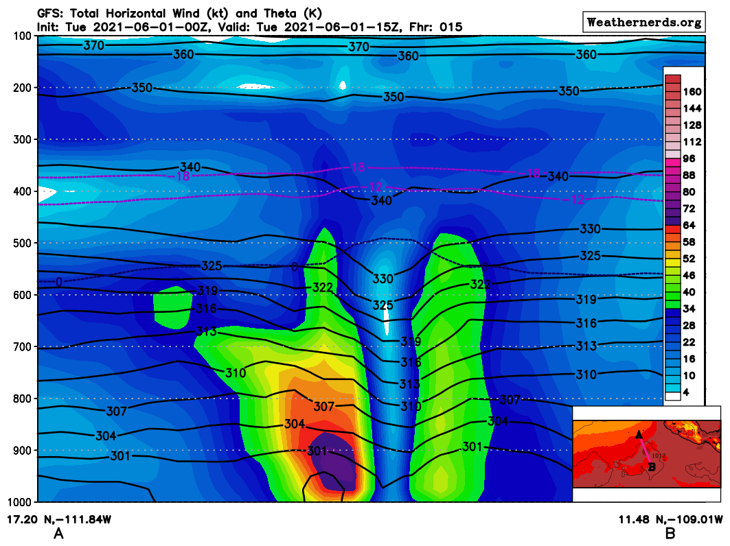
Blanca is currently located within a favorable environment for
strengthening that consists of low vertical wind shear, warm sea
surface temperatures, and a moist atmosphere. These conditions
favor additional strengthening during the next 12 hours or so, but
by Tuesday afternoon increasing southwesterly shear is likely to
put an end to Blanca's intensification phase. After that time, an
additional increase in shear and gradually decreasing sea surface
temperatures are expected to cause slow weakening throughout the
remainder of the forecast period. Blanca is now forecast to become
a remnant low by day 5, but it could occur a little sooner than
that. The NHC intensity forecast is in best agreement with the
HCCA and ICON consensus aids.
The initial motion estimate is 300/8 kt, a little slower toward the
west-northwest than before. A deepening mid- to upper-level trough
near the central portion of the Baja peninsula is forecast to
weaken the western extent of the ridge, which is expected to cause
Blanca to slow its forward speed over the next couple of days. As
the tropical storm weakens in 2-3 days, it should turn more westward
when it becomes a vertically shallow system and is steered by the
low-level easterly trade wind flow. Although there is an increase
in the spread of the guidance after 72 hours, the latest NHC track
forecast remains near the middle of the guidance envelope, and it
is very similar to the previous official forecast.
FORECAST POSITIONS AND MAX WINDS
INIT 01/0300Z 13.9N 109.4W 50 KT 60 MPH
12H 01/1200Z 14.4N 110.4W 55 KT 65 MPH
24H 02/0000Z 15.1N 111.6W 50 KT 60 MPH
36H 02/1200Z 15.6N 112.5W 45 KT 50 MPH
48H 03/0000Z 15.9N 113.2W 40 KT 45 MPH
60H 03/1200Z 16.0N 113.8W 35 KT 40 MPH
72H 04/0000Z 16.1N 114.6W 35 KT 40 MPH
96H 05/0000Z 16.1N 116.5W 30 KT 35 MPH
120H 06/0000Z 16.2N 118.4W 25 KT 30 MPH...POST-TROP/REMNT LOW
$$
Forecaster Brown
NWS National Hurricane Center Miami FL EP022021
900 PM MDT Mon May 31 2021
The satellite presentation of Blanca has continued to improve this
evening. Bursts of deep convection have recently developed near the
estimated center, which has led to an increase in banding that can
be seen in the latest microwave imagery. Subjective Dvorak
classifications are T3.0 (45 kt) and T3.5 (55 kt) from TAFB and
SAB, respectively. Based on these data and the continued
organization seen in recent satellite imagery, the initial
intensity has been set at 50 kt for this advisory.
Blanca is currently located within a favorable environment for
strengthening that consists of low vertical wind shear, warm sea
surface temperatures, and a moist atmosphere. These conditions
favor additional strengthening during the next 12 hours or so, but
by Tuesday afternoon increasing southwesterly shear is likely to
put an end to Blanca's intensification phase. After that time, an
additional increase in shear and gradually decreasing sea surface
temperatures are expected to cause slow weakening throughout the
remainder of the forecast period. Blanca is now forecast to become
a remnant low by day 5, but it could occur a little sooner than
that. The NHC intensity forecast is in best agreement with the
HCCA and ICON consensus aids.
The initial motion estimate is 300/8 kt, a little slower toward the
west-northwest than before. A deepening mid- to upper-level trough
near the central portion of the Baja peninsula is forecast to
weaken the western extent of the ridge, which is expected to cause
Blanca to slow its forward speed over the next couple of days. As
the tropical storm weakens in 2-3 days, it should turn more westward
when it becomes a vertically shallow system and is steered by the
low-level easterly trade wind flow. Although there is an increase
in the spread of the guidance after 72 hours, the latest NHC track
forecast remains near the middle of the guidance envelope, and it
is very similar to the previous official forecast.
FORECAST POSITIONS AND MAX WINDS
INIT 01/0300Z 13.9N 109.4W 50 KT 60 MPH
12H 01/1200Z 14.4N 110.4W 55 KT 65 MPH
24H 02/0000Z 15.1N 111.6W 50 KT 60 MPH
36H 02/1200Z 15.6N 112.5W 45 KT 50 MPH
48H 03/0000Z 15.9N 113.2W 40 KT 45 MPH
60H 03/1200Z 16.0N 113.8W 35 KT 40 MPH
72H 04/0000Z 16.1N 114.6W 35 KT 40 MPH
96H 05/0000Z 16.1N 116.5W 30 KT 35 MPH
120H 06/0000Z 16.2N 118.4W 25 KT 30 MPH...POST-TROP/REMNT LOW
$$
Forecaster Brown
0 likes
Visit the Caribbean-Central America Weather Thread where you can find at first post web cams,radars
and observations from Caribbean basin members Click Here
and observations from Caribbean basin members Click Here
-
Sciencerocks
- Category 5
- Posts: 7286
- Age: 38
- Joined: Thu Jul 06, 2017 1:51 am

Re: EPAC: BLANCA - Tropical Storm
If it verifies there is a cane forecast, Lopsided but yeah 3rd base on the cards.
2 likes
-
Yellow Evan
- Professional-Met
- Posts: 15952
- Age: 25
- Joined: Fri Jul 15, 2011 12:48 pm
- Location: Henderson, Nevada/Honolulu, HI
- Contact:
Re: EPAC: BLANCA - Tropical Storm

Am more likely to get a six figure job out of grad school than this mess is to become a hurricane.
1 likes
-
Kingarabian

- S2K Supporter

- Posts: 15435
- Joined: Sat Aug 08, 2009 3:06 am
- Location: Honolulu, Hawaii

-
Yellow Evan
- Professional-Met
- Posts: 15952
- Age: 25
- Joined: Fri Jul 15, 2011 12:48 pm
- Location: Henderson, Nevada/Honolulu, HI
- Contact:
Re: EPAC: BLANCA - Tropical Storm
TXPZ29 KNES 010558
TCSENP
A. 02E (BLANCA)
B. 01/0530Z
C. 14.2N
D. 108.8W
E. THREE/GOES-W
F. T3.5/3.5
G. IR/EIR/SWIR
H. REMARKS...CONVECTION WRAPS 0.8 ON LOG 10 SPIRAL FOR A DT OF
3.5. MET=3.5 AND PT=3.5. FT IS BASED ON DT.
I. ADDL POSITIONS
NIL
...KIM
TCSENP
A. 02E (BLANCA)
B. 01/0530Z
C. 14.2N
D. 108.8W
E. THREE/GOES-W
F. T3.5/3.5
G. IR/EIR/SWIR
H. REMARKS...CONVECTION WRAPS 0.8 ON LOG 10 SPIRAL FOR A DT OF
3.5. MET=3.5 AND PT=3.5. FT IS BASED ON DT.
I. ADDL POSITIONS
NIL
...KIM
0 likes
-
Yellow Evan
- Professional-Met
- Posts: 15952
- Age: 25
- Joined: Fri Jul 15, 2011 12:48 pm
- Location: Henderson, Nevada/Honolulu, HI
- Contact:
Re: EPAC: BLANCA - Tropical Storm
* GFS version *
* EAST PACIFIC 2021 SHIPS INTENSITY FORECAST *
* IR SAT DATA AVAILABLE, OHC AVAILABLE *
* BLANCA EP022021 06/01/21 06 UTC *
TIME (HR) 0 6 12 18 24 36 48 60 72 84 96 108 120 132 144 156 168
V (KT) NO LAND 50 54 58 60 60 58 52 45 35 27 21 16 N/A N/A N/A N/A N/A
V (KT) LAND 50 54 58 60 60 58 52 45 35 27 21 16 N/A N/A N/A N/A N/A
V (KT) LGEM 50 55 57 57 55 49 41 34 28 22 18 N/A N/A N/A N/A N/A N/A
Storm Type TROP TROP TROP TROP TROP TROP TROP TROP TROP TROP TROP TROP TROP TROP TROP N/A N/A
SHEAR (KT) 11 13 18 19 18 20 14 16 18 15 17 18 26 40 43 N/A N/A
SHEAR ADJ (KT) 5 5 3 6 6 4 10 6 8 8 7 1 0 -4 -4 N/A N/A
SHEAR DIR 243 241 244 243 253 277 262 241 271 252 244 237 261 281 282 N/A N/A
SST (C) 29.4 29.4 29.1 28.8 28.3 27.7 27.3 27.2 26.8 26.2 26.0 26.2 25.6 25.3 25.2 N/A N/A
POT. INT. (KT) 158 158 154 151 145 138 134 133 129 123 121 123 116 113 112 N/A N/A
200 MB T (C) -52.2 -52.6 -52.5 -52.2 -52.8 -53.1 -53.1 -53.0 -53.2 -53.5 -53.5 -53.9 -54.0 -53.8 -53.3 N/A N/A
200 MB VXT (C) 0.1 0.1 0.1 0.0 0.1 -0.1 -0.2 -0.3 -0.4 -0.1 0.0 -0.1 -0.2 0.0 0.1 N/A N/A
TH_E DEV (C) 4 4 3 3 3 2 2 2 3 3 3 2 2 2 2 N/A N/A
700-500 MB RH 65 66 65 63 61 60 53 50 45 44 42 39 37 37 37 N/A N/A
MODEL VTX (KT) 14 12 13 14 13 15 14 14 13 12 11 9 7 5 4 LOST LOST
850 MB ENV VOR -21 -16 -12 -16 -19 -18 -12 3 9 9 3 11 3 -11 -17 N/A N/A
200 MB DIV 121 118 129 115 75 25 0 -18 -14 -11 0 -12 -8 -22 -18 N/A N/A
700-850 TADV -6 -5 -2 0 1 0 0 0 0 0 0 2 1 0 1 N/A N/A
LAND (KM) 759 772 794 820 846 831 837 864 908 963 1032 1098 1144 1184 1221 N/A N/A
LAT (DEG N) 14.0 14.4 14.8 15.1 15.4 15.8 16.0 16.0 16.1 16.1 16.0 16.1 16.3 xx.x xx.x N/A N/A
LONG(DEG W) 109.4 110.1 110.7 111.3 111.8 112.5 113.2 113.8 114.8 115.7 116.6 117.6 118.5 xxx.x xxx.x N/A N/A
STM SPEED (KT) 7 7 7 6 5 4 3 4 5 4 4 5 4 4 3 N/A N/A
HEAT CONTENT 49 43 26 18 13 9 7 6 3 0 0 0 0 0 0 N/A N/A
FORECAST TRACK FROM OFCI INITIAL HEADING/SPEED (DEG/KT):305/ 7 CX,CY: -5/ 4
T-12 MAX WIND: 35 PRESSURE OF STEERING LEVEL (MB): 599 (MEAN=587)
GOES IR BRIGHTNESS TEMP. STD DEV. 50-200 KM RAD: 8.5 (MEAN=14.5)
% GOES IR PIXELS WITH T < -20 C 50-200 KM RAD: 99.0 (MEAN=65.0)
PRELIM RI PROB (DV .GE. 35 KT IN 36 HR): 36.0
INDIVIDUAL CONTRIBUTIONS TO INTENSITY CHANGE
6 12 18 24 36 48 60 72 84 96 108 120 132 144 156 168
------------------------------------------------------------------------------
SAMPLE MEAN CHANGE 0. 0. 1. 1. 1. 2. 1. 1. 0. -0. -1. -2. -2. -3. -4. -4.
SST POTENTIAL 1. 2. 3. 4. 6. 7. 9. 10. 10. 10. 10. 8. 7. 5. 5. 4.
VERTICAL SHEAR MAG -0. -0. -1. -1. -2. -3. -3. -5. -5. -6. -7. -8. -11. -14. -14. -14.
VERTICAL SHEAR ADJ -0. -1. -1. -2. -3. -4. -4. -3. -2. -1. -0. -0. -0. -0. -1. -1.
VERTICAL SHEAR DIR -1. -2. -3. -4. -6. -9. -11. -12. -13. -14. -14. -13. -12. -10. -9. -8.
PERSISTENCE 3. 5. 5. 5. 4. 3. 3. 2. 2. 2. 2. 2. 2. 2. 2. 2.
200/250 MB TEMP. -0. -0. -0. -0. -1. -1. -1. -2. -3. -3. -4. -4. -4. -5. -6. -6.
THETA_E EXCESS -0. -1. -1. -2. -4. -5. -6. -7. -8. -9. -9. -9. -10. -10. -12. -13.
700-500 MB RH 0. 0. 0. 0. 0. -0. -0. -0. -1. -1. -1. -1. -2. -2. -3. -4.
MODEL VTX TENDENCY -0. -0. 0. -1. 1. 0. 0. -2. -3. -5. -7. -8. -10. -10. -9. -9.
850 MB ENV VORTICITY -0. -0. -0. -0. -0. 0. 0. 1. 1. 1. 1. 1. 1. 1. 1. 1.
200 MB DIVERGENCE 0. 1. 1. 1. 1. 1. 1. 0. -0. -1. -1. -1. -1. -0. 0. 1.
850-700 T ADVEC 0. 0. 0. 0. 0. -0. -0. 0. 0. 0. 0. 0. 0. 0. 0. 0.
ZONAL STORM MOTION -0. -0. -0. -0. -0. -1. -1. -1. -1. -1. -1. -1. -1. -1. -0. 0.
STEERING LEVEL PRES 0. 0. 0. 0. 0. 0. 0. 0. 0. 1. 1. 1. 0. 0. 0. 0.
DAYS FROM CLIM. PEAK -0. -0. -0. -0. -0. -0. -1. -1. -2. -2. -2. -2. -3. -3. -4. -5.
GOES PREDICTORS 1. 2. 3. 3. 3. 2. 3. 3. 2. 2. 3. 3. 3. 2. 2. 1.
OCEAN HEAT CONTENT 0. 0. 0. 0. 0. 0. -0. -0. -0. -0. 0. 0. 1. 1. 2. 3.
RI POTENTIAL 1. 2. 4. 6. 9. 8. 4. 1. -1. -3. -4. -4. -4. -4. -4. -4.
------------------------------------------------------------------------------
TOTAL CHANGE 4. 8. 10. 10. 8. 2. -5. -15. -22. -29. -34. -39. -46. -51. -53. -56.
CURRENT MAX WIND (KT): 50. LAT, LON: 14.0 109.4
** 2021 E. Pacific RI INDEX EP022021 BLANCA 06/01/21 06 UTC **
(SHIPS-RII PREDICTOR TABLE for 30 KT OR MORE MAXIMUM WIND INCREASE IN NEXT 24-h)
Predictor Value RI Predictor Range Scaled Value(0-1) % Contribution
POT = MPI-VMAX (KT) : 103.2 40.5 to 149.3 0.58 7.9
12 HR PERSISTENCE (KT) : 15.0 -22.0 to 44.0 0.56 8.8
D200 (10**7s-1) : 111.6 -33.0 to 159.5 0.75 9.5
850-200 MB SHEAR (KT) : 15.8 19.6 to 1.3 0.21 2.5
MAXIMUM WIND (KT) : 50.0 22.5 to 132.0 0.78 7.5
STD DEV OF IR BR TEMP : 8.5 37.8 to 2.1 0.82 7.1
BL DRY-AIR FLUX (W/M2) : 231.0 800.8 to -82.5 0.65 -6.2
HEAT CONTENT (KJ/CM2) : 29.8 2.7 to 106.7 0.26 1.9
%area of TPW <45 mm upshear : 0.0 56.6 to 0.0 1.00 2.7
2nd PC OF IR BR TEMP : 0.3 2.2 to -2.3 0.42 0.6
SHIPS Prob RI for 20kt/ 12hr RI threshold= 29% is 4.5 times climatological mean ( 6.3%)
SHIPS Prob RI for 25kt/ 24hr RI threshold= 58% is 4.6 times climatological mean (12.5%)
SHIPS Prob RI for 30kt/ 24hr RI threshold= 42% is 4.9 times climatological mean ( 8.6%)
SHIPS Prob RI for 35kt/ 24hr RI threshold= 26% is 4.2 times climatological mean ( 6.2%)
SHIPS Prob RI for 40kt/ 24hr RI threshold= 20% is 4.7 times climatological mean ( 4.2%)
SHIPS Prob RI for 45kt/ 36hr RI threshold= 27% is 4.0 times climatological mean ( 6.7%)
SHIPS Prob RI for 55kt/ 48hr RI threshold= 16% is 2.7 times climatological mean ( 5.9%)
SHIPS Prob RI for 65kt/ 72hr RI threshold= 9% is 2.0 times climatological mean ( 4.7%)
Matrix of RI probabilities
------------------------------------------------------------------------------
RI (kt / h) | 20/12 | 25/24 | 30/24 | 35/24 | 40/24 | 45/36 | 55/48 |65/72
------------------------------------------------------------------------------
SHIPS-RII: 28.5% 57.9% 42.3% 26.3% 19.7% 26.7% 16.0% 9.4%
Logistic: 11.3% 14.4% 12.9% 4.9% 1.6% 1.1% 0.1% 0.3%
Bayesian: 16.8% 4.6% 4.7% 1.6% 0.0% 0.2% 0.0% 0.0%
Consensus: 18.9% 25.6% 20.0% 10.9% 7.1% 9.3% 5.4% 3.2%
DTOPS: 10.0% 7.0% 4.0% 4.0% 3.0% 1.0% 0.0% 0.0%
## ANNULAR HURRICANE INDEX (AHI) EP022021 BLANCA 06/01/21 06 UTC ##
## STORM NOT ANNULAR, SCREENING STEP FAILED, NPASS=2 NFAIL=5 ##
## AHI= 0 (AHI OF 100 IS BEST FIT TO ANN. STRUC., 1 IS MARGINAL, 0 IS NOT ANNULAR) ##
0 likes
-
Sciencerocks
- Category 5
- Posts: 7286
- Age: 38
- Joined: Thu Jul 06, 2017 1:51 am
-
Yellow Evan
- Professional-Met
- Posts: 15952
- Age: 25
- Joined: Fri Jul 15, 2011 12:48 pm
- Location: Henderson, Nevada/Honolulu, HI
- Contact:
Re: EPAC: BLANCA - Tropical Storm
000
WTPZ42 KNHC 010839
TCDEP2
Tropical Storm Blanca Discussion Number 7
NWS National Hurricane Center Miami FL EP022021
300 AM MDT Tue Jun 01 2021
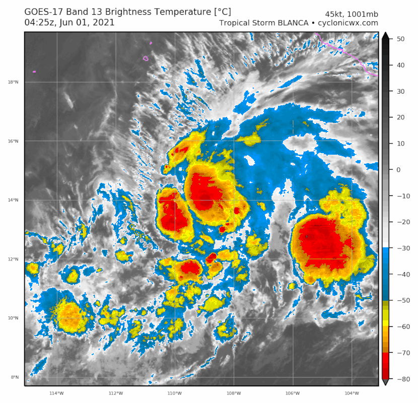
Blanca's satellite appearance has changed little tonight, as the
cyclone has maintained deep convection near its center with a couple
of banding elements observed in recent imagery. Overnight ASCAT data
indicate Blanca remains a compact tropical cyclone with a small
radius of tropical-storm-force winds. The 35-40 kt winds shown by
the scatterometer are likely not representative of the cyclone's
peak intensity given the small size of the wind field. The initial
advisory intensity of 50 kt is supported by a blend of the objective
UW-CIMSS ADT and SATCON intensity estimates and subjective Dvorak
classifications of T3.5/55 kt from SAB and T3.0/45 kt from TAFB.
The cyclone's estimated motion is 305/6 kt, as it continues to move
around the southwestern extent of a mid-level ridge that extends
across central Mexico. A mid- to upper-level trough near the Baja
California peninsula is beginning to weaken the steering ridge, and
so Blanca is expected to move generally west-northwestward with a
continued decrease in forward speed over the next couple of days.
Afterwards, the system is forecast to slowly turn westward within
the low-level trade winds as it weakens and becomes vertically
shallow. The latest NHC forecast track is largely an update of the
previous one and remains close to the HCCA corrected consensus aid.
Blanca has a brief window today for some additional strengthening,
although the vertical wind shear may already be increasing over the
system. By tonight, increasing southwesterly or west-southwesterly
shear should induce a weakening trend that will likely continue
through late this week. As Blanca moves into an environment with
cooler sea surface temperatures and drier mid-level air in 2-3 days,
the cyclone is forecast to weaken to a depression by 72 hours and a
remnant low by the end of the forecast period, if not sooner. Once
again, the NHC intensity forecast captures the overall trend
reflected by the HCCA and ICON consensus aids.
FORECAST POSITIONS AND MAX WINDS
INIT 01/0900Z 14.2N 109.6W 50 KT 60 MPH
12H 01/1800Z 14.6N 110.5W 55 KT 65 MPH
24H 02/0600Z 15.1N 111.5W 50 KT 60 MPH
36H 02/1800Z 15.5N 112.3W 45 KT 50 MPH
48H 03/0600Z 15.7N 112.8W 40 KT 45 MPH
60H 03/1800Z 15.9N 113.5W 35 KT 40 MPH
72H 04/0600Z 16.0N 114.4W 30 KT 35 MPH
96H 05/0600Z 16.0N 116.4W 25 KT 30 MPH
120H 06/0600Z 16.1N 118.5W 25 KT 30 MPH...POST-TROP/REMNT LOW
$$
Forecaster Reinhart/Beven
WTPZ42 KNHC 010839
TCDEP2
Tropical Storm Blanca Discussion Number 7
NWS National Hurricane Center Miami FL EP022021
300 AM MDT Tue Jun 01 2021
Blanca's satellite appearance has changed little tonight, as the
cyclone has maintained deep convection near its center with a couple
of banding elements observed in recent imagery. Overnight ASCAT data
indicate Blanca remains a compact tropical cyclone with a small
radius of tropical-storm-force winds. The 35-40 kt winds shown by
the scatterometer are likely not representative of the cyclone's
peak intensity given the small size of the wind field. The initial
advisory intensity of 50 kt is supported by a blend of the objective
UW-CIMSS ADT and SATCON intensity estimates and subjective Dvorak
classifications of T3.5/55 kt from SAB and T3.0/45 kt from TAFB.
The cyclone's estimated motion is 305/6 kt, as it continues to move
around the southwestern extent of a mid-level ridge that extends
across central Mexico. A mid- to upper-level trough near the Baja
California peninsula is beginning to weaken the steering ridge, and
so Blanca is expected to move generally west-northwestward with a
continued decrease in forward speed over the next couple of days.
Afterwards, the system is forecast to slowly turn westward within
the low-level trade winds as it weakens and becomes vertically
shallow. The latest NHC forecast track is largely an update of the
previous one and remains close to the HCCA corrected consensus aid.
Blanca has a brief window today for some additional strengthening,
although the vertical wind shear may already be increasing over the
system. By tonight, increasing southwesterly or west-southwesterly
shear should induce a weakening trend that will likely continue
through late this week. As Blanca moves into an environment with
cooler sea surface temperatures and drier mid-level air in 2-3 days,
the cyclone is forecast to weaken to a depression by 72 hours and a
remnant low by the end of the forecast period, if not sooner. Once
again, the NHC intensity forecast captures the overall trend
reflected by the HCCA and ICON consensus aids.
FORECAST POSITIONS AND MAX WINDS
INIT 01/0900Z 14.2N 109.6W 50 KT 60 MPH
12H 01/1800Z 14.6N 110.5W 55 KT 65 MPH
24H 02/0600Z 15.1N 111.5W 50 KT 60 MPH
36H 02/1800Z 15.5N 112.3W 45 KT 50 MPH
48H 03/0600Z 15.7N 112.8W 40 KT 45 MPH
60H 03/1800Z 15.9N 113.5W 35 KT 40 MPH
72H 04/0600Z 16.0N 114.4W 30 KT 35 MPH
96H 05/0600Z 16.0N 116.4W 25 KT 30 MPH
120H 06/0600Z 16.1N 118.5W 25 KT 30 MPH...POST-TROP/REMNT LOW
$$
Forecaster Reinhart/Beven
0 likes
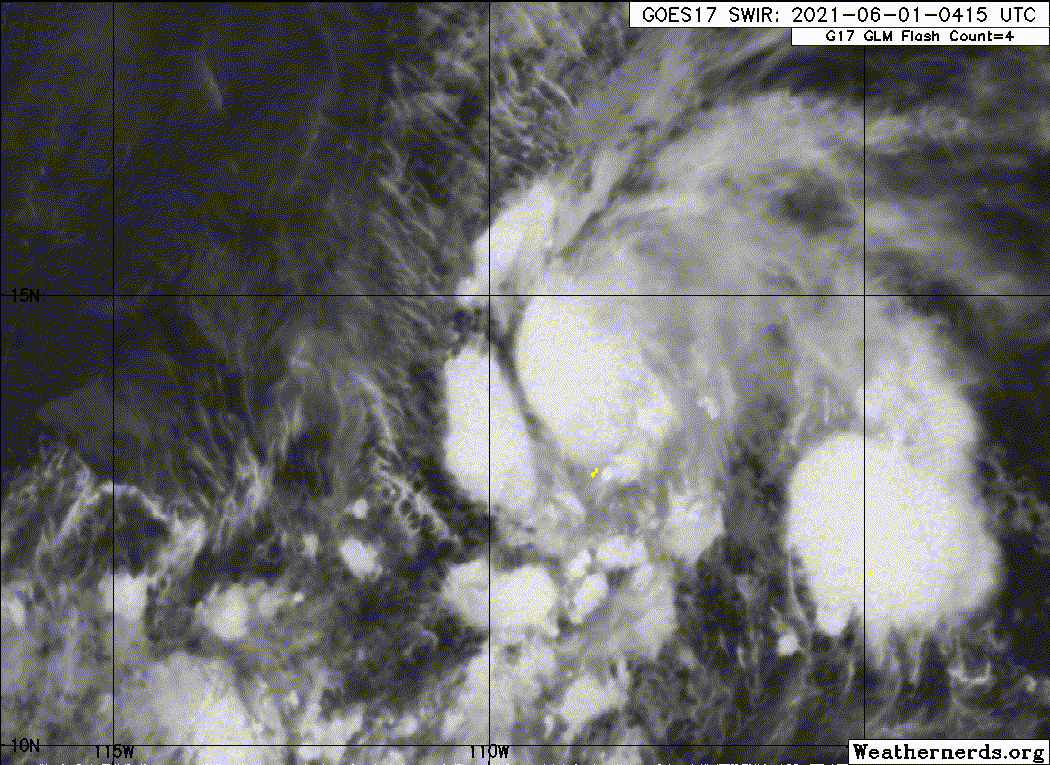
Re: EPAC: BLANCA - Tropical Storm
Still has a few intense storms feeding into that small core on sat.
2 likes
Re: EPAC: BLANCA - Tropical Storm
TXPZ29 KNES 011202
TCSENP
A. 02E (BLANCA)
B. 01/1130Z
C. 13.8N
D. 108.7W
E. ONE/GOES-W
F. T4.5/4.5
G. IR/EIR
H. REMARKS...SYSTEM DISPLAYS AN EYE LIKE FEATURE WITH MG FOR EYE TEMP
AND BLACK AS THE SURROUNDING RING TEMP EMBEDDED IN LG RESULTING IN A DT
OF 5.0 FOR EYE PATTERN. MET AND PT ARE 4.0. FT IS BASED ON CONSTRAINTS
OF FT CANNOT BE GREATER THAN 1 OVER 6 HOURS FROM PREVIOUS FT.
I. ADDL POSITIONS
NIL
...PATEL
0 likes
Who is online
Users browsing this forum: No registered users and 72 guests