EPAC: CARLOS - Remnants

Moderator: S2k Moderators

Message
Author
User avatar
cycloneye
Admin
Admin
Posts: 139086
Age: 67
Joined: Thu Oct 10, 2002 10:54 am
Location: San Juan, Puerto Rico

Re: EPAC: CARLOS - Tropical Storm

#181 Postby cycloneye » Sun Jun 13, 2021 3:45 pm

Tropical Storm Carlos Discussion Number 5
NWS National Hurricane Center Miami FL EP032021
200 PM PDT Sun Jun 13 2021

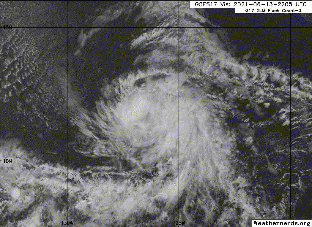
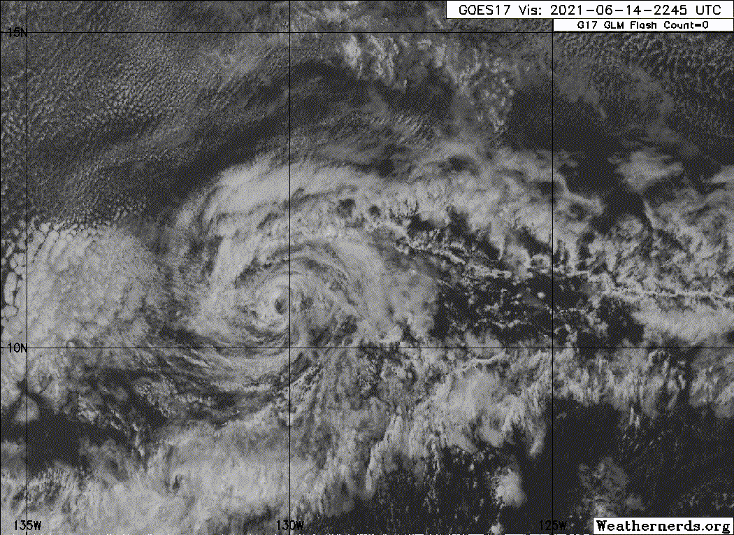
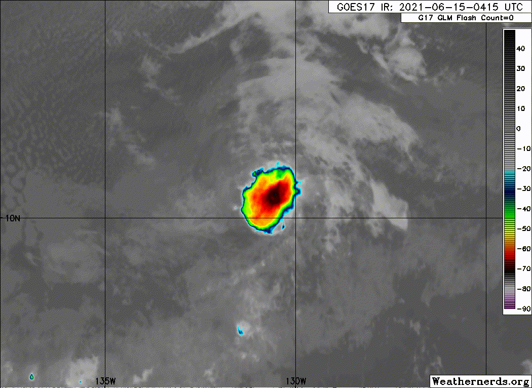
Deep convection has managed to persist over the center of Carlos
throughout the day today, although the appearance of this convection
has become more ragged as the day has progressed. The blended CI
values from TAFB and SAB suggest the system still has an intensity
of 45 kt. A recent ASCAT overpass only partially captured the
circulation with peak wind vectors of 39 kt. Compensating for
possible undersampling by the instrument over only a portion of
such a compact cyclone, maintaining 45 kt seems reasonable for the
initial advisory intensity.

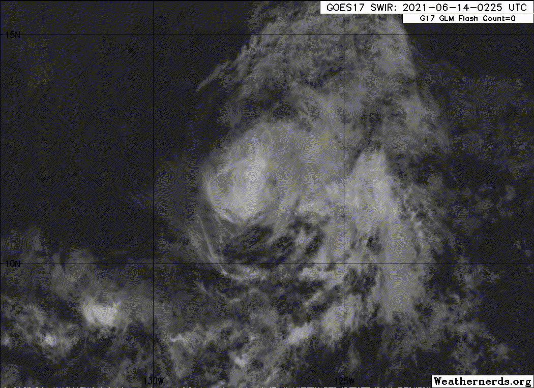
Dry and stable air lies just to the north and west of Carlos, and
occasional intrusions of this air into the cyclone's circulation
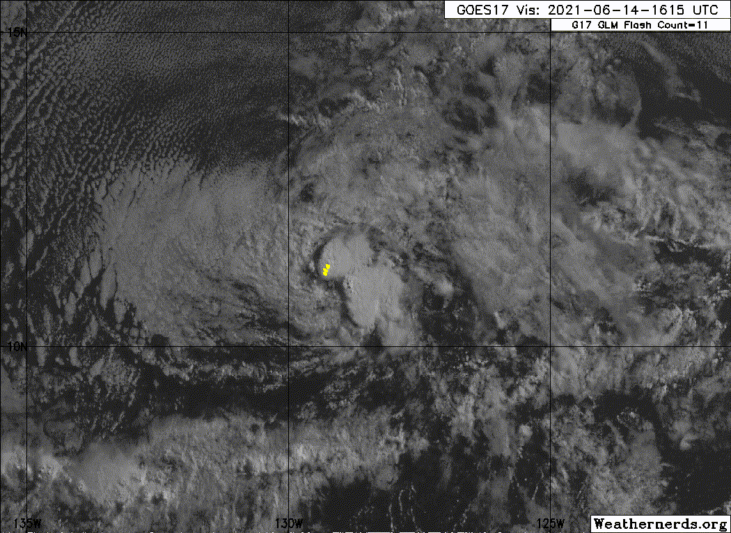
could disrupt convection. However, the overnight diurnal convective
maximum could overcome these intrusions over the next couple of
nights. Therefore, only slight weakening is indicated through that
time period. By 48 h, Carlos is expected to move into the stable
airmass which should further disrupt its convection, causing
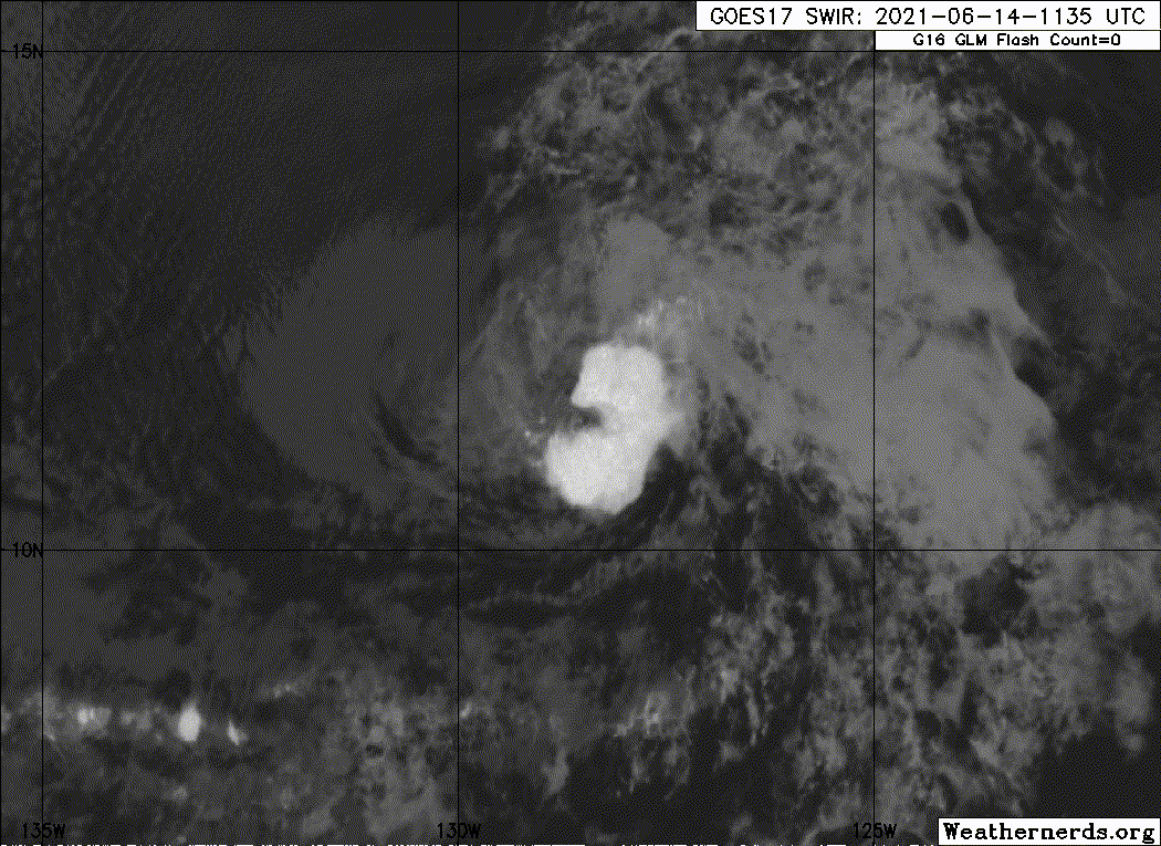
additional weakening. By late in the forecast period the cyclone
is forecast to be near or have crossed the 26 degree C SST
isotherm. This should cause any remaining convection to gradually
dissipate. Although not shown in the official forecast, it is
possible Carlos will degenerate into a remnant low by the end of
the forecast period, as suggested by the GFS. The latest NHC
intensity forecast is very near the various multi-model consensus
solutions.

Carlos is beginning to show signs of slowing and turning to the
left, with the initial motion now 260/6 kt. Model guidance remains
in good agreement through 48 h, with the storm slowing and turning
west-southwest as a mid-level ridge becomes oriented SW-NE to the
north of the cyclone. There is still a vast amount of track guidance
spread beyond 72 h, but not as much as earlier today. The GFS, which
continues to be the easternmost solution has shifted well west of
its previous track, showing Carlos turning northwest in a few days
in response to a building ridge to its east, and weakening ridge to
the north. The remaining guidance maintains the ridge to the north
and shows Carlos turning west by midweek, then west-northwest by
late this week. The official NHC forecast is near the previous one
through 48 h. Beyond 48 h, large adjustments were required to
accommodate the continuing westward trends in the guidance.
Despite the abrupt shift in the official forecast for the latter
half of the period, it remains well east of the consensus and the
majority of available track guidance.


FORECAST POSITIONS AND MAX WINDS

INIT 13/2100Z 11.7N 126.6W 45 KT 50 MPH
12H 14/0600Z 11.4N 127.4W 40 KT 45 MPH
24H 14/1800Z 11.0N 128.3W 40 KT 45 MPH
36H 15/0600Z 10.6N 129.2W 40 KT 45 MPH
48H 15/1800Z 10.4N 130.0W 35 KT 40 MPH
60H 16/0600Z 10.3N 130.8W 30 KT 35 MPH
72H 16/1800Z 10.3N 131.3W 30 KT 35 MPH
96H 17/1800Z 10.7N 132.0W 25 KT 30 MPH
120H 18/1800Z 11.4N 132.7W 25 KT 30 MPH

$$
Forecaster Latto
0 likes   
Visit the Caribbean-Central America Weather Thread where you can find at first post web cams,radars
and observations from Caribbean basin members Click Here

User avatar
cycloneye
Admin
Admin
Posts: 139086
Age: 67
Joined: Thu Oct 10, 2002 10:54 am
Location: San Juan, Puerto Rico

Re: EPAC: CARLOS - Tropical Storm

#182 Postby cycloneye » Sun Jun 13, 2021 7:48 pm

EP, 03, 2021061400, , BEST, 0, 117N, 1268W, 40, 1001, TS
0 likes   
Visit the Caribbean-Central America Weather Thread where you can find at first post web cams,radars
and observations from Caribbean basin members Click Here

Sciencerocks
Category 5
Category 5
Posts: 7286
Age: 38
Joined: Thu Jul 06, 2017 1:51 am

Re: EPAC: CARLOS - Tropical Storm

#183 Postby Sciencerocks » Sun Jun 13, 2021 8:36 pm

Image
0 likes   

User avatar
cycloneye
Admin
Admin
Posts: 139086
Age: 67
Joined: Thu Oct 10, 2002 10:54 am
Location: San Juan, Puerto Rico

Re: EPAC: CARLOS - Tropical Storm

#184 Postby cycloneye » Sun Jun 13, 2021 9:44 pm

Tropical Storm Carlos Discussion Number 6
NWS National Hurricane Center Miami FL EP032021
800 PM PDT Sun Jun 13 2021

The satellite appearance of Carlos has degraded this evening. A
ragged area of deep convection persists near and to the west of the
estimated center position, but infrared cloud top temperatures have
recently warmed and the system's organization has not improved.
Therefore, the initial intensity of Carlos is lowered to 40 kt for
this advisory. This is consistent with objective UW-CIMSS ADT and
SATCON estimates between 35-40 kt, as well as an average of the
subjective Dvorak classifications received from TAFB and SAB.

Carlos continues to be steered west-southwestward by a mid-level
ridge to its north and northwest. This general motion is expected to
persist for the next couple of days. Fortunately, the vast majority
of reliable track guidance has come into much better agreement for
day 3 and beyond, showing the weakening cyclone moving generally
westward to the south of a low-level ridge. Substantial adjustments
were once again made to the official NHC track forecast beyond 48 h
to show a westward to west-northwestward motion on days 3-5, which
is consistent with the latest guidance consensus. The updated track
forecast lies closer to the HFIP corrected consensus approach (HCCA)
and TVCE consensus aids, although it is still somewhat slower and
right-of-track to allow for a gradual shift in the NHC forecast.

Carlos is forecast to move over warm sea-surface temperatures in
an environment with fairly low vertical wind shear for the next 12 h
or so. However, surrounding dry air may periodically disrupt the
cyclone's convective structure, and thus limit its ability to become
more organized and intensify. Therefore, only small fluctuations in
intensity are expected. Thereafter, decreasing oceanic heat content
and increasing southwesterly vertical wind shear within a drier
mid-level environment should induce a weakening trend. The latest
NHC forecast calls for Carlos to weaken into a tropical depression
by Tuesday night. Marginal environmental conditions and continued
bouts of dry air will affect Carlos through late week, and it is
plausible that Carlos will become a remnant low even earlier than
forecast, perhaps by the end of the forecast period.


FORECAST POSITIONS AND MAX WINDS

INIT 14/0300Z 11.6N 127.1W 40 KT 45 MPH
12H 14/1200Z 11.3N 127.9W 40 KT 45 MPH
24H 15/0000Z 10.9N 128.9W 35 KT 40 MPH
36H 15/1200Z 10.5N 130.2W 35 KT 40 MPH
48H 16/0000Z 10.2N 131.6W 30 KT 35 MPH
60H 16/1200Z 10.2N 132.6W 30 KT 35 MPH
72H 17/0000Z 10.3N 133.7W 25 KT 30 MPH
96H 18/0000Z 11.0N 135.0W 25 KT 30 MPH
120H 19/0000Z 11.5N 136.5W 25 KT 30 MPH

$$
Forecaster Reinhart/Pasch
0 likes   
Visit the Caribbean-Central America Weather Thread where you can find at first post web cams,radars
and observations from Caribbean basin members Click Here

User avatar
Yellow Evan
Professional-Met
Professional-Met
Posts: 15952
Age: 25
Joined: Fri Jul 15, 2011 12:48 pm
Location: Henderson, Nevada/Honolulu, HI
Contact:

Re: EPAC: CARLOS - Tropical Storm

#185 Postby Yellow Evan » Sun Jun 13, 2021 11:42 pm

Image

Good job guys.
0 likes   

Sciencerocks
Category 5
Category 5
Posts: 7286
Age: 38
Joined: Thu Jul 06, 2017 1:51 am

Re: EPAC: CARLOS - Tropical Storm

#186 Postby Sciencerocks » Mon Jun 14, 2021 12:47 am

Image
0 likes   

User avatar
Kingarabian
S2K Supporter
S2K Supporter
Posts: 15435
Joined: Sat Aug 08, 2009 3:06 am
Location: Honolulu, Hawaii

Re: EPAC: CARLOS - Tropical Storm

#187 Postby Kingarabian » Mon Jun 14, 2021 2:22 am

Good bye Carlos lol
0 likes   
RIP Kobe Bryant

User avatar
cycloneye
Admin
Admin
Posts: 139086
Age: 67
Joined: Thu Oct 10, 2002 10:54 am
Location: San Juan, Puerto Rico

Re: EPAC: CARLOS - Tropical Storm

#188 Postby cycloneye » Mon Jun 14, 2021 4:38 am

Tropical Storm Carlos Discussion Number 7
NWS National Hurricane Center Miami FL EP032021
200 AM PDT Mon Jun 14 2021

The satellite presentation of Carlos has continued to erode early
this morning, with only three remnant convective cells noted
rotating around the center. As a result, subjective and objective
satellite intensity estimates have fallen sharply. Thus, the
initial intensity has also been lowered to 35 kt, which could be
generous.

The initial motion estimate is 255/06 kt. Carlos is forecast by the
global and regional models to be steered west-southwestward to
westward throughout the 5-day period by a strong low- to mid-level
subtropical ridge situated to its north and northwest. The latest
model guidance has come into much better agreement on this track
scenario, especially compared to this time yesterday, and the new
NHC track forecast follows suit and lies close to a blend of the
HCCA and TVCE consensus track models.

Although sea-surface temperatures are expected to remain warm enough
to support a tropical cyclone, the continued ingestion of cooler,
drier, and more stable air that now completely surrounds Carlos is
forecast to continue to erode the central deep convection, with the
cyclone weakening a tropical depression later today. By 36-48h,
southwesterly vertical wind shear in excess of 20 kt is expected to
hasten the weakening process, resulting in Carlos degenerating into
a remnant low. Although there will likely be periodic short-lived
bursts of convection, especially at night, the general trend should
be gradual weakening throughout the 120-h forecast period, perhaps
even faster than indicated by the official intensity forecast.


FORECAST POSITIONS AND MAX WINDS

INIT 14/0900Z 11.4N 127.8W 35 KT 40 MPH
12H 14/1800Z 11.2N 128.5W 30 KT 35 MPH
24H 15/0600Z 10.8N 129.6W 30 KT 35 MPH
36H 15/1800Z 10.4N 130.8W 25 KT 30 MPH
48H 16/0600Z 10.2N 132.1W 25 KT 30 MPH...POST-TROP/REMNT LOW
60H 16/1800Z 10.2N 133.3W 25 KT 30 MPH...POST-TROP/REMNT LOW
72H 17/0600Z 10.5N 134.4W 20 KT 25 MPH...POST-TROP/REMNT LOW
96H 18/0600Z 11.0N 136.0W 20 KT 25 MPH...POST-TROP/REMNT LOW
120H 19/0600Z 11.5N 137.6W 20 KT 25 MPH...POST-TROP/REMNT LOW

$$
Forecaster Stewart
0 likes   
Visit the Caribbean-Central America Weather Thread where you can find at first post web cams,radars
and observations from Caribbean basin members Click Here

User avatar
ElectricStorm
Category 5
Category 5
Posts: 4561
Age: 23
Joined: Tue Aug 13, 2019 11:23 pm
Location: Skiatook, OK / Norman, OK

Re: EPAC: CARLOS - Tropical Storm

#189 Postby ElectricStorm » Mon Jun 14, 2021 4:39 am

Looks like Carlos is on the way out. At least it was able to finally do something after that initial 90/90 fail lol
2 likes   
I am in no way a professional. Take what I say with a grain of salt as I could be totally wrong. Please refer to the NHC, NWS, or SPC for official information.

Boomer Sooner!

User avatar
Yellow Evan
Professional-Met
Professional-Met
Posts: 15952
Age: 25
Joined: Fri Jul 15, 2011 12:48 pm
Location: Henderson, Nevada/Honolulu, HI
Contact:

Re: EPAC: CARLOS - Tropical Storm

#190 Postby Yellow Evan » Mon Jun 14, 2021 8:45 am

I don’t think I’ve seen all it’s convection vanish in a deep tropical storm like this before. Seems to have lost its ITCZ life support and is well on its way to becoming a remnant low.
0 likes   

Sciencerocks
Category 5
Category 5
Posts: 7286
Age: 38
Joined: Thu Jul 06, 2017 1:51 am

Re: EPAC: CARLOS - Tropical Storm

#191 Postby Sciencerocks » Mon Jun 14, 2021 10:06 am

Image
0 likes   

User avatar
cycloneye
Admin
Admin
Posts: 139086
Age: 67
Joined: Thu Oct 10, 2002 10:54 am
Location: San Juan, Puerto Rico

Re: EPAC: CARLOS - Tropical Storm

#192 Postby cycloneye » Mon Jun 14, 2021 12:17 pm

Tropical Storm Carlos Discussion Number 8
NWS National Hurricane Center Miami FL EP032021
800 AM PDT Mon Jun 14 2021

After being nearly devoid of deep convection for much of the night,
a new burst of convection has redeveloped near the center of the
cyclone's circulation. A blend of the latest Dvorak T-numbers from
TAFB and SAB support maintaining an initial intensity of 35 kt for
this advisory.

Carlos is moving west-southwest at 7 kt, steered by a low- to
mid-level ridge to its north. Most of the track guidance is now in
good agreement on keeping this ridge intact over the next several
days, forcing Carlos on the same west-southwest trajectory for the
next day or so, followed by a gradual turn to the west by midweek.
The latest NHC track forecast is near the previous one through 48 h,
and a little faster and south of it beyond that time. Most guidance
remains to the left of the latest NHC forecast, so additional
adjustments may be required later today.

Satellite images show a vast area of dry and stable air to the north
and west of Carlos, with stratocumulus being drawn into the western
portion of the cyclone's circulation. This undoubtedly helped to
contribute to the sputtering of convective activity overnight. The
ongoing intrusions of dry, stable air should continue to
periodically disrupt the development of deep convection over the
next day or so, which should cause Carlos to slowly weaken. By
36-48 h, southwesterly vertical wind shear in excess of 20 kt is
expected to hasten the weakening process, resulting in Carlos
degenerating into a remnant low by midweek. Thereafter, only
sporadic convection is expected to develop in association with the
remnant low as it gradually spins down. The latest NHC intensity
forecast is nearly the same as the previous one and is in agreement
with the bulk of the guidance.

FORECAST POSITIONS AND MAX WINDS

INIT 14/1500Z 11.3N 128.6W 35 KT 40 MPH
12H 15/0000Z 10.9N 129.6W 30 KT 35 MPH
24H 15/1200Z 10.6N 130.9W 30 KT 35 MPH
36H 16/0000Z 10.3N 132.3W 25 KT 30 MPH
48H 16/1200Z 10.2N 133.6W 25 KT 30 MPH...POST-TROP/REMNT LOW
60H 17/0000Z 10.2N 134.7W 25 KT 30 MPH...POST-TROP/REMNT LOW
72H 17/1200Z 10.3N 135.8W 20 KT 25 MPH...POST-TROP/REMNT LOW
96H 18/1200Z 10.7N 137.4W 20 KT 25 MPH...POST-TROP/REMNT LOW
120H 19/1200Z 11.1N 139.0W 20 KT 25 MPH...POST-TROP/REMNT LOW

$$
Forecaster Latto
0 likes   
Visit the Caribbean-Central America Weather Thread where you can find at first post web cams,radars
and observations from Caribbean basin members Click Here

Sciencerocks
Category 5
Category 5
Posts: 7286
Age: 38
Joined: Thu Jul 06, 2017 1:51 am

Re: EPAC: CARLOS - Tropical Storm

#193 Postby Sciencerocks » Mon Jun 14, 2021 2:43 pm

Image
0 likes   

User avatar
cycloneye
Admin
Admin
Posts: 139086
Age: 67
Joined: Thu Oct 10, 2002 10:54 am
Location: San Juan, Puerto Rico

Re: EPAC: CARLOS - Tropical Storm

#194 Postby cycloneye » Mon Jun 14, 2021 2:45 pm

EP, 03, 2021061418, , BEST, 0, 110N, 1296W, 30, 1007, TD
0 likes   
Visit the Caribbean-Central America Weather Thread where you can find at first post web cams,radars
and observations from Caribbean basin members Click Here

User avatar
cycloneye
Admin
Admin
Posts: 139086
Age: 67
Joined: Thu Oct 10, 2002 10:54 am
Location: San Juan, Puerto Rico

Re: EPAC: CARLOS - Tropical Depression

#195 Postby cycloneye » Mon Jun 14, 2021 3:42 pm

Tropical Depression Carlos Discussion Number 9
NWS National Hurricane Center Miami FL EP032021
200 PM PDT Mon Jun 14 2021

The convective burst that occurred this morning near the center of
Carlos has been gradually dissipating throughout the day. Satellite
imagery shows dry and stable air being entrained into the
circulation and the cyclone's center has become partially exposed.
The latest Dvorak estimate from TAFB indicates that Carlos has
weakened to a 30-kt tropical depression, and this will be the
initial advisory intensity.

Carlos is moving west-southwest at 8 kt, steered by a low- to
mid-level ridge to its north. Most of the track guidance is in good
agreement on keeping this ridge intact over the next several days,
forcing Carlos on the same west-southwest trajectory for the next
day or so, followed by a gradual turn to the west by midweek. The
latest NHC track forecast was adjusted to be a little faster and to
the south of the previous one to better match the trend in the
guidance, and is now near the northern end of the multi-model
consensus.

The depression is forecast to continue to traverse a dry and stable
airmass for the remainder of the week, and ongoing intrusions of
this air should inhibit the cyclone from producing long-lived
convection. The lack of deep convection should cause Carlos to
continue a slow weakening trend and eventually degenerate into a
remnant low. The official NHC forecast calls for this transition to
to occur by 48 h. However, it could occur sooner than this if
organized deep convection fails to regenerate.


FORECAST POSITIONS AND MAX WINDS

INIT 14/2100Z 10.9N 130.0W 30 KT 35 MPH
12H 15/0600Z 10.5N 131.1W 30 KT 35 MPH
24H 15/1800Z 10.1N 132.6W 30 KT 35 MPH
36H 16/0600Z 9.9N 134.0W 25 KT 30 MPH
48H 16/1800Z 9.9N 135.3W 25 KT 30 MPH...POST-TROP/REMNT LOW
60H 17/0600Z 9.9N 136.5W 25 KT 30 MPH...POST-TROP/REMNT LOW
72H 17/1800Z 10.1N 137.5W 20 KT 25 MPH...POST-TROP/REMNT LOW
96H 18/1800Z 10.3N 140.0W 20 KT 25 MPH...POST-TROP/REMNT LOW
120H 19/1800Z...DISSIPATED

$$
Forecaster Latto
0 likes   
Visit the Caribbean-Central America Weather Thread where you can find at first post web cams,radars
and observations from Caribbean basin members Click Here

Sciencerocks
Category 5
Category 5
Posts: 7286
Age: 38
Joined: Thu Jul 06, 2017 1:51 am

Re: EPAC: CARLOS - Tropical Depression

#196 Postby Sciencerocks » Mon Jun 14, 2021 9:26 pm

Image
0 likes   

User avatar
Yellow Evan
Professional-Met
Professional-Met
Posts: 15952
Age: 25
Joined: Fri Jul 15, 2011 12:48 pm
Location: Henderson, Nevada/Honolulu, HI
Contact:

Re: EPAC: CARLOS - Tropical Depression

#197 Postby Yellow Evan » Mon Jun 14, 2021 9:30 pm

Convection seems to have returned for now. Odds are at least decent it can linger around for a while for that reason.
0 likes   

User avatar
cycloneye
Admin
Admin
Posts: 139086
Age: 67
Joined: Thu Oct 10, 2002 10:54 am
Location: San Juan, Puerto Rico

Re: EPAC: CARLOS - Tropical Depression

#198 Postby cycloneye » Mon Jun 14, 2021 10:02 pm

Tropical Depression Carlos Discussion Number 10
NWS National Hurricane Center Miami FL EP032021
800 PM PDT Mon Jun 14 2021

Carlos is barely holding on as a tropical cyclone. The depression
was completely devoid of convection for several hours this afternoon
with a completely exposed low-level center, but recently a small
burst of convection pulsed near and to the west-southwest of the
low-level center. Given the unfavorable environment the system is
embedded within, this activity is likely to be short-lived. Carlos
remains a 30-kt tropical depression with this advisory, in best
agreement with the subjective Dvorak classification received from
TAFB.

The depression is still moving west-southwestward, or 250/10 kt.
This general motion will continue for the next 24 h, followed by a
westward motion to the south of a low- to mid-level ridge that
should continue through Carlos' dissipation. The latest NHC track
forecast track is somewhat faster and slightly south of the previous
one, in agreement with the latest multi-model consensus.

Despite reasonably warm sea-surface temperatures along its track,
Carlos is expected to continue battling intrusions of dry air from
its surrounding environment as well as increasing west-southwesterly
shear. Therefore, the future looks bleak for Carlos, and the system
appears likely to degenerate to a remnant low within the next 24 h
or so. This forecast is consistent with the latest GFS and ECMWF
simulated satellite imagery, which shows little potential for any
sustained, organized convection going forward. The majority of the
global guidance now suggests that the remnant low will dissipate by
Friday night, which is reflected in this forecast advisory.


FORECAST POSITIONS AND MAX WINDS

INIT 15/0300Z 10.5N 130.8W 30 KT 35 MPH
12H 15/1200Z 10.1N 132.1W 25 KT 30 MPH
24H 16/0000Z 9.8N 133.6W 25 KT 30 MPH...POST-TROP/REMNT LOW
36H 16/1200Z 9.7N 135.0W 25 KT 30 MPH...POST-TROP/REMNT LOW
48H 17/0000Z 9.7N 136.3W 25 KT 30 MPH...POST-TROP/REMNT LOW
60H 17/1200Z 9.8N 137.6W 25 KT 30 MPH...POST-TROP/REMNT LOW
72H 18/0000Z 10.0N 139.0W 20 KT 25 MPH...POST-TROP/REMNT LOW
96H 19/0000Z...DISSIPATED

$$
Forecaster Reinhart/Pasch
0 likes   
Visit the Caribbean-Central America Weather Thread where you can find at first post web cams,radars
and observations from Caribbean basin members Click Here

Sciencerocks
Category 5
Category 5
Posts: 7286
Age: 38
Joined: Thu Jul 06, 2017 1:51 am

Re: EPAC: CARLOS - Tropical Depression

#199 Postby Sciencerocks » Tue Jun 15, 2021 2:35 am

Image
0 likes   

User avatar
cycloneye
Admin
Admin
Posts: 139086
Age: 67
Joined: Thu Oct 10, 2002 10:54 am
Location: San Juan, Puerto Rico

Re: EPAC: CARLOS - Tropical Depression

#200 Postby cycloneye » Tue Jun 15, 2021 4:42 am

Tropical Depression Carlos Discussion Number 11
NWS National Hurricane Center Miami FL EP032021
200 AM PDT Tue Jun 15 2021

Organized deep convection has dissipated once again near the
low-level center of Carlos, thanks to a combination of very dry,
stable mid-level air and increasing southwesterly vertical wind
shear. A blend of the latest subjective and objective intensity
estimates supports maintaining the current intensity of 30-kt for
this advisory, though this may be somewhat generous given the
highest wind retrieval from a partial 0459 UTC ASCAT-A pass was only
26 kt.

Carlos is continuing to move steadily to the west-southwest at
245/10 kt. This current motion should continue for the next
day or so followed by a gradual bend westward as the shallow cyclone
becomes increasingly steered by a large poleward low-level ridge
over the north Pacific. The latest NHC track is once again a bit
faster and slightly south of the previous forecast, but remains in
agreement with the multi-model consensus.

The continued combination of very dry 40-45 percent relative
humidity and 25-30 kts of southwesterly vertical wind shear will
ultimately lead to Carlos' demise, despite the cyclone traversing
sufficently warm 27-28 C sea-surface temperatures. Now that
convection has dissipated again near the center, without another
resurgence, it is only a matter of time before the cyclone
degenerates into a remnant low. Investigating simulated satellite
forecasts from global model (GFS, ECMWF, CMC) and regional hurricane
model (HWRF) output suggests that any additional convective bursts
will quickly shear off to the east and not be sufficently organized
to maintain the cyclone's identity. Therefore, Carlos is expected
to become a remnant low in 24 h, but could occur as soon as this
afternoon if convection does not return soon. The remnant low will
continue to slowly spin down, likely opening up into a trough by 72
h.


FORECAST POSITIONS AND MAX WINDS

INIT 15/0900Z 10.1N 131.8W 30 KT 35 MPH
12H 15/1800Z 9.6N 133.1W 25 KT 30 MPH
24H 16/0600Z 9.5N 134.5W 25 KT 30 MPH...POST-TROP/REMNT LOW
36H 16/1800Z 9.5N 135.8W 25 KT 30 MPH...POST-TROP/REMNT LOW
48H 17/0600Z 9.5N 137.1W 25 KT 30 MPH...POST-TROP/REMNT LOW
60H 17/1800Z 9.7N 138.6W 20 KT 25 MPH...POST-TROP/REMNT LOW
72H 18/0600Z...DISSIPATED

$$
Forecaster Papin/Stewart
0 likes   
Visit the Caribbean-Central America Weather Thread where you can find at first post web cams,radars
and observations from Caribbean basin members Click Here


Return to “2021”

Who is online

Users browsing this forum: No registered users and 61 guests