ATL: Remnants of INVEST 95L - Discussion

Moderator: S2k Moderators

Message
Author
User avatar
abajan
S2K Supporter
S2K Supporter
Posts: 4175
Joined: Sun Sep 07, 2003 5:10 am
Location: Barbados

Re: ATL: INVEST 95L - Discussion

#201 Postby abajan » Tue Jun 29, 2021 11:23 am

Stormybajan wrote:
abajan wrote:

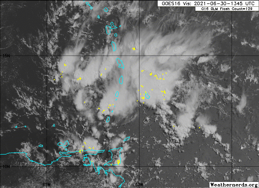
Despite an apparent outflow boundary, that looks pretty serious to me.


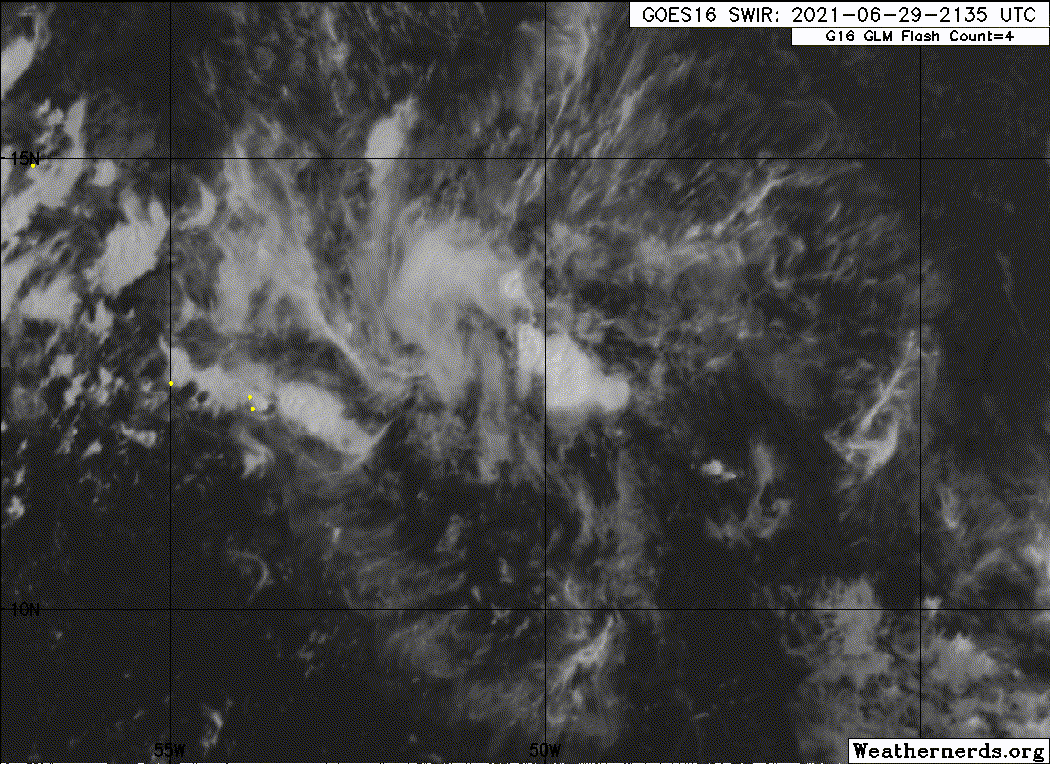
The thing is I think those images are delayed by like 4 hours ..right now its not doing so hot. Dry air seems to be the issue right now but 95L has always been a night kind of system so tonight is where the action will be closely watched
https://realearth.ssec.wisc.edu/

Good catch! I didn't check the times shown on the loop. :lol:
1 likes   

User avatar
cycloneye
Admin
Admin
Posts: 139083
Age: 67
Joined: Thu Oct 10, 2002 10:54 am
Location: San Juan, Puerto Rico

Re: ATL: INVEST 95L - Discussion

#202 Postby cycloneye » Tue Jun 29, 2021 1:06 pm

Disorganized showers and thunderstorms continue in association with
a tropical wave located over the tropical Atlantic about 650 miles
east of the Lesser Antilles. Some slow development of this
disturbance is possible later this week while the system moves
westward to west-northwestward at 20 to 25 mph, likely reaching the
Lesser Antilles by Wednesday night. Regardless of development,
this system could bring locally heavy rainfall to portions of the
Lesser Antilles during the next few days.
* Formation chance through 48 hours...low...20 percent.
* Formation chance through 5 days...low...30 percent.


Image
1 likes   
Visit the Caribbean-Central America Weather Thread where you can find at first post web cams,radars
and observations from Caribbean basin members Click Here

Shell Mound
Category 5
Category 5
Posts: 2434
Age: 31
Joined: Thu Sep 07, 2017 3:39 pm
Location: St. Petersburg, FL → Scandinavia

Re: ATL: INVEST 95L - Discussion

#203 Postby Shell Mound » Tue Jun 29, 2021 1:15 pm

Cat5James wrote:
Shell Mound wrote:
Weatherboy1 wrote:First post for the 2021 season here (though I have been reading contributions of others). As some have noted already, 95 looks a LOT different now than at any point over the last few days. Definitely think its chances are on the upswing, and this will be noted in today's NHC outlooks. Will it jump straight to a TD soon? That's a bit of a stretch. But if we keep seeing deep convection firing and the structure of the wave improve, can't rule it out.

Currently there is no sign of a mid-level circulation, much less a low-level centre. Additionally, even the ECMWF, especially its ensemble, has, like the GFS and HWRF, been too aggressive with tropical waves thus far in 2021. Over the past few days it showed 95L becoming a tropical storm by now, and that obviously has not transpired. VWS due to the TUTT should remain fairly strong and even increase as 95L bypasses the Lesser Antilles. Overall, I highly doubt that this system will become a depression or named storm, given model biases observed to date, the current absence of structural organisation, and current and expected VWS.

There is a clear vorticity signature at 850mb... let's see how 95L progresses through the day

Based on the latest trends, low-level flow in the background (net shear) is too strong for a well-defined centre to develop, given the trade-linked inversion.
0 likes   
CVW / MiamiensisWx / Shell Mound
The posts in this forum are NOT official forecasts and should not be used as such. They are just the opinion of the poster and may or may not be backed by sound meteorological data. They are NOT endorsed by any professional institution or STORM2K. For official information, please refer to products from the NHC and NWS.

User avatar
cycloneye
Admin
Admin
Posts: 139083
Age: 67
Joined: Thu Oct 10, 2002 10:54 am
Location: San Juan, Puerto Rico

Re: ATL: INVEST 95L - Discussion

#204 Postby cycloneye » Tue Jun 29, 2021 2:15 pm

AL, 95, 2021062918, , BEST, 0, 124N, 503W, 30, 1011, DB
1 likes   
Visit the Caribbean-Central America Weather Thread where you can find at first post web cams,radars
and observations from Caribbean basin members Click Here

User avatar
aspen
Category 5
Category 5
Posts: 8057
Joined: Sat Oct 12, 2019 7:10 pm
Location: Connecticut, USA

Re: ATL: INVEST 95L - Discussion

#205 Postby aspen » Tue Jun 29, 2021 4:45 pm

Definitely not as impressive convection-wise as this morning, but there are some new hot towers firing up, and there’s what looks to be outflow to my untrained eye. I’m not giving up on this yet, but it doesn’t have much time.
6 likes   
Irene '11 Sandy '12 Hermine '16 5/15/2018 Derecho Fay '20 Isaias '20 Elsa '21 Henri '21 Ida '21

I am only a meteorology enthusiast who knows a decent amount about tropical cyclones. Look to the professional mets, the NHC, or your local weather office for the best information.

User avatar
Stormybajan
Category 1
Category 1
Posts: 428
Joined: Thu May 20, 2021 3:21 pm
Location: Windward Islands

Re: ATL: INVEST 95L - Discussion

#206 Postby Stormybajan » Tue Jun 29, 2021 5:27 pm

aspen wrote:Definitely not as impressive convection-wise as this morning, but there are some new hot towers firing up, and there’s what looks to be outflow to my untrained eye. I’m not giving up on this yet, but it doesn’t have much time.


For me, development wise, it looks be done unless it can perform a miracle overnight..I think the bigger question is will it fire enough convection to have meaningful impacts to the islands tomorrow
2 likes   
Sad West Indies and Manchester United fan ⚽️

User avatar
msbee
S2K Supporter
S2K Supporter
Posts: 3010
Joined: Wed Jun 11, 2003 10:11 am
Location: St. Maarten

Re: ATL: INVEST 95L - Discussion

#207 Postby msbee » Tue Jun 29, 2021 6:22 pm

Stormybajan wrote:
aspen wrote:Definitely not as impressive convection-wise as this morning, but there are some new hot towers firing up, and there’s what looks to be outflow to my untrained eye. I’m not giving up on this yet, but it doesn’t have much time.


For me, development wise, it looks be done unless it can perform a miracle overnight..I think the bigger question is will it fire enough convection to have meaningful impacts to the islands tomorrow


I hope no "meaningful impacts" for the islands.
But MeteoFrance has Martinique, Guadeloupe, and St Martin on yellow alert for storms tomorrow.
https://meteofrance.gp/fr/vigilance
2 likes   
Too many hurricanes to remember

tolakram
Admin
Admin
Posts: 19165
Age: 60
Joined: Sun Aug 27, 2006 8:23 pm
Location: Florence, KY (name is Mark)

Re: ATL: INVEST 95L - Discussion

#208 Postby tolakram » Tue Jun 29, 2021 6:31 pm

msbee wrote:
Stormybajan wrote:
aspen wrote:Definitely not as impressive convection-wise as this morning, but there are some new hot towers firing up, and there’s what looks to be outflow to my untrained eye. I’m not giving up on this yet, but it doesn’t have much time.


For me, development wise, it looks be done unless it can perform a miracle overnight..I think the bigger question is will it fire enough convection to have meaningful impacts to the islands tomorrow


I hope no "meaningful impacts" for the islands.
But MeteoFrance has Martinique, Guadeloupe, and St Martin on yellow alert for storms tomorrow.
https://meteofrance.gp/fr/vigilance


I'm worried about the next wave, this one seems to be improving the environment for it. Even if it doesn't develop that could be a lot of rain so I can understand the alerts.
8 likes   
M a r k
- - - - -
Join us in chat: Storm2K Chatroom Invite. Android and IOS apps also available.

The posts in this forum are NOT official forecasts and should not be used as such. Posts are NOT endorsed by any professional institution or STORM2K.org. For official information and forecasts, please refer to NHC and NWS products.

User avatar
cycloneye
Admin
Admin
Posts: 139083
Age: 67
Joined: Thu Oct 10, 2002 10:54 am
Location: San Juan, Puerto Rico

Re: ATL: INVEST 95L - Discussion

#209 Postby cycloneye » Tue Jun 29, 2021 7:46 pm

msbee wrote:
Stormybajan wrote:
aspen wrote:Definitely not as impressive convection-wise as this morning, but there are some new hot towers firing up, and there’s what looks to be outflow to my untrained eye. I’m not giving up on this yet, but it doesn’t have much time.


For me, development wise, it looks be done unless it can perform a miracle overnight..I think the bigger question is will it fire enough convection to have meaningful impacts to the islands tomorrow


I hope no "meaningful impacts" for the islands.
But MeteoFrance has Martinique, Guadeloupe, and St Martin on yellow alert for storms tomorrow.
https://meteofrance.gp/fr/vigilance


Hello Barbara. Be careful there with this wave passage. Is the one behind I am much more worried about for the islands. We will see how it all evolves in the next 2-3 days.
1 likes   
Visit the Caribbean-Central America Weather Thread where you can find at first post web cams,radars
and observations from Caribbean basin members Click Here

Sciencerocks
Category 5
Category 5
Posts: 7286
Age: 38
Joined: Thu Jul 06, 2017 1:51 am

Re: ATL: INVEST 95L - Discussion

#210 Postby Sciencerocks » Tue Jun 29, 2021 8:02 pm

Image
0 likes   

User avatar
msbee
S2K Supporter
S2K Supporter
Posts: 3010
Joined: Wed Jun 11, 2003 10:11 am
Location: St. Maarten

Re: ATL: INVEST 95L - Discussion

#211 Postby msbee » Tue Jun 29, 2021 8:10 pm

cycloneye wrote:
msbee wrote:
Stormybajan wrote:
For me, development wise, it looks be done unless it can perform a miracle overnight..I think the bigger question is will it fire enough convection to have meaningful impacts to the islands tomorrow


I hope no "meaningful impacts" for the islands.
But MeteoFrance has Martinique, Guadeloupe, and St Martin on yellow alert for storms tomorrow.
https://meteofrance.gp/fr/vigilance


Hello Barbara. Be careful there with this wave passage. Is the one behind I am much more worried about for the islands. We will see how it all evolves in the next 2-3 days.

Hi Luis. Yes, I am more worried about the one behind too.
Watching carefully.
1 likes   
Too many hurricanes to remember

hurricanes1234
Category 5
Category 5
Posts: 2903
Joined: Sat Jul 28, 2012 6:19 pm
Location: Trinidad and Tobago

Re: ATL: INVEST 95L - Discussion

#212 Postby hurricanes1234 » Tue Jun 29, 2021 8:32 pm

cycloneye wrote:
msbee wrote:
Stormybajan wrote:
For me, development wise, it looks be done unless it can perform a miracle overnight..I think the bigger question is will it fire enough convection to have meaningful impacts to the islands tomorrow


I hope no "meaningful impacts" for the islands.
But MeteoFrance has Martinique, Guadeloupe, and St Martin on yellow alert for storms tomorrow.
https://meteofrance.gp/fr/vigilance


Hello Barbara. Be careful there with this wave passage. Is the one behind I am much more worried about for the islands. We will see how it all evolves in the next 2-3 days.


Watching closely in Trinidad as well because even though the waves themselves (or whatever becomes of them) are expected to miss us to the north, it's likely that we could get peripheral impacts, plus they're probably gonna alter our wind regime as they pass to the north and trigger localised strong thunderstorms over land.
5 likes   
PLEASE NOTE: With the exception of information from weather agencies that I may copy and paste here, my posts will NEVER be official, since I am NOT a meteorologist. They are solely my amateur opinion, and may or may not be accurate. Therefore, please DO NOT use them as official details, particularly when making important decisions. Thank you.

colbroe
Tropical Storm
Tropical Storm
Posts: 190
Joined: Sat Aug 07, 2004 4:57 am

Re: ATL: INVEST 95L - Discussion

#213 Postby colbroe » Wed Jun 30, 2021 4:25 am

Barbados is currently experiancing thundershowers and severe lightning and gustywinds 95 l is hovering nearby
2 likes   

tolakram
Admin
Admin
Posts: 19165
Age: 60
Joined: Sun Aug 27, 2006 8:23 pm
Location: Florence, KY (name is Mark)

Re: ATL: INVEST 95L - Discussion

#214 Postby tolakram » Wed Jun 30, 2021 7:16 am

1 likes   
M a r k
- - - - -
Join us in chat: Storm2K Chatroom Invite. Android and IOS apps also available.

The posts in this forum are NOT official forecasts and should not be used as such. Posts are NOT endorsed by any professional institution or STORM2K.org. For official information and forecasts, please refer to NHC and NWS products.

User avatar
abajan
S2K Supporter
S2K Supporter
Posts: 4175
Joined: Sun Sep 07, 2003 5:10 am
Location: Barbados

Re: ATL: INVEST 95L - Discussion

#215 Postby abajan » Wed Jun 30, 2021 7:53 am

colbroe wrote:Barbados is currently experiancing thundershowers and severe lightning and gustywinds 95 l is hovering nearby

Some of the loudest thunder I've heard in quite a few years. And more's on the way as I type!
6 likes   

User avatar
Stormybajan
Category 1
Category 1
Posts: 428
Joined: Thu May 20, 2021 3:21 pm
Location: Windward Islands

Re: ATL: INVEST 95L - Discussion

#216 Postby Stormybajan » Wed Jun 30, 2021 8:04 am

abajan wrote:
colbroe wrote:Barbados is currently experiancing thundershowers and severe lightning and gustywinds 95 l is hovering nearby

Some of the loudest thunder I've heard in quite a few years. And more's on the way as I type!


YES! Around 5 am it woke me up. I cant remember hearing thunder that loud ever :lol: sounded like a kraken coming from the sky or something
6 likes   
Sad West Indies and Manchester United fan ⚽️

User avatar
abajan
S2K Supporter
S2K Supporter
Posts: 4175
Joined: Sun Sep 07, 2003 5:10 am
Location: Barbados

Re: ATL: INVEST 95L - Discussion

#217 Postby abajan » Wed Jun 30, 2021 9:08 am

Stormybajan wrote:
abajan wrote:
colbroe wrote:Barbados is currently experiancing thundershowers and severe lightning and gustywinds 95 l is hovering nearby

Some of the loudest thunder I've heard in quite a few years. And more's on the way as I type!


YES! Around 5 am it woke me up. I cant remember hearing thunder that loud ever :lol: sounded like a kraken coming from the sky or something

I've experienced brighter lightning and louder thunder - much louder. But not in Barbados. It was a severe thunderstorm in Ohio, way back in 1980. One bolt was particularly scary. The blinding flash and accompanying thunder happened all at once: absolutely no pause between the lightning and thunder. It was just a massive BANG. My cousin, at whose house I was staying, swore it hit the antenna of his ham radio setup. Thankfully, it didn't. It must've struck a nearby tree or something.
4 likes   

Sciencerocks
Category 5
Category 5
Posts: 7286
Age: 38
Joined: Thu Jul 06, 2017 1:51 am

Re: ATL: INVEST 95L - Discussion

#218 Postby Sciencerocks » Wed Jun 30, 2021 12:16 pm

Image
2 likes   

User avatar
AJC3
Admin
Admin
Posts: 3873
Age: 60
Joined: Tue Aug 31, 2004 7:04 pm
Location: West Melbourne, Florida
Contact:

Re: ATL: Remnants of INVEST 95L - Discussion

#219 Postby AJC3 » Thu Jul 01, 2021 2:51 pm

The ex-95L threads have been temporarily moved back into TT, since thee were starting to be discussed in the Elsa thread.
0 likes   

User avatar
InfernoFlameCat
Category 5
Category 5
Posts: 1966
Age: 21
Joined: Mon Dec 14, 2020 10:52 am
Location: Buford, GA

Re: ATL: Remnants of INVEST 95L - Discussion

#220 Postby InfernoFlameCat » Thu Jul 01, 2021 6:38 pm

95L might not be done yet. This thing really is laying down the red carpet for Elsa whilst it steps on the hot coals of the Caribbean itself.
3 likes   
I am by no means a professional. DO NOT look at my forecasts for official information or make decisions based on what I post.

Goal: to become a registered expert over tropical and subtropical cyclones.


Return to “2021”

Who is online

Users browsing this forum: No registered users and 77 guests