USTropics wrote:ZipWx wrote:Can someone weigh in on these high streaming clouds fanning out and away from Elsa as the inner convection collapses?
Energy transfer?
caneman wrote:HurricaneBelle wrote:Presented without comment:
"The initial intensity is being held at 65 kt just in case convection redevelops
around the ragged eye feature later tonight."
Really curious as to what caused the almost instantaneous collapse right as it was in ramp up mode. Fascinating
Essentially it was a two-pronged attack. Elsa was experiencing SW shear, which consistently displaced the MLC the NE throughout the day, leaving the SW quadrant of Elsa devoid of sustainable convection. 18z HWRF analysis was Elsa at her peak:
https://i.imgur.com/L4D2LKz.png However, if we start to look at the RH for 400-700mb, we can begin to see issues. In the image below, the LLC and MLC are the best stacked we've seen Elsa since the storm crossed Barbados. However, tiny cores are susceptible to dry air intrusion, and we can see this has begun:
https://i.imgur.com/saJidN4.png Shear from the west is starting to drive mid-level dry air into the center of Elsa, in fact RH values directly to the west of the center were at 57% (to the east we had RH values in the 85-90% range):
https://i.imgur.com/Ec20UjZ.png At the same time, Elsa is ramping up, her tiny core is finally vertically stacked and the wind field begins to expand. There is no sustained convection on the western/southwestern quadrant of Elsa, and this eventually entrains dry air in the vertical air column of Elsa's circulation. This disrupts vorticity, and Elsa responds by becoming elongated from the east to west (essentially the LLC has become squashed and elongated). At the same time, the MLC becomes decoupled and races off to the NE, away from the LLC. We can see this in the 00z HWRF forecast (8PM ET):
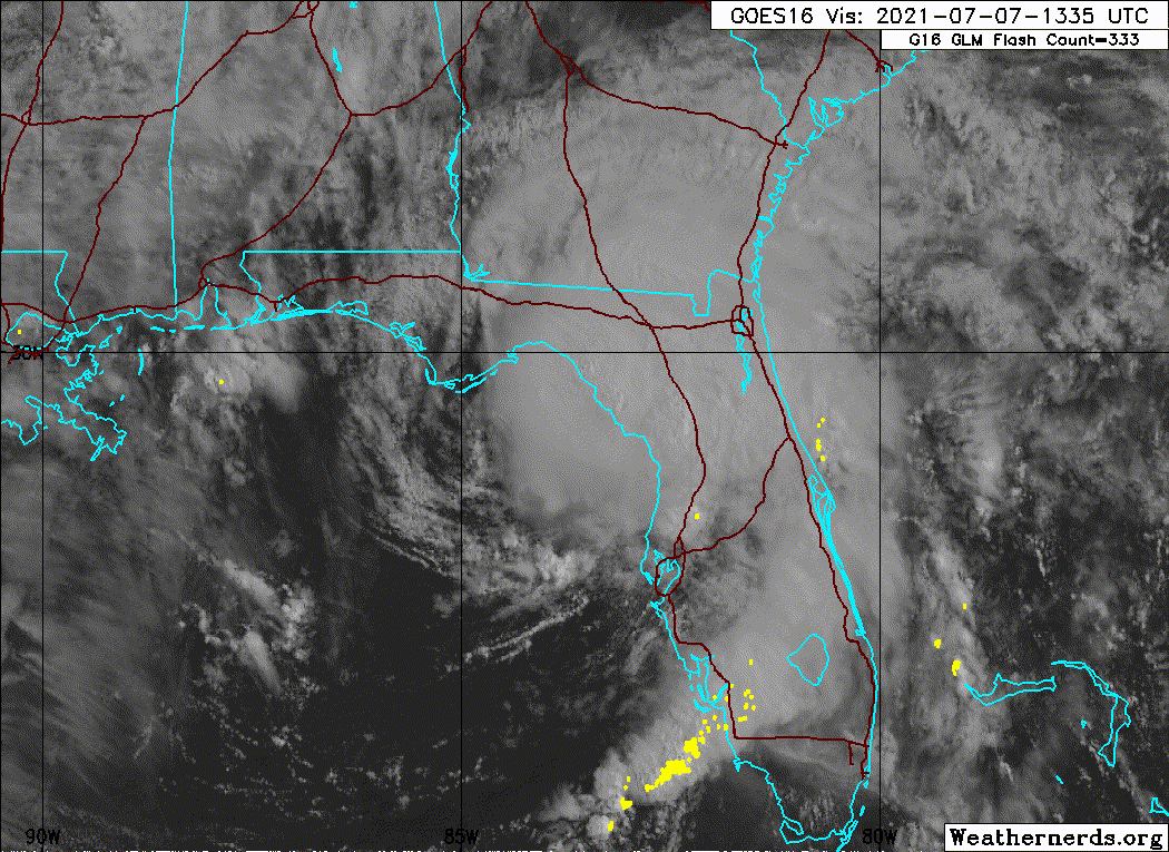
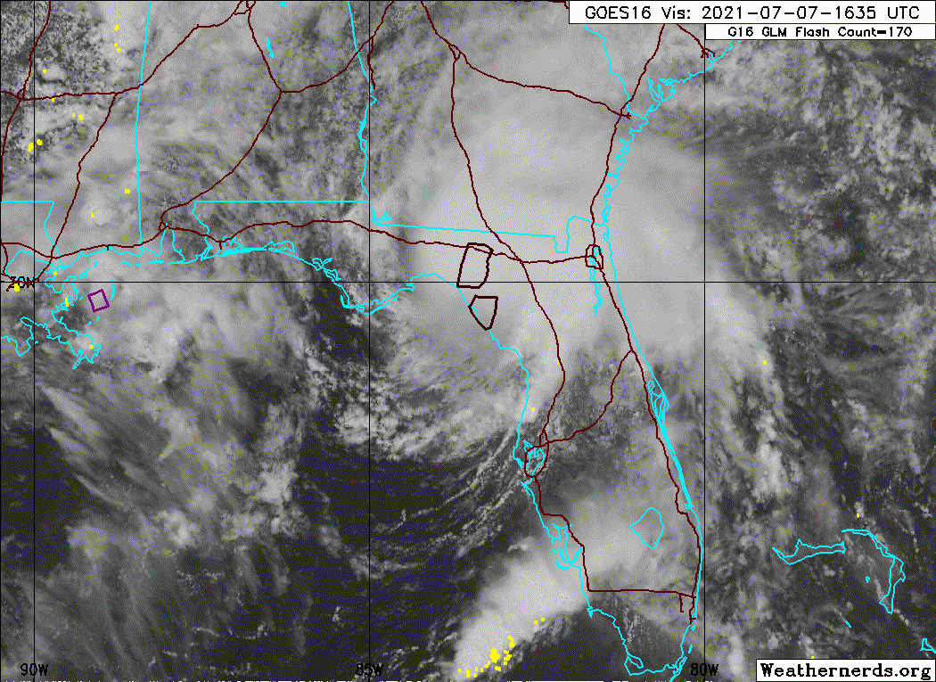
https://i.imgur.com/mVF7X8C.png We can begin to see this occur in the last frames of visible imagery, as the outflow boundaries creates a fanning of the cloud tops to the north and northwest:
https://i.imgur.com/vBZ1mCx.gif Here are the last 130 radar frames saved as a video to see this occur in real-time:
https://youtu.be/kSzM0Q3zH1Y
Wow. Just wow. What a beautiful reply. Thanks so much.
However...I fear I am about to express what may be a (life long) character defect--when I want/need to know something, I'm like a dog worry'n a bone...
What is the mechanism, smaller scale dynamics of cells, I presume, that would cause such a dramatic exhaust event when convection collapses? I guess this may be less a tropical cyclone question, and more a general meteorology question.
If the convection is collapsing and the heat/energy pump engine is breaking, why THEN the big exhaust out the top?
Or, what process is balancing, or holding in check said exhaust when (yes, I know we can observe an exhaust process in healthy, ventilating sysrems) the storm engine is chugging along?
Perhaps my puzzlement has to do with a matter of degree (bad weather joke, sorry), that is, how dramatic in scale were the exhaust cloud fans, and how perfectly (seemingly) timed to appear associated causally with the dryair, shear focussed, convection collapse.
Now beating dead horse with half chewed bone.


