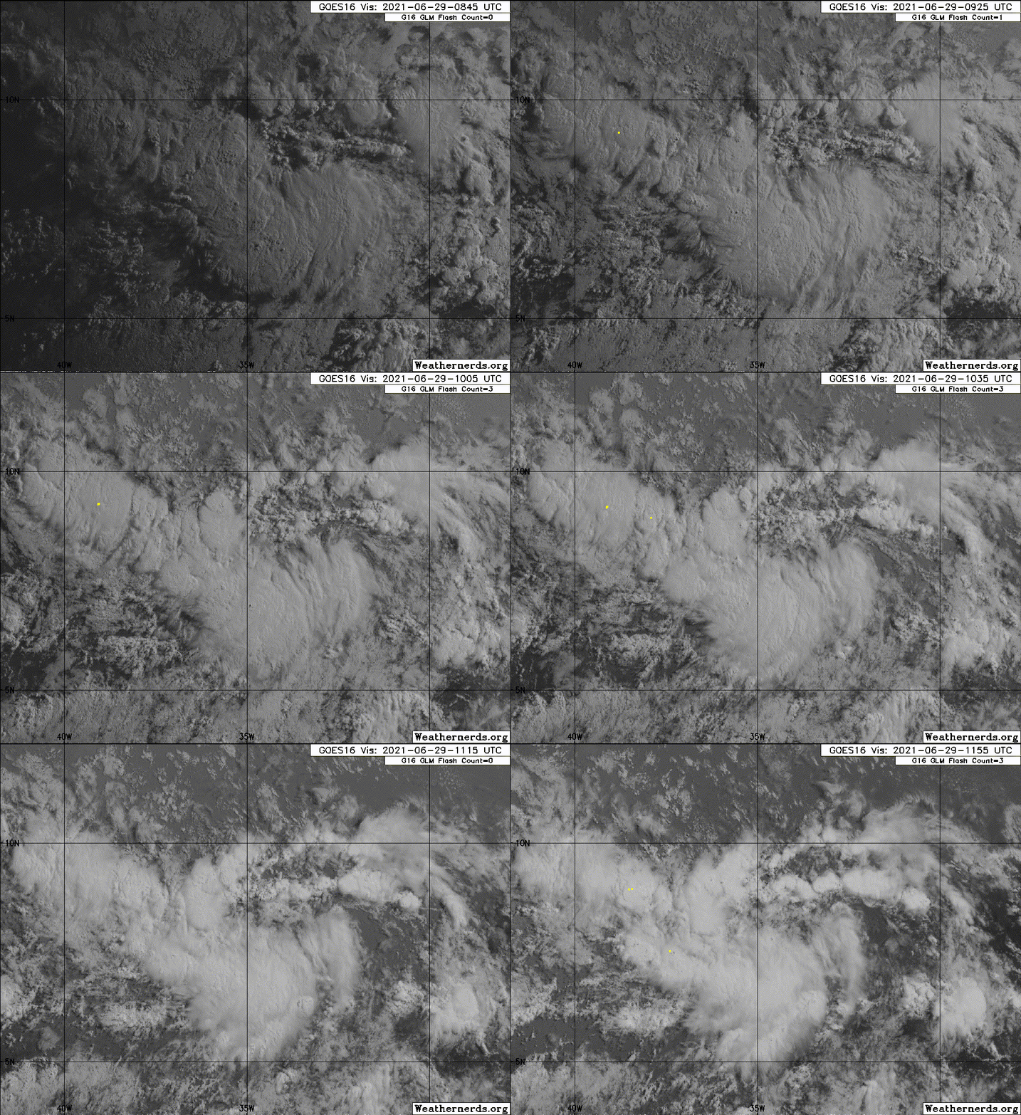
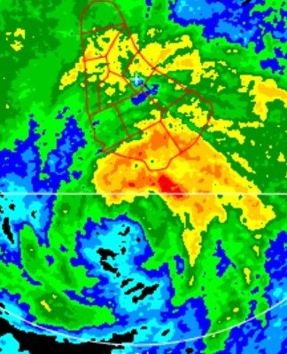
ATL: ELSA - Post-Tropical - Discussion
Moderator: S2k Moderators
- ElectricStorm
- Category 5

- Posts: 4552
- Age: 23
- Joined: Tue Aug 13, 2019 11:23 pm
- Location: Skiatook, OK / Norman, OK
Re: ATL: INVEST 97L - Discussion
Now this little guy is going to be one to watch. I know it's still early in the season, but it's got some potential, and the track looks to be pretty concerning as well.
0 likes
I am in no way a professional. Take what I say with a grain of salt as I could be totally wrong. Please refer to the NHC, NWS, or SPC for official information.
Boomer Sooner!
Boomer Sooner!
-
AlphaToOmega
- Category 5

- Posts: 1448
- Joined: Sat Jun 26, 2021 10:51 am
- Location: Somewhere in Massachusetts
Re: ATL: INVEST 97L - Discussion
If we trust the NHC percentages, we have a 52% chance of seeing an MDR tropical cyclone within the next 5 days.
Invest 95L chance: 40% within 5 days
Invest 97L chance: 20% within 5 days
The chance of Invest 95L not developing within 5 days is 60%, and the chance of Invest 97L not developing within 5 days is 80%. 60% * 80% = 48%, the chance of seeing neither develop within the next 5 days. It officially more likely than not that we see MDR development within the next 5 days.
7 likes
- Iceresistance
- Category 5

- Posts: 8913
- Age: 20
- Joined: Sat Oct 10, 2020 9:45 am
- Location: Tecumseh, OK/Norman, OK
Re: ATL: INVEST 97L - Discussion
AlphaToOmega wrote:If we trust the NHC percentages, we have a 52% chance of seeing an MDR tropical cyclone within the next 5 days.
Invest 95L chance: 40% within 5 days
Invest 97L chance: 20% within 5 days
The chance of Invest 95L not developing within 5 days is 60%, and the chance of Invest 97L not developing within 5 days is 80%. 60% * 80% = 48%, the chance of seeing neither develop within the next 5 days. It officially more likely than not that we see MDR development within the next 5 days.
Nice calculation!
0 likes
Bill 2015 & Beta 2020
Winter 2020-2021
All observations are in Tecumseh, OK unless otherwise noted.
Winter posts are focused mainly for Oklahoma & Texas.
Take any of my forecasts with a grain of salt, refer to the NWS, SPC, and NHC for official information
Never say Never with weather! Because ANYTHING is possible!
Winter 2020-2021

All observations are in Tecumseh, OK unless otherwise noted.
Winter posts are focused mainly for Oklahoma & Texas.
Take any of my forecasts with a grain of salt, refer to the NWS, SPC, and NHC for official information
Never say Never with weather! Because ANYTHING is possible!
-
Sciencerocks
- Category 5

- Posts: 7286
- Age: 38
- Joined: Thu Jul 06, 2017 1:51 am
- cycloneye
- Admin

- Posts: 139083
- Age: 67
- Joined: Thu Oct 10, 2002 10:54 am
- Location: San Juan, Puerto Rico
Re: ATL: INVEST 97L - Discussion
Sciencerocks wrote:https://imagizer.imageshack.com/img923/104/I3Dq2o.gif
Images are delayed.
1 likes
Visit the Caribbean-Central America Weather Thread where you can find at first post web cams,radars
and observations from Caribbean basin members Click Here
and observations from Caribbean basin members Click Here
- crownweather
- S2K Supporter

- Posts: 576
- Age: 49
- Joined: Sat Aug 12, 2006 9:21 am
- Location: Sturbridge, Massachusetts
- Contact:
Re: ATL: INVEST 97L - Discussion
cycloneye wrote:Sciencerocks wrote:https://imagizer.imageshack.com/img923/104/I3Dq2o.gif
Images are delayed.
6 to 8 hour outage on satellite feed from NOAA for some sites.
I've been using these 2 sites the last few hours -
https://www.star.nesdis.noaa.gov/GOES/sector_band.php?sat=G16§or=taw&band=01&length=12
https://weather.cod.edu/satrad/?parms=global-atlantic-14-48-0-100-1&checked=map&colorbars=
4 likes
Rob Lightbown
Crown Weather Services
https://crownweather.com
Crown Weather Services
https://crownweather.com
- SFLcane
- S2K Supporter

- Posts: 9606
- Age: 46
- Joined: Sat Jun 05, 2010 1:44 pm
- Location: Lake Worth Florida
Re: ATL: INVEST 97L - Discussion
cycloneye wrote:Sciencerocks wrote:https://imagizer.imageshack.com/img923/104/I3Dq2o.gif
Images are delayed.
Yep currently giving me vibes of GFS bias once again over doing things. We shall see
0 likes
- SFLcane
- S2K Supporter

- Posts: 9606
- Age: 46
- Joined: Sat Jun 05, 2010 1:44 pm
- Location: Lake Worth Florida
Re: ATL: INVEST 97L - Discussion
Weakening now… That fast trade flow makes it hard to close off. As soon as it leaves the ITCZ it's gonna struggle to stay closed and upright.
1 likes
- SFLcane
- S2K Supporter

- Posts: 9606
- Age: 46
- Joined: Sat Jun 05, 2010 1:44 pm
- Location: Lake Worth Florida
Re: ATL: INVEST 97L - Discussion
The upper-level environment is favorable but there's some fast mid-level flow. It might struggle
0 likes
Re: ATL: INVEST 97L - Discussion
SFLcane wrote:The upper-level environment is favorable but there's some fast mid-level flow. It might struggle
That might be what the HWRF and HMON are sniffing out in 60-66 hours.
0 likes
Irene '11 Sandy '12 Hermine '16 5/15/2018 Derecho Fay '20 Isaias '20 Elsa '21 Henri '21 Ida '21
I am only a meteorology enthusiast who knows a decent amount about tropical cyclones. Look to the professional mets, the NHC, or your local weather office for the best information.
I am only a meteorology enthusiast who knows a decent amount about tropical cyclones. Look to the professional mets, the NHC, or your local weather office for the best information.
Re: ATL: INVEST 97L - Discussion
Kazmit wrote:The second MDR invest this June, and this one looks way more likely to develop. Just wait until two months from now...
A front-loaded season isn't a harbinger for the remaining part of the season. That's the beauty of the weather, it's ever-changing. I don't like these early season threats, but we have seen seasons with several threats early that ended up being normal hurricane seasons.
2 likes
Personal Forecast Disclaimer:
The posts in this forum are NOT official forecast and should not be used as such. They are just the opinion of the poster and may or may not be backed by sound meteorological data. They are NOT endorsed by any professional institution or storm2k.org. For official information, please refer to the NHC and NWS products.
The posts in this forum are NOT official forecast and should not be used as such. They are just the opinion of the poster and may or may not be backed by sound meteorological data. They are NOT endorsed by any professional institution or storm2k.org. For official information, please refer to the NHC and NWS products.
-
AlphaToOmega
- Category 5

- Posts: 1448
- Joined: Sat Jun 26, 2021 10:51 am
- Location: Somewhere in Massachusetts
Re: ATL: INVEST 97L - Discussion
Shower activity associated with a tropical wave located about 900
miles southwest of the Cabo Verde Islands continues to show signs
of organization. Additional development of this system is possible
during the next several days as it moves generally west-
northwestward at about 20 mph.
* Formation chance through 48 hours...low...20 percent.
* Formation chance through 5 days...medium...40 percent.

The chance of an MDR system within the next five days has gone up to 58% based on my calculations (70% * 60% = 42%)
miles southwest of the Cabo Verde Islands continues to show signs
of organization. Additional development of this system is possible
during the next several days as it moves generally west-
northwestward at about 20 mph.
* Formation chance through 48 hours...low...20 percent.
* Formation chance through 5 days...medium...40 percent.

The chance of an MDR system within the next five days has gone up to 58% based on my calculations (70% * 60% = 42%)
0 likes
- AnnularCane
- S2K Supporter

- Posts: 2634
- Joined: Thu Jun 08, 2006 9:18 am
- Location: Wytheville, VA
Re: ATL: INVEST 97L - Discussion
What were the 8 a.m. percentages? I can't find a post about that anywhere.
0 likes
"But it never rained rain. It never snowed snow. And it never blew just wind. It rained things like soup and juice. It snowed mashed potatoes and green peas. And sometimes the wind blew in storms of hamburgers." -- Judi Barrett, Cloudy with a Chance of Meatballs
-
hurricanes1234
- Category 5

- Posts: 2903
- Joined: Sat Jul 28, 2012 6:19 pm
- Location: Trinidad and Tobago
Re: ATL: INVEST 97L - Discussion
Is it just me or the Weathernerds site hasn't updated for several hours now?
The floaters seem to be stuck on 11:55 UTC this morning.
The floaters seem to be stuck on 11:55 UTC this morning.
1 likes
PLEASE NOTE: With the exception of information from weather agencies that I may copy and paste here, my posts will NEVER be official, since I am NOT a meteorologist. They are solely my amateur opinion, and may or may not be accurate. Therefore, please DO NOT use them as official details, particularly when making important decisions. Thank you.
- cycloneye
- Admin

- Posts: 139083
- Age: 67
- Joined: Thu Oct 10, 2002 10:54 am
- Location: San Juan, Puerto Rico
Re: ATL: INVEST 97L - Discussion
AnnularCane wrote:What were the 8 a.m. percentages? I can't find a post about that anywhere.
At 8 AM it was at 10%/20%.
0 likes
Visit the Caribbean-Central America Weather Thread where you can find at first post web cams,radars
and observations from Caribbean basin members Click Here
and observations from Caribbean basin members Click Here
- Stormybajan
- Category 1

- Posts: 428
- Joined: Thu May 20, 2021 3:21 pm
- Location: Windward Islands
Re: ATL: INVEST 97L - Discussion
AnnularCane wrote:What were the 8 a.m. percentages? I can't find a post about that anywhere.
Think they were 10-20 in 2 and 5 days at 8 AM
0 likes
Sad West Indies and Manchester United fan ⚽️
-
hurricanes1234
- Category 5

- Posts: 2903
- Joined: Sat Jul 28, 2012 6:19 pm
- Location: Trinidad and Tobago
Re: ATL: INVEST 97L - Discussion
AnnularCane wrote:What were the 8 a.m. percentages? I can't find a post about that anywhere.
From the 8 AM update:
2. Shower activity associated with a tropical wave located about 800 miles southwest of the Cabo Verde islands has become a little better organized since yesterday. Additional slow development of this system is possible during the next several days as it moves generally west-northwestward at about 20 mph. * Formation chance through 48 hours...low...10 percent. * Formation chance through 5 days...low...20 percent
0 likes
PLEASE NOTE: With the exception of information from weather agencies that I may copy and paste here, my posts will NEVER be official, since I am NOT a meteorologist. They are solely my amateur opinion, and may or may not be accurate. Therefore, please DO NOT use them as official details, particularly when making important decisions. Thank you.
- AnnularCane
- S2K Supporter

- Posts: 2634
- Joined: Thu Jun 08, 2006 9:18 am
- Location: Wytheville, VA
Re: ATL: INVEST 97L - Discussion
Oh, so it really did go up. Thanks!
0 likes
"But it never rained rain. It never snowed snow. And it never blew just wind. It rained things like soup and juice. It snowed mashed potatoes and green peas. And sometimes the wind blew in storms of hamburgers." -- Judi Barrett, Cloudy with a Chance of Meatballs
- SouthDadeFish
- Professional-Met

- Posts: 2835
- Joined: Thu Sep 23, 2010 2:54 pm
- Location: Miami, FL
- Contact:
Re: ATL: INVEST 97L - Discussion
I'm just one person, but a 20% chance of genesis over the next 48 h seems way too low, IMO. I would say more like 50%. But of course the NHC has access to a lot more data than I do!
We'll see what the Euro ensembles say here shortly.
We'll see what the Euro ensembles say here shortly.
7 likes
- SFLcane
- S2K Supporter

- Posts: 9606
- Age: 46
- Joined: Sat Jun 05, 2010 1:44 pm
- Location: Lake Worth Florida
Re: ATL: INVEST 97L - Discussion
SouthDadeFish wrote:I'm just one person, but a 20% chance of genesis over the next 48 h seems way too low, IMO. I would say more like 50%. But of course the NHC has access to a lot more data than I do!
We'll see what the Euro ensembles say here shortly.
Euro op is meh. Maybe we get genesis but the Euro is clearly seeing something
0 likes
Who is online
Users browsing this forum: No registered users and 57 guests


