WPAC: NEPARTAK - Post-Tropical

Moderator: S2k Moderators

Message
Author
User avatar
MHC Tracking
Tropical Storm
Tropical Storm
Posts: 169
Joined: Mon Mar 15, 2021 10:05 am

Re: WPAC: NEPARTAK - Tropical Storm

#21 Postby MHC Tracking » Fri Jul 23, 2021 2:47 pm

Well the good folks at JTWC agree with you, and I believe their assessment is spot on. This system is not tropical, nor will it ever be. However, with the politics of the Olympics involved, no one is going to let it slide by without issuing some sort of warning, as it has the potential to create substantial impacts.

Eh, I still think we should all watch the sea of Japan around the 120 hour mark for a potential transition, but that's subjective, and, as you said, it might never become tropical at all.
0 likes   

User avatar
ElectricStorm
Category 5
Category 5
Posts: 4566
Age: 23
Joined: Tue Aug 13, 2019 11:23 pm
Location: Skiatook, OK / Norman, OK

Re: WPAC: NEPARTAK - Tropical Storm

#22 Postby ElectricStorm » Fri Jul 23, 2021 2:51 pm

Wait I thought the JTWC didn't initiate warnings on subtropical systems, yet they call this TD11W and then say it's still subtropical... Huh
0 likes   
I am in no way a professional. Take what I say with a grain of salt as I could be totally wrong. Please refer to the NHC, NWS, or SPC for official information.

Boomer Sooner!

User avatar
cycloneye
Admin
Admin
Posts: 139115
Age: 67
Joined: Thu Oct 10, 2002 10:54 am
Location: San Juan, Puerto Rico

Re: WPAC: NEPARTAK - Tropical Storm

#23 Postby cycloneye » Fri Jul 23, 2021 3:29 pm

0 likes   
Visit the Caribbean-Central America Weather Thread where you can find at first post web cams,radars
and observations from Caribbean basin members Click Here

User avatar
Hayabusa
Category 5
Category 5
Posts: 3738
Joined: Sun Sep 16, 2018 1:05 pm

Re: WPAC: NEPARTAK - Tropical Storm

#24 Postby Hayabusa » Fri Jul 23, 2021 4:42 pm

Who made this latest discussion? I like it :lol:
WDPN33 PGTW 232100
MSGID/GENADMIN/JOINT TYPHOON WRNCEN PEARL HARBOR HI//
SUBJ/PROGNOSTIC REASONING FOR TROPICAL STORM 11W (NEPARTAK) WARNING
NR 002//
RMKS/
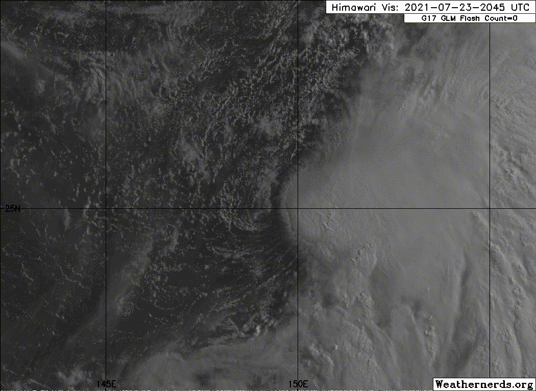
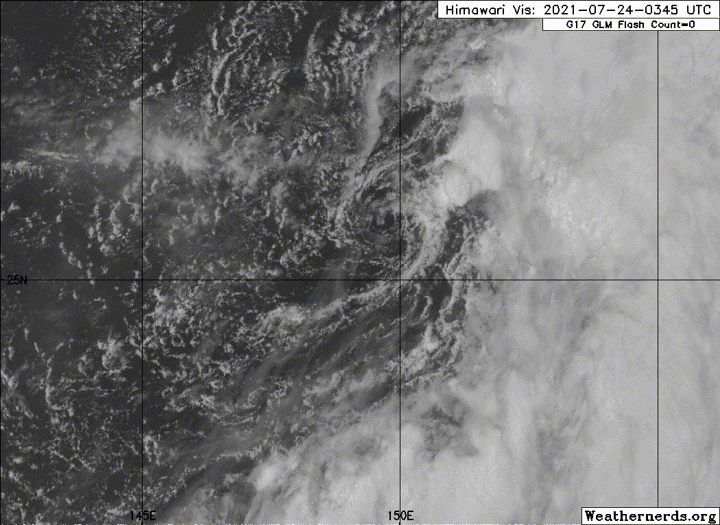
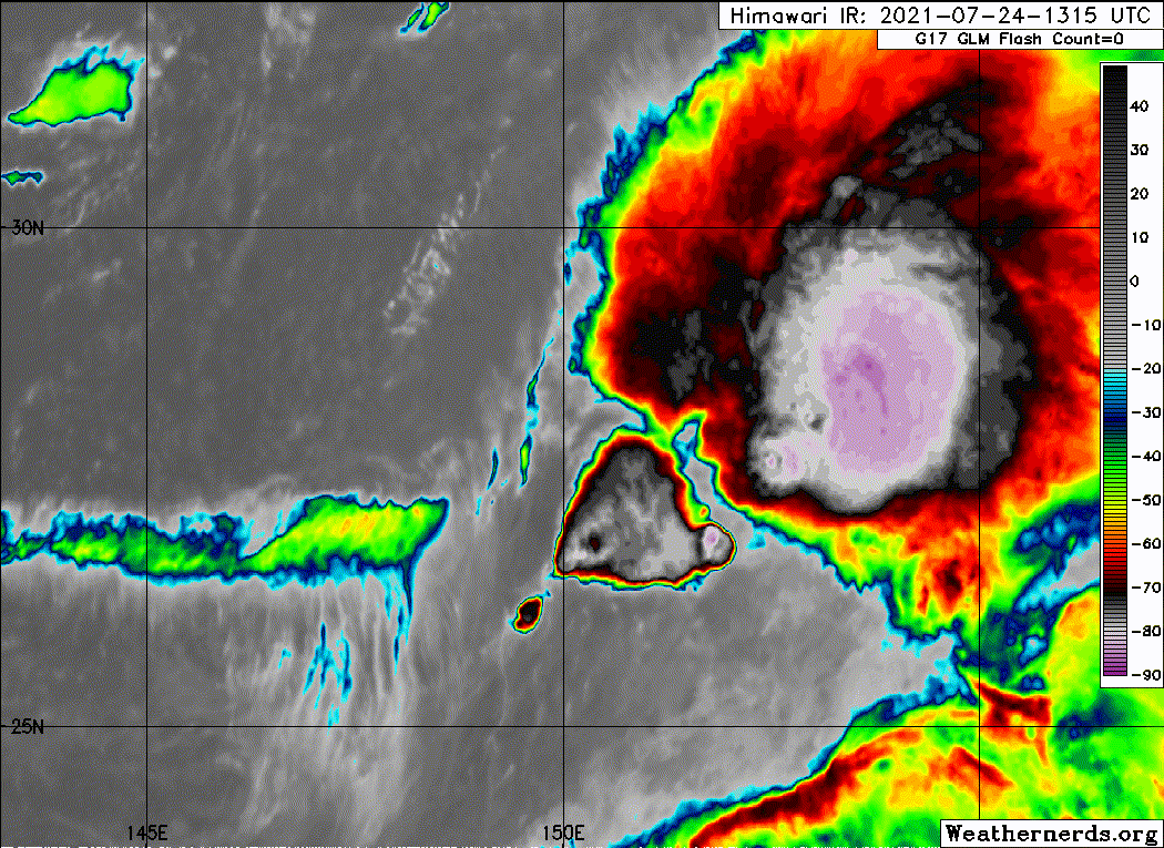
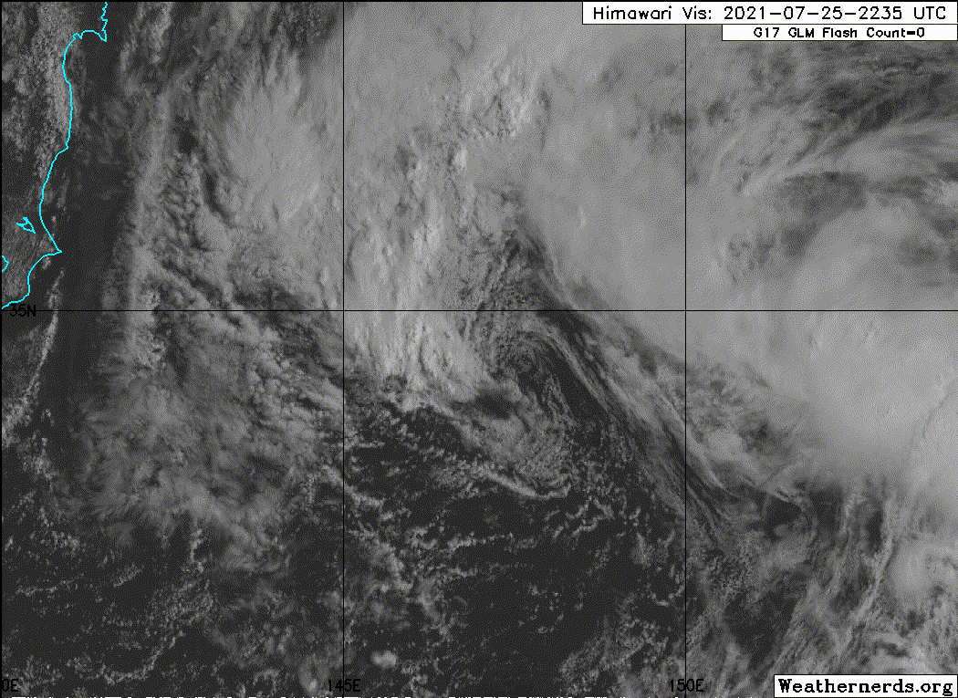
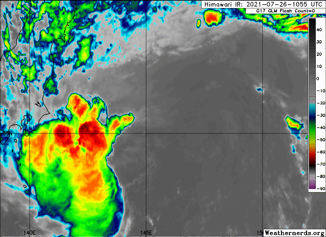
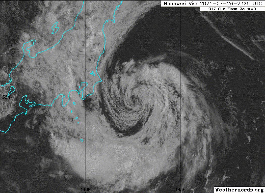
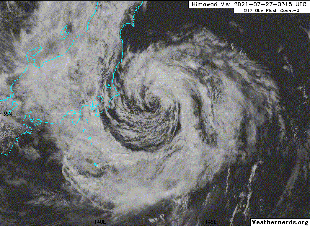
FORECAST DISCUSSION: TROPICAL STORM 11W IS A SUBTROPICAL SYSTEM.
TROPICAL STORM 11W WILL NOT CHANGE INTO A TROPICAL SYSTEM. IT WILL
NOT DEVELOP INTO A VIGOROUS STORM AND MAY NOT TOP 50 KNOTS ALONG ITS
TRACK TOWARDS THE EAST COAST OF JAPAN, BUT IT WILL GENERATE SOME
RAISED SURF FOR THE OLYMPIC SURFING EVENTS. ITS ORIGIN AT THE
EASTERN EDGE OF A MONSOON GYRE PLACES IT WITHIN THE DIVERGENT REGION
OF A DEEP SUBTROPICAL TROUGH WITH EXCELLENT EQUATORWARD OUTFLOW BUT
HIGH VERTICAL WIND SHEAR. THE ASYMMETRIC WIND FIELD REVEALED BY THE
EARLIER SCATTEROMETER PASS IS TYPICAL OF SUBTROPICAL CYCLONES.


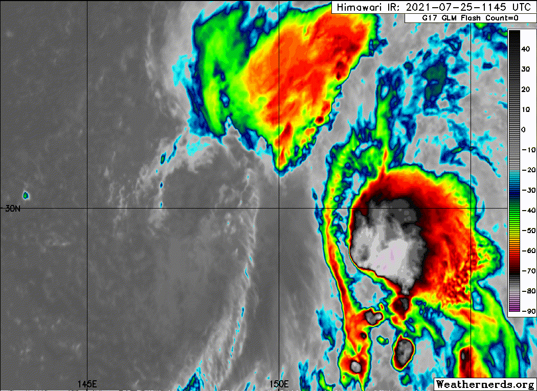
MODEL DISCUSSION: MODEL GUIDANCE OVER THE PAST TWO DAYS HAS BEEN
CONSISTENT IN INDICATING A TRACK TOWARDS THE TOHOKU REGION OF
JAPAN. BY THE TIME THE STORM REACHES THE COAST, HOWEVER, THERE IS A
WIDE SPREAD IN WHERE THE STORM MAY STRIKE, WITH OUR TWO
CHAMPIONS--ECMWF AND GFS--BEING THE OUTLIERS OF THE CONSENSUS
MEMBERS. ECMWF POINTS TO THE NORTHERN CHIBA PENINSULA, WHILE GFS
POINTS TOWARDS MISAWA. THE REST OF THE GUIDANCE IS PACKED BETWEEN
THE TWO, WITH THE MEAN POINTING AT SENDAI. THE KEY POINT IN THE
TRACK IS THE 30TH LATITUDE, WHERE THE STORM IS EXPECTED TO MAKE ITS
TURN TO THE NORTHWEST. AS IT DOES THAT, THE CERTAINTY OF WHERE THE
STORM WILL COME ASHORE WILL INCREASE SHARPLY. UNTIL WE SEE THE
STORM ROUND THAT TURN, FORECAST TRACK UNCERTAINTY WILL REMAIN HIGH.
THE INTENSITY FORECAST IS MUCH EASIER: IN ADDITION TO THE STORM
BEING A SUB-TROPICAL SYSTEM, THE SYSTEM WILL ENCOUNTER HIGH
VERTICAL WIND SHEAR AND LOW OCEAN HEAT CONTENT THROUGH THE DURATION
OF ITS TRACK. THE INTENSITY FORECAST LIES ON THE HIGH SIDE OF THE
INTENSITY CONSENSUS MEAN. TROPICAL STORM NEPARTAK IS NOT EXPECTED
TO EVER REACH TYPHOON STRENGTH.
0 likes   
ヤンデレ女が寝取られるているのを見たい!!!
ECMWF ensemble NWPAC plots: https://ecmwfensnwpac.imgbb.com/
Multimodel NWPAC plots: https://multimodelnwpac.imgbb.com/
GFS Ensemble NWPAC plots (16 & 35 day forecast): https://gefsnwpac.imgbb.com/
Plots updated automatically

User avatar
cycloneye
Admin
Admin
Posts: 139115
Age: 67
Joined: Thu Oct 10, 2002 10:54 am
Location: San Juan, Puerto Rico

Re: WPAC: NEPARTAK - Tropical Storm

#25 Postby cycloneye » Fri Jul 23, 2021 4:52 pm

:uarrow: Maybe Levi Cowan?
0 likes   
Visit the Caribbean-Central America Weather Thread where you can find at first post web cams,radars
and observations from Caribbean basin members Click Here

StormTracker89
Tropical Depression
Tropical Depression
Posts: 57
Joined: Sat May 16, 2020 3:47 pm
Location: Somewhere in the Pacific

Re: WPAC: NEPARTAK - Tropical Storm

#26 Postby StormTracker89 » Fri Jul 23, 2021 6:51 pm

Weather Dude wrote:Wait I thought the JTWC didn't initiate warnings on subtropical systems, yet they call this TD11W and then say it's still subtropical... Huh

As a matter of routine, no, but if required or requested due to "operational concerns", they can and do.
0 likes   

Sciencerocks
Category 5
Category 5
Posts: 7286
Age: 38
Joined: Thu Jul 06, 2017 1:51 am

Re: WPAC: NEPARTAK - Tropical Storm

#27 Postby Sciencerocks » Fri Jul 23, 2021 7:23 pm

Image
0 likes   

User avatar
ElectricStorm
Category 5
Category 5
Posts: 4566
Age: 23
Joined: Tue Aug 13, 2019 11:23 pm
Location: Skiatook, OK / Norman, OK

Re: WPAC: NEPARTAK - Tropical Storm

#28 Postby ElectricStorm » Fri Jul 23, 2021 9:22 pm

This thing is looking ugly... At least it won't be too bad for the Olympics
0 likes   
I am in no way a professional. Take what I say with a grain of salt as I could be totally wrong. Please refer to the NHC, NWS, or SPC for official information.

Boomer Sooner!

Sciencerocks
Category 5
Category 5
Posts: 7286
Age: 38
Joined: Thu Jul 06, 2017 1:51 am

Re: WPAC: NEPARTAK - Tropical Storm

#29 Postby Sciencerocks » Sat Jul 24, 2021 2:33 am

Image
1 likes   

Sciencerocks
Category 5
Category 5
Posts: 7286
Age: 38
Joined: Thu Jul 06, 2017 1:51 am

Re: WPAC: NEPARTAK - Tropical Storm

#30 Postby Sciencerocks » Sat Jul 24, 2021 11:52 am

Image
0 likes   

Sciencerocks
Category 5
Category 5
Posts: 7286
Age: 38
Joined: Thu Jul 06, 2017 1:51 am

Re: WPAC: NEPARTAK - Tropical Storm

#31 Postby Sciencerocks » Sat Jul 24, 2021 8:35 pm

Image
0 likes   

User avatar
ElectricStorm
Category 5
Category 5
Posts: 4566
Age: 23
Joined: Tue Aug 13, 2019 11:23 pm
Location: Skiatook, OK / Norman, OK

Re: WPAC: NEPARTAK - Tropical Storm

#32 Postby ElectricStorm » Sun Jul 25, 2021 12:51 am


That is one of the weirdest TCs I've seen in awhile. Also, is that a front on the W/SW side of it? If so, then this should be extratropical...
0 likes   
I am in no way a professional. Take what I say with a grain of salt as I could be totally wrong. Please refer to the NHC, NWS, or SPC for official information.

Boomer Sooner!

Sciencerocks
Category 5
Category 5
Posts: 7286
Age: 38
Joined: Thu Jul 06, 2017 1:51 am

Re: WPAC: NEPARTAK - Tropical Storm

#33 Postby Sciencerocks » Sun Jul 25, 2021 12:59 am

Weather Dude wrote:

That is one of the weirdest TCs I've seen in awhile. Also, is that a front on the W/SW side of it? If so, then this should be extratropical...


It sure is! That is a jet streak cutting through its core. This thing doesn't have a chance to organize convection. :eek:
0 likes   

Sciencerocks
Category 5
Category 5
Posts: 7286
Age: 38
Joined: Thu Jul 06, 2017 1:51 am

Re: WPAC: NEPARTAK - Tropical Storm

#34 Postby Sciencerocks » Sun Jul 25, 2021 10:24 am

lol
Image
3 likes   

Sciencerocks
Category 5
Category 5
Posts: 7286
Age: 38
Joined: Thu Jul 06, 2017 1:51 am

Re: WPAC: NEPARTAK - Tropical Storm

#35 Postby Sciencerocks » Sun Jul 25, 2021 9:19 pm

Image
0 likes   

User avatar
aspen
Category 5
Category 5
Posts: 8057
Joined: Sat Oct 12, 2019 7:10 pm
Location: Connecticut, USA

Re: WPAC: NEPARTAK - Tropical Storm

#36 Postby aspen » Mon Jul 26, 2021 7:22 am

Are we sure this is even a TC?
3 likes   
Irene '11 Sandy '12 Hermine '16 5/15/2018 Derecho Fay '20 Isaias '20 Elsa '21 Henri '21 Ida '21

I am only a meteorology enthusiast who knows a decent amount about tropical cyclones. Look to the professional mets, the NHC, or your local weather office for the best information.

Sciencerocks
Category 5
Category 5
Posts: 7286
Age: 38
Joined: Thu Jul 06, 2017 1:51 am

Re: WPAC: NEPARTAK - Tropical Storm

#37 Postby Sciencerocks » Mon Jul 26, 2021 9:26 am

Looks extratropical too me
Image
0 likes   

User avatar
Hayabusa
Category 5
Category 5
Posts: 3738
Joined: Sun Sep 16, 2018 1:05 pm

Re: WPAC: NEPARTAK - Tropical Storm

#38 Postby Hayabusa » Mon Jul 26, 2021 10:16 am

Please correct the naming it's mistakenly spelled with a C.
Image
0 likes   
ヤンデレ女が寝取られるているのを見たい!!!
ECMWF ensemble NWPAC plots: https://ecmwfensnwpac.imgbb.com/
Multimodel NWPAC plots: https://multimodelnwpac.imgbb.com/
GFS Ensemble NWPAC plots (16 & 35 day forecast): https://gefsnwpac.imgbb.com/
Plots updated automatically

Sciencerocks
Category 5
Category 5
Posts: 7286
Age: 38
Joined: Thu Jul 06, 2017 1:51 am

Re: WPAC: NEPARTAK - Tropical Storm

#39 Postby Sciencerocks » Mon Jul 26, 2021 9:58 pm

Image
0 likes   

Sciencerocks
Category 5
Category 5
Posts: 7286
Age: 38
Joined: Thu Jul 06, 2017 1:51 am

Re: WPAC: NEPARTAK - Tropical Storm

#40 Postby Sciencerocks » Tue Jul 27, 2021 1:56 am

Image
0 likes   


Return to “2021”

Who is online

Users browsing this forum: No registered users and 24 guests