CPAC: JIMENA - Remnants
Moderator: S2k Moderators
-
Sciencerocks
- Category 5

- Posts: 7286
- Age: 38
- Joined: Thu Jul 06, 2017 1:51 am
-
cycloneye

- Admin

- Posts: 139104
- Age: 67
- Joined: Thu Oct 10, 2002 10:54 am
- Location: San Juan, Puerto Rico
Re: EPAC: NINE-E - Tropical Depression
Tropical Depression Nine-E Discussion Number 9
NWS National Hurricane Center Miami FL EP092021
500 PM HST Wed Aug 04 2021
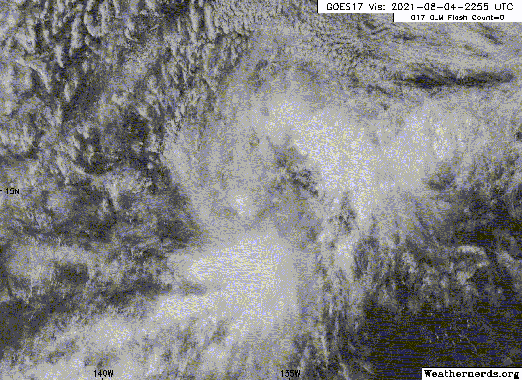
The system has not become noticeably better organized since earlier
today, with a small area of deep convection near the center and
some slightly curved bands of convection well removed to the east
and northeast of the center. Microwave imagery also suggests
little change in structure. The current intensity is held at
30 kt for now, in agreement with earlier scatterometer
observations.
Although the center fixes have some scatter, my best estimate for
motion is slowly northwestward, or 325/6 kt. A mid-level ridge to
the northeast of the tropical cyclone is forecast to be maintained
for the next 48-72 hours. This should keep the system on a
generally northwestward heading until late in the forecast period.
By that time, the weakening cyclone should turn a little to the left
following the low-level environmental winds. The official track
forecast is similar to the previous one and just to the right of
the multi-model consensus, in slight deference to the GFS solution
which is even farther to the right of these tracks.
Since the system should be in a fairly moist, low-shear environment
for the next day or so, at least some slight strengthening seems
likely. Thereafter, cooler SSTs and increased shear should cause
weakening. The official intensity forecast is near or above most
of the model guidance.
FORECAST POSITIONS AND MAX WINDS
INIT 05/0300Z 15.3N 136.2W 30 KT 35 MPH
12H 05/1200Z 16.0N 136.6W 35 KT 40 MPH
24H 06/0000Z 16.9N 137.7W 40 KT 45 MPH
36H 06/1200Z 17.8N 138.9W 35 KT 40 MPH
48H 07/0000Z 18.8N 140.3W 30 KT 35 MPH
60H 07/1200Z 19.8N 142.0W 30 KT 35 MPH
72H 08/0000Z 20.5N 143.5W 25 KT 30 MPH...POST-TROP/REMNT LOW
96H 09/0000Z 22.0N 147.0W 25 KT 30 MPH...POST-TROP/REMNT LOW
120H 10/0000Z...DISSIPATED
$$
Forecaster Pasch
NWS National Hurricane Center Miami FL EP092021
500 PM HST Wed Aug 04 2021
The system has not become noticeably better organized since earlier
today, with a small area of deep convection near the center and
some slightly curved bands of convection well removed to the east
and northeast of the center. Microwave imagery also suggests
little change in structure. The current intensity is held at
30 kt for now, in agreement with earlier scatterometer
observations.
Although the center fixes have some scatter, my best estimate for
motion is slowly northwestward, or 325/6 kt. A mid-level ridge to
the northeast of the tropical cyclone is forecast to be maintained
for the next 48-72 hours. This should keep the system on a
generally northwestward heading until late in the forecast period.
By that time, the weakening cyclone should turn a little to the left
following the low-level environmental winds. The official track
forecast is similar to the previous one and just to the right of
the multi-model consensus, in slight deference to the GFS solution
which is even farther to the right of these tracks.
Since the system should be in a fairly moist, low-shear environment
for the next day or so, at least some slight strengthening seems
likely. Thereafter, cooler SSTs and increased shear should cause
weakening. The official intensity forecast is near or above most
of the model guidance.
FORECAST POSITIONS AND MAX WINDS
INIT 05/0300Z 15.3N 136.2W 30 KT 35 MPH
12H 05/1200Z 16.0N 136.6W 35 KT 40 MPH
24H 06/0000Z 16.9N 137.7W 40 KT 45 MPH
36H 06/1200Z 17.8N 138.9W 35 KT 40 MPH
48H 07/0000Z 18.8N 140.3W 30 KT 35 MPH
60H 07/1200Z 19.8N 142.0W 30 KT 35 MPH
72H 08/0000Z 20.5N 143.5W 25 KT 30 MPH...POST-TROP/REMNT LOW
96H 09/0000Z 22.0N 147.0W 25 KT 30 MPH...POST-TROP/REMNT LOW
120H 10/0000Z...DISSIPATED
$$
Forecaster Pasch
0 likes
Visit the Caribbean-Central America Weather Thread where you can find at first post web cams,radars
and observations from Caribbean basin members Click Here
and observations from Caribbean basin members Click Here
-
Sciencerocks
- Category 5
- Posts: 7286
- Age: 38
- Joined: Thu Jul 06, 2017 1:51 am
-
cycloneye
- Admin
- Posts: 139104
- Age: 67
- Joined: Thu Oct 10, 2002 10:54 am
- Location: San Juan, Puerto Rico
Re: EPAC: JIMENA - Tropical Storm
Tropical Storm Jimena Discussion Number 10
NWS National Hurricane Center Miami FL EP092021
1100 PM HST Wed Aug 04 2021
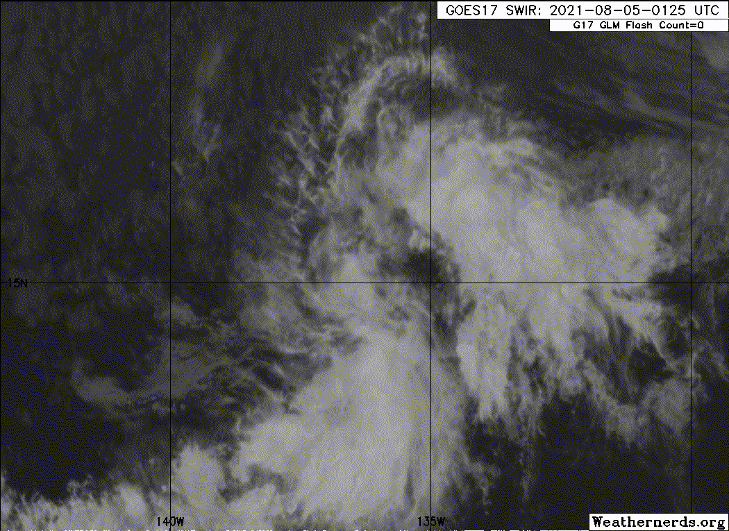
Deep convection has increased near the center of the cyclone during
the last several hours, and an outer convective band is present in
the southeastern semicircle. Subjective satellite intensity
estimates are 35 kt from TAFB and SAB, and the CIMSS satellite
consensus estimate is 39 kt. Based on these data, the system is
upgraded to Tropical Storm Jimena with 35-kt winds.
The initial motion is 315/6 kt. A mid-level ridge to the northeast
of the tropical cyclone is forecast to continue for the next 2-3
days, and this should keep Jimena moving generally northwestward.
After that time, a west-northwestward motion is expected as the
weakening system is steered more by the low-level flow. The track
guidance models have shifted a bit to the right since the previous
advisory. Therefore, the official forecast will also be nudged to
the right. However, the new forecast track still lies to the left
of the consensus models.
While Jimena is in a moist and low-shear environment, the storm is
moving over decreasing sea surface temperatures, with the center
forecast to be over 25 C water in about 24 h. Thus, little
additional strengthening is expected. After 24 h, the system
should weaken due to even colder SSTs and increasing shear. The
new intensity forecast has only minor tweaks from the previous
forecast, and it lies near the upper edge of the intensity guidance.
FORECAST POSITIONS AND MAX WINDS
INIT 05/0900Z 15.5N 136.6W 35 KT 40 MPH
12H 05/1800Z 16.2N 137.2W 35 KT 40 MPH
24H 06/0600Z 17.1N 138.4W 35 KT 40 MPH
36H 06/1800Z 18.0N 139.5W 35 KT 40 MPH
48H 07/0600Z 19.0N 140.9W 30 KT 35 MPH
60H 07/1800Z 20.0N 142.4W 30 KT 35 MPH
72H 08/0600Z 21.0N 143.9W 25 KT 30 MPH...POST-TROP/REMNT LOW
96H 09/0600Z 22.0N 147.0W 20 KT 25 MPH...POST-TROP/REMNT LOW
120H 10/0600Z...DISSIPATED
$$
Forecaster Beven
NWS National Hurricane Center Miami FL EP092021
1100 PM HST Wed Aug 04 2021
Deep convection has increased near the center of the cyclone during
the last several hours, and an outer convective band is present in
the southeastern semicircle. Subjective satellite intensity
estimates are 35 kt from TAFB and SAB, and the CIMSS satellite
consensus estimate is 39 kt. Based on these data, the system is
upgraded to Tropical Storm Jimena with 35-kt winds.
The initial motion is 315/6 kt. A mid-level ridge to the northeast
of the tropical cyclone is forecast to continue for the next 2-3
days, and this should keep Jimena moving generally northwestward.
After that time, a west-northwestward motion is expected as the
weakening system is steered more by the low-level flow. The track
guidance models have shifted a bit to the right since the previous
advisory. Therefore, the official forecast will also be nudged to
the right. However, the new forecast track still lies to the left
of the consensus models.
While Jimena is in a moist and low-shear environment, the storm is
moving over decreasing sea surface temperatures, with the center
forecast to be over 25 C water in about 24 h. Thus, little
additional strengthening is expected. After 24 h, the system
should weaken due to even colder SSTs and increasing shear. The
new intensity forecast has only minor tweaks from the previous
forecast, and it lies near the upper edge of the intensity guidance.
FORECAST POSITIONS AND MAX WINDS
INIT 05/0900Z 15.5N 136.6W 35 KT 40 MPH
12H 05/1800Z 16.2N 137.2W 35 KT 40 MPH
24H 06/0600Z 17.1N 138.4W 35 KT 40 MPH
36H 06/1800Z 18.0N 139.5W 35 KT 40 MPH
48H 07/0600Z 19.0N 140.9W 30 KT 35 MPH
60H 07/1800Z 20.0N 142.4W 30 KT 35 MPH
72H 08/0600Z 21.0N 143.9W 25 KT 30 MPH...POST-TROP/REMNT LOW
96H 09/0600Z 22.0N 147.0W 20 KT 25 MPH...POST-TROP/REMNT LOW
120H 10/0600Z...DISSIPATED
$$
Forecaster Beven
0 likes
Visit the Caribbean-Central America Weather Thread where you can find at first post web cams,radars
and observations from Caribbean basin members Click Here
and observations from Caribbean basin members Click Here
-
Yellow Evan

- Professional-Met

- Posts: 15952
- Age: 25
- Joined: Fri Jul 15, 2011 12:48 pm
- Location: Henderson, Nevada/Honolulu, HI
- Contact:

-
Shell Mound
- Category 5
- Posts: 2434
- Age: 31
- Joined: Thu Sep 07, 2017 3:39 pm
- Location: St. Petersburg, FL → Scandinavia
Re: EPAC: JIMENA - Tropical Storm
This system looks to have rapidly deepened into a compact hurricane, given low VWS and ample divergence, hence rapid alignment of MLC and LLC.
0 likes
CVW / MiamiensisWx / Shell Mound
The posts in this forum are NOT official forecasts and should not be used as such. They are just the opinion of the poster and may or may not be backed by sound meteorological data. They are NOT endorsed by any professional institution or STORM2K. For official information, please refer to products from the NHC and NWS.

Re: EPAC: JIMENA - Tropical Storm
Shell Mound wrote:
This system looks to have rapidly deepened into a compact hurricane, given low VWS and ample divergence, hence rapid alignment of MLC and LLC.
I doubt it’s a hurricane. Convection is currently too shallow, so any hurricane-force winds won’t be translating down to the surface.
2 likes
Irene '11 Sandy '12 Hermine '16 5/15/2018 Derecho Fay '20 Isaias '20 Elsa '21 Henri '21 Ida '21
I am only a meteorology enthusiast who knows a decent amount about tropical cyclones. Look to the professional mets, the NHC, or your local weather office for the best information.
I am only a meteorology enthusiast who knows a decent amount about tropical cyclones. Look to the professional mets, the NHC, or your local weather office for the best information.
-
Sciencerocks
- Category 5
- Posts: 7286
- Age: 38
- Joined: Thu Jul 06, 2017 1:51 am
-
Sciencerocks
- Category 5
- Posts: 7286
- Age: 38
- Joined: Thu Jul 06, 2017 1:51 am
Re: EPAC: JIMENA - Tropical Storm
000
WTPZ44 KNHC 051437
TCDEP4
Tropical Storm Jimena Discussion Number 11
NWS National Hurricane Center Miami FL EP092021
500 AM HST Thu Aug 05 2021
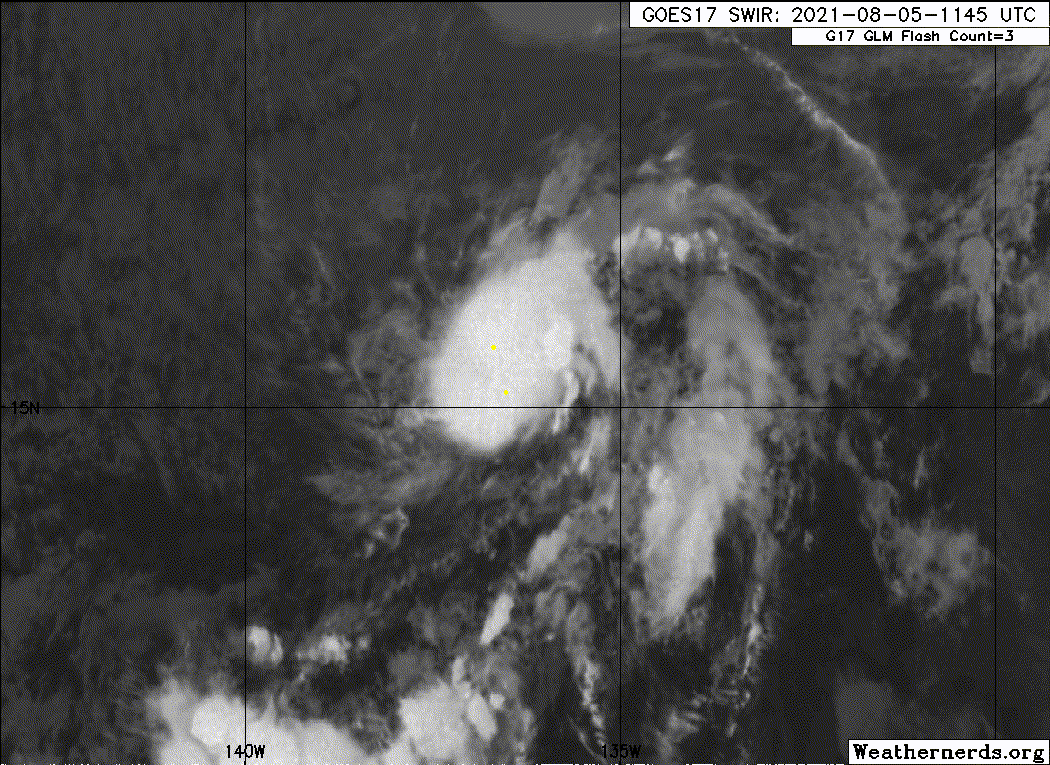
Conventional satellite imagery indicates that Jimena's cloud pattern
has changed little during the past several hours, although most
recently, enhanced infrared images show some warming of the cloud
tops just west of the center. Timely AMSR-2 and GMI passive
microwave color composite images revealed a well-developed banding
feature wrapping around the surface center from the north and west
portions of the cyclone. The initial intensity is held at 35 kt and
is in agreement with the Dvorak satellite intensity estimates from
TAFB and SAB.
The large-scale models and the statistical-dynamical SHIPS intensity
guidance (GFS/ECMWF) show that the previously noted period of
conducive atmospheric and oceanic conditions should be ending soon.
By the 36-hour period, sub-25C sea-surface temperatures and a
gradually stabilizing/drier surrounding air mass should cause Jimena
to weaken. Guidance also shows increasing west-northwesterly shear
beyond 48 hours. Accordingly, the NHC forecast calls for Jimena to
weaken to a depression by mid-period, and degenerate into a remnant
low in 60 hours.
Based on the aforementioned microwave images, the initial motion is
estimated to be northwestward, or 315/6 kt. A subtropical ridge
anchored to the northeast of the cyclone is forecast to steer Jimena
toward the northwest through the 48 period. Afterward, a turn
toward the west-northwest is expected as the vertically shallow
system is influenced more by the easterly tradewinds. The official
forecast is basically an update of the previous one and lies near
the multi-model consensus (TVCN) aid.
FORECAST POSITIONS AND MAX WINDS
INIT 05/1500Z 16.1N 137.2W 35 KT 40 MPH
12H 06/0000Z 16.5N 137.7W 35 KT 40 MPH
24H 06/1200Z 17.5N 138.9W 35 KT 40 MPH
36H 07/0000Z 18.5N 140.2W 30 KT 35 MPH
48H 07/1200Z 19.5N 141.5W 30 KT 35 MPH
60H 08/0000Z 20.3N 142.9W 25 KT 30 MPH...POST-TROP/REMNT LOW
72H 08/1200Z 20.9N 144.3W 20 KT 25 MPH...POST-TROP/REMNT LOW
96H 09/1200Z...DISSIPATED
$$
Forecaster Roberts
WTPZ44 KNHC 051437
TCDEP4
Tropical Storm Jimena Discussion Number 11
NWS National Hurricane Center Miami FL EP092021
500 AM HST Thu Aug 05 2021
Conventional satellite imagery indicates that Jimena's cloud pattern
has changed little during the past several hours, although most
recently, enhanced infrared images show some warming of the cloud
tops just west of the center. Timely AMSR-2 and GMI passive
microwave color composite images revealed a well-developed banding
feature wrapping around the surface center from the north and west
portions of the cyclone. The initial intensity is held at 35 kt and
is in agreement with the Dvorak satellite intensity estimates from
TAFB and SAB.
The large-scale models and the statistical-dynamical SHIPS intensity
guidance (GFS/ECMWF) show that the previously noted period of
conducive atmospheric and oceanic conditions should be ending soon.
By the 36-hour period, sub-25C sea-surface temperatures and a
gradually stabilizing/drier surrounding air mass should cause Jimena
to weaken. Guidance also shows increasing west-northwesterly shear
beyond 48 hours. Accordingly, the NHC forecast calls for Jimena to
weaken to a depression by mid-period, and degenerate into a remnant
low in 60 hours.
Based on the aforementioned microwave images, the initial motion is
estimated to be northwestward, or 315/6 kt. A subtropical ridge
anchored to the northeast of the cyclone is forecast to steer Jimena
toward the northwest through the 48 period. Afterward, a turn
toward the west-northwest is expected as the vertically shallow
system is influenced more by the easterly tradewinds. The official
forecast is basically an update of the previous one and lies near
the multi-model consensus (TVCN) aid.
FORECAST POSITIONS AND MAX WINDS
INIT 05/1500Z 16.1N 137.2W 35 KT 40 MPH
12H 06/0000Z 16.5N 137.7W 35 KT 40 MPH
24H 06/1200Z 17.5N 138.9W 35 KT 40 MPH
36H 07/0000Z 18.5N 140.2W 30 KT 35 MPH
48H 07/1200Z 19.5N 141.5W 30 KT 35 MPH
60H 08/0000Z 20.3N 142.9W 25 KT 30 MPH...POST-TROP/REMNT LOW
72H 08/1200Z 20.9N 144.3W 20 KT 25 MPH...POST-TROP/REMNT LOW
96H 09/1200Z...DISSIPATED
$$
Forecaster Roberts
0 likes
-
Sciencerocks
- Category 5
- Posts: 7286
- Age: 38
- Joined: Thu Jul 06, 2017 1:51 am

-
galaxy401

- Category 5
- Posts: 2299
- Age: 28
- Joined: Sat Aug 25, 2012 9:04 pm
- Location: Casa Grande, Arizona
Re: EPAC: JIMENA - Tropical Storm
This Jimena is a far cry from all of her predecessors.
0 likes
Got my eyes on moving right into Hurricane Alley: Florida.
-
cycloneye
- Admin
- Posts: 139104
- Age: 67
- Joined: Thu Oct 10, 2002 10:54 am
- Location: San Juan, Puerto Rico
Re: EPAC: JIMENA - Tropical Storm
Tropical Storm Jimena Discussion Number 12
NWS National Hurricane Center Miami FL EP092021
1100 AM HST Thu Aug 05 2021
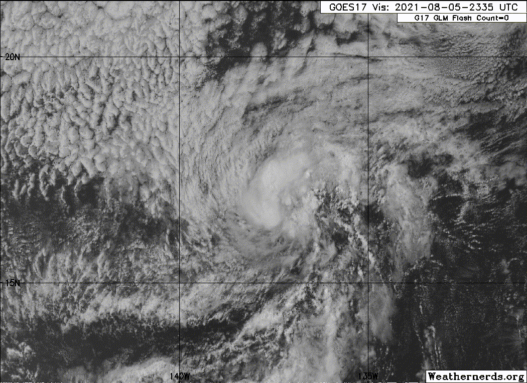
Jimena's cloud pattern, which has changed little since earlier this
morning, consists of a fragmented curved band in the northwestern
semicircle and a patch of deep convection just to the southeast of
the surface center. The subjective Dvorak satellite intensity
estimates from TAFB and SAB remain unchanged (T2.5) and the initial
intensity is held at 35 kt.
Jimena has about another 12 hours or so before it traverses
decreasing (sub-25C) sea-surface temperatures, and the surrounding
environment becomes less favorable due to an intruding dry and
stable air mass. Increasing west-northwesterly shear is also
expected to negatively affect the cyclone beyond the 36 hour period.
The official intensity forecast, which is similar to the IVCN
intensity consensus model, indicates Jimena becoming a depression
in about 24 hours and further weakening to a remnant low on
Saturday, and opening up into a trough of low pressure on Sunday.
The initial motions is estimated to be northwest, or 310/7 kt. A
mid-tropospheric ridge situated to the northeast of the cyclone
should keep Jimena moving toward the northwest through the 48
period. Afterward, a turn toward the west-northwest is forecast as
the vertically shallow system is steered by the low-level
environmental flow. The NHC track forecast, once again, follows
the TVCN consensus aid closely, and is similar to the previous
advisory.
FORECAST POSITIONS AND MAX WINDS
INIT 05/2100Z 16.4N 137.6W 35 KT 40 MPH
12H 06/0600Z 17.0N 138.4W 35 KT 40 MPH
24H 06/1800Z 17.9N 139.7W 30 KT 35 MPH
36H 07/0600Z 18.8N 141.1W 30 KT 35 MPH
48H 07/1800Z 19.7N 142.5W 25 KT 30 MPH...POST-TROP/REMNT LOW
60H 08/0600Z 20.2N 143.9W 25 KT 30 MPH...POST-TROP/REMNT LOW
72H 08/1800Z...DISSIPATED
$$
Forecaster Roberts
NWS National Hurricane Center Miami FL EP092021
1100 AM HST Thu Aug 05 2021
Jimena's cloud pattern, which has changed little since earlier this
morning, consists of a fragmented curved band in the northwestern
semicircle and a patch of deep convection just to the southeast of
the surface center. The subjective Dvorak satellite intensity
estimates from TAFB and SAB remain unchanged (T2.5) and the initial
intensity is held at 35 kt.
Jimena has about another 12 hours or so before it traverses
decreasing (sub-25C) sea-surface temperatures, and the surrounding
environment becomes less favorable due to an intruding dry and
stable air mass. Increasing west-northwesterly shear is also
expected to negatively affect the cyclone beyond the 36 hour period.
The official intensity forecast, which is similar to the IVCN
intensity consensus model, indicates Jimena becoming a depression
in about 24 hours and further weakening to a remnant low on
Saturday, and opening up into a trough of low pressure on Sunday.
The initial motions is estimated to be northwest, or 310/7 kt. A
mid-tropospheric ridge situated to the northeast of the cyclone
should keep Jimena moving toward the northwest through the 48
period. Afterward, a turn toward the west-northwest is forecast as
the vertically shallow system is steered by the low-level
environmental flow. The NHC track forecast, once again, follows
the TVCN consensus aid closely, and is similar to the previous
advisory.
FORECAST POSITIONS AND MAX WINDS
INIT 05/2100Z 16.4N 137.6W 35 KT 40 MPH
12H 06/0600Z 17.0N 138.4W 35 KT 40 MPH
24H 06/1800Z 17.9N 139.7W 30 KT 35 MPH
36H 07/0600Z 18.8N 141.1W 30 KT 35 MPH
48H 07/1800Z 19.7N 142.5W 25 KT 30 MPH...POST-TROP/REMNT LOW
60H 08/0600Z 20.2N 143.9W 25 KT 30 MPH...POST-TROP/REMNT LOW
72H 08/1800Z...DISSIPATED
$$
Forecaster Roberts
0 likes
Visit the Caribbean-Central America Weather Thread where you can find at first post web cams,radars
and observations from Caribbean basin members Click Here
and observations from Caribbean basin members Click Here
-
Yellow Evan
- Professional-Met
- Posts: 15952
- Age: 25
- Joined: Fri Jul 15, 2011 12:48 pm
- Location: Henderson, Nevada/Honolulu, HI
- Contact:
Re: EPAC: JIMENA - Tropical Storm
TXPZ28 KNES 052359
TCSENP
A. 09E (JIMENA)
B. 05/2330Z
C. 16.6N
D. 137.4W
E. THREE/GOES-W
F. T3.0/3.0
G. IR/EIR/VIS
H. REMARKS...6/10 BANDING RESULTS IN A DT OF 3.0. MET AND PT=3.0. FT
IS BASED ON MET DUE TO IRREG CONVECTION AND BANDING FEATURES NOT CLR-CUT.
I. ADDL POSITIONS
NIL
...KONON
TCSENP
A. 09E (JIMENA)
B. 05/2330Z
C. 16.6N
D. 137.4W
E. THREE/GOES-W
F. T3.0/3.0
G. IR/EIR/VIS
H. REMARKS...6/10 BANDING RESULTS IN A DT OF 3.0. MET AND PT=3.0. FT
IS BASED ON MET DUE TO IRREG CONVECTION AND BANDING FEATURES NOT CLR-CUT.
I. ADDL POSITIONS
NIL
...KONON
0 likes
-
cycloneye
- Admin
- Posts: 139104
- Age: 67
- Joined: Thu Oct 10, 2002 10:54 am
- Location: San Juan, Puerto Rico
Re: EPAC: JIMENA - Tropical Storm
Tropical Storm Jimena Discussion Number 13
NWS National Hurricane Center Miami FL EP092021
500 PM HST Thu Aug 05 2021
Jimena is approaching the Central Pacific basin. The compact
tropical storm has generally changed little during the past several
hours, and it continues to have curved bands that wrap across the
western half of the circulation. The Dvorak classifications from
TAFB, SAB, and the University of Wisconsin range from 35 to 45 kt.
The initial intensity is held at 35 kt, but Jimena could be a little
stronger. Unfortunately, all of the ASCAT passes missed the system
earlier today, but new data from the instrument may be available
tonight.
The storm continues to move northwestward at about 6 kt. A gradual
turn to the left, or toward the west, is expected during the
next few days as the storm loses deep convection and is steered
primarily by the low-level trade wind flow. The NHC track forecast
has been adjusted to the south of the previous one, trending toward
the latest guidance.
Jimena has now crossed the 26 C isotherm and is expected to move
over progressively cooler waters during the next couple of days.
These cool waters combined with a drier airmass and an increase in
shear should cause steady weakening. Jimena is expected to become a
remnant low by 36 hours and dissipate in a few days.
FORECAST POSITIONS AND MAX WINDS
INIT 06/0300Z 16.9N 137.8W 35 KT 40 MPH
12H 06/1200Z 17.5N 138.7W 35 KT 40 MPH
24H 07/0000Z 18.2N 140.2W 30 KT 35 MPH
36H 07/1200Z 18.7N 141.9W 30 KT 35 MPH...POST-TROP/REMNT LOW
48H 08/0000Z 19.0N 143.4W 25 KT 30 MPH...POST-TROP/REMNT LOW
60H 08/1200Z 19.4N 144.8W 20 KT 25 MPH...POST-TROP/REMNT LOW
72H 09/0000Z...DISSIPATED
$$
Forecaster Cangialosi
0 likes
Visit the Caribbean-Central America Weather Thread where you can find at first post web cams,radars
and observations from Caribbean basin members Click Here
and observations from Caribbean basin members Click Here
-
Sciencerocks
- Category 5
- Posts: 7286
- Age: 38
- Joined: Thu Jul 06, 2017 1:51 am
-
cycloneye
- Admin
- Posts: 139104
- Age: 67
- Joined: Thu Oct 10, 2002 10:54 am
- Location: San Juan, Puerto Rico
Re: EPAC: JIMENA - Tropical Storm
Tropical Storm Jimena Discussion Number 14
NWS National Hurricane Center Miami FL EP092021
1100 PM HST Thu Aug 05 2021
Convection associated with Jimena has diminished some during the
past few hours. However, recently-received ASCAT data showed 35 kt
winds in a small area to the northwest of the center. Based mainly
on this data, the initial intensity is held at 35 kt. The storm is
moving over cooler sea-surface temperatures, and that, along with
increasing shear and a drier airmass, should cause the cyclone to
decay into a remnant low by the 36 h point. The new intensity
forecast follows the trend of the guidance and has only minor
adjustments from the previous forecast.
The initial motion is northwestward or 310/7 kt. As Jimena weakens,
the increasingly shallow system is expected to be steered by the
low-level trade-wind flow, which should cause it to turn gradually
to the west-northwest. The new official forecast has little change
from the previous forecast.
FORECAST POSITIONS AND MAX WINDS
INIT 06/0900Z 17.2N 138.2W 35 KT 40 MPH
12H 06/1800Z 17.8N 139.4W 35 KT 40 MPH
24H 07/0600Z 18.5N 140.9W 30 KT 35 MPH
36H 07/1800Z 19.0N 142.3W 25 KT 30 MPH...POST-TROP/REMNT LOW
48H 08/0600Z 19.3N 143.8W 25 KT 30 MPH...POST-TROP/REMNT LOW
60H 08/1800Z 19.5N 145.5W 20 KT 25 MPH...POST-TROP/REMNT LOW
72H 09/0600Z...DISSIPATED
$$
Forecaster Beven
0 likes
Visit the Caribbean-Central America Weather Thread where you can find at first post web cams,radars
and observations from Caribbean basin members Click Here
and observations from Caribbean basin members Click Here
-
cycloneye
- Admin
- Posts: 139104
- Age: 67
- Joined: Thu Oct 10, 2002 10:54 am
- Location: San Juan, Puerto Rico
Re: EPAC: JIMENA - Tropical Storm
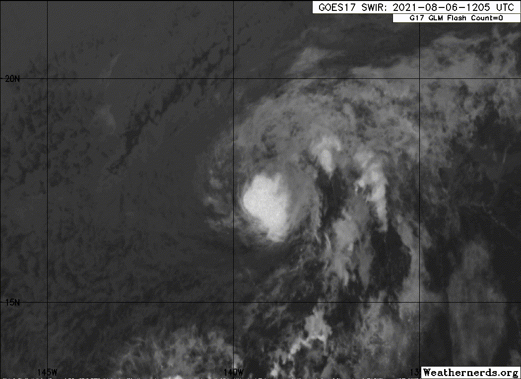
Tropical Storm Jimena Discussion Number 15
NWS National Hurricane Center Miami FL EP092021
500 AM HST Fri Aug 06 2021
A convective mass continues to persist over the center of Jimena,
although coldest cloud tops have warmed over the past few hours.
A fortuitous 1105 UTC AMSR-2 pass shows the center a bit west of
the earlier estimates, which places it beneath the coldest
remaining cloud tops. The intensity is held at 35 kt based on a
blend of Final-T and CI numbers from TAFB, SAB and ADT. This
intensity is also supported by overnight ASCAT data and a more
recent ship observation. Jimena is currently moving over SSTs near
24C. Going forward, westerly shear will increase along the
cyclone's path during the next 12-24 hr. These factors should cause
the tropical cyclone to weaken, and Jimena is expected to degenerate
into a remnant low by Saturday morning. The NHC intensity forecast
is in good agreement with the SHIPS and HCCA guidance.
The initial motion estimate is 300/8 kt. As Jimena weakens, the
increasingly shallow system is expected to be steered by the
low-level trade-wind flow, which should cause it to gradually turn
toward the west in about 48 hours. The ECMWF is a little faster and
lies on the southwest side of the guidance envelope, while the GFS
is slower and northeast of the consensus. The NHC forecast was
adjusted to the southwest of the previous forecast during the
first 12-24 hours based on the farther west initial position.
Thereafter, the track is close to the previous forecast, and in
best agreement with the HCCA and TVCN consensus models.
FORECAST POSITIONS AND MAX WINDS
INIT 06/1500Z 17.5N 139.3W 35 KT 40 MPH
12H 07/0000Z 18.0N 140.4W 30 KT 35 MPH
24H 07/1200Z 18.7N 141.8W 25 KT 30 MPH...POST-TROP/REMNT LOW
36H 08/0000Z 19.2N 143.3W 25 KT 30 MPH...POST-TROP/REMNT LOW
48H 08/1200Z 19.5N 144.9W 20 KT 25 MPH...POST-TROP/REMNT LOW
60H 09/0000Z 19.6N 146.7W 20 KT 25 MPH...POST-TROP/REMNT LOW
72H 09/1200Z...DISSIPATED
$$
Forecaster Hagen/Brown
0 likes
Visit the Caribbean-Central America Weather Thread where you can find at first post web cams,radars
and observations from Caribbean basin members Click Here
and observations from Caribbean basin members Click Here
-
Sciencerocks
- Category 5
- Posts: 7286
- Age: 38
- Joined: Thu Jul 06, 2017 1:51 am
-
Sciencerocks
- Category 5
- Posts: 7286
- Age: 38
- Joined: Thu Jul 06, 2017 1:51 am
-
weeniepatrol

- Category 3

- Posts: 857
- Joined: Sat Aug 22, 2020 5:30 pm
- Location: WA State
Who is online
Users browsing this forum: No registered users and 14 guests