EPAC: HILDA - Post-Tropical

Moderator: S2k Moderators

Message
Author
User avatar
Yellow Evan
Professional-Met
Professional-Met
Posts: 15954
Age: 25
Joined: Fri Jul 15, 2011 12:48 pm
Location: Henderson, Nevada/Honolulu, HI
Contact:

Re: EPAC: HILDA - Hurricane

#121 Postby Yellow Evan » Mon Aug 02, 2021 12:52 pm

Image

T4.5 with DG eye embedded in MG surrounded by LG.
0 likes   

User avatar
Yellow Evan
Professional-Met
Professional-Met
Posts: 15954
Age: 25
Joined: Fri Jul 15, 2011 12:48 pm
Location: Henderson, Nevada/Honolulu, HI
Contact:

Re: EPAC: HILDA - Hurricane

#122 Postby Yellow Evan » Mon Aug 02, 2021 1:11 pm

TXPZ29 KNES 021756
TCSENP

A. 08E (HILDA)

B. 02/1730Z

C. 15.6N

D. 122.7W

E. THREE/GOES-W

F. T4.0/4.5

G. IR/EIR/VIS

H. REMARKS...CENTER IS EMEDDED IN DG RESULTING IN A DT OF 4.0. MET
AND PT AGREE. FT IS BASED ON MET DUE TO SOME UNCERTAINTY IN THE PRECISE
CENTER LOCATION.

I. ADDL POSITIONS

NIL


...TURK
0 likes   

Sciencerocks
Category 5
Category 5
Posts: 7287
Age: 38
Joined: Thu Jul 06, 2017 1:51 am

Re: EPAC: HILDA - Hurricane

#123 Postby Sciencerocks » Mon Aug 02, 2021 2:48 pm

Image
0 likes   

User avatar
cycloneye
Admin
Admin
Posts: 139121
Age: 67
Joined: Thu Oct 10, 2002 10:54 am
Location: San Juan, Puerto Rico

Re: EPAC: HILDA - Hurricane

#124 Postby cycloneye » Mon Aug 02, 2021 3:40 pm

Hurricane Hilda Discussion Number 13
NWS National Hurricane Center Miami FL EP082021
200 PM PDT Mon Aug 02 2021

Recent satellite images show that Hilda's cloud pattern has become
less organized, with the low-level center on the northeast edge of
the central dense overcast. Microwave data also show a less
distinct eye feature, along with a more broken eyewall. The
initial wind speed is lowered to 65 kt, which is closest to the
latest CIMSS-SATCON value.

Hilda continues moving northwestward and should remain on that
heading for the next day or two while it is steered by the
subtropical ridge located near and west of Mexico. No changes were
made to the forecast during that time. After that, the ridge
builds farther to the west and a weakened Hilda should respond by
taking west-northwestward and westward turns by late week.
However, exactly when that happens is difficult to tell due to
potential interaction at long range with the remnants of former TD
9-E. A fair number of the models are showing that system
regenerating and getting closer to Hilda, which would have the
tendency to steer Hilda farther northward. While the new forecast
responds to this scenario by shifting the official track about half
a degree poleward on day 3 and beyond, a lot of the latest guidance
is even farther north.

It seems like Hilda might finally be on a steadier weakening trend
with the recent degradation noted in satellite data. With moderate
northeasterly shear and decreasing water temperatures in the path of
the cyclone, Hilda should continue to lose strength during the next
few days. Somewhat surprisingly, guidance is a little higher than
the last cycle, which doesn't feel like the correct forecast move
at this time, especially as the forecast shifts northward over
cooler waters faster. The new NHC forecast maintains the weakening
trend from the last advisory, and now ends up lower than the bulk of
the guidance. Remnant-low status is anticipated just after day 3.


FORECAST POSITIONS AND MAX WINDS

INIT 02/2100Z 15.9N 122.8W 65 KT 75 MPH
12H 03/0600Z 16.5N 123.3W 60 KT 70 MPH
24H 03/1800Z 17.4N 124.2W 55 KT 65 MPH
36H 04/0600Z 18.3N 125.2W 50 KT 60 MPH
48H 04/1800Z 19.2N 126.5W 40 KT 45 MPH
60H 05/0600Z 20.1N 128.0W 35 KT 40 MPH
72H 05/1800Z 21.1N 129.9W 30 KT 35 MPH
96H 06/1800Z 22.0N 134.0W 25 KT 30 MPH...POST-TROP/REMNT LOW
120H 07/1800Z 22.0N 139.0W 20 KT 25 MPH...POST-TROP/REMNT LOW

$$
Forecaster Blake
0 likes   
Visit the Caribbean-Central America Weather Thread where you can find at first post web cams,radars
and observations from Caribbean basin members Click Here

Sciencerocks
Category 5
Category 5
Posts: 7287
Age: 38
Joined: Thu Jul 06, 2017 1:51 am

Re: EPAC: HILDA - Hurricane

#125 Postby Sciencerocks » Mon Aug 02, 2021 8:09 pm

Image
0 likes   

User avatar
cycloneye
Admin
Admin
Posts: 139121
Age: 67
Joined: Thu Oct 10, 2002 10:54 am
Location: San Juan, Puerto Rico

Re: EPAC: HILDA - Hurricane

#126 Postby cycloneye » Mon Aug 02, 2021 9:37 pm

Hurricane Hilda Discussion Number 14
NWS National Hurricane Center Miami FL EP082021
800 PM PDT Mon Aug 02 2021

Moderate northeasterly wind shear continues to take a toll on Hilda
this evening. The upper-level outflow on the northern and eastern
sides of the circulation has a sharp edge in satellite imagery.
Recent SSMIS microwave data show the structure of Hilda has changed
little since earlier today, with a weakness in the upshear portion
of the eyewall and a slight displacement of the low- and mid-level
centers. The various objective intensity estimates and subjective
Dvorak classifications from TAFB and SAB support holding the initial
intensity at 65 kt for this advisory.

Hilda is moving northwestward, or 315/6 kt, under the influence of a
subtropical ridge to its northeast. This general motion is expected
to continue through midweek, and the track guidance remains tightly
clustered during this period. As Hilda continues weakening and the
ridge builds westward, Hilda is forecast to move west-northwestward
and then westward within the low-level flow through the rest of the
period. However, a complicating factor is the potential for some
interaction with the remnants of TD Nine-E, which now have a high
chance of redevelopment during the next couple of days. The official
NHC track forecast has been adjusted slightly poleward once again at
day 3 and beyond, bringing it closer to the reliable consensus aids
TVCE and HCCA and accounting for the aforementioned possibility of
some interaction between the two systems.

Moderate northeasterly shear will persist for the next day or so,
and afterwards the cooler sea-surface temperatures along Hilda's
forecast track will offset any reduction in shear over the system.
Therefore, weakening is expected during the next several days. The
official NHC intensity forecast lies slightly above the multi-model
consensus aids in the near-term, but then closely follows IVCN and
HCCA once Hilda reaches the cooler waters. The system is forecast to
degenerate into a remnant low by 96 h, but this transition could
occur soon after 72 h based on some of the latest GFS and ECMWF
simulated satellite imagery.


FORECAST POSITIONS AND MAX WINDS

INIT 03/0300Z 16.4N 123.3W 65 KT 75 MPH
12H 03/1200Z 17.1N 123.9W 60 KT 70 MPH
24H 04/0000Z 18.0N 124.8W 50 KT 60 MPH
36H 04/1200Z 18.9N 125.9W 45 KT 50 MPH
48H 05/0000Z 19.8N 127.2W 40 KT 45 MPH
60H 05/1200Z 20.8N 128.9W 35 KT 40 MPH
72H 06/0000Z 21.6N 130.9W 30 KT 35 MPH
96H 07/0000Z 22.5N 135.0W 25 KT 30 MPH...POST-TROP/REMNT LOW
120H 08/0000Z 22.6N 139.5W 20 KT 25 MPH...POST-TROP/REMNT LOW

$$
Forecaster Reinhart/Pasch
0 likes   
Visit the Caribbean-Central America Weather Thread where you can find at first post web cams,radars
and observations from Caribbean basin members Click Here

User avatar
Yellow Evan
Professional-Met
Professional-Met
Posts: 15954
Age: 25
Joined: Fri Jul 15, 2011 12:48 pm
Location: Henderson, Nevada/Honolulu, HI
Contact:

Re: EPAC: HILDA - Hurricane

#127 Postby Yellow Evan » Mon Aug 02, 2021 11:54 pm

I don’t think this is a hurricane anymore.
0 likes   

User avatar
Yellow Evan
Professional-Met
Professional-Met
Posts: 15954
Age: 25
Joined: Fri Jul 15, 2011 12:48 pm
Location: Henderson, Nevada/Honolulu, HI
Contact:

Re: EPAC: HILDA - Hurricane

#128 Postby Yellow Evan » Tue Aug 03, 2021 1:33 am

TXPZ29 KNES 030610
TCSENP

A. 08E (HILDA)

B. 03/0530Z

C. 16.6N

D. 123.5W

E. THREE/GOES-W

F. T4.0/4.0

G. IR/EIR/SWIR

H. REMARKS...SYSTEM IS EMBEDDED IN DG RESULTING IN AN EMBEDDED CENTER
PATTERN DT OF 4.0. THE 24 HR DEVELOPMENT TREND IS WEAKENING SLOWLY
RESULTING MET AND PT TO BE 4.0. FT IS BASED ON MET DUE TO UNCERTAINTY
IN CENTER LOCATION AND NOT CLEAR CUT CLOUD FEATURES>

I. ADDL POSITIONS

NIL


...PATEL
0 likes   

User avatar
cycloneye
Admin
Admin
Posts: 139121
Age: 67
Joined: Thu Oct 10, 2002 10:54 am
Location: San Juan, Puerto Rico

Re: EPAC: HILDA - Tropical Storm

#129 Postby cycloneye » Tue Aug 03, 2021 4:29 am

Tropical Storm Hilda Discussion Number 15
NWS National Hurricane Center Miami FL EP082021
200 AM PDT Tue Aug 03 2021

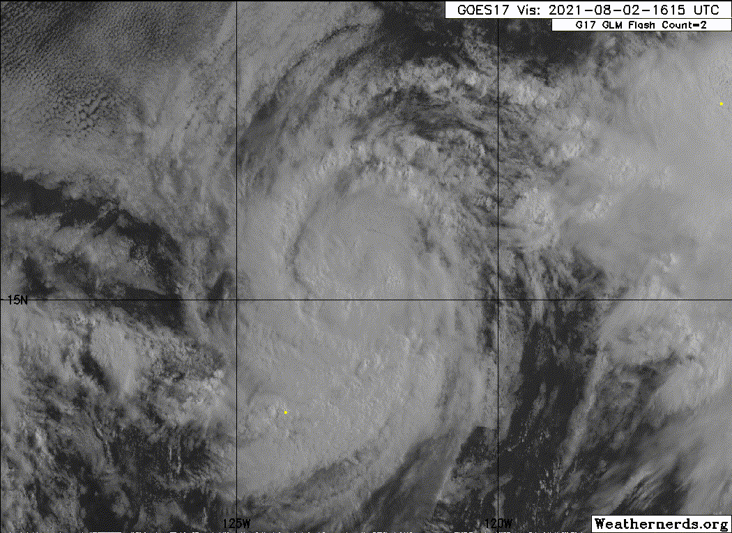
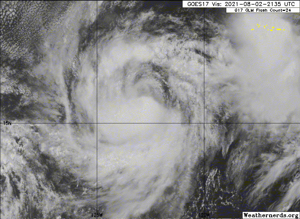
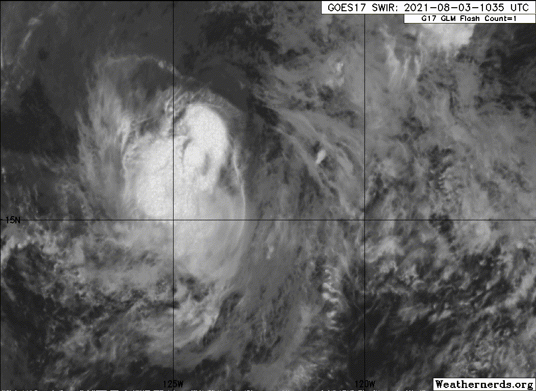
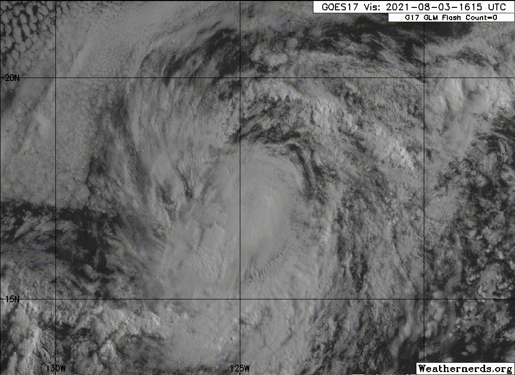
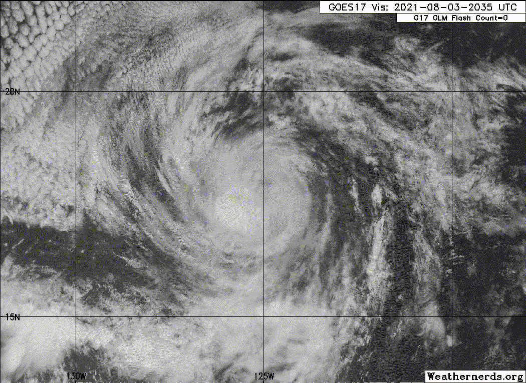
Overnight, Hilda's deep convection has continued to pulse, but
primarily in the southern semicircle of the circulation as 15-20 kt
of northeasterly vertical wind shear continues displacing this
activity downshear. A helpful ASCAT-B pass at 0602 UTC indicated the
center of Hilda was located on the northern edge of the convective
cirrus canopy, with the instrument also indicating a peak wind
retrieval of 53 kt. The most recent microwave imagery concurs with
this assessment and also indicates the earlier eyewall is no longer
well-defined. While the 0600 UTC subjective Dvorak estimates from
TAFB and SAB were both T4.0/65 kt, the most recent objective Dvorak
estimate from UW-CIMSS was down to T3.5/55 kt. Given the devolving
convective structure seen on microwave, the initial intensity has
been reduced to 60 kt, leaning towards the lower intensity
estimates.

Hilda continues to move slowly northwestward, at 315/7 kt as it
remains positioned southwest of a mid-level ridge centered over
southern California. Over the next several days, this ridge is
forecast to build westward over the East Pacific as a short-wave
trough offshore of California lifts out. This synoptic pattern
should allow Hilda to gradually bend to the west-northwest and
increase its forward motion slightly over the forecast period. Hilda
will also become increasingly influenced by low-level ridging,
steering the cyclone more westward as it becomes a weak and shallow
cyclone. The latest NHC track forecast is just a touch south of the
previous forecast track, blending the reliable TVCE and HCCA
consensus aids.

Northeasterly vertical wind shear, related to the remaining
convective outflow of Ignacio, is expected to keep Hilda on a
weakening trend over the next day or so. Even though this shear is
expected to subside thereafter, Hilda will also be crossing the 25
degree Celsius sea-surface temperature isotherm in 24 hours. Thus,
continued weakening is expected. The latest NHC intensity forecast
follows the HCCA consensus aid closely, showing weakening throughout
the forecast period. The tropical cyclone is now expected to
degenerate to a remnant low by Friday, when model guidance suggests
organized deep-convection will cease. The remnant low is then
expected to open up into a trough by the weekend, well east of
Hawaii.

FORECAST POSITIONS AND MAX WINDS

INIT 03/0900Z 17.0N 123.9W 60 KT 70 MPH
12H 03/1800Z 17.6N 124.6W 50 KT 60 MPH
24H 04/0600Z 18.6N 125.5W 45 KT 50 MPH
36H 04/1800Z 19.4N 126.7W 40 KT 45 MPH
48H 05/0600Z 20.2N 128.1W 35 KT 40 MPH
60H 05/1800Z 21.0N 129.9W 30 KT 35 MPH
72H 06/0600Z 21.7N 132.0W 25 KT 30 MPH...POST-TROP/REMNT LOW
96H 07/0600Z 22.4N 136.2W 25 KT 30 MPH...POST-TROP/REMNT LOW
120H 08/0600Z...DISSIPATED

$$
Forecaster Papin/Brown
0 likes   
Visit the Caribbean-Central America Weather Thread where you can find at first post web cams,radars
and observations from Caribbean basin members Click Here

User avatar
Yellow Evan
Professional-Met
Professional-Met
Posts: 15954
Age: 25
Joined: Fri Jul 15, 2011 12:48 pm
Location: Henderson, Nevada/Honolulu, HI
Contact:

Re: EPAC: HILDA - Tropical Storm

#130 Postby Yellow Evan » Tue Aug 03, 2021 7:45 am

TXPZ29 KNES 031228
TCSENP

A. 08E (HILDA)

B. 03/1130Z

C. 17.2N

D. 124.2W

E. THREE/GOES-W

F. T3.5/4.0

G. IR/EIR/SWIR

H. REMARKS...6/10 BANDING AROUND LLCC YIELDS DT OF 3.0. MET AND PT ARE
3.5 AND FT IS BASED ON MET DUE TO BANDING NOT BEING CLEAR-CUT.

I. ADDL POSITIONS

NIL


...MLEVINE
0 likes   

Sciencerocks
Category 5
Category 5
Posts: 7287
Age: 38
Joined: Thu Jul 06, 2017 1:51 am

Re: EPAC: HILDA - Tropical Storm

#131 Postby Sciencerocks » Tue Aug 03, 2021 9:36 am

Image
0 likes   

User avatar
cycloneye
Admin
Admin
Posts: 139121
Age: 67
Joined: Thu Oct 10, 2002 10:54 am
Location: San Juan, Puerto Rico

Re: EPAC: HILDA - Tropical Storm

#132 Postby cycloneye » Tue Aug 03, 2021 9:38 am

Tropical Storm Hilda Discussion Number 16
NWS National Hurricane Center Miami FL EP082021
800 AM PDT Tue Aug 03 2021

There's been little change with the structure of Hilda overnight as
deep convection continues to be mostly south of the center due to
persistent northeasterly shear. The low-level eye feature in 37 GHz
microwave data remains on the latest passes, but it isn't very deep
because of the shear. A blend of the T- and CI-numbers from
TAFB/SAB, plus the UW-CIMSS SATCON, yields 60 kt as the initial wind
speed. Hilda should weaken during the next several days, first
primarily due to shear, then cool water temperatures and a more
stable environment on Wed-Fri. Model guidance is in good agreement
on this scenario, and the latest forecast is close to the previous
NHC advisory and the model consensus. Hilda should decay into a
remnant low by Friday and dissipate as a trough this weekend well
east of the Hawaii.

The initial motion estimate, 315/7 kt, is the same as the previous
advisory. Hilda is maintaining this motion as it is steered by a
mid-level ridge centered over southern California. The global
models are consistently building this ridge westward over the
eastern Pacific during the next several days as a shortwave trough
lifts out along 135W, causing Hilda to turn west-northwestward by
Thursday. The only significant forecast difference is how quickly
the cyclone moves, mostly in the latter stages, with more of the
guidance showing a faster motion, perhaps because the models are
showing a weaker Hilda being steered by the quicker low-level flow.
The new NHC prediction shows that acceleration at long-range as
well, near or just behind the latest model consensus.


FORECAST POSITIONS AND MAX WINDS

INIT 03/1500Z 17.5N 124.5W 60 KT 70 MPH
12H 04/0000Z 18.2N 125.3W 50 KT 60 MPH
24H 04/1200Z 19.1N 126.4W 45 KT 50 MPH
36H 05/0000Z 19.9N 127.7W 40 KT 45 MPH
48H 05/1200Z 20.8N 129.4W 35 KT 40 MPH
60H 06/0000Z 21.6N 131.4W 30 KT 35 MPH
72H 06/1200Z 22.3N 133.5W 25 KT 30 MPH...POST-TROP/REMNT LOW
96H 07/1200Z 23.0N 138.0W 25 KT 30 MPH...POST-TROP/REMNT LOW
120H 08/1200Z...DISSIPATED

$$
Forecaster Blake
0 likes   
Visit the Caribbean-Central America Weather Thread where you can find at first post web cams,radars
and observations from Caribbean basin members Click Here

Sciencerocks
Category 5
Category 5
Posts: 7287
Age: 38
Joined: Thu Jul 06, 2017 1:51 am

Re: EPAC: HILDA - Tropical Storm

#133 Postby Sciencerocks » Tue Aug 03, 2021 11:01 am

Image
0 likes   

User avatar
Yellow Evan
Professional-Met
Professional-Met
Posts: 15954
Age: 25
Joined: Fri Jul 15, 2011 12:48 pm
Location: Henderson, Nevada/Honolulu, HI
Contact:

Re: EPAC: HILDA - Tropical Storm

#134 Postby Yellow Evan » Tue Aug 03, 2021 2:32 pm

TXPZ29 KNES 031801
TCSENP

A. 08E (HILDA)

B. 03/1730Z

C. 17.7N

D. 124.7W

E. THREE/GOES-W

F. T3.5/4.0

G. IR/EIR/VIS/GMI/SSMIS

H. REMARKS...AN IRREGULAR CDO WITH A DIAMETER > 1.5 DEG YIELDS A DT OF
3.0. MET IS 4.0 AND PT IS 3.5. FT IS BASED ON PT DUE TO UNCERTAINTY OF
EXACT LLCC LOCATION.

I. ADDL POSITIONS

03/1145Z 17.3N 124.3W GMI
03/1253Z 17.2N 124.3W SSMIS


...MLEVINE
0 likes   

Sciencerocks
Category 5
Category 5
Posts: 7287
Age: 38
Joined: Thu Jul 06, 2017 1:51 am

Re: EPAC: HILDA - Tropical Storm

#135 Postby Sciencerocks » Tue Aug 03, 2021 2:49 pm

Image
0 likes   

User avatar
cycloneye
Admin
Admin
Posts: 139121
Age: 67
Joined: Thu Oct 10, 2002 10:54 am
Location: San Juan, Puerto Rico

Re: EPAC: HILDA - Tropical Storm

#136 Postby cycloneye » Tue Aug 03, 2021 3:40 pm

Tropical Storm Hilda Discussion Number 17
NWS National Hurricane Center Miami FL EP082021
200 PM PDT Tue Aug 03 2021

Deep convection in Hilda's central dense overcast has been weakening
today, with the low-level center still on the northern side of the
cloud mass. Satellite classifications have decreased since the last
advisory, and a partial ASCAT pass around 1700 UTC showed maximum
winds of about 45 kt. Assuming some undersampling and that the
eastern radius-of-maximum winds could have been missed, the initial
wind speed is set to 50 kt. A combination of shear, cool water
temperatures, and a more stable environment should keep Hilda on a
weakening trend throughout the forecast period. Model guidance
continues to be in very good agreement, and the new NHC forecast is
basically an update of the previous one. Hilda is expected to
degenerate into a remnant low by Friday and dissipate as a trough
this weekend well east of the Hawaiian Islands.

The storm continues moving northwestward, now a little slower at
about 6 kt. A mid-level ridge centered over southern California
should build westward during the next few days as a mid-latitude
trough along 135W moves northward out of the area. This pattern is
expected to turn Hilda west-northwestward tomorrow and accelerate
the cyclone in that direction as it encounters stronger low- to
mid-level flow. Model guidance is a shade faster and to the left of
the last cycle, and the new NHC track forecast follows that trend.


FORECAST POSITIONS AND MAX WINDS

INIT 03/2100Z 17.8N 125.0W 50 KT 60 MPH
12H 04/0600Z 18.5N 125.9W 45 KT 50 MPH
24H 04/1800Z 19.4N 127.2W 40 KT 45 MPH
36H 05/0600Z 20.2N 128.6W 35 KT 40 MPH
48H 05/1800Z 21.1N 130.5W 30 KT 35 MPH
60H 06/0600Z 21.9N 132.7W 30 KT 35 MPH...POST-TROP/REMNT LOW
72H 06/1800Z 22.5N 135.5W 25 KT 30 MPH...POST-TROP/REMNT LOW
96H 07/1800Z...DISSIPATED

$$
Forecaster Blake
0 likes   
Visit the Caribbean-Central America Weather Thread where you can find at first post web cams,radars
and observations from Caribbean basin members Click Here

Sciencerocks
Category 5
Category 5
Posts: 7287
Age: 38
Joined: Thu Jul 06, 2017 1:51 am

Re: EPAC: HILDA - Tropical Storm

#137 Postby Sciencerocks » Tue Aug 03, 2021 7:07 pm

Image
0 likes   

User avatar
Yellow Evan
Professional-Met
Professional-Met
Posts: 15954
Age: 25
Joined: Fri Jul 15, 2011 12:48 pm
Location: Henderson, Nevada/Honolulu, HI
Contact:

Re: EPAC: HILDA - Tropical Storm

#138 Postby Yellow Evan » Tue Aug 03, 2021 8:04 pm

TXPZ29 KNES 040003
TCSENP

A. 08E (HILDA)

B. 03/2330Z

C. 18.1N

D. 125.2W

E. THREE/GOES-W

F. T2.5/3.5

G. IR/EIR/VIS

H. REMARKS...EXPOSED LLCC IS EMBEDDED <.75 DEG FROM A LARGE COLD OVC
RESULTING IN A DT OF 2.5 USING SHEAR PATTERN. MET=3.5 AND PT=3.0. MID
AND LOW-LEVEL CENTERS HAVE DECOUPLED IN LAST 6 HR FT IS BASED ON DT..

I. ADDL POSITIONS

NIL


...KONON


This isn't a shear pattern. Just the convection is over warm SSTs so it appears that way.
0 likes   

User avatar
cycloneye
Admin
Admin
Posts: 139121
Age: 67
Joined: Thu Oct 10, 2002 10:54 am
Location: San Juan, Puerto Rico

Re: EPAC: HILDA - Tropical Storm

#139 Postby cycloneye » Tue Aug 03, 2021 9:40 pm

Tropical Storm Hilda Discussion Number 18
NWS National Hurricane Center Miami FL EP082021
800 PM PDT Tue Aug 03 2021

Hilda is a weakening tropical cyclone. Its low-level center is now
exposed in visible satellite imagery, and infrared cloud top
temperatures have rapidly warmed as the system is currently not
producing any deep convection. Despite this lack of convection,
earlier scatterometer data revealed several 45-kt wind vectors in
the northern and eastern portions of the circulation. The initial
intensity is lowered to 45 kt for this advisory, which is supported
by a blend of the final-T numbers and current intensity estimates
from TAFB and SAB, and the objective UW-CIMSS SATCON estimate.

A mid-level ridge centered over the southwestern U.S. continues to
steer Hilda northwestward at around 7 kt. As the vortex spins down
and becomes vertically shallow, Hilda is expected to turn
west-northwestward and accelerate a bit as a low-level ridge builds
westward across the eastern Pacific. The official NHC track forecast
is largely unchanged from the previous one and lies close to the
multi-model consensus.

Hilda is moving over cooler waters and into a more stable
environment, so continued weakening is expected over the next few
days. The official NHC forecast now shows Hilda weakening to a
tropical depression by Thursday morning and degenerating to a
remnant low soon thereafter. The remnant low is still expected to
open up into a trough this weekend well east-northeast of the
Hawaiian Islands.


FORECAST POSITIONS AND MAX WINDS

INIT 04/0300Z 18.4N 125.5W 45 KT 50 MPH
12H 04/1200Z 19.1N 126.5W 40 KT 45 MPH
24H 05/0000Z 19.9N 128.0W 35 KT 40 MPH
36H 05/1200Z 20.7N 129.8W 30 KT 35 MPH
48H 06/0000Z 21.6N 132.0W 30 KT 35 MPH...POST-TROP/REMNT LOW
60H 06/1200Z 22.3N 134.4W 25 KT 30 MPH...POST-TROP/REMNT LOW
72H 07/0000Z 22.9N 136.7W 25 KT 30 MPH...POST-TROP/REMNT LOW
96H 08/0000Z...DISSIPATED

$$
Forecaster Reinhart/Pasch
0 likes   
Visit the Caribbean-Central America Weather Thread where you can find at first post web cams,radars
and observations from Caribbean basin members Click Here

User avatar
cycloneye
Admin
Admin
Posts: 139121
Age: 67
Joined: Thu Oct 10, 2002 10:54 am
Location: San Juan, Puerto Rico

Re: EPAC: HILDA - Tropical Storm

#140 Postby cycloneye » Wed Aug 04, 2021 5:46 am

Tropical Storm Hilda Discussion Number 19
NWS National Hurricane Center Miami FL EP082021
200 AM PDT Wed Aug 04 2021

Hilda continues to weaken tonight. For a 12 h period, the low-level
circulation was mostly devoid of deep convection, though recently a
few convective cells are redeveloping south of the estimated center.
Unfortunately, there has not been any recent scatterometer data to
help determine the storm's intensity. The current initial intensity
of Hilda is set to a possibly generous 40 kt for this advisory,
blending the final-T numbers and current intensity estimates from
TAFB and SAB, in addition to the most recent UW-CIMSS SATCON
intensity estimate. Further weakening is forecast, as Hilda is now
moving over sea-surface temperatures below 25 C, though some
residual mid-level moisture may allow for sporadic convective bursts
to occur for the next 24-36 hours. By 48 hours, the ECMWF, GFS, and
HWRF models all agree Hilda will lose any remaining organized
convection and become a remnant low, with this low opening up to a
trough this weekend, well east-northeast of the Hawaiian
Islands.

Now that Hilda is becoming an increasingly shallow cyclone, the
storm is beginning to bend slightly to the left, now moving to the
west-northwest at 300/8 kt. Low- to mid-level ridging to the north
and east of Hilda is expected to build in further over the next
several days, and should allow the cyclone to turn a bit more
westward at a slightly faster motion by the end of the forecast
period. The latest NHC track forecast is very close to the
previous one, and remains near the multi-model consensus.


FORECAST POSITIONS AND MAX WINDS

INIT 04/0900Z 18.9N 126.6W 40 KT 45 MPH
12H 04/1800Z 19.6N 127.8W 35 KT 40 MPH
24H 05/0600Z 20.4N 129.5W 30 KT 35 MPH
36H 05/1800Z 21.3N 131.5W 30 KT 35 MPH
48H 06/0600Z 22.1N 133.6W 25 KT 30 MPH...POST-TROP/REMNT LOW
60H 06/1800Z 22.6N 136.1W 25 KT 30 MPH...POST-TROP/REMNT LOW
72H 07/0600Z...DISSIPATED

$$
Forecaster Papin/Beven
0 likes   
Visit the Caribbean-Central America Weather Thread where you can find at first post web cams,radars
and observations from Caribbean basin members Click Here


Return to “2021”

Who is online

Users browsing this forum: No registered users and 28 guests