ATL: INVEST 93L - Discussion
Moderator: S2k Moderators
-
AlphaToOmega
- Category 5

- Posts: 1448
- Joined: Sat Jun 26, 2021 10:51 am
- Location: Somewhere in Massachusetts
Re: ATL: INVEST 93L - Discussion
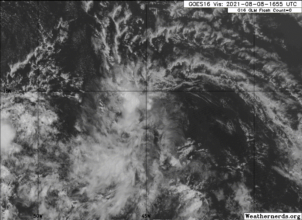
Tons of models develop Invest 93L, and only a few models develop Invest 92L. However, the global models are more enthusiastic about the wave west of Invest 93L. Invest 93L still seems to be in the best spot for tropical development. Upper ocean heat content is only marginal where Invest 93L is currently located; but the the atmospheric pattern for Invest 93L seems to be pretty favorable, for wind shear is only 10 knots where Invest 93L is located. This wave is surrounded by a tropical wave to its west and a tropical wave to its east, so dry air is not going to be a factor. If Invest 93L could make it past 50° W, it would develop much more easily.
0 likes

Re: ATL: INVEST 93L - Discussion
MarioProtVI wrote:AtlanticWind wrote:HWRF ends with pretty strong Hurricane.
HWRF does poorly with invests especially in this area. I remember it constantly blew up pre-Gonzalo / early stages of TD 7 up to a potent hurricane (one of the reasons why the intensity forecast was so high IIRC) and it ended up peaking at 60-70 mph. HMON doesn’t even develop it so I’d toss this run out until we get a clearer picture or more agreement from other models
Aren’t the trade winds weaker now? That was why it busted so badly with Elsa, although it did correctly forecast a compact Cat 1 passing through the Lesser Antilles.
0 likes
Irene '11 Sandy '12 Hermine '16 5/15/2018 Derecho Fay '20 Isaias '20 Elsa '21 Henri '21 Ida '21
I am only a meteorology enthusiast who knows a decent amount about tropical cyclones. Look to the professional mets, the NHC, or your local weather office for the best information.
I am only a meteorology enthusiast who knows a decent amount about tropical cyclones. Look to the professional mets, the NHC, or your local weather office for the best information.
-
AlphaToOmega
- Category 5
- Posts: 1448
- Joined: Sat Jun 26, 2021 10:51 am
- Location: Somewhere in Massachusetts
-
cycloneye

- Admin

- Posts: 139140
- Age: 67
- Joined: Thu Oct 10, 2002 10:54 am
- Location: San Juan, Puerto Rico
Re: ATL: INVEST 93L - Discussion
Showers and thunderstorms associated with an area of low pressure
located over the tropical Atlantic about midway between the Cabo
Verde Islands and the Lesser Antilles have become more concentrated
since yesterday. Environmental conditions are expected to become a
little more favorable for gradual development, and this system
could become a tropical depression within the next few days. The
system is forecast to move slowly toward the west-southwest or west
during the next couple of days, and then move a little faster toward
the west by mid-week.
* Formation chance through 48 hours...low...30 percent.
* Formation chance through 5 days...medium...40 percent.
0 likes
Visit the Caribbean-Central America Weather Thread where you can find at first post web cams,radars
and observations from Caribbean basin members Click Here
and observations from Caribbean basin members Click Here
-
tolakram
- Admin
- Posts: 19165
- Age: 60
- Joined: Sun Aug 27, 2006 8:23 pm
- Location: Florence, KY (name is Mark)
Re: ATL: INVEST 93L - Discussion
AlphaToOmega wrote:Which global model best handles monsoon troughs?
None?
I know we all expect the wave ahead of 93 to be tagged, but there's no hard and fast rule as far as I know, so whatever develops, if anything, might be 93.
0 likes
M a r k
- - - - -
Join us in chat: Storm2K Chatroom Invite. Android and IOS apps also available.
The posts in this forum are NOT official forecasts and should not be used as such. Posts are NOT endorsed by any professional institution or STORM2K.org. For official information and forecasts, please refer to NHC and NWS products.
Re: ATL: INVEST 93L - Discussion
AlphaToOmega wrote:Tons of models develop Invest 93L, and only a few models develop Invest 92L. However, the global models are more enthusiastic about the wave west of Invest 93L. Invest 93L still seems to be in the best spot for tropical development. Upper ocean heat content is only marginal where Invest 93L is currently located; but the the atmospheric pattern for Invest 93L seems to be pretty favorable, for wind shear is only 10 knots where Invest 93L is located. This wave is surrounded by a tropical wave to its west and a tropical wave to its east, so dry air is not going to be a factor. If Invest 93L could make it past 50° W, it would develop much more easily.
There is almost always dry air. It appears quickly and swiftly like those phantom ULLs that love to shear storms apart.
0 likes
-
Category5Kaiju

- Category 5
- Posts: 3360
- Age: 22
- Joined: Thu Dec 24, 2020 12:45 pm
- Location: Seattle
Re: ATL: INVEST 93L - Discussion
Something I have learned from continuously tracking these systems since 2017: in many cases when the dry air looks to be an inhibiting factor, some of these waves actually perform better than expected and blow up in convection and shield themselves from the dry air with a moisture bubble. So, just something to watch, all I am saying is unless I see it actually happen real time and that there is substantial evidence to prove such, I assume that the dry air won’t be an automatic death knell to these waves, particularly 93L.
0 likes
Unless explicitly stated, all information covered in my posts is based on my opinions and observations. Please refer to a professional meteorologist or an accredited weather research agency otherwise, especially if serious decisions must be made in the event of a potentially life-threatening tropical storm or hurricane.
-
NXStumpy_Robothing
- Category 1

- Posts: 325
- Age: 23
- Joined: Fri Jun 05, 2020 11:50 pm
- Location: North Georgia
Re: ATL: INVEST 93L - Discussion
In most scenarios, dry air on the periphery of a system will not be enough on its own to be an inhibiting factor on the eventual strength of a cyclone (though it does usually mean a system will be smaller than otherwise anticipated). When a tropical cyclone is surrounded by dirty air, it can and will often form a insulated moisture pouch thanks to the thermodynamics that power recurring convection in such a system. Instead, what you need is to have some amount of shear that will impact the core circulation. Obviously, the weaker the cyclone, the closer to the ground this shear needs to be in order to allow dry air to infiltrate the system.
In 93L's case - it's currently flirting the boundary between lighter overall shear and upper-level divergence aloft, and greater low-level shear/lower-level divergence, and it's displayed quite easily with its convective pattern, which is pulsing down from its overnight peak. It remains to be seen if it can regenerate that previously-impressive convection it had overnight, or if that lower-level easterly shear will continue to allow dry air to infiltrate the small low pressure area at the center. As with most things in the tropics, we just have to wait and see what it does.
In 93L's case - it's currently flirting the boundary between lighter overall shear and upper-level divergence aloft, and greater low-level shear/lower-level divergence, and it's displayed quite easily with its convective pattern, which is pulsing down from its overnight peak. It remains to be seen if it can regenerate that previously-impressive convection it had overnight, or if that lower-level easterly shear will continue to allow dry air to infiltrate the small low pressure area at the center. As with most things in the tropics, we just have to wait and see what it does.
3 likes
Undergraduate Meteorology Student, Georgia Institute of Technology
Re: ATL: INVEST 93L - Discussion
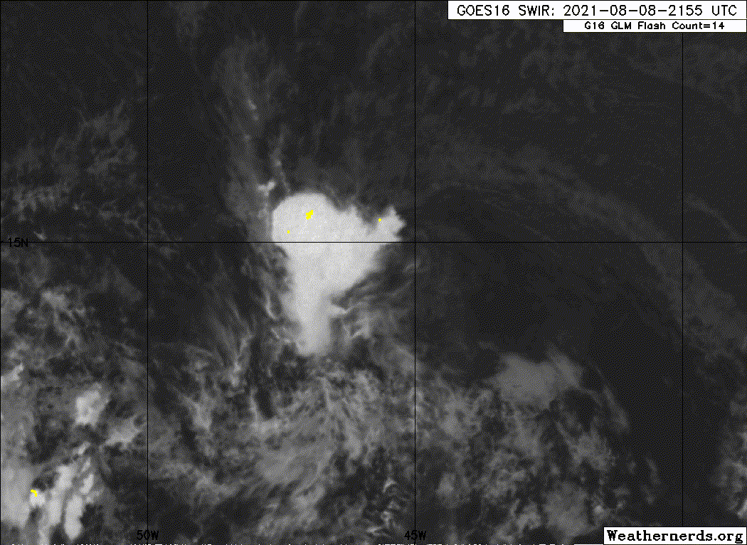
The vorticity signature for this looks quite good — stronger than 94L and whatever’s left of 92L — but convection has significantly waned as a result of dry air and Dmin. 93L needs to pop some more fast before it’s killed off, although if it does die, then there would probably be less vorticity competition with 94L.
0 likes
Irene '11 Sandy '12 Hermine '16 5/15/2018 Derecho Fay '20 Isaias '20 Elsa '21 Henri '21 Ida '21
I am only a meteorology enthusiast who knows a decent amount about tropical cyclones. Look to the professional mets, the NHC, or your local weather office for the best information.
I am only a meteorology enthusiast who knows a decent amount about tropical cyclones. Look to the professional mets, the NHC, or your local weather office for the best information.
-
Sciencerocks
- Category 5
- Posts: 7287
- Age: 38
- Joined: Thu Jul 06, 2017 1:51 am

-
cycloneye
- Admin
- Posts: 139140
- Age: 67
- Joined: Thu Oct 10, 2002 10:54 am
- Location: San Juan, Puerto Rico
Re: ATL: INVEST 93L - Discussion
Showers and thunderstorms associated with an area of low pressure
located over the tropical Atlantic about midway between the Cabo
Verde Islands and the Lesser Antilles have diminished this morning.
Although environmental conditions appear to be only marginally
conducive for development, this system could still become a
tropical depression later this week while it moves toward the
west-southwest or west at around 10 mph.
* Formation chance through 48 hours...low...30 percent.
* Formation chance through 5 days...medium...40 percent.
0 likes
Visit the Caribbean-Central America Weather Thread where you can find at first post web cams,radars
and observations from Caribbean basin members Click Here
and observations from Caribbean basin members Click Here
-
Sciencerocks
- Category 5
- Posts: 7287
- Age: 38
- Joined: Thu Jul 06, 2017 1:51 am
-
cycloneye
- Admin
- Posts: 139140
- Age: 67
- Joined: Thu Oct 10, 2002 10:54 am
- Location: San Juan, Puerto Rico
Re: ATL: INVEST 93L - Discussion
Disorganized showers and thunderstorms have changed little in
association with an elongated low pressure system located over the
tropical Atlantic about midway between the Cabo Verde Islands and
the Lesser Antilles. Although environmental conditions appear to be
only marginally conducive for development, this system could still
become a tropical depression later this week while it moves toward
the west or west-southwest at around 10 mph.
* Formation chance through 48 hours...low...30 percent.
* Formation chance through 5 days...medium...40 percent.
0 likes
Visit the Caribbean-Central America Weather Thread where you can find at first post web cams,radars
and observations from Caribbean basin members Click Here
and observations from Caribbean basin members Click Here
-
Sciencerocks
- Category 5
- Posts: 7287
- Age: 38
- Joined: Thu Jul 06, 2017 1:51 am
-
ElectricStorm

- Category 5
- Posts: 4570
- Age: 23
- Joined: Tue Aug 13, 2019 11:23 pm
- Location: Skiatook, OK / Norman, OK
Re: ATL: INVEST 93L - Discussion
Looks like I may have been wrong about this one developing. All the attention is on 94L now
2. Disorganized showers and thunderstorms have changed little in
association with an elongated low pressure area located about 1000
miles east of the Lesser Antilles. Development of this system is
becoming less likely during the next few days while it moves toward
the west or west-southwest at around 10 mph.
* Formation chance through 48 hours...low...20 percent.
* Formation chance through 5 days...low...30 percent.
0 likes
I am in no way a professional. Take what I say with a grain of salt as I could be totally wrong. Please refer to the NHC, NWS, or SPC for official information.
Boomer Sooner!
Boomer Sooner!
-
AlphaToOmega
- Category 5
- Posts: 1448
- Joined: Sat Jun 26, 2021 10:51 am
- Location: Somewhere in Massachusetts
Re: ATL: INVEST 93L - Discussion
Still to early to say requiescat in pace
2. Disorganized showers and thunderstorms have changed little in
association with an elongated low pressure area located several
hundred miles east of the Lesser Antilles. Development of this
system is becoming less likely during the next few days while it
moves toward the west or west-southwest at around 10 mph.
* Formation chance through 48 hours...low...10 percent.
* Formation chance through 5 days...low...20 percent.
0 likes
-
Category5Kaiju
- Category 5
- Posts: 3360
- Age: 22
- Joined: Thu Dec 24, 2020 12:45 pm
- Location: Seattle
Re: ATL: INVEST 93L - Discussion
RIP 93L, at least you did your role by moistening the air for the next waves to come 
2 likes
Unless explicitly stated, all information covered in my posts is based on my opinions and observations. Please refer to a professional meteorologist or an accredited weather research agency otherwise, especially if serious decisions must be made in the event of a potentially life-threatening tropical storm or hurricane.
Who is online
Users browsing this forum: No registered users and 34 guests