EPAC: PAMELA - Remnants
Moderator: S2k Moderators

Re: EPAC: SIXTEEN-E - Tropical Depression
The first visible imagery of the day suggests Pamela’s LLC is nicely tucked under the large burst of -80C and colder convection. Still a TD on the 12z BT, but it’ll likely become a TS at 5pm and a hurricane sometime tomorrow.
1 likes
Irene '11 Sandy '12 Hermine '16 5/15/2018 Derecho Fay '20 Isaias '20 Elsa '21 Henri '21 Ida '21
I am only a meteorology enthusiast who knows a decent amount about tropical cyclones. Look to the professional mets, the NHC, or your local weather office for the best information.
I am only a meteorology enthusiast who knows a decent amount about tropical cyclones. Look to the professional mets, the NHC, or your local weather office for the best information.
-
zeehag
- Tropical Storm

- Posts: 172
- Age: 75
- Joined: Sun Jul 17, 2011 9:49 pm
- Location: mazatlan,sinaloa, mexico, fixing patricia's mess.
- Contact:
Re: EPAC: SIXTEEN-E - Tropical Depression
Yellow Evan wrote:https://twitter.com/icyclone/status/1447146117892878340?s=21
hopefully not all the tacos in mazatlan will be soaked... welcome to our haven of no canes and all play. contact me i f you need to find anything specific. i will be hunkered but available as long as we have electricity service
0 likes
-
Sciencerocks
- Category 5

- Posts: 7287
- Age: 38
- Joined: Thu Jul 06, 2017 1:51 am
Re: EPAC: SIXTEEN-E - Tropical Depression
12z HWRF develops a pinhole eye and has very rapid intensification on Tuesday, perhaps in time for the first recon mission at 1730z. Is that when it’s supposed to leave or be at Pamela’s center?
Edit: and there’s the EWRC again
Edit: and there’s the EWRC again
0 likes
Irene '11 Sandy '12 Hermine '16 5/15/2018 Derecho Fay '20 Isaias '20 Elsa '21 Henri '21 Ida '21
I am only a meteorology enthusiast who knows a decent amount about tropical cyclones. Look to the professional mets, the NHC, or your local weather office for the best information.
I am only a meteorology enthusiast who knows a decent amount about tropical cyclones. Look to the professional mets, the NHC, or your local weather office for the best information.


Re: EPAC: SIXTEEN-E - Tropical Depression
Center is almost entirely exposed....yikes. I though conditions were super favorable but apparently not. Not writing it off though yet, we've seen this before.
1 likes
-
Yellow Evan

- Professional-Met

- Posts: 15956
- Age: 25
- Joined: Fri Jul 15, 2011 12:48 pm
- Location: Henderson, Nevada/Honolulu, HI
- Contact:
Re: EPAC: SIXTEEN-E - Tropical Depression
000
WTPZ41 KNHC 101440
TCDEP1
Tropical Depression Sixteen-E Discussion Number 2
NWS National Hurricane Center Miami FL EP162021
1000 AM CDT Sun Oct 10 2021
The depression is gradually getting better organized this morning,
as a large mass of deep convection with clouds tops colder than -80
degrees C has developed over the cyclone's center. The initial
advisory is held at 30 kt for this advisory and is based on the
latest Dvorak intensity estimates from TAFB and SAB.
The initial motion of the depression is 290/15 kt. This
west-northwestward motion is forecast to continue through tonight as
the cyclone moves along the southern periphery of a mid-tropospheric
ridge located over Mexico. Early this week, a short-wave trough is
expected to dig southward over the western United States and
northern Mexico which would produce a weakness in the ridge. This
should cause the cyclone to make a gradual turn to the north Monday
through Tuesday night, with a northeastward motion expected by
Wednesday. The track model guidance is in very good agreement on
this scenario and the latest NHC forecast track is little changed
from the previous one. Based on the forecast track, the center of
the cyclone should pass near or south of the southern tip of the
Baja California peninsula Tuesday night or early Wednesday, then
reach the coast of west-central mainland Mexico Wednesday night or
early Thursday.
The recent increase in convection over the cyclone's center suggests
that a bout of intensification is soon to get underway, and the
depression is expected to become a tropical storm later today. The
environment surrounding the depression is ideal for strengthening
over the next 2 to 3 days, and it is possible that the system could
undergo a period of rapid intensification (RI) during that time. The
latest GFS-SHIPS RI guidance continues to indicate a greater than 40
percent chance of a 65-kt increase in strength over the next 72 h.
Based on a blend of the latest HCCA and IVCN intensity solutions and
the SHIPS RI guidance, the latest NHC intensity forecast is similar
to the previous one, indicating the cyclone reaching 95 kt in 72 h.
Although not explicitly shown in the forecast, the system could
become a major hurricane before reaching the coast of mainland
Mexico.
Key Messages:
1. The tropical cyclone is forecast to be at or near major hurricane
intensity when it reaches the coast of west-central mainland Mexico
by late Wednesday or early Thursday, and could bring
life-threatening storm surge, flash flooding, and dangerous winds to
a portion of that area. Residents in this area should monitor the
progress of this system and ensure they have their hurricane plan in
place.
2. The tropical cyclone is expected to pass near or south of the
southern tip of the Baja California peninsula as a hurricane Tuesday
night or Wednesday, and could bring strong winds and heavy rainfall
to the extreme southern portion of the peninsula. Watches could be
required for portions of this area tonight or early Monday.
FORECAST POSITIONS AND MAX WINDS
INIT 10/1500Z 14.8N 104.7W 30 KT 35 MPH
12H 11/0000Z 15.4N 106.6W 40 KT 45 MPH
24H 11/1200Z 16.0N 108.2W 50 KT 60 MPH
36H 12/0000Z 17.1N 109.4W 65 KT 75 MPH
48H 12/1200Z 18.4N 110.0W 75 KT 85 MPH
60H 13/0000Z 19.9N 109.9W 85 KT 100 MPH
72H 13/1200Z 21.8N 109.0W 95 KT 110 MPH
96H 14/1200Z 26.3N 105.5W 55 KT 65 MPH...INLAND
120H 15/1200Z...DISSIPATED
$$
Forecaster Latto
0 likes

Re: EPAC: SIXTEEN-E - Tropical Depression
WiscoWx02 wrote:Center is almost entirely exposed....yikes. I though conditions were super favorable but apparently not. Not writing it off though yet, we've seen this before.
It literally just formed. It’s gonna look quite ugly in its first 12-24 hours, and models don’t have it really get going until later tomorrow. However, if the HWRF’s consistent scenario of a pinhole that gets interrupted by an EWRC verifies, then Pamela will likely be a slight under-achiever like Genevieve — gets to MH status, but nowhere near as strong as originally expected or modeled.
0 likes
Irene '11 Sandy '12 Hermine '16 5/15/2018 Derecho Fay '20 Isaias '20 Elsa '21 Henri '21 Ida '21
I am only a meteorology enthusiast who knows a decent amount about tropical cyclones. Look to the professional mets, the NHC, or your local weather office for the best information.
I am only a meteorology enthusiast who knows a decent amount about tropical cyclones. Look to the professional mets, the NHC, or your local weather office for the best information.
-
Yellow Evan
- Professional-Met
- Posts: 15956
- Age: 25
- Joined: Fri Jul 15, 2011 12:48 pm
- Location: Henderson, Nevada/Honolulu, HI
- Contact:
Re: EPAC: SIXTEEN-E - Tropical Depression
Some northerly shear from either an upper trough or a ULAC is causing problems atm. Despite the shear, it’s had an ominous look ever since designation really.
0 likes
-
Yellow Evan
- Professional-Met
- Posts: 15956
- Age: 25
- Joined: Fri Jul 15, 2011 12:48 pm
- Location: Henderson, Nevada/Honolulu, HI
- Contact:
-
Yellow Evan
- Professional-Met
- Posts: 15956
- Age: 25
- Joined: Fri Jul 15, 2011 12:48 pm
- Location: Henderson, Nevada/Honolulu, HI
- Contact:
Re: EPAC: SIXTEEN-E - Tropical Depression

12z HWRF calling for mid-level shear to spike in about 60 hours.
0 likes
-
Yellow Evan
- Professional-Met
- Posts: 15956
- Age: 25
- Joined: Fri Jul 15, 2011 12:48 pm
- Location: Henderson, Nevada/Honolulu, HI
- Contact:
-
cycloneye

- Admin

- Posts: 139201
- Age: 67
- Joined: Thu Oct 10, 2002 10:54 am
- Location: San Juan, Puerto Rico
Re: EPAC: SIXTEEN-E - Tropical Depression
A. 16E (NONAME)
B. 10/1730Z
C. 15.0N
D. 105.4W
E. THREE/GOES-E
F. T2.0/2.0
G. IR/EIR/VIS
H. REMARKS...5/10 BANDING AROUND THE LLCC YIELDS A DT OF 2.5. MET IS
1.5 AND PT IS 2.0. FT IS BASED ON CONSTRAINTS AS THE FT MUST BE LESS
THAN 2.5 IN THE FIRST 24 HOURS OF DEVELOPMENT.
I. ADDL POSITIONS
NIL
...TUGGLE
B. 10/1730Z
C. 15.0N
D. 105.4W
E. THREE/GOES-E
F. T2.0/2.0
G. IR/EIR/VIS
H. REMARKS...5/10 BANDING AROUND THE LLCC YIELDS A DT OF 2.5. MET IS
1.5 AND PT IS 2.0. FT IS BASED ON CONSTRAINTS AS THE FT MUST BE LESS
THAN 2.5 IN THE FIRST 24 HOURS OF DEVELOPMENT.
I. ADDL POSITIONS
NIL
...TUGGLE
0 likes
Visit the Caribbean-Central America Weather Thread where you can find at first post web cams,radars
and observations from Caribbean basin members Click Here
and observations from Caribbean basin members Click Here
-
Sciencerocks
- Category 5
- Posts: 7287
- Age: 38
- Joined: Thu Jul 06, 2017 1:51 am
-
cycloneye
- Admin
- Posts: 139201
- Age: 67
- Joined: Thu Oct 10, 2002 10:54 am
- Location: San Juan, Puerto Rico
Re: EPAC: SIXTEEN-E - Tropical Depression
Hello Pamela. The 12z Best track was revised upwards to TS. EP, 16, 2021101012, , BEST, 0, 147N, 1039W, 35, 1007, TS
EP, 16, 2021101018, , BEST, 0, 153N, 1054W, 40, 1005, TS, 34, NEQ, 50, 0, 0, 0, 1010, 150, 30, 0, 0, E, 0, , 0, 0, PAMELA, M
2 likes
Visit the Caribbean-Central America Weather Thread where you can find at first post web cams,radars
and observations from Caribbean basin members Click Here
and observations from Caribbean basin members Click Here
-
Sciencerocks
- Category 5
- Posts: 7287
- Age: 38
- Joined: Thu Jul 06, 2017 1:51 am
Re: EPAC: PAMELA - Tropical Storm
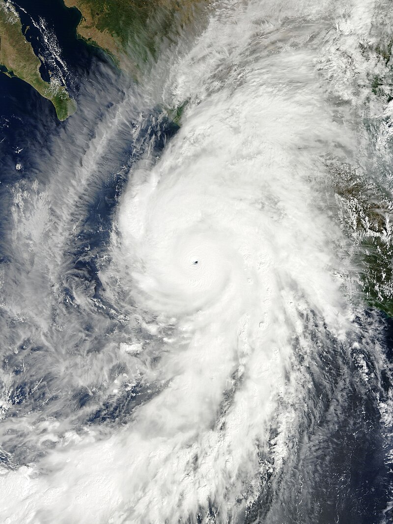
If Pamela does bomb out into a pinhole Cat 5 like Patricia, hopefully it’s at the perfect time for recon and increasing shear weakens Pamela before landfall.
2 likes
Irene '11 Sandy '12 Hermine '16 5/15/2018 Derecho Fay '20 Isaias '20 Elsa '21 Henri '21 Ida '21
I am only a meteorology enthusiast who knows a decent amount about tropical cyclones. Look to the professional mets, the NHC, or your local weather office for the best information.
I am only a meteorology enthusiast who knows a decent amount about tropical cyclones. Look to the professional mets, the NHC, or your local weather office for the best information.
-
zeehag
- Tropical Storm
- Posts: 172
- Age: 75
- Joined: Sun Jul 17, 2011 9:49 pm
- Location: mazatlan,sinaloa, mexico, fixing patricia's mess.
- Contact:
Re: EPAC: PAMELA - Tropical Storm
please keep convincing pammy baby to weaken before landfall. we donot want any more mayhem than necessary.
grateful for the track moving north a tad..hoping for a tad more.. get it away from us. i guess i am a semi magnet for epac letter P canes..hahaha
grateful for the track moving north a tad..hoping for a tad more.. get it away from us. i guess i am a semi magnet for epac letter P canes..hahaha
0 likes
-
cycloneye
- Admin
- Posts: 139201
- Age: 67
- Joined: Thu Oct 10, 2002 10:54 am
- Location: San Juan, Puerto Rico
Re: EPAC: PAMELA - Tropical Storm
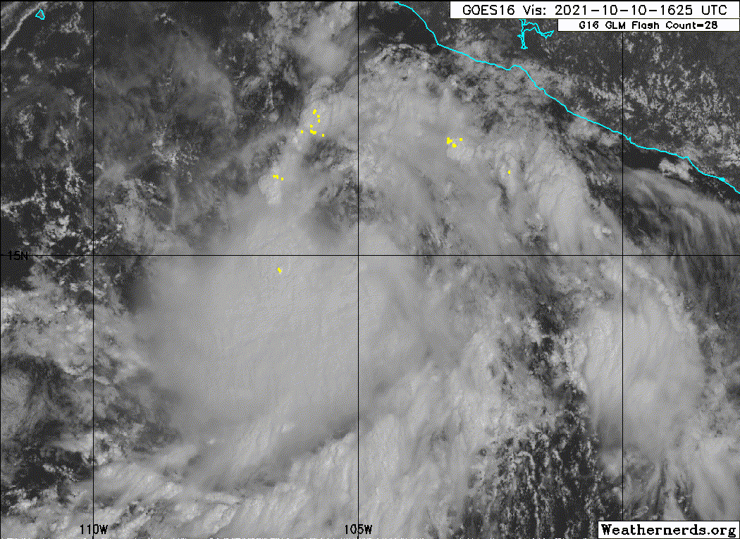
Tropical Storm Pamela Discussion Number 3
NWS National Hurricane Center Miami FL EP162021
400 PM CDT Sun Oct 10 2021
The cyclone has strengthened since last night, with deep convection
persisting over the system's low-level center for much of the
morning. Over the past few hours, there has been evidence of some
northeasterly shear impacting the cyclone, and the center has become
partially exposed. Despite this shear, a 1528 UTC scatterometer
overpass revealed an area of 35 to 38-kt winds in the northeastern
quadrant. Therefore, the depression has been upgraded to 40-kt
Tropical Storm Pamela.
Pamela is moving west-northwestward, or 290/13 kt to the south of a
strong mid-tropospheric ridge. A weakness is forecast to develop in
the ridge early this week as a mid- to upper-level trough digs
southward over the western United States and northern Mexico. The
cyclone is forecast to slow its forward motion and turn northwest,
and then north into this weakness late Monday through Tuesday.
By Tuesday night, Pamela should begin to get caught in the
southwesterly flow between the ridge and trough and turn
northeastward. The track model guidance continues to be in very
good agreement on this scenario and the latest NHC forecast track
is nearly unchanged from the previous one. Based on the forecast
track, the center of the cyclone should pass near or south of the
southern tip of the Baja California peninsula Tuesday night or
early Wednesday, then reach the coast of west-central mainland
Mexico by late Wednesday.
The current northeasterly wind shear is about 10-15 kt based on the
most recent UW-CIMMS analysis, and this is also recognized by both
the EC and GFS-SHIPS guidance. This magnitude of shear is forecast
to persist for the next 18-24 h before subsiding to under 10 kt by
36 h. Pamela will be passing over very warm waters near 30 C until
it reaches the coast of Mexico while embedded in a moist
atmospheric environment. Therefore, despite the shear, steady
strengthening is expected, and a faster rate of intensification is
possible after 36 h. The latest NHC intensity forecast is close to
the IVCN consensus solution, but is slightly below the HFIP
corrected consensus HCCA, which indicates that Pamela could become a
major hurricane prior to landfall along the coast of mainland
Mexico.
Key Messages:
1. Pamela is forecast to be at or near major hurricane intensity
when it reaches the coast of west-central mainland Mexico by late
Wednesday, and could bring life-threatening storm surge, flash
flooding, and dangerous winds to a portion of that area. Residents
in this area should monitor the progress of this system and ensure
they have their hurricane plan in place.
2. Pamela is expected to pass near or south of the southern tip of
the Baja California peninsula as a hurricane Tuesday night or
early Wednesday, and could bring strong winds and heavy rainfall to
the extreme southern portion of the peninsula. Watches could be
required for portions of this area tonight or early Monday.
FORECAST POSITIONS AND MAX WINDS
INIT 10/2100Z 15.5N 105.9W 40 KT 45 MPH
12H 11/0600Z 16.0N 107.4W 50 KT 60 MPH
24H 11/1800Z 16.9N 108.8W 60 KT 70 MPH
36H 12/0600Z 18.1N 109.7W 70 KT 80 MPH
48H 12/1800Z 19.6N 109.9W 80 KT 90 MPH
60H 13/0600Z 21.2N 109.3W 90 KT 105 MPH
72H 13/1800Z 23.3N 108.0W 95 KT 110 MPH
96H 14/1800Z 28.1N 103.1W 25 KT 30 MPH...POST-TROP/INLAND
120H 15/1800Z...DISSIPATED
$$
Forecaster Latto
0 likes
Visit the Caribbean-Central America Weather Thread where you can find at first post web cams,radars
and observations from Caribbean basin members Click Here
and observations from Caribbean basin members Click Here
Who is online
Users browsing this forum: No registered users and 32 guests