ATL: IAN - Post-Tropical - Discussion

Moderator: S2k Moderators

Message
Author
User avatar
skyline385
Category 5
Category 5
Posts: 2575
Age: 33
Joined: Wed Aug 26, 2020 11:15 pm
Location: Houston TX

Re: ATL: IAN - Tropical Storm - Discussion

#1201 Postby skyline385 » Sat Sep 24, 2022 10:08 pm

d3v123 wrote:So with NHC tracking even more west again this run, do we expect to keep that west trend/placement?


I posted an AOML verification in the models thread, basically all models miscalculated the new center location and its north of previous runs.

https://www.storm2k.org/phpbb2/viewtopi ... 2#p2995062
2 likes   

Chris_in_Tampa
Category 5
Category 5
Posts: 4963
Age: 41
Joined: Thu Jun 21, 2007 11:06 pm
Location: Tampa, Florida, USA
Contact:

Re: ATL: IAN - Tropical Storm - Discussion

#1202 Postby Chris_in_Tampa » Sat Sep 24, 2022 10:08 pm

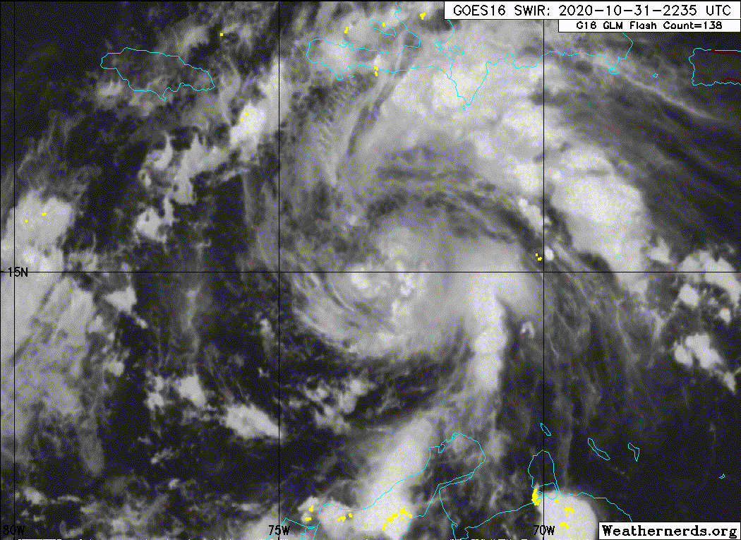
floridasun wrote:with stift to right you think cone cover south fl again down in miami dade or wait over night to see more stift to east over night

The NHC forecast cone is always the same during a particular year. It has set radii at each point. It doesn't reflect uncertainty for a current storm. They can't adjust it even if there were greater uncertainty earlier on.

Cone for Ian:
https://www.nhc.noaa.gov/refresh/graphi ... e#contents

See bottom of that page or here for info about the cone:
https://www.nhc.noaa.gov/aboutcone.shtml

If they were to move the cone to also include south Florida, the western Panhandle would be completely out of it. They need to reflect where the models are, combined with their expertise, on where it's going, making gradual shifts when possible. If an area moves out of the cone, it doesn't mean your safe.

Over past 5 years, two thirds of the time the center point of a storm would be inside the circles described in the links I provided. (They create a cone drawing a line around those circles at each forecast point) A third of the time, it wouldn't be. And that is the center point. The center point could be on the edge of the cone, within it, but effects could be felt hundreds of miles outside the cone, depending on the size of the storm, from that center point. So, approximately one third of the time on average the center point will be outside the cone. And again, doesn't consider impacts outside the cone. Unfortunately a lot of people don't really understand that, or emphasize that, even some meteorologists. It's great to be out of the cone, but it doesn't mean you need to stop paying attention. Things will change as they need to. So people always need to pay close attention.

They readjust the radii each year, using last 5 years of data each time.
8 likes   

User avatar
tropicwatch
Category 5
Category 5
Posts: 3205
Age: 60
Joined: Sat Jun 02, 2007 10:01 am
Location: Panama City Florida
Contact:

Re: ATL: IAN - Tropical Storm - Discussion

#1203 Postby tropicwatch » Sat Sep 24, 2022 10:09 pm

NHC doesn't usually put this kind of headline up unless they are very confident.
"IAN FORECAST TO BEGIN RAPIDLY INTENSIFYING AND BECOME A
HURRICANE ON SUNDAY... "
8 likes   
Tropicwatch


Agnes 72', Eloise 75, Elena 85', Kate 85', Charley 86', Florence 88', Beryl 94', Dean 95', Erin 95', Opal 95', Earl 98', Georges 98', Ivan 2004', Arlene 2005', Dennis 2005', Ida 2009' Debby 2012' Irma 2017' Michael 2018'

User avatar
Teban54
Category 5
Category 5
Posts: 1983
Joined: Sat May 19, 2018 1:19 pm

Re: ATL: IAN - Tropical Storm - Discussion

#1204 Postby Teban54 » Sat Sep 24, 2022 10:10 pm

Remember, the 5pm NHC forecast was already east of TVCN (which had a drastic west shift at that time). I think they didn't want to make a huge shift at 5pm, and they're just catching up at 11pm.

Also, while convection is a bit anemic now, I think it might just be a pulse down phase. IIRC, one of Eta or Iota (I can't remember which) was almost devoid of convection at one point.
5 likes   

User avatar
cheezyWXguy
Category 5
Category 5
Posts: 5566
Joined: Mon Feb 13, 2006 12:29 am
Location: Dallas, TX

Re: ATL: IAN - Tropical Storm - Discussion

#1205 Postby cheezyWXguy » Sat Sep 24, 2022 10:17 pm

Teban54 wrote:Remember, the 5pm NHC forecast was already east of TVCN (which had a drastic west shift at that time). I think they didn't want to make a huge shift at 5pm, and they're just catching up at 11pm.

Also, while convection is a bit anemic now, I think it might just be a pulse down phase. IIRC, one of Eta or Iota (I can't remember which) was almost devoid of convection at one point.

As wxman pointed out earlier nhc is likely to follow the tvcn as a safe bet, which I imagine holds even more true about n times of uncertainty like this. I have hunch the 0z models will start pushing back east, and if they do the nhc will adjust, but I really don’t want to bet on anything at this point. My personal unofficial view is that still that Sarasota to the big bend should be on high alert, but I’d much rather leave decisive statements to the people who do this for a living.
2 likes   

User avatar
birddogsc
Tropical Storm
Tropical Storm
Posts: 118
Joined: Tue Aug 25, 2015 2:09 pm

Re: ATL: IAN - Tropical Storm - Discussion

#1206 Postby birddogsc » Sat Sep 24, 2022 10:19 pm

NHC has IAN spinning down from a CAT3 to a CAT1 in less than 8 hours just before landfall? I would think the OHC would be high in that area, and the forward speed should be sufficient to not make upwelling an issue. Shear?
4 likes   

tolakram
Admin
Admin
Posts: 19182
Age: 60
Joined: Sun Aug 27, 2006 8:23 pm
Location: Florence, KY (name is Mark)

Re: ATL: IAN - Tropical Storm - Discussion

#1207 Postby tolakram » Sat Sep 24, 2022 10:20 pm

birddogsc wrote:NHC has IAN spinning down from a CAT3 to a CAT1 in less than 8 hours just before landfall? I would think the OHC would be high in that area, and the forward speed should be sufficient to not make upwelling an issue. Shear?


Basically travelling under the jet streak, so would probably uncouple pretty quickly.
3 likes   
M a r k
- - - - -
Join us in chat: Storm2K Chatroom Invite. Android and IOS apps also available.

The posts in this forum are NOT official forecasts and should not be used as such. Posts are NOT endorsed by any professional institution or STORM2K.org. For official information and forecasts, please refer to NHC and NWS products.

TallyTracker
Category 2
Category 2
Posts: 586
Joined: Thu Oct 11, 2018 2:46 pm

Re: ATL: IAN - Tropical Storm - Discussion

#1208 Postby TallyTracker » Sat Sep 24, 2022 10:27 pm

I’m starting to make my detailed evacuation plan now. lol Don’t want to be in Tallahassee for a hurricane. The tree damage could take weeks to restore power in some areas with a Cat 1/2 direct hit. Most of my family lives in the path so I’ll probably be taking a fall trip to MS or west TN if this path holds for another 36 hours.
4 likes   
Fran '96, Georges '98, Gordon '00, Gabrielle '01, Charley '04, Frances '04, Jeanne '04, Barry '07, Fay '08, Debby '12, Matthew '16, Emily '17, Irma '17, Michael ‘18, Elsa ‘21, Fred ‘21, Mindy ‘21, Nicole ‘22, Idalia ‘23

User avatar
skyline385
Category 5
Category 5
Posts: 2575
Age: 33
Joined: Wed Aug 26, 2020 11:15 pm
Location: Houston TX

Re: ATL: IAN - Tropical Storm - Discussion

#1209 Postby skyline385 » Sat Sep 24, 2022 10:27 pm

birddogsc wrote:NHC has IAN spinning down from a CAT3 to a CAT1 in less than 8 hours just before landfall? I would think the OHC would be high in that area, and the forward speed should be sufficient to not make upwelling an issue. Shear?


Yes 30-40 kts of shear along with the front eroding it combined with dry air getting into the core from the west

Image
2 likes   

User avatar
birddogsc
Tropical Storm
Tropical Storm
Posts: 118
Joined: Tue Aug 25, 2015 2:09 pm

Re: ATL: IAN - Tropical Storm - Discussion

#1210 Postby birddogsc » Sat Sep 24, 2022 10:30 pm

tolakram wrote:
birddogsc wrote:NHC has IAN spinning down from a CAT3 to a CAT1 in less than 8 hours just before landfall? I would think the OHC would be high in that area, and the forward speed should be sufficient to not make upwelling an issue. Shear?


Basically travelling under the jet streak, so would probably uncouple pretty quickly.


So, the streamlines are showing the jet streak here, but the GFS is not modeling the separation of the centers?
Image
1 likes   

BobHarlem
Category 5
Category 5
Posts: 1668
Joined: Thu Oct 20, 2005 6:11 pm

Re: ATL: IAN - Tropical Storm - Discussion

#1211 Postby BobHarlem » Sat Sep 24, 2022 10:30 pm

Really think the NHC went conservative (on track, not intensity), there's a lot of new recon data going into the 0z global runs tonight, and they just went with straight TVCN. If the models shift right, so will the consensus. (And left if they go that way) They didn't elaborate (no stewart style discussions) but they did mention the model split.
Last edited by BobHarlem on Sat Sep 24, 2022 10:31 pm, edited 1 time in total.
1 likes   

User avatar
chaser1
S2K Supporter
S2K Supporter
Posts: 4751
Age: 63
Joined: Sat Oct 15, 2005 5:59 pm
Location: Longwood, Fl

Re: ATL: IAN - Tropical Storm - Discussion

#1212 Postby chaser1 » Sat Sep 24, 2022 10:30 pm

tropicwatch wrote:NHC doesn't usually put this kind of headline up unless they are very confident.
"IAN FORECAST TO BEGIN RAPIDLY INTENSIFYING AND BECOME A
HURRICANE ON SUNDAY... "


You're right. It's a pretty bold statement.
1 likes   
Personal Forecast Disclaimer:
The posts in this forum are NOT official forecast and should not be used as such. They are just the opinion of the poster and may or may not be backed by sound meteorological data. They are NOT endorsed by any professional institution or storm2k.org. For official information, please refer to the NHC and NWS products.


StAuggy
Tropical Storm
Tropical Storm
Posts: 119
Age: 44
Joined: Sat Sep 14, 2019 10:48 am
Location: St Augustine

Re: ATL: IAN - Tropical Storm - Discussion

#1213 Postby StAuggy » Sat Sep 24, 2022 10:32 pm

skyline385 wrote:
birddogsc wrote:NHC has IAN spinning down from a CAT3 to a CAT1 in less than 8 hours just before landfall? I would think the OHC would be high in that area, and the forward speed should be sufficient to not make upwelling an issue. Shear?


Yes 30-40 kts of shear along with the front eroding it combined with dry air getting into the core from the west


https://i.imgur.com/ldvcqqE.png


The right turn into the peninsula could negate those effects to a degree so don’t bank on a substantial weakening at landfall unless it heads way north
Last edited by StAuggy on Sat Sep 24, 2022 10:34 pm, edited 1 time in total.
1 likes   

User avatar
Teban54
Category 5
Category 5
Posts: 1983
Joined: Sat May 19, 2018 1:19 pm

Re: ATL: IAN - Tropical Storm - Discussion

#1214 Postby Teban54 » Sat Sep 24, 2022 10:32 pm

Teban54 wrote:Remember, the 5pm NHC forecast was already east of TVCN (which had a drastic west shift at that time). I think they didn't want to make a huge shift at 5pm, and they're just catching up at 11pm.

Also, while convection is a bit anemic now, I think it might just be a pulse down phase. IIRC, one of Eta or Iota (I can't remember which) was almost devoid of convection at one point.

This is the closest I can find. Here is Eta about half an hour before it was named:
Image
16 hours later, it was at 50 kts with a developing eyewall. It reached the (official) peak intensity of 130 kts another 30 hours later.

Ian's current appearance for comparison:
Image
14 likes   

User avatar
sweetpea
S2K Supporter
S2K Supporter
Posts: 841
Age: 56
Joined: Fri Jun 10, 2005 5:49 pm
Location: Sopchoppy, FL

Re: ATL: IAN - Tropical Storm - Discussion

#1215 Postby sweetpea » Sat Sep 24, 2022 10:41 pm

TallyTracker wrote:I’m starting to make my detailed evacuation plan now. lol Don’t want to be in Tallahassee for a hurricane. The tree damage could take weeks to restore power in some areas with a Cat 1/2 direct hit. Most of my family lives in the path so I’ll probably be taking a fall trip to MS or west TN if this path holds for another 36 hours.

We are sitting here down in Sopchoppy deciding what to do. We are about 3.5 miles as the crow flies from the gulf. Think we will decide tomorrow afternoon. Be safe.
2 likes   

Hurricane Mike
Category 2
Category 2
Posts: 562
Joined: Tue Apr 10, 2018 7:44 am

Re: ATL: IAN - Tropical Storm - Discussion

#1216 Postby Hurricane Mike » Sat Sep 24, 2022 10:52 pm

Here's a midnight update on Ian for the night owls
https://www.youtube.com/watch?v=T-O3CCq0hW8
3 likes   

LARanger
Tropical Depression
Tropical Depression
Posts: 82
Joined: Wed Oct 07, 2020 12:45 pm

Re: ATL: INVEST 98L - Discussion

#1217 Postby LARanger » Sat Sep 24, 2022 10:53 pm

Craters wrote:
LARanger wrote:
Keldeo1997 wrote:I know some people on here like their Hebert box's :cheesy:


New one on me, and I'm iffy on whether it's "a thing", but now I want to see something similar for Louisiana.


Ask and you shall receive, LARanger:

[url]https://i.ibb.co/ryRX7gF/Cajun-boxes.jpg [/url]


2020 Hurricane Season, is that you?
5 likes   
Baton Rouge area cyclone dilettante, PSWAGGER* tropical weather & hydrology model developer
(* Pseudo-Scientific Wild-A** Guesses Generally Expressed Ridiculously)
The GFDL would've had all this figured out by now.

Patrick99
Category 5
Category 5
Posts: 1761
Joined: Mon May 24, 2004 3:43 pm
Location: Miami, FL

Re: ATL: IAN - Tropical Storm - Discussion

#1218 Postby Patrick99 » Sat Sep 24, 2022 11:07 pm

Wow it looks like convection is really eroding. Regardless of track....this has some work to do. What's happening? Could it be dry air?
2 likes   

NFLnut
Category 2
Category 2
Posts: 537
Joined: Sun Aug 29, 2004 7:37 pm

Re: ATL: IAN - Tropical Storm - Discussion

#1219 Postby NFLnut » Sat Sep 24, 2022 11:08 pm

tropicwatch wrote:NHC doesn't usually put this kind of headline up unless they are very confident.
"IAN FORECAST TO BEGIN RAPIDLY INTENSIFYING AND BECOME A
HURRICANE ON SUNDAY... "


Well .. they're forecasting 130mph in 60 hours and 140 in 72 so it's gotta start intensifying pretty soon to keep with that.
2 likes   

User avatar
ScottNAtlanta
Category 5
Category 5
Posts: 2014
Joined: Sat May 25, 2013 3:11 pm
Location: Atlanta, GA

Re: ATL: IAN - Tropical Storm - Discussion

#1220 Postby ScottNAtlanta » Sat Sep 24, 2022 11:21 pm

Well, recon is there, but they are not finding a center where it is supposed to be. It is farther south (what they have covered thus far) and not exactly a wind shift either. I'm pretty sure it isn't stacked yet. They aren't reporting surface pressures either so it is kind of hard to tell.
3 likes   
The posts in this forum are NOT official forecast and should not be used as such. They are just the opinion of the poster and may or may not be backed by sound meteorological data. They are NOT endorsed by any professional institution or storm2k.org. For official information, please refer to the NHC and NWS products.


Return to “2022”

Who is online

Users browsing this forum: No registered users and 9 guests