ATL: NICOLE - Models

Moderator: S2k Moderators

Message
Author
jlauderdal
S2K Supporter
S2K Supporter
Posts: 7182
Joined: Wed May 19, 2004 5:46 am
Location: NE Fort Lauderdale
Contact:

Re: ATL: NICOLE - Models

#161 Postby jlauderdal » Mon Nov 07, 2022 9:08 am

NDG wrote:Good shift to south by the 12z early models, including the TVCN consensus, I would expect a shift south by the NHC's track.
UKMET is keeping the TVCN from being even further south towards Palm Beach County.

https://i.imgur.com/Ww86RpY.gif

Not surprising tvcn came south based on our friend the GFS. Gonna have to include myself now for landfall...Hollywood to Melbourne, significant shift south as Stuart was on my southerly point earlier
1 likes   

tolakram
Admin
Admin
Posts: 20009
Age: 62
Joined: Sun Aug 27, 2006 8:23 pm
Location: Florence, KY (name is Mark)

Re: ATL: NICOLE - Models

#162 Postby tolakram » Mon Nov 07, 2022 10:10 am

cane5 wrote:Just curious for our experts please describe what the models 48 hours from potential landfall in general got it right with Ian ? There seemed to be a consensus that was all Tampa and I think was underplaying storm winds. All accept the ICON got it right as far as landfall don’t remember what it predicted in storm winds. But it was a complete miss at 48 hours including the NHC !


Please do not follow any single model, they all have their strengths and weaknesses and will vary wildly based on upper level conditions. In the case of Ian the forecast was initially pulled to far north due to the GFS insisting on a more northerly track. Model watchers noted the GFS was an outlier. In this case the GFS is furthest south at the moment, but the models are generally close with variance in the windfield size. If the GFS gets it right this time I don't think we all will start following everything the GFS indicates.
4 likes   
M a r k
- - - - -
Join us in chat: Storm2K Chatroom Invite. Android and IOS apps also available.

The posts in this forum are NOT official forecasts and should not be used as such. Posts are NOT endorsed by any professional institution or STORM2K.org. For official information and forecasts, please refer to NHC and NWS products.

BobHarlem
Category 5
Category 5
Posts: 2102
Joined: Thu Oct 20, 2005 6:11 pm

Re: ATL: NICOLE - Models

#163 Postby BobHarlem » Mon Nov 07, 2022 10:31 am

12z icon is landfall in Palm Bay cat 1 then briefly gets into the Gulf. Please do not latch on to the Icon (or any model really) it's more for the trends.
3 likes   

tolakram
Admin
Admin
Posts: 20009
Age: 62
Joined: Sun Aug 27, 2006 8:23 pm
Location: Florence, KY (name is Mark)

Re: ATL: NICOLE - Models

#164 Postby tolakram » Mon Nov 07, 2022 10:38 am

ICON missing some frames on tidbits but looks to be a bit stronger.

Image
1 likes   
M a r k
- - - - -
Join us in chat: Storm2K Chatroom Invite. Android and IOS apps also available.

The posts in this forum are NOT official forecasts and should not be used as such. Posts are NOT endorsed by any professional institution or STORM2K.org. For official information and forecasts, please refer to NHC and NWS products.

tolakram
Admin
Admin
Posts: 20009
Age: 62
Joined: Sun Aug 27, 2006 8:23 pm
Location: Florence, KY (name is Mark)

Re: ATL: NICOLE - Models

#165 Postby tolakram » Mon Nov 07, 2022 10:39 am

Image
1 likes   
M a r k
- - - - -
Join us in chat: Storm2K Chatroom Invite. Android and IOS apps also available.

The posts in this forum are NOT official forecasts and should not be used as such. Posts are NOT endorsed by any professional institution or STORM2K.org. For official information and forecasts, please refer to NHC and NWS products.

User avatar
AdamFirst
S2K Supporter
S2K Supporter
Posts: 2491
Age: 36
Joined: Thu Aug 14, 2008 10:54 am
Location: Port Saint Lucie, FL

Re: ATL: NICOLE - Models

#166 Postby AdamFirst » Mon Nov 07, 2022 10:43 am

12z ICON landfalls on the St Lucie-Indian River County line, pretty much same as last run. Stronger at landfall, though.
3 likes   
Dolphins Marlins Canes Golden Panthers HEAT
Andrew 1992 - Irene 1999 - Frances 2004 - Jeanne 2004 - Wilma 2005 - Fay 2008 - Isaac 2012 - Matthew 2016 - Irma 2017 - Dorian 2019 - Ian 2022 - Nicole 2022 - Milton 2024

tolakram
Admin
Admin
Posts: 20009
Age: 62
Joined: Sun Aug 27, 2006 8:23 pm
Location: Florence, KY (name is Mark)

Re: ATL: NICOLE - Models

#167 Postby tolakram » Mon Nov 07, 2022 10:51 am

12Z ICON landfall
Image
1 likes   
M a r k
- - - - -
Join us in chat: Storm2K Chatroom Invite. Android and IOS apps also available.

The posts in this forum are NOT official forecasts and should not be used as such. Posts are NOT endorsed by any professional institution or STORM2K.org. For official information and forecasts, please refer to NHC and NWS products.

tolakram
Admin
Admin
Posts: 20009
Age: 62
Joined: Sun Aug 27, 2006 8:23 pm
Location: Florence, KY (name is Mark)

Re: ATL: NICOLE - Models

#168 Postby tolakram » Mon Nov 07, 2022 10:55 am

12Z GFS
Image
1 likes   
M a r k
- - - - -
Join us in chat: Storm2K Chatroom Invite. Android and IOS apps also available.

The posts in this forum are NOT official forecasts and should not be used as such. Posts are NOT endorsed by any professional institution or STORM2K.org. For official information and forecasts, please refer to NHC and NWS products.

User avatar
AdamFirst
S2K Supporter
S2K Supporter
Posts: 2491
Age: 36
Joined: Thu Aug 14, 2008 10:54 am
Location: Port Saint Lucie, FL

Re: ATL: NICOLE - Models

#169 Postby AdamFirst » Mon Nov 07, 2022 11:10 am

12z GEM (Canadian) into Indian River-Brevard County line.
1 likes   
Dolphins Marlins Canes Golden Panthers HEAT
Andrew 1992 - Irene 1999 - Frances 2004 - Jeanne 2004 - Wilma 2005 - Fay 2008 - Isaac 2012 - Matthew 2016 - Irma 2017 - Dorian 2019 - Ian 2022 - Nicole 2022 - Milton 2024

User avatar
SFLcane
S2K Supporter
S2K Supporter
Posts: 10163
Age: 47
Joined: Sat Jun 05, 2010 1:44 pm
Location: Lake Worth Florida

Re: ATL: NICOLE - Models

#170 Postby SFLcane » Mon Nov 07, 2022 11:16 am

4 likes   

User avatar
Hypercane_Kyle
Category 5
Category 5
Posts: 3352
Joined: Sat Mar 07, 2015 7:58 pm
Location: Cape Canaveral, FL

Re: ATL: NICOLE - Models

#171 Postby Hypercane_Kyle » Mon Nov 07, 2022 11:18 am

For those wondering, the 16.3 is what's going to replace the current version of the GFS.
7 likes   
My posts are my own personal opinion, defer to the National Hurricane Center (NHC) and other NOAA products for decision making during hurricane season.

LarryWx
S2K Supporter
S2K Supporter
Posts: 6301
Joined: Sun Sep 07, 2003 2:04 pm
Location: GA

Re: ATL: NICOLE - Models

#172 Postby LarryWx » Mon Nov 07, 2022 11:21 am

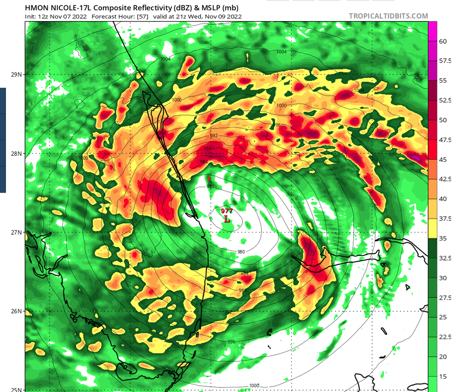
12Z UKMET: landfall near/just south of Cape Canaveral, which is similar to its prior run and 100+ miles north of Euro, GFS, and JMA but is similar to CMC and just north of ICON (interesting battle between Euro/GFS/JMA and UKMET/ICON/CMC) (Euro 12Z not out yet)


MET OFFICE TROPICAL CYCLONE GUIDANCE FOR NORTH-EAST PACIFIC AND ATLANTIC

GLOBAL MODEL DATA TIME 1200UTC 07.11.2022

TROPICAL STORM NICOLE ANALYSED POSITION : 26.3N 69.1W

ATCF IDENTIFIER : AL172022

LEAD CENTRAL MAXIMUM WIND
VERIFYING TIME TIME POSITION PRESSURE (MB) SPEED (KNOTS)
-------------- ---- -------- ------------- -------------
1200UTC 07.11.2022 0 26.3N 69.1W 1004 37
0000UTC 08.11.2022 12 26.9N 70.8W 1002 33
1200UTC 08.11.2022 24 27.6N 72.0W 1001 36
0000UTC 09.11.2022 36 27.4N 74.6W 1000 45
1200UTC 09.11.2022 48 27.0N 76.2W 998 42
0000UTC 10.11.2022 60 27.0N 78.5W 997 45
1200UTC 10.11.2022 72 28.4N 81.1W 996 38
0000UTC 11.11.2022 84 29.2N 83.2W 997 31
1200UTC 11.11.2022 96 30.8N 83.3W 1001 29
0000UTC 12.11.2022 108 34.8N 80.3W 1000 33
1200UTC 12.11.2022 120 40.2N 73.5W 992 46
0000UTC 13.11.2022 132 48.7N 64.6W 983 41
1200UTC 13.11.2022 144 CEASED TRACKING
2 likes   
Personal Forecast Disclaimer:
The posts in this forum are NOT official forecasts and should not be used as such. They are just the opinion of the poster and may or may not be backed by sound meteorological data. They are NOT endorsed by any professional institution or storm2k.org. For official information, please refer to the NHC and NWS products.

cane5
Category 1
Category 1
Posts: 252
Joined: Fri Jul 02, 2021 4:24 pm

Re: ATL: NICOLE - Models

#173 Postby cane5 » Mon Nov 07, 2022 11:40 am

tolakram wrote:
cane5 wrote:Just curious for our experts please describe what the models 48 hours from potential landfall in general got it right with Ian ? There seemed to be a consensus that was all Tampa and I think was underplaying storm winds. All accept the ICON got it right as far as landfall don’t remember what it predicted in storm winds. But it was a complete miss at 48 hours including the NHC !


Please do not follow any single model, they all have their strengths and weaknesses and will vary wildly based on upper level conditions. In the case of Ian the forecast was initially pulled to far north due to the GFS insisting on a more northerly track. Model watchers noted the GFS was an outlier. In this case the GFS is furthest south at the moment, but the models are generally close with variance in the windfield size. If the GFS gets it right this time I don't think we all will start following everything the GFS indicates.


Cool thanks Tolka
1 likes   

User avatar
NDG
S2K Supporter
S2K Supporter
Posts: 15446
Joined: Sun Jul 09, 2006 10:14 pm
Location: Orlando, FL

Re: ATL: NICOLE - Models

#174 Postby NDG » Mon Nov 07, 2022 11:49 am

At least we are seeing better consensus from the latest global models.

Image
3 likes   

User avatar
Spacecoast
Category 2
Category 2
Posts: 758
Joined: Thu Aug 31, 2017 2:03 pm

Re: ATL: NICOLE - Models

#175 Postby Spacecoast » Mon Nov 07, 2022 11:54 am

12z GEFS...
Image
Image
3 likes   

LarryWx
S2K Supporter
S2K Supporter
Posts: 6301
Joined: Sun Sep 07, 2003 2:04 pm
Location: GA

Re: ATL: NICOLE - Models

#176 Postby LarryWx » Mon Nov 07, 2022 11:54 am

I think the 12Z UKMET track is probably too far north. Why? Because it initialized at 26.3 N, 69.1 W. The NHC actual position for then was 25.9 N, 69.1 W. This means Nicole was initialized by the 12Z UKMET ~30 miles too far north.
6 likes   
Personal Forecast Disclaimer:
The posts in this forum are NOT official forecasts and should not be used as such. They are just the opinion of the poster and may or may not be backed by sound meteorological data. They are NOT endorsed by any professional institution or storm2k.org. For official information, please refer to the NHC and NWS products.

JPmia
S2K Supporter
S2K Supporter
Posts: 1070
Joined: Thu Jun 03, 2004 11:01 pm
Location: Fort Lauderdale, FL

Re: ATL: NICOLE - Models

#177 Postby JPmia » Mon Nov 07, 2022 12:06 pm

Hypercane_Kyle wrote:For those wondering, the 16.3 is what's going to replace the current version of the GFS.


Is there a link for the 16.3 GFS version?
1 likes   

User avatar
DESTRUCTION5
Category 5
Category 5
Posts: 4423
Age: 43
Joined: Wed Sep 03, 2003 11:25 am
Location: Stuart, FL

Re: ATL: NICOLE - Models

#178 Postby DESTRUCTION5 » Mon Nov 07, 2022 12:07 pm

12z HWRF coming in much stronger thru 40 hrs
2 likes   
GATOR NATION IS E V E R Y W H E R E !

User avatar
Canelaw99
S2K Supporter
S2K Supporter
Posts: 2127
Age: 48
Joined: Tue Aug 31, 2004 8:27 am
Location: Homestead, FL

Re: ATL: NICOLE - Models

#179 Postby Canelaw99 » Mon Nov 07, 2022 12:10 pm

3 likes   
Always heed the advice of the NHC, NOAA, local weather officials, etc. rather than my completely amateur S FL opinion :sun:

User avatar
SFLcane
S2K Supporter
S2K Supporter
Posts: 10163
Age: 47
Joined: Sat Jun 05, 2010 1:44 pm
Location: Lake Worth Florida

Re: ATL: NICOLE - Models

#180 Postby SFLcane » Mon Nov 07, 2022 12:22 pm

Woah... huge

Image
3 likes   


Return to “2022”

Who is online

Users browsing this forum: No registered users and 3 guests