ATL: ALEX - Post-Tropical

Moderator: S2k Moderators

Message
Author
JPmia
S2K Supporter
S2K Supporter
Posts: 1070
Joined: Thu Jun 03, 2004 11:01 pm
Location: Fort Lauderdale, FL

Re: ATL: INVEST 91L - Discussion

#21 Postby JPmia » Wed Jun 01, 2022 9:57 am

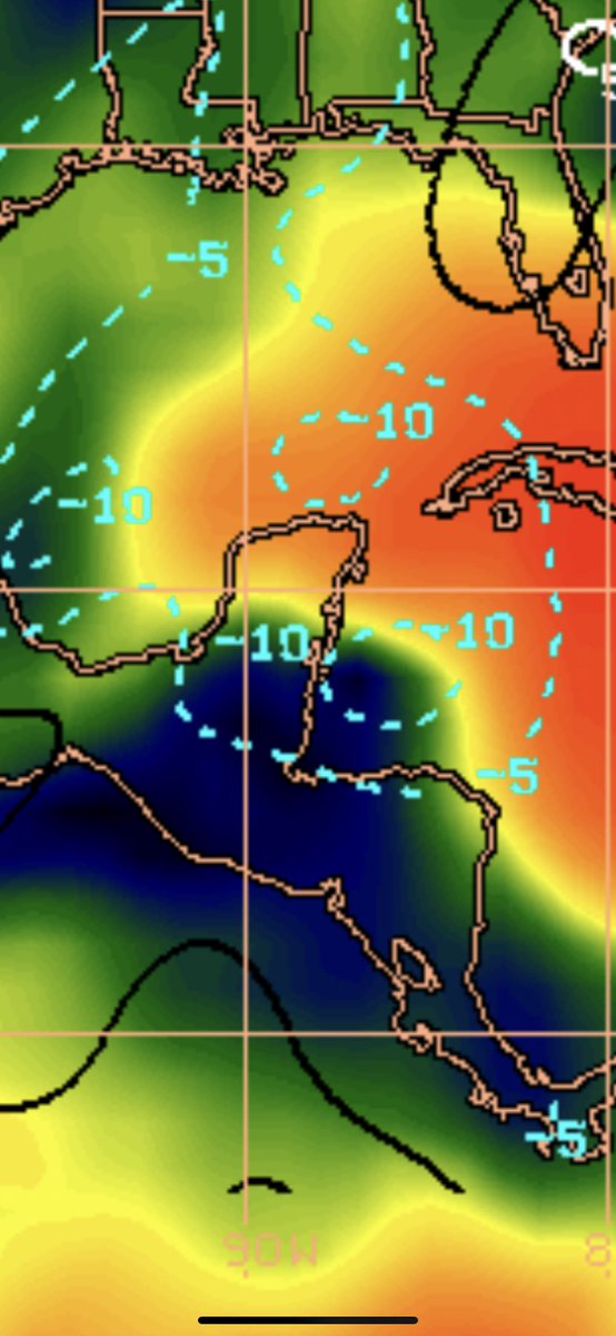
wxman57 wrote:I still think that the EC is too far north. The place to watch is the NW Caribbean, not the eastern BoC. Low tracks across the southern FL Peninsula on Saturday, with all squalls well to the east of the center. Recon will likely find 35-40 kt winds in a small area of squalls well east of the center, and the NHC will call it Alex on Friday. Southern Florida is in somewhat of a drought, so the rain may be welcomed. I don't think there will be any land observations of TS sustained wind, just gusts in passing squalls.


Sounds like Tropical Storm and/or PTC watches may be needed for southern Florida then.
0 likes   

AutoPenalti
Category 5
Category 5
Posts: 3950
Age: 27
Joined: Mon Aug 17, 2015 4:16 pm
Location: Ft. Lauderdale, Florida

Re: ATL: INVEST 91L - Discussion

#22 Postby AutoPenalti » Wed Jun 01, 2022 10:12 am

IMO this may be a little bit harder for models to track than what people realize, looks like it's trying to consolidate east of the Yucatan, and it seems to be doing it rather quicker than models have it. Shear is also decreasing in the area.
4 likes   
The posts in this forum are NOT official forecasts and should not be used as such. They are just the opinion of the poster and may or may not be backed by sound meteorological data. They are NOT endorsed by any professional institution or STORM2K. For official information, please refer to products from the NHC and NWS.


Model Runs Cheat Sheet:
GFS (5:30 AM/PM, 11:30 AM/PM)
HWRF, GFDL, UKMET, NAVGEM (6:30-8:00 AM/PM, 12:30-2:00 AM/PM)
ECMWF (1:45 AM/PM)

TCVN
is a weighted averaged

User avatar
cycloneye
Admin
Admin
Posts: 139493
Age: 67
Joined: Thu Oct 10, 2002 10:54 am
Location: San Juan, Puerto Rico

Re: ATL: INVEST 91L - Discussion

#23 Postby cycloneye » Wed Jun 01, 2022 10:16 am

Increasing vorticity east of Yucatán.

Image
1 likes   
Visit the Caribbean-Central America Weather Thread where you can find at first post web cams,radars
and observations from Caribbean basin members Click Here

AutoPenalti
Category 5
Category 5
Posts: 3950
Age: 27
Joined: Mon Aug 17, 2015 4:16 pm
Location: Ft. Lauderdale, Florida

Re: ATL: INVEST 91L - Discussion

#24 Postby AutoPenalti » Wed Jun 01, 2022 10:20 am

Image
0 likes   
The posts in this forum are NOT official forecasts and should not be used as such. They are just the opinion of the poster and may or may not be backed by sound meteorological data. They are NOT endorsed by any professional institution or STORM2K. For official information, please refer to products from the NHC and NWS.


Model Runs Cheat Sheet:
GFS (5:30 AM/PM, 11:30 AM/PM)
HWRF, GFDL, UKMET, NAVGEM (6:30-8:00 AM/PM, 12:30-2:00 AM/PM)
ECMWF (1:45 AM/PM)

TCVN
is a weighted averaged

User avatar
skyline385
Category 5
Category 5
Posts: 2520
Age: 33
Joined: Wed Aug 26, 2020 11:15 pm
Location: Houston TX

Re: ATL: INVEST 91L - Discussion

#25 Postby skyline385 » Wed Jun 01, 2022 10:24 am

It's down to 925mb as well, there is also a very distinct increase in it over the last 3 hours.

https://tropic.ssec.wisc.edu/real-time/ ... oom=&time=
0 likes   

Sciencerocks
Category 5
Category 5
Posts: 7294
Age: 38
Joined: Thu Jul 06, 2017 1:51 am

Re: ATL: INVEST 91L - Discussion

#26 Postby Sciencerocks » Wed Jun 01, 2022 10:26 am

Image
1 likes   

AutoPenalti
Category 5
Category 5
Posts: 3950
Age: 27
Joined: Mon Aug 17, 2015 4:16 pm
Location: Ft. Lauderdale, Florida

Re: ATL: INVEST 91L - Discussion

#27 Postby AutoPenalti » Wed Jun 01, 2022 10:39 am

Anti-cyclone will be displaced to the east.
1 likes   
The posts in this forum are NOT official forecasts and should not be used as such. They are just the opinion of the poster and may or may not be backed by sound meteorological data. They are NOT endorsed by any professional institution or STORM2K. For official information, please refer to products from the NHC and NWS.


Model Runs Cheat Sheet:
GFS (5:30 AM/PM, 11:30 AM/PM)
HWRF, GFDL, UKMET, NAVGEM (6:30-8:00 AM/PM, 12:30-2:00 AM/PM)
ECMWF (1:45 AM/PM)

TCVN
is a weighted averaged

ChrisH-UK
Category 1
Category 1
Posts: 427
Joined: Sat May 29, 2021 8:22 am

Re: ATL: INVEST 91L - Discussion

#28 Postby ChrisH-UK » Wed Jun 01, 2022 10:44 am

Belize and Cancun Radar loops. Looks a bit messy but shows some rotation in it.


1 likes   

User avatar
MGC
S2K Supporter
S2K Supporter
Posts: 5795
Joined: Sun Mar 23, 2003 9:05 pm
Location: Pass Christian MS, or what is left.

Re: ATL: INVEST 91L - Discussion

#29 Postby MGC » Wed Jun 01, 2022 11:08 am

CCW rotation becoming evident in visible satellite loop this morning. Looks like an ULL is spinning up over the BOC also. Odds increasing for a TC to form, thinking a TD next 24-36 hours IMO....MGC
0 likes   

User avatar
DESTRUCTION5
Category 5
Category 5
Posts: 4391
Age: 42
Joined: Wed Sep 03, 2003 11:25 am
Location: Stuart, FL

Re: ATL: INVEST 91L - Discussion

#30 Postby DESTRUCTION5 » Wed Jun 01, 2022 11:49 am

12z GFS is darn near locked in with the euro now with a path across South Central FL.
0 likes   
GATOR NATION IS E V E R Y W H E R E !

zzh
Category 1
Category 1
Posts: 375
Joined: Fri Aug 27, 2021 2:18 pm

Re: ATL: INVEST 91L - Discussion

#31 Postby zzh » Wed Jun 01, 2022 12:10 pm

Image
0 likes   

User avatar
NDG
S2K Supporter
S2K Supporter
Posts: 14934
Joined: Sun Jul 09, 2006 10:14 pm
Location: Orlando, FL

Re: ATL: INVEST 91L - Discussion

#32 Postby NDG » Wed Jun 01, 2022 12:16 pm


Yep, clearly seen on vis satellite that the vorticity east of the YP is not quite yet at the surface and surface circulation remains elongated.
0 likes   

User avatar
Hypercane_Kyle
Category 5
Category 5
Posts: 2900
Joined: Sat Mar 07, 2015 7:58 pm
Location: Cape Canaveral, FL

Re: ATL: INVEST 91L - Discussion

#33 Postby Hypercane_Kyle » Wed Jun 01, 2022 12:17 pm

Very, very broad LLC. Most of the rotation is in the mid-levels.
0 likes   
My posts are my own personal opinion, defer to the National Hurricane Center (NHC) and other NOAA products for decision making during hurricane season.

User avatar
SFLcane
S2K Supporter
S2K Supporter
Posts: 9620
Age: 46
Joined: Sat Jun 05, 2010 1:44 pm
Location: Lake Worth Florida

Re: ATL: INVEST 91L - Discussion

#34 Postby SFLcane » Wed Jun 01, 2022 12:35 pm


Getting close!
0 likes   

User avatar
cycloneye
Admin
Admin
Posts: 139493
Age: 67
Joined: Thu Oct 10, 2002 10:54 am
Location: San Juan, Puerto Rico

Re: ATL: INVEST 91L - Discussion

#35 Postby cycloneye » Wed Jun 01, 2022 12:38 pm


Near the Yucatan Peninsula and Southeastern Gulf of Mexico:
A broad area of low pressure located near the east coast of the
Yucatan Peninsula is producing a large area of disorganized
showers and thunderstorms over the northwestern Caribbean Sea
and Yucatan Peninsula. Despite strong upper-level winds, gradual
development is forecast and this system is likely to become a
tropical depression while it moves slowly northeastward over the
northwestern Caribbean Sea and southeastern Gulf of Mexico during
the next day or two. Regardless of development, locally heavy
rainfall is likely across portions of the Yucatan Peninsula during
the next day or so, spreading across western Cuba, South Florida,
and the Florida Keys on Friday and Saturday. Interests in the
Yucatan Peninsula, western Cuba, the Florida Keys, and the Florida
Peninsula should monitor the progress of this system.
* Formation chance through 48 hours...high...70 percent.
* Formation chance through 5 days...high...80 percent.
0 likes   
Visit the Caribbean-Central America Weather Thread where you can find at first post web cams,radars
and observations from Caribbean basin members Click Here

User avatar
ScottNAtlanta
Category 5
Category 5
Posts: 2009
Joined: Sat May 25, 2013 3:11 pm
Location: Atlanta, GA

Re: ATL: INVEST 91L - Discussion

#36 Postby ScottNAtlanta » Wed Jun 01, 2022 12:43 pm

It is looking like that vorticity center is trying to tuck under the convection east of it on visible satellite.
0 likes   
The posts in this forum are NOT official forecast and should not be used as such. They are just the opinion of the poster and may or may not be backed by sound meteorological data. They are NOT endorsed by any professional institution or storm2k.org. For official information, please refer to the NHC and NWS products.

User avatar
NDG
S2K Supporter
S2K Supporter
Posts: 14934
Joined: Sun Jul 09, 2006 10:14 pm
Location: Orlando, FL

Re: ATL: INVEST 91L - Discussion

#37 Postby NDG » Wed Jun 01, 2022 12:52 pm

Buoy 42056 east of YP reporting pressure down to 1009mb, down 3 mb from 24 hrs ago.


Jun 1, 12:50 pm 79 73 82 ESE 27G36 1009.00
0 likes   

Sciencerocks
Category 5
Category 5
Posts: 7294
Age: 38
Joined: Thu Jul 06, 2017 1:51 am

Re: ATL: INVEST 91L - Discussion

#38 Postby Sciencerocks » Wed Jun 01, 2022 12:55 pm

Getting better organized.
Image
1 likes   

Jelmergraaff
Tropical Storm
Tropical Storm
Posts: 127
Age: 21
Joined: Fri Aug 27, 2021 1:00 pm
Location: The Netherlands

Re: ATL: INVEST 91L - Discussion

#39 Postby Jelmergraaff » Wed Jun 01, 2022 1:06 pm

Sciencerocks wrote:Getting better organized.
https://imagizer.imageshack.com/img921/8559/oe4Lbv.gif


I'm noticing two things. For one, it does indeed seem to organise pretty well, at least, better than some models are showing. ECMWF (06z) is for example not really showing any distinct LLC for the coming 24 - 30 hours. The second thing is a movement of the center of convection - which is currently over water - to the NNW. This could indicate a developement like GFS (12z) is showing, where a closed-off system moves right through between Cuba and Cancun.
0 likes   
20-year old meteorologist from The Netherlands. Interested in all fields of meteorology, including tropical systems like hurricanes.

AutoPenalti
Category 5
Category 5
Posts: 3950
Age: 27
Joined: Mon Aug 17, 2015 4:16 pm
Location: Ft. Lauderdale, Florida

Re: ATL: INVEST 91L - Discussion

#40 Postby AutoPenalti » Wed Jun 01, 2022 1:18 pm

Every hour just appears to be better organized.
2 likes   
The posts in this forum are NOT official forecasts and should not be used as such. They are just the opinion of the poster and may or may not be backed by sound meteorological data. They are NOT endorsed by any professional institution or STORM2K. For official information, please refer to products from the NHC and NWS.


Model Runs Cheat Sheet:
GFS (5:30 AM/PM, 11:30 AM/PM)
HWRF, GFDL, UKMET, NAVGEM (6:30-8:00 AM/PM, 12:30-2:00 AM/PM)
ECMWF (1:45 AM/PM)

TCVN
is a weighted averaged


Return to “2022”

Who is online

Users browsing this forum: No registered users and 8 guests