ATL: NICOLE - Models
Moderator: S2k Moderators


Re: ATL: NICOLE - Models
The 18z GFS is slightly stronger and maintains a few more MB across the state more into the GULF this time.
0 likes

Re: ATL: NICOLE - Models
Blown Away wrote:N2FSU wrote:18z GFS with a shift west on landfall in the Gulfhttps://uploads.tapatalk-cdn.com/20221107/46441c99fff8d6d8cbcf2c9c58e6866a.jpeg
https://uploads.tapatalk-cdn.com/20221107/428a26f9f44a006ead2041cbae51c956.jpeg
Sent from my iPhone using Tapatalk
Hurricanes are mad at FSU and coming your way!
I bet they are after Saturday night!
5 likes
-
Blown Away

- S2K Supporter

- Posts: 10253
- Joined: Wed May 26, 2004 6:17 am
Re: ATL: NICOLE - Models

18z GEFS...Little more aggressive
0 likes
Hurricane Eye Experience: David 79, Irene 99, Frances 04, Jeanne 04, Wilma 05… Hurricane Brush Experience: Andrew 92, Erin 95, Floyd 99, Matthew 16, Irma 17, Ian 22, Nicole 22…
-
jlauderdal
- S2K Supporter
- Posts: 7240
- Joined: Wed May 19, 2004 5:46 am
- Location: NE Fort Lauderdale
- Contact:
Re: RE: Re: ATL: NICOLE - Models
I like the dip south so it starts in miami before a trip north nailing all of soflaBlown Away wrote:
18z NAM... Just because...

2 likes
-
DESTRUCTION5

- Category 5

- Posts: 4430
- Age: 44
- Joined: Wed Sep 03, 2003 11:25 am
- Location: Stuart, FL
Re: ATL: NICOLE - Models
Blown Away wrote:https://i.imgur.com/0tYc6Lo.gif
18z NAM... Just because...
I mean it is a good winter model
1 likes
GATOR NATION IS E V E R Y W H E R E !

Re: ATL: NICOLE - Models
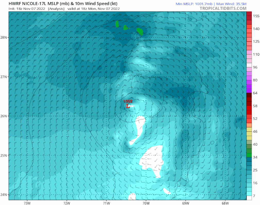
HWRF shifted about 100 miles west and 50 miles south through Wednesday from 12z to 18z
0 likes
Re: RE: Re: ATL: NICOLE - Models
jlauderdal wrote:I like the dip south so it starts in miami before a trip north nailing all of soflaBlown Away wrote:https://i.imgur.com/0tYc6Lo.gif
18z NAM... Just because...
Why dont you just say it you’d like to see all of Florida underwater..lol
1 likes
-
tolakram
- Admin

- Posts: 20176
- Age: 62
- Joined: Sun Aug 27, 2006 8:23 pm
- Location: Florence, KY (name is Mark)
Re: ATL: NICOLE - Models
18Z HWRF

0 likes
M a r k
- - - - -
Join us in chat: Storm2K Chatroom Invite. Android and IOS apps also available.
The posts in this forum are NOT official forecasts and should not be used as such. Posts are NOT endorsed by any professional institution or STORM2K.org. For official information and forecasts, please refer to NHC and NWS products.

-
tolakram
- Admin
- Posts: 20176
- Age: 62
- Joined: Sun Aug 27, 2006 8:23 pm
- Location: Florence, KY (name is Mark)
Re: ATL: NICOLE - Models
HWRF takes it just north of west across Florida. Not sure I'm buying it.

0 likes
M a r k
- - - - -
Join us in chat: Storm2K Chatroom Invite. Android and IOS apps also available.
The posts in this forum are NOT official forecasts and should not be used as such. Posts are NOT endorsed by any professional institution or STORM2K.org. For official information and forecasts, please refer to NHC and NWS products.
- - - - -
Join us in chat: Storm2K Chatroom Invite. Android and IOS apps also available.
The posts in this forum are NOT official forecasts and should not be used as such. Posts are NOT endorsed by any professional institution or STORM2K.org. For official information and forecasts, please refer to NHC and NWS products.
-
tolakram
- Admin
- Posts: 20176
- Age: 62
- Joined: Sun Aug 27, 2006 8:23 pm
- Location: Florence, KY (name is Mark)
Re: ATL: NICOLE - Models
18Z HWRF

0 likes
M a r k
- - - - -
Join us in chat: Storm2K Chatroom Invite. Android and IOS apps also available.
The posts in this forum are NOT official forecasts and should not be used as such. Posts are NOT endorsed by any professional institution or STORM2K.org. For official information and forecasts, please refer to NHC and NWS products.
- - - - -
Join us in chat: Storm2K Chatroom Invite. Android and IOS apps also available.
The posts in this forum are NOT official forecasts and should not be used as such. Posts are NOT endorsed by any professional institution or STORM2K.org. For official information and forecasts, please refer to NHC and NWS products.
-
tolakram
- Admin
- Posts: 20176
- Age: 62
- Joined: Sun Aug 27, 2006 8:23 pm
- Location: Florence, KY (name is Mark)
Re: ATL: NICOLE - Models
Same run, but humidity.

1 likes
M a r k
- - - - -
Join us in chat: Storm2K Chatroom Invite. Android and IOS apps also available.
The posts in this forum are NOT official forecasts and should not be used as such. Posts are NOT endorsed by any professional institution or STORM2K.org. For official information and forecasts, please refer to NHC and NWS products.
- - - - -
Join us in chat: Storm2K Chatroom Invite. Android and IOS apps also available.
The posts in this forum are NOT official forecasts and should not be used as such. Posts are NOT endorsed by any professional institution or STORM2K.org. For official information and forecasts, please refer to NHC and NWS products.
-
jlauderdal
- S2K Supporter
- Posts: 7240
- Joined: Wed May 19, 2004 5:46 am
- Location: NE Fort Lauderdale
- Contact:
Re: ATL: NICOLE - Models
[quote="tolakram"]Same run, but humidity.
I remember when the gfs was showing a whole bunch of dry air prior to landfall, that idea seems to have dried up
I remember when the gfs was showing a whole bunch of dry air prior to landfall, that idea seems to have dried up
2 likes
Re: ATL: NICOLE - Models

About a 90 mile shift west around my parts
Sent from my iPhone using Tapatalk
0 likes
-
eastcoastFL

- Category 5
- Posts: 3996
- Age: 44
- Joined: Thu Apr 12, 2007 12:29 pm
- Location: Palm City, FL
Re: ATL: NICOLE - Models
SFLcane wrote:Ooof! Strongest run yet. Eyewall over my house.
https://i.postimg.cc/mgShydX8/775-AE4-DE-DAAB-440-B-8143-F9-EA7737112-A.gif
Still northern Pb county/Martin county line… Are any models trending north ?
0 likes
Personal Forecast Disclaimer:
The posts in this forum are NOT official forecast and should not be used as such. They are just the opinion of the poster and may or may not be backed by sound meteorological data. They are NOT endorsed by any professional institution or storm2k.org. For official information, please refer to the NHC and NWS products.
The posts in this forum are NOT official forecast and should not be used as such. They are just the opinion of the poster and may or may not be backed by sound meteorological data. They are NOT endorsed by any professional institution or storm2k.org. For official information, please refer to the NHC and NWS products.

Re: ATL: NICOLE - Models
The SW slide under the moisture envelope with low shear starts around hour 42 with landfall about 20 hours later.
If the 18Z HWRF run verifies we could easily see a millibar an hour or more surface pressure drops all the way to landfall. We don't want a storm with a surface pressure below 980 making landfall anywhere on the east coast of Florida.
If the 18Z HWRF run verifies we could easily see a millibar an hour or more surface pressure drops all the way to landfall. We don't want a storm with a surface pressure below 980 making landfall anywhere on the east coast of Florida.
2 likes
Re: ATL: NICOLE - Models
Really models can only project the metrics available. Until this forms as a closed feature new information just might completely change things. We know there is a relentless high pressure ridge that’s going to force our girl into Florida. Aside from that models might change 20 hours out. It’s nice the all the Publixes are busy in Vero same thing should be happening in Miami and like the people in Naples I doubt they were as prepared as they should have because all we heard minute by minute was the models all pointed to Tampa. But I distinctly remember how early everyone reacted or didn’t react.
0 likes
-
Blown Away
- S2K Supporter
- Posts: 10253
- Joined: Wed May 26, 2004 6:17 am
Re: ATL: NICOLE - Models
0 likes
Hurricane Eye Experience: David 79, Irene 99, Frances 04, Jeanne 04, Wilma 05… Hurricane Brush Experience: Andrew 92, Erin 95, Floyd 99, Matthew 16, Irma 17, Ian 22, Nicole 22…
-
Blown Away
- S2K Supporter
- Posts: 10253
- Joined: Wed May 26, 2004 6:17 am
Re: ATL: NICOLE - Models
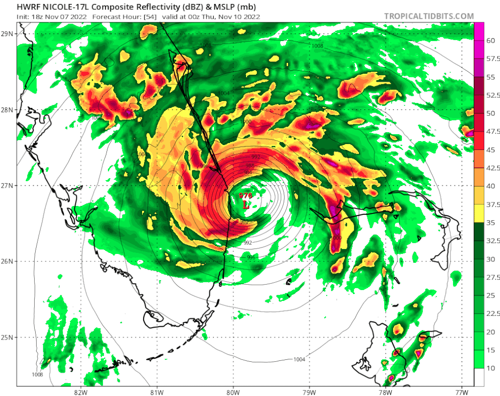
18z HWRF… 88 mph at landfall near WPB…
0 likes
Hurricane Eye Experience: David 79, Irene 99, Frances 04, Jeanne 04, Wilma 05… Hurricane Brush Experience: Andrew 92, Erin 95, Floyd 99, Matthew 16, Irma 17, Ian 22, Nicole 22…
-
eastcoastFL
- Category 5
- Posts: 3996
- Age: 44
- Joined: Thu Apr 12, 2007 12:29 pm
- Location: Palm City, FL
Re: ATL: NICOLE - Models
Blown Away wrote:[url]https://i.postimg.cc/fRmSzfHT/hwrf-mslp-wind-17-L-fh0-93.gif [/url]
18z HWRF… 88 mph at landfall near WPB…
That would put me right in the northern eye wall. The late night runs will be interesting, I wonder how much the models change when this thing makes it’s transition to tropical. Or if they change at all?
0 likes
Personal Forecast Disclaimer:
The posts in this forum are NOT official forecast and should not be used as such. They are just the opinion of the poster and may or may not be backed by sound meteorological data. They are NOT endorsed by any professional institution or storm2k.org. For official information, please refer to the NHC and NWS products.
The posts in this forum are NOT official forecast and should not be used as such. They are just the opinion of the poster and may or may not be backed by sound meteorological data. They are NOT endorsed by any professional institution or storm2k.org. For official information, please refer to the NHC and NWS products.
Who is online
Users browsing this forum: No registered users and 16 guests