ATL: IAN - Post-Tropical - Discussion
Moderator: S2k Moderators
- Iceresistance
- Category 5

- Posts: 9594
- Age: 22
- Joined: Sat Oct 10, 2020 9:45 am
- Location: Tecumseh, OK/Norman, OK
Re: ATL: IAN - Hurricane - Discussion
The wind measurement may be instantaneous from this Eastern Eyewall Dropsonde, but it's leading me to suggest that the stronger winds have yet to mix down to the surface.

https://s4.gifyu.com/images/Eastern-Eyewall-of-Ian.png

https://s4.gifyu.com/images/Eastern-Eyewall-of-Ian.png
1 likes
Bill 2015 & Beta 2020
Winter 2020-2021
All observations are in Tecumseh, OK unless otherwise noted.
Winter posts are focused mainly for Oklahoma & Texas.
Take any of my forecasts with a grain of salt, refer to the NWS, SPC, and NHC for official information
Never say Never with weather! Because ANYTHING is possible!
Winter 2020-2021

All observations are in Tecumseh, OK unless otherwise noted.
Winter posts are focused mainly for Oklahoma & Texas.
Take any of my forecasts with a grain of salt, refer to the NWS, SPC, and NHC for official information
Never say Never with weather! Because ANYTHING is possible!
- Hypercane_Kyle
- Category 5

- Posts: 3465
- Joined: Sat Mar 07, 2015 7:58 pm
- Location: Cape Canaveral, FL
Re: ATL: IAN - Hurricane - Discussion
GCANE wrote:Core rapidly warming up
Just technical FYI - "cooling" is the word you're looking for, as the darker reds represent colder cloud tops.
1 likes
My posts are my own personal opinion, defer to the National Hurricane Center (NHC) and other NOAA products for decision making during hurricane season.
- eastcoastFL
- Category 5

- Posts: 3996
- Age: 44
- Joined: Thu Apr 12, 2007 12:29 pm
- Location: Palm City, FL
Re: ATL: IAN - Hurricane - Discussion
Iceresistance wrote:The wind measurement may be instantaneous from this Eastern Eyewall Dropsonde, but it's leading me to suggest that the stronger winds have yet to mix down to the surface.
https://s4.gifyu.com/images/Eastern-Eyewall-of-Ian.png
https://s4.gifyu.com/images/Eastern-Eyewall-of-Ian.png
That’s my thought as well. Pressure continues to drop. Just a matter of time until the winds catch up.
5 likes
Personal Forecast Disclaimer:
The posts in this forum are NOT official forecast and should not be used as such. They are just the opinion of the poster and may or may not be backed by sound meteorological data. They are NOT endorsed by any professional institution or storm2k.org. For official information, please refer to the NHC and NWS products.
The posts in this forum are NOT official forecast and should not be used as such. They are just the opinion of the poster and may or may not be backed by sound meteorological data. They are NOT endorsed by any professional institution or storm2k.org. For official information, please refer to the NHC and NWS products.
Re: ATL: IAN - Hurricane - Discussion
A Charlie track certainly seems plausible. It was a non event here in Saint Augustine while Daytona, 65 miles South had a punch to the gut. Same type of set up. Lets see if it materializes. Model runs today and tonight will be interesting!!!
1 likes
The following post is NOT an official forecast and should not be used as such. It is just the opinion of the poster and may or may not be backed by sound meteorological data. It is NOT endorsed by any professional institution including storm2k.org For Official Information please refer to the NHC and NWS products.
Re: ATL: IAN - Hurricane - Discussion
Iceresistance wrote:The wind measurement may be instantaneous from this Eastern Eyewall Dropsonde, but it's leading me to suggest that the stronger winds have yet to mix down to the surface.
https://s4.gifyu.com/images/Eastern-Eyewall-of-Ian.png
https://s4.gifyu.com/images/Eastern-Eyewall-of-Ian.png
Updraft from the tower is likely playing a part in that
1 likes
Re: ATL: IAN - Hurricane - Discussion
NDG wrote:But cat 2 starts at 96 mph.
That's knot relevant.
12 likes
Baton Rouge area cyclone dilettante, PSWAGGER* tropical weather & hydrology model developer
(* Pseudo-Scientific Wild-A** Guesses Generally Expressed Ridiculously)
The GFDL would've had all this figured out by now.
(* Pseudo-Scientific Wild-A** Guesses Generally Expressed Ridiculously)
The GFDL would've had all this figured out by now.
- eastcoastFL
- Category 5

- Posts: 3996
- Age: 44
- Joined: Thu Apr 12, 2007 12:29 pm
- Location: Palm City, FL
Re: ATL: IAN - Hurricane - Discussion
That outflow is sure something


9 likes
Personal Forecast Disclaimer:
The posts in this forum are NOT official forecast and should not be used as such. They are just the opinion of the poster and may or may not be backed by sound meteorological data. They are NOT endorsed by any professional institution or storm2k.org. For official information, please refer to the NHC and NWS products.
The posts in this forum are NOT official forecast and should not be used as such. They are just the opinion of the poster and may or may not be backed by sound meteorological data. They are NOT endorsed by any professional institution or storm2k.org. For official information, please refer to the NHC and NWS products.
- cheezyWXguy
- Category 5

- Posts: 6282
- Joined: Mon Feb 13, 2006 12:29 am
- Location: Dallas, TX
Re: ATL: IAN - Hurricane - Discussion
Hypercane_Kyle wrote:GCANE wrote:Core rapidly warming up
Just technical FYI - "cooling" is the word you're looking for, as the darker reds represent colder cloud tops.
I think he literally means the storm’s warm core, not the cloud tops
8 likes
Re: ATL: IAN - Hurricane - Discussion
Hypercane_Kyle wrote:GCANE wrote:Core rapidly warming up
Just technical FYI - "cooling" is the word you're looking for, as the darker reds represent colder cloud tops.
Its actually west of that. Its the blue now turning white
0 likes
- ElectricStorm
- Category 5

- Posts: 5148
- Age: 25
- Joined: Tue Aug 13, 2019 11:23 pm
- Location: Norman, OK
Re: ATL: IAN - Hurricane - Discussion
GCANE wrote:Hypercane_Kyle wrote:GCANE wrote:Core rapidly warming up
Just technical FYI - "cooling" is the word you're looking for, as the darker reds represent colder cloud tops.
Its actually west of that. Its the blue now turning white
That looks like another dry slot to me
0 likes
B.S Meteorology, University of Oklahoma '25
Please refer to the NHC, NWS, or SPC for official information.
Please refer to the NHC, NWS, or SPC for official information.
- eastcoastFL
- Category 5

- Posts: 3996
- Age: 44
- Joined: Thu Apr 12, 2007 12:29 pm
- Location: Palm City, FL
Re: ATL: IAN - Hurricane - Discussion
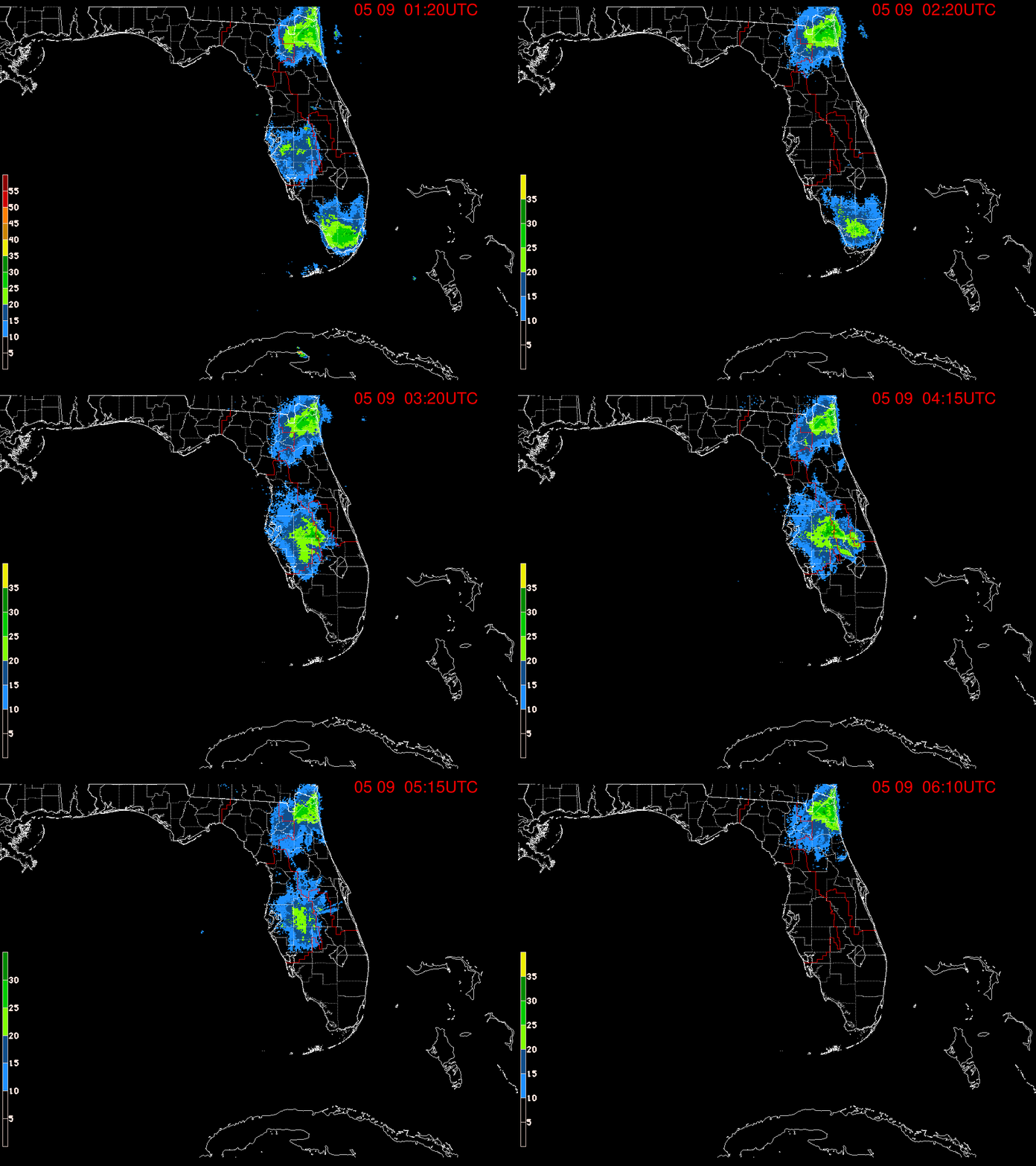
Rain across south Florida getting more and more persistent.


2 likes
Personal Forecast Disclaimer:
The posts in this forum are NOT official forecast and should not be used as such. They are just the opinion of the poster and may or may not be backed by sound meteorological data. They are NOT endorsed by any professional institution or storm2k.org. For official information, please refer to the NHC and NWS products.
The posts in this forum are NOT official forecast and should not be used as such. They are just the opinion of the poster and may or may not be backed by sound meteorological data. They are NOT endorsed by any professional institution or storm2k.org. For official information, please refer to the NHC and NWS products.
Re: ATL: IAN - Hurricane - Discussion
cheezyWXguy wrote:Hypercane_Kyle wrote:GCANE wrote:Core rapidly warming up
Just technical FYI - "cooling" is the word you're looking for, as the darker reds represent colder cloud tops.
I think he literally means the storm’s warm core, not the cloud tops
Correct - thanks
1 likes
- ConvergenceZone
- Category 5

- Posts: 5241
- Joined: Fri Jul 29, 2005 1:40 am
- Location: Northern California
Re: ATL: IAN - Hurricane - Discussion
Hammy wrote:Recon still doesn't support Cat 2 intensity.
but satellite representation sure does! I've seen cat 3s look worse on satellite than Ian
2 likes
Re: ATL: IAN - Hurricane - Discussion
LARanger wrote:NDG wrote:But cat 2 starts at 96 mph.
That's knot relevant.
95 knots at flight level is not enough for a Cat 2 once is reduced for surface wind estimates, which equal around 90-95 mph at the surface.
0 likes
-
Sailingtime
- Tropical Low

- Posts: 38
- Joined: Thu Aug 29, 2019 7:02 pm
Re: ATL: IAN - Hurricane - Discussion
eastcoastFL wrote:Rain across south Florida getting more and more persistent.
https://apps.sfwmd.gov/sfwmd/common/images/weather/noaaport/radar_flanim.gif
Last edited by Sailingtime on Mon Sep 26, 2022 6:57 pm, edited 2 times in total.
0 likes
- eastcoastFL
- Category 5

- Posts: 3996
- Age: 44
- Joined: Thu Apr 12, 2007 12:29 pm
- Location: Palm City, FL
Re: ATL: IAN - Hurricane - Discussion

1 likes
Personal Forecast Disclaimer:
The posts in this forum are NOT official forecast and should not be used as such. They are just the opinion of the poster and may or may not be backed by sound meteorological data. They are NOT endorsed by any professional institution or storm2k.org. For official information, please refer to the NHC and NWS products.
The posts in this forum are NOT official forecast and should not be used as such. They are just the opinion of the poster and may or may not be backed by sound meteorological data. They are NOT endorsed by any professional institution or storm2k.org. For official information, please refer to the NHC and NWS products.
-
Aric Dunn
- Category 5

- Posts: 21238
- Age: 43
- Joined: Sun Sep 19, 2004 9:58 pm
- Location: Ready for the Chase.
- Contact:
Re: ATL: IAN - Hurricane - Discussion
4 towers in each quad... next phase of RI appears to be underway.. eye much less ragged.


4 likes
Note: If I make a post that is brief. Please refer back to previous posts for the analysis or reasoning. I do not re-write/qoute what my initial post said each time.
If there is nothing before... then just ask
Space & Atmospheric Physicist, Embry-Riddle Aeronautical University,
I believe the sky is falling...
If there is nothing before... then just ask
Space & Atmospheric Physicist, Embry-Riddle Aeronautical University,
I believe the sky is falling...
Re: ATL: IAN - Hurricane - Discussion
Hypercane_Kyle wrote:GCANE wrote:Core rapidly warming up
Just technical FYI - "cooling" is the word you're looking for, as the darker reds represent colder cloud tops.
Temperature of the eye also has a direct correlation to storm strength. Warmer eye = stronger TC.
5 likes
Who is online
Users browsing this forum: No registered users and 40 guests


