#3236 Postby fci » Tue Sep 27, 2022 12:35 pm
LarryWx wrote:12Z UKMET furthest SE track yet with landfall only 20 miles north of Naples/20 miles south of Ft. Myers, goes across FL to Melbourne, and then 2nd landfall Charleston:
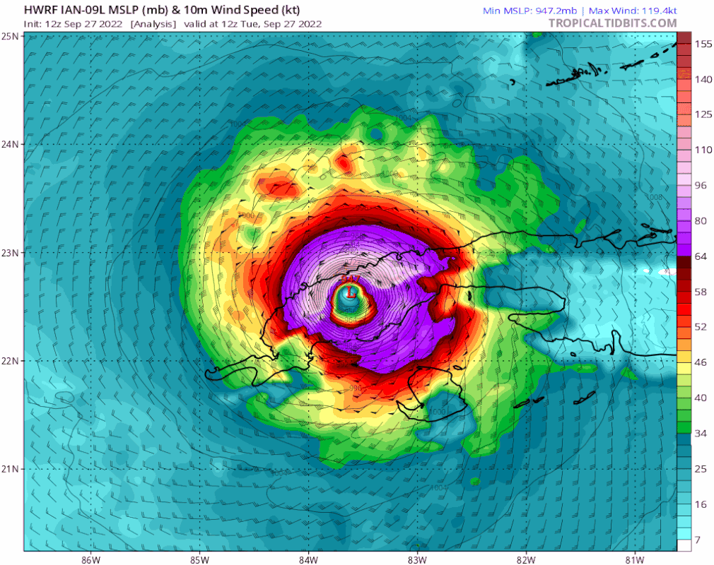
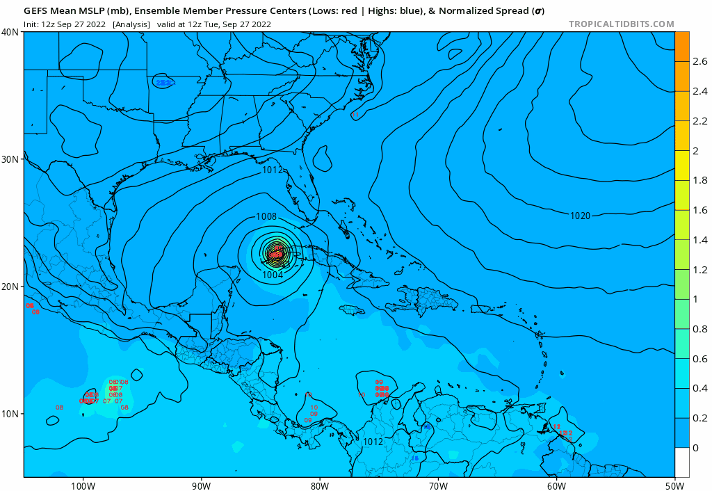
HURRICANE IAN ANALYSED POSITION : 22.5N 83.5W
ATCF IDENTIFIER : AL092022
LEAD CENTRAL MAXIMUM WIND
VERIFYING TIME TIME POSITION PRESSURE (MB) SPEED (KNOTS)
-------------- ---- -------- ------------- -------------
1200UTC 27.09.2022 0 22.5N 83.5W 979 56
0000UTC 28.09.2022 12 24.5N 83.2W 977 60
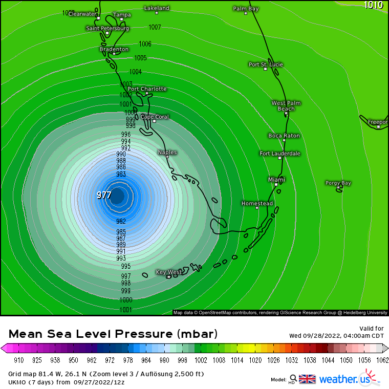
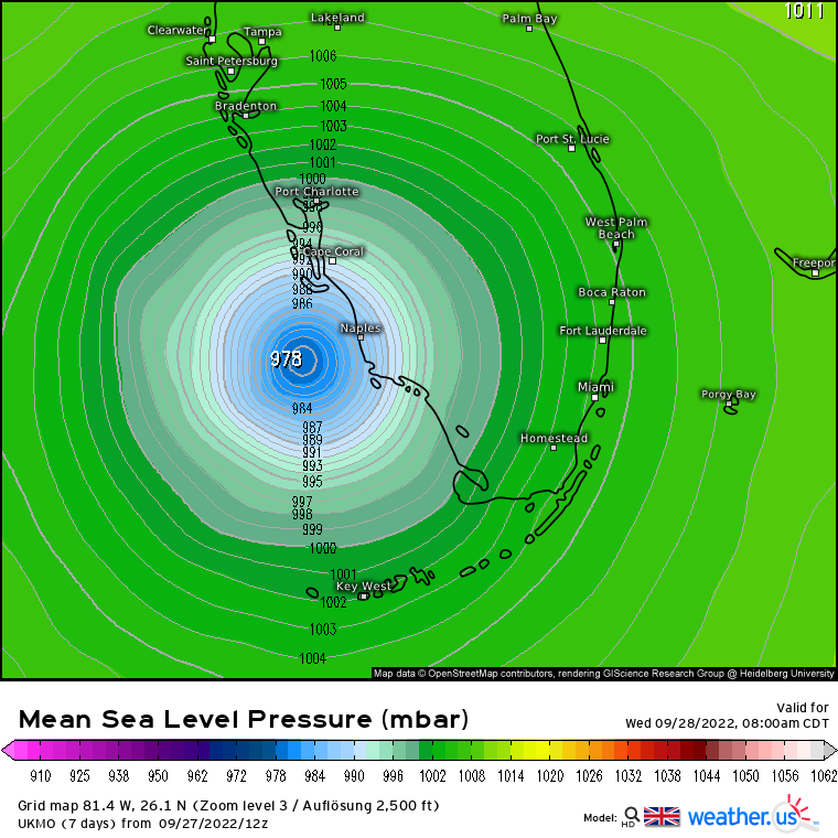
1200UTC 28.09.2022 24 25.9N 82.3W 976 60
0000UTC 29.09.2022 36 27.0N 81.4W 989 42
1200UTC 29.09.2022 48 28.1N 80.6W 992 44
0000UTC 30.09.2022 60 29.2N 79.9W 989 53
1200UTC 30.09.2022 72 30.5N 79.9W 985 57
0000UTC 01.10.2022 84 33.0N 80.0W 985 40
1200UTC 01.10.2022 96 34.9N 81.4W 999 29
0000UTC 02.10.2022 108 36.3N 81.0W 1005 23
1200UTC 02.10.2022 120 CEASED TRACKING
That’s a much scarier track for those of us on the East Coast, even Palm Beach County.
“Closest to” says just 77 miles here in Boynton/Lake Worth.
4 likes
Personal Forecast Disclaimer:
My posts are just my opinion and are most likely not backed by sound meteorological data. They are NOT endorsed by any professional institution or storm2k.org. For official information, please refer to the NHC and NWS products.
Bottom line is that I am just expressing my opinion!!!


