ATL: IAN - Post-Tropical - Discussion
Moderator: S2k Moderators

Re: ATL: IAN - Hurricane - Discussion
I suspect that the strongest winds are probably some distance away from the center with the storm being in its hybrid configuration at the moment. And it probably does not have a sharp wind maximum anywhere, but probably a spread-out high wind plateau of high-tropical-storm winds covering a larger area. I seriously doubt if this thing has hurricane force winds anywhere near the surface. Still, it can definitely cause some rain flooding and minor coastal flooding on the east side.
1 likes
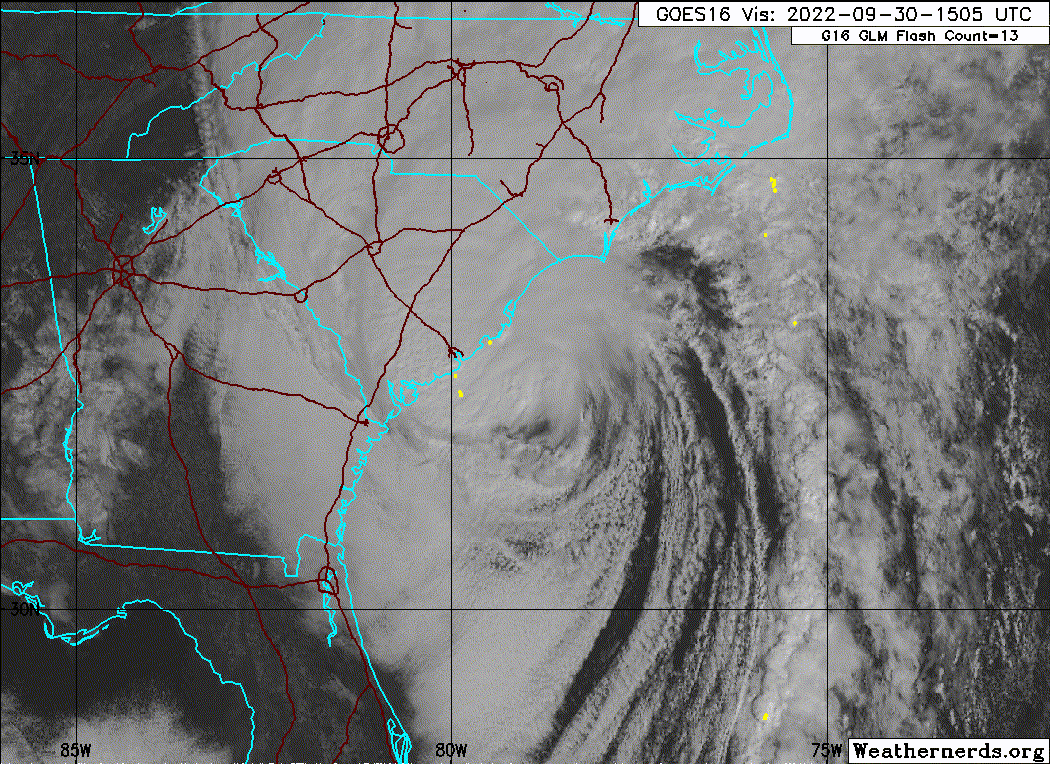
-
tolakram
- Admin

- Posts: 20178
- Age: 62
- Joined: Sun Aug 27, 2006 8:23 pm
- Location: Florence, KY (name is Mark)
Re: ATL: IAN - Hurricane - Discussion
saved loop

0 likes
M a r k
- - - - -
Join us in chat: Storm2K Chatroom Invite. Android and IOS apps also available.
The posts in this forum are NOT official forecasts and should not be used as such. Posts are NOT endorsed by any professional institution or STORM2K.org. For official information and forecasts, please refer to NHC and NWS products.

Re: ATL: IAN - Hurricane - Discussion
I think one thing too here is the trouble with messaging when you have a major city threatened. It seems often that the focus is on the effects to the major city, to the detriment of focus on neighboring communities. This is not an NHC problem so much as a media problem. And I don't bring it up as media bashing. Cities do have more people and therefor greater risk of loss of life, particularly from surge so I understand the focus on cities to a degree. I dont think the public at large has a great appreciation for what the surge risk is to an typical waterfront community when a large, high IKE, storm is bearing down. Most people only understand categories and wind, and until the tsunami comes to your town, its is truly hard to fathom the real risk. I certainly felt that way with Katrina. I knew it would be bad. Most people in Mississippi knew it would be bad. But even many people who survived Camille struggled to grasp the possibilities, and when the media is focused on New Orleans (or Tampa, or Houston, etc) impacts, it is just a setup to catch people off guard.
I will say the NHC has made great headway in their surge messaging since Katrina. their maps are decent and they communicate the real risk...its just that I am not sure they really reach very many people or that people "get it".
I think the best answer is some sort of impact scale map or more focus on storm size, the trouble is you cant throw out Saffir Simpson as its a well understand scale from a public knowledge point of view. Perhaps modifying S-S scale to capture surge risk/IKE/Storm size is the next best step. Maybe keep the categories but instead of a category being based on wind alone they could make the categories based on a size/surge/wind combination? just spitballing here.
5 likes
Re: ATL: IAN - Hurricane - Discussion
Is Josh right here? I still have my doubts.
0 likes
Personal Forecast Disclaimer:
The posts in this forum are NOT official forecasts and should not be used as such. They are just the opinion of the poster and may or may not be backed by sound meteorological data. They are NOT endorsed by any professional institution or storm2k.org. For official information, please refer to the NHC and NWS products.
The posts in this forum are NOT official forecasts and should not be used as such. They are just the opinion of the poster and may or may not be backed by sound meteorological data. They are NOT endorsed by any professional institution or storm2k.org. For official information, please refer to the NHC and NWS products.
Re: ATL: IAN - Hurricane - Discussion
If the main center really came inland like Josh said, why are the winds at Georgetown still strong from the north? A low to its SW would be giving G'town SE to E winds, not N winds. Also, the SLP is still falling rapidly there at 29.10" as of 1:35 PM.
Last edited by LarryWx on Fri Sep 30, 2022 1:09 pm, edited 1 time in total.
2 likes
Personal Forecast Disclaimer:
The posts in this forum are NOT official forecasts and should not be used as such. They are just the opinion of the poster and may or may not be backed by sound meteorological data. They are NOT endorsed by any professional institution or storm2k.org. For official information, please refer to the NHC and NWS products.
The posts in this forum are NOT official forecasts and should not be used as such. They are just the opinion of the poster and may or may not be backed by sound meteorological data. They are NOT endorsed by any professional institution or storm2k.org. For official information, please refer to the NHC and NWS products.
Re: ATL: IAN - Hurricane - Discussion
Winds just started picking up about 15 minutes ago out of the north I think where I am in the Raleigh area (south Raleigh/Garner area).
Not too too crazy, but it's definitely gusting a bit now, which it really hadn't been until now.
Not too too crazy, but it's definitely gusting a bit now, which it really hadn't been until now.
1 likes
Re: ATL: IAN - Hurricane - Discussion
I noticed that as Ian approached Cuba it headed directly north from the Sep 27 2AM EDT fix just west of the Isle of Youth to the 8AM fix near Vinales Cuba. When Ian exited Cuba the heading was NNE. Vinales is in a bit of a gap in the mountains. The mountains west of there are lower, fewer and more longitudinal and in line with the wind compared to those east of Vinales which are higher, more numerous and the main ridgeline more latitudinal and athwart the wind. Could the mountains to the east have caused more drag on the right side of Ian and contributed to the heading bending eastward as it exited Cuba? If there were no mountains would the storm have continued north longer? Another example of this possible drag effect would be Charlie's sudden veer to the right. Does drag on one side have any influence on steering? Do models include terrain or proximity to land as a steering factor?
2 likes
The above post is not official and should not be used as such. It is the opinion of the poster and may or may not be backed by sound meteorological data. It is not endorsed by any professional institution or storm2k.org. For official information, please refer to the NHC and NWS products.
-
typhoonty
- Tropical Storm

- Posts: 121
- Age: 31
- Joined: Wed May 31, 2017 10:37 pm
- Location: Fort Myers / Tallahassee, FL
- Contact:
Re: ATL: IAN - Hurricane - Discussion
This is former WINK chief meteorologist Jim Farrell. He made the most irresponsible post I've ever seen a meteorologist make 2 hours before the eyewall came ashore talking about good news, and in the comments he says to expect less rain. If you want to know why Lee County didn't evacuate this is it. I hope he never lives this down. They aren't even on the air right now because their studio got submerged, Karma. Watch NBC2 and boycott WINK forever if you live in southwest Florida.

6 likes
FSU Meteorology student, opinions are mine, 20 years experience covering TC's, consult NHC/Local officials when making decisions.
Gabrielle '01, Michelle '01, Charley '04, Frances '04, Dennis '05, Katrina '05, Rita '05, Wilma '05, Fay '08, Isaac '12 Hermine '16, Irma '17, Michael '18, Eta '20, Elsa '21, IAN '22, Idalia '23, Debby '24, Helene '24
Gabrielle '01, Michelle '01, Charley '04, Frances '04, Dennis '05, Katrina '05, Rita '05, Wilma '05, Fay '08, Isaac '12 Hermine '16, Irma '17, Michael '18, Eta '20, Elsa '21, IAN '22, Idalia '23, Debby '24, Helene '24
Re: ATL: IAN - Hurricane - Discussion
LarryWx wrote:If the main center really came inland like Josh said, why are the winds at Georgetown still strong from the north? A low to its SW would be giving G'town SE to E winds, not N winds. Also, the SLP is still falling rapidly there at 29.10" as of 1:35 PM.
The NHC at 2 PM just confirmed that the center has still not made landfall.
0 likes
Personal Forecast Disclaimer:
The posts in this forum are NOT official forecasts and should not be used as such. They are just the opinion of the poster and may or may not be backed by sound meteorological data. They are NOT endorsed by any professional institution or storm2k.org. For official information, please refer to the NHC and NWS products.
The posts in this forum are NOT official forecasts and should not be used as such. They are just the opinion of the poster and may or may not be backed by sound meteorological data. They are NOT endorsed by any professional institution or storm2k.org. For official information, please refer to the NHC and NWS products.
-
Tireman4

- S2K Supporter

- Posts: 5903
- Age: 60
- Joined: Fri Jun 30, 2006 1:08 pm
- Location: Humble, Texas
- Contact:
Re: ATL: IAN - Hurricane - Discussion
socplay02 wrote:Winds just started picking up about 15 minutes ago out of the north I think where I am in the Raleigh area (south Raleigh/Garner area).
Not too too crazy, but it's definitely gusting a bit now, which it really hadn't been until now.
I am watching my undergraduate alma mater, North Carolina Wesleyan University in Rocky Mount, NC play LaGrange College. It is windy, gusty at times. Driving rain, as well. ( No, I am not there. It is on Youtube. LOL)
1 likes
-
Iceresistance

- Category 5

- Posts: 9579
- Age: 22
- Joined: Sat Oct 10, 2020 9:45 am
- Location: Tecumseh, OK/Norman, OK
Re: ATL: IAN - Hurricane - Discussion
cycloneye wrote:galaxy401 wrote:cycloneye wrote:
Any source to that info? To have a archive about that in this thread.
Sure thing, here is a link I found:
https://twitter.com/ElijahWeather/status/1575850450384875522
Not the most reliable admittedly, but everyone is still assessing damage so it will probably bounce around more.
Thank you. If there are more updates on the number of fatalities, post them.
We're now officially at 21 dead in Florida.
https://www.sun-sentinel.com/news/weath ... story.html
1 likes
Bill 2015 & Beta 2020
Winter 2020-2021
All observations are in Tecumseh, OK unless otherwise noted.
Winter posts are focused mainly for Oklahoma & Texas.
Take any of my forecasts with a grain of salt, refer to the NWS, SPC, and NHC for official information
Never say Never with weather! Because ANYTHING is possible!
Winter 2020-2021
All observations are in Tecumseh, OK unless otherwise noted.
Winter posts are focused mainly for Oklahoma & Texas.
Take any of my forecasts with a grain of salt, refer to the NWS, SPC, and NHC for official information
Never say Never with weather! Because ANYTHING is possible!
-
Iceresistance
- Category 5
- Posts: 9579
- Age: 22
- Joined: Sat Oct 10, 2020 9:45 am
- Location: Tecumseh, OK/Norman, OK
Re: ATL: IAN - Hurricane - Discussion
Landfall near Georgetown, SC
Hurricane Ian Tropical Cyclone Update
NWS National Hurricane Center Miami FL AL092022
215 PM EDT Fri Sep 30 2022
...HURRICANE IAN MAKES LANDFALL NEAR GEORGETOWN SOUTH CAROLINA...
Surface observations indicate that the center of Hurricane Ian
made landfall at 205 pm EDT (1805 UTC) near Georgetown, South
Carolina with maximum sustained winds of 85 mph (140 km/h) and an
estimated minimum central pressure of 977 mb (28.85 inches).
1 likes
Bill 2015 & Beta 2020
Winter 2020-2021
All observations are in Tecumseh, OK unless otherwise noted.
Winter posts are focused mainly for Oklahoma & Texas.
Take any of my forecasts with a grain of salt, refer to the NWS, SPC, and NHC for official information
Never say Never with weather! Because ANYTHING is possible!
Winter 2020-2021
All observations are in Tecumseh, OK unless otherwise noted.
Winter posts are focused mainly for Oklahoma & Texas.
Take any of my forecasts with a grain of salt, refer to the NWS, SPC, and NHC for official information
Never say Never with weather! Because ANYTHING is possible!
-
Sciencerocks
- Category 5
- Posts: 10181
- Age: 40
- Joined: Thu Jul 06, 2017 1:51 am
-
wxman57

- Moderator-Pro Met

- Posts: 23171
- Age: 68
- Joined: Sat Jun 21, 2003 8:06 pm
- Location: Houston, TX (southwest)
Re: ATL: IAN - Hurricane - Discussion
Comradez wrote:I suspect that the strongest winds are probably some distance away from the center with the storm being in its hybrid configuration at the moment. And it probably does not have a sharp wind maximum anywhere, but probably a spread-out high wind plateau of high-tropical-storm winds covering a larger area. I seriously doubt if this thing has hurricane force winds anywhere near the surface. Still, it can definitely cause some rain flooding and minor coastal flooding on the east side.
No, the strongest winds are clearly northwest of the center, affecting Charleston. No TS wind can be found to the right of the track (sustained). I'm still hunting for any sustained wind even close to hurricane strength.
0 likes
Re: ATL: IAN - Hurricane - Discussion
Iceresistance wrote:Landfall near Georgetown, SCHurricane Ian Tropical Cyclone Update
NWS National Hurricane Center Miami FL AL092022
215 PM EDT Fri Sep 30 2022
...HURRICANE IAN MAKES LANDFALL NEAR GEORGETOWN SOUTH CAROLINA...
Surface observations indicate that the center of Hurricane Ian
made landfall at 205 pm EDT (1805 UTC) near Georgetown, South
Carolina with maximum sustained winds of 85 mph (140 km/h) and an
estimated minimum central pressure of 977 mb (28.85 inches).
A Georgetown landfall about one hour later than when Josh declared landfall 20 miles to the SW makes much more sense and is consistent with the Georgetown obs I was seeing and posting.
1 likes
Personal Forecast Disclaimer:
The posts in this forum are NOT official forecasts and should not be used as such. They are just the opinion of the poster and may or may not be backed by sound meteorological data. They are NOT endorsed by any professional institution or storm2k.org. For official information, please refer to the NHC and NWS products.
The posts in this forum are NOT official forecasts and should not be used as such. They are just the opinion of the poster and may or may not be backed by sound meteorological data. They are NOT endorsed by any professional institution or storm2k.org. For official information, please refer to the NHC and NWS products.
-
BensonTCwatcher

- Category 5
- Posts: 1050
- Joined: Sat Aug 28, 2004 10:11 pm
- Location: Southport NC
Re: ATL: IAN - Hurricane - Discussion
Update from Southport NC. Just got back from walking the harbor 2 block from my house . Surge plus high tide was 4.5- 5 ft above normal high tide. We get some high king tides, but this is the highest since Florence. Water crested at the top of the bulkheads and flooded the low lying restaurants and a couple of homes crawlspace and a couple 1st floor At least one home on Bay St has water in the garage. Not much if any wind damage. Winds have been a steady 30-35 mph with a few gusts at 50. All of that high wind is on the waterfront. I consider us lucky and keeping FL folks in our prayers
2 likes
-
NC George

- Category 2

- Posts: 635
- Age: 56
- Joined: Sun Sep 14, 2003 11:44 am
- Location: Washington, NC, USA
Re: ATL: IAN - Hurricane - Discussion
Tornado warning for eastern NC - Pamlico and Beaufort county. Current location near Bayboro moving to the NW.
0 likes
Bertha '96, Fran '96, Bonnie '98, Dennis '99, Floyd '99  , Isabel '03, Irene '11, Matthew '16, Isaias '20, PTC16????
Avatar is heading into Florence 2018, moving friend's boat, only land between us and Hurricane Florence is Ocracoke Island!
Avatar is heading into Florence 2018, moving friend's boat, only land between us and Hurricane Florence is Ocracoke Island!
-
cycloneye

- Admin
- Posts: 149267
- Age: 69
- Joined: Thu Oct 10, 2002 10:54 am
- Location: San Juan, Puerto Rico
Re: ATL: IAN - Hurricane - Discussion
0 likes
Visit the Caribbean-Central America Weather Thread where you can find at first post web cams,radars
and observations from Caribbean basin members Click Here
and observations from Caribbean basin members Click Here
-
Supersoaker
- Tropical Wave

- Posts: 6
- Joined: Fri Aug 27, 2021 9:13 pm
Re: ATL: IAN - Hurricane - Discussion
Michael took out 74 (at least) and it hit the middle of nowhere. Look for this number to rise significantly over the coming days and weeks.
2 likes
-
tolakram
- Admin
- Posts: 20178
- Age: 62
- Joined: Sun Aug 27, 2006 8:23 pm
- Location: Florence, KY (name is Mark)
Re: ATL: IAN - Hurricane - Discussion
1 likes
M a r k
- - - - -
Join us in chat: Storm2K Chatroom Invite. Android and IOS apps also available.
The posts in this forum are NOT official forecasts and should not be used as such. Posts are NOT endorsed by any professional institution or STORM2K.org. For official information and forecasts, please refer to NHC and NWS products.
- - - - -
Join us in chat: Storm2K Chatroom Invite. Android and IOS apps also available.
The posts in this forum are NOT official forecasts and should not be used as such. Posts are NOT endorsed by any professional institution or STORM2K.org. For official information and forecasts, please refer to NHC and NWS products.
Who is online
Users browsing this forum: No registered users and 16 guests