
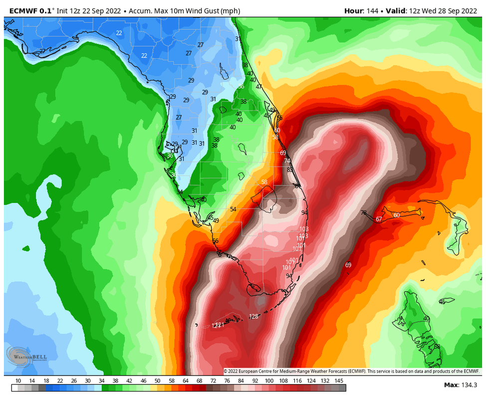
Jelmergraaff wrote:This is a pretty rare situation in which the spread of the GEFS (GFS Ensemble) excludes the ECMWF Operational scenario, crossing over SW-Florida. Of course, this is subject to change, but in general it is quite rare to see not even a single GEFS-member going for a solution as far SE as the Euro. Not saying the Euro-scenario is impossible, but in my eyes not too likely regarding the fact that with the GEFSv16 update two years ago the model spread was already increased quite a lot. EPS (Euro Ensemble) spread - and some other models - however do include several members showing a more westerly option.
For now, I would see the Operational ECMWF scenario as one of the SE-most outliers and therefore not too likely. Taking into account all models, you'd probably get somewhere like the TVCN.
https://www.tropicaltidbits.com/storminfo/98L_gefs_latest.png
The TVCN goes directly over the peninsula… and that’s with the GFS weighted into it.


