EP, 06, 2022071612, , BEST, 0, 138N, 1033W, 55, 997, TS
EPAC: ESTELLE - Post-Tropical
Moderator: S2k Moderators
-
cycloneye

- Admin

- Posts: 139026
- Age: 67
- Joined: Thu Oct 10, 2002 10:54 am
- Location: San Juan, Puerto Rico
Re: EPAC: ESTELLE - Tropical Storm
0 likes
Visit the Caribbean-Central America Weather Thread where you can find at first post web cams,radars
and observations from Caribbean basin members Click Here
and observations from Caribbean basin members Click Here
-
Yellow Evan

- Professional-Met

- Posts: 15951
- Age: 25
- Joined: Fri Jul 15, 2011 12:48 pm
- Location: Henderson, Nevada/Honolulu, HI
- Contact:
Re: EPAC: ESTELLE - Tropical Storm
TXPZ27 KNES 161211
TCSENP
A. 06E (ESTELLE)
B. 16/1130Z
C. 13.8N
D. 103.4W
E. THREE/GOES-E
F. T3.5/3.5
G. IR/EIR/SSMIS
H. REMARKS...CONVECTION WRAPS 9/10 ON A LOG10 SPIRAL FOR A DT OF
3.5. MET=3.0 AND PT=3.5. FT IS BASED ON DT.
I. ADDL POSITIONS
16/1058Z 14.0N 103.0W SSMIS
...KIM
TCSENP
A. 06E (ESTELLE)
B. 16/1130Z
C. 13.8N
D. 103.4W
E. THREE/GOES-E
F. T3.5/3.5
G. IR/EIR/SSMIS
H. REMARKS...CONVECTION WRAPS 9/10 ON A LOG10 SPIRAL FOR A DT OF
3.5. MET=3.0 AND PT=3.5. FT IS BASED ON DT.
I. ADDL POSITIONS
16/1058Z 14.0N 103.0W SSMIS
...KIM
0 likes
-
Yellow Evan
- Professional-Met
- Posts: 15951
- Age: 25
- Joined: Fri Jul 15, 2011 12:48 pm
- Location: Henderson, Nevada/Honolulu, HI
- Contact:


-
skyline385

- Category 5

- Posts: 2444
- Age: 33
- Joined: Wed Aug 26, 2020 11:15 pm
- Location: Palm Beach County FL
-
MHC Tracking

- Tropical Storm

- Posts: 169
- Joined: Mon Mar 15, 2021 10:05 am
Re: EPAC: ESTELLE - Tropical Storm
Latest SHIPS (12z) brings this to ~105 kt with a 50/50 shot of 45 kts of intensification in 24 hours 
Fairly decent shot at a major here if it can fend off the ~15 kt of shear, which it seems to be effective at doing
Fairly decent shot at a major here if it can fend off the ~15 kt of shear, which it seems to be effective at doing
0 likes
-
Yellow Evan
- Professional-Met
- Posts: 15951
- Age: 25
- Joined: Fri Jul 15, 2011 12:48 pm
- Location: Henderson, Nevada/Honolulu, HI
- Contact:
Re: EPAC: ESTELLE - Tropical Storm
* GFS version *
* EAST PACIFIC 2021 SHIPS INTENSITY FORECAST *
* IR SAT DATA AVAILABLE, OHC AVAILABLE *
* ESTELLE EP062022 07/16/22 12 UTC *
TIME (HR) 0 6 12 18 24 36 48 60 72 84 96 108 120 132 144 156 168
V (KT) NO LAND 55 64 73 82 90 102 107 102 97 89 81 70 59 50 43 36 29
V (KT) LAND 55 64 73 82 90 102 107 102 97 89 81 70 59 50 43 36 29
V (KT) LGEM 55 65 74 83 91 103 107 101 89 76 65 54 45 37 31 26 22
Storm Type TROP TROP TROP TROP TROP TROP TROP TROP TROP TROP TROP TROP TROP TROP TROP TROP TROP
SHEAR (KT) 12 13 8 9 16 17 18 24 25 12 8 6 10 1 3 6 9
SHEAR ADJ (KT) -3 -3 -6 -3 0 0 0 -3 -2 -3 0 -2 -1 3 1 6 2
SHEAR DIR 51 63 79 50 41 60 50 26 27 33 5 334 305 34 246 135 162
SST (C) 29.3 29.4 29.5 29.4 29.3 29.5 29.0 27.9 26.8 25.9 25.1 23.6 22.3 22.2 21.9 22.4 22.1
POT. INT. (KT) 157 158 159 158 158 160 155 144 132 123 115 99 85 84 81 87 84
200 MB T (C) -53.2 -52.8 -52.3 -52.8 -53.0 -52.1 -52.7 -51.9 -52.4 -51.8 -52.2 -51.5 -51.8 -51.8 -52.3 -52.3 -52.6
200 MB VXT (C) 0.2 0.2 0.1 0.2 0.2 0.2 0.6 0.6 0.9 1.0 0.8 0.8 1.3 0.7 0.8 0.6 0.4
TH_E DEV (C) 5 6 6 5 5 4 3 3 2 1 1 0 0 0 0 0 0
700-500 MB RH 75 76 76 78 78 79 80 76 75 76 72 67 64 58 55 49 47
MODEL VTX (KT) 15 17 19 20 23 26 29 28 31 32 32 29 27 24 21 18 16
850 MB ENV VOR -3 8 24 14 21 34 28 30 45 47 44 56 49 41 41 45 52
200 MB DIV 100 108 119 145 130 145 152 124 68 84 42 -20 -27 -6 -25 -15 -18
700-850 TADV -2 -2 -1 0 0 -3 -3 -4 -7 -1 -4 6 -4 2 -3 3 -3
LAND (KM) 460 443 434 444 462 521 630 689 762 855 954 1074 1146 1259 1406 1619 1812
LAT (DEG N) 13.8 14.2 14.6 15.0 15.3 16.0 16.6 17.2 17.9 18.6 19.4 20.3 21.3 xx.x xx.x xx.x xx.x
LONG(DEG W) 103.3 104.1 104.8 105.6 106.4 108.4 110.2 112.6 115.0 117.2 119.5 121.7 123.8 xxx.x xxx.x xxx.x xxx.x
STM SPEED (KT) 9 8 8 8 9 10 10 12 11 11 11 11 10 10 10 12 13
HEAT CONTENT 29 31 28 21 17 18 13 7 3 0 0 0 0 0 0 0 0
FORECAST TRACK FROM OFCI INITIAL HEADING/SPEED (DEG/KT):295/ 9 CX,CY: -7/ 4
T-12 MAX WIND: 35 PRESSURE OF STEERING LEVEL (MB): 535 (MEAN=587)
GOES IR BRIGHTNESS TEMP. STD DEV. 50-200 KM RAD: 14.9 (MEAN=14.5)
% GOES IR PIXELS WITH T < -20 C 50-200 KM RAD: 89.0 (MEAN=65.0)
PRELIM RI PROB (DV .GE. 35 KT IN 36 HR): 67.7
INDIVIDUAL CONTRIBUTIONS TO INTENSITY CHANGE
6 12 18 24 36 48 60 72 84 96 108 120 132 144 156 168
------------------------------------------------------------------------------
SAMPLE MEAN CHANGE 0. 0. 1. 1. 1. 2. 1. 1. 0. -0. -1. -2. -2. -3. -4. -4.
SST POTENTIAL 1. 2. 3. 4. 6. 8. 9. 10. 10. 9. 8. 5. 2. -2. -5. -9.
VERTICAL SHEAR MAG -0. -0. -0. -0. -1. -2. -3. -5. -6. -6. -5. -4. -3. -2. -1. -1.
VERTICAL SHEAR ADJ 0. 1. 1. 1. 1. 1. 1. 1. 1. 0. 0. 0. 0. 0. 0. 0.
VERTICAL SHEAR DIR 0. 1. 2. 2. 4. 5. 6. 5. 5. 4. 3. 3. 2. 2. 1. 1.
PERSISTENCE 4. 6. 7. 7. 6. 4. 3. 2. 2. 2. 2. 2. 2. 2. 2. 2.
200/250 MB TEMP. 0. -0. -0. -0. -1. -1. -2. -2. -2. -1. 0. 2. 4. 5. 7. 7.
THETA_E EXCESS -0. -0. -0. -1. -1. -2. -3. -4. -6. -7. -8. -9. -10. -11. -13. -15.
700-500 MB RH 0. 0. 0. 1. 1. 1. 1. 1. 2. 2. 2. 2. 2. 2. 3. 3.
MODEL VTX TENDENCY 1. 2. 4. 6. 8. 13. 16. 22. 23. 22. 18. 13. 9. 6. 2. 0.
850 MB ENV VORTICITY -0. -0. -0. -0. -0. 0. 0. 0. 0. -0. -0. -0. -0. -0. -0. -0.
200 MB DIVERGENCE 0. 1. 1. 2. 2. 4. 6. 7. 8. 8. 6. 4. 2. 1. -0. -1.
850-700 T ADVEC 0. 0. 0. 0. 0. -0. -0. -0. -0. -0. -0. -0. -0. -0. -0. -0.
ZONAL STORM MOTION 0. 0. 0. 0. 0. 0. 0. 0. 0. 0. -0. -0. -0. -0. -0. 0.
STEERING LEVEL PRES -0. -0. -0. -0. -1. -1. -1. -1. -1. -1. -1. -1. -1. -1. -1. -0.
DAYS FROM CLIM. PEAK -0. -0. -0. -0. -0. -0. -0. -1. -1. -1. -1. -2. -2. -2. -3. -3.
GOES PREDICTORS 0. 0. 0. 0. 1. 1. 1. 1. 1. 1. 2. 2. 2. 2. 2. 2.
OCEAN HEAT CONTENT 0. 0. 0. 0. 0. 0. 0. -0. -0. -0. 0. 0. 1. 1. 2. 4.
RI POTENTIAL 2. 5. 9. 13. 20. 18. 11. 3. -2. -7. -10. -12. -12. -12. -11. -11.
------------------------------------------------------------------------------
TOTAL CHANGE 9. 18. 27. 35. 47. 52. 47. 42. 34. 26. 15. 4. -5. -12. -19. -26.
CURRENT MAX WIND (KT): 55. LAT, LON: 13.8 103.3
** 2021 E. Pacific RI INDEX EP062022 ESTELLE 07/16/22 12 UTC **
(SHIPS-RII PREDICTOR TABLE for 30 KT OR MORE MAXIMUM WIND INCREASE IN NEXT 24-h)
Predictor Value RI Predictor Range Scaled Value(0-1) % Contribution
POT = MPI-VMAX (KT) : 103.1 40.5 to 149.3 0.58 10.2
12 HR PERSISTENCE (KT) : 20.0 -22.0 to 44.0 0.64 12.9
D200 (10**7s-1) : 120.4 -33.0 to 159.5 0.80 13.2
850-200 MB SHEAR (KT) : 11.7 19.6 to 1.3 0.43 6.9
MAXIMUM WIND (KT) : 55.0 22.5 to 132.0 0.92 11.5
STD DEV OF IR BR TEMP : 14.9 37.8 to 2.1 0.64 7.2
BL DRY-AIR FLUX (W/M2) : 56.4 800.8 to -82.5 0.84 -10.5
HEAT CONTENT (KJ/CM2) : 25.2 2.7 to 106.7 0.22 2.0
%area of TPW <45 mm upshear : 0.0 56.6 to 0.0 1.00 3.5
2nd PC OF IR BR TEMP : -0.5 2.2 to -2.3 0.60 1.2
SHIPS Prob RI for 20kt/ 12hr RI threshold= 35% is 5.6 times climatological mean ( 6.3%)
SHIPS Prob RI for 25kt/ 24hr RI threshold= 68% is 5.5 times climatological mean (12.5%)
SHIPS Prob RI for 30kt/ 24hr RI threshold= 58% is 6.8 times climatological mean ( 8.6%)
SHIPS Prob RI for 35kt/ 24hr RI threshold= 51% is 8.2 times climatological mean ( 6.2%)
SHIPS Prob RI for 40kt/ 24hr RI threshold= 30% is 7.0 times climatological mean ( 4.2%)
SHIPS Prob RI for 45kt/ 36hr RI threshold= 50% is 7.5 times climatological mean ( 6.7%)
SHIPS Prob RI for 55kt/ 48hr RI threshold= 38% is 6.4 times climatological mean ( 5.9%)
SHIPS Prob RI for 65kt/ 72hr RI threshold= 12% is 2.6 times climatological mean ( 4.7%)
Matrix of RI probabilities
------------------------------------------------------------------------------
RI (kt / h) | 20/12 | 25/24 | 30/24 | 35/24 | 40/24 | 45/36 | 55/48 |65/72
------------------------------------------------------------------------------
SHIPS-RII: 35.3% 68.5% 58.1% 50.7% 29.5% 50.5% 38.0% 12.5%
Logistic: 15.1% 36.5% 20.9% 14.9% 10.5% 9.9% 10.5% 2.2%
Bayesian: 43.8% 37.8% 46.1% 26.2% 11.9% 6.4% 1.0% 0.0%
Consensus: 31.4% 47.6% 41.7% 30.6% 17.3% 22.3% 16.5% 4.9%
DTOPS: 52.0% 76.0% 66.0% 51.0% 29.0% 66.0% 57.0% 3.0%
## ANNULAR HURRICANE INDEX (AHI) EP062022 ESTELLE 07/16/22 12 UTC ##
## STORM NOT ANNULAR, SCREENING STEP FAILED, NPASS=3 NFAIL=4 ##
## AHI= 0 (AHI OF 100 IS BEST FIT TO ANN. STRUC., 1 IS MARGINAL, 0 IS NOT ANNULAR) ##
0 likes

Re: EPAC: ESTELLE - Tropical Storm
My final guess 115kts may end up being too low. Very healthy flow and looks more like some of the bigger ones. Estelle is probably already a hurricane.

3 likes
The above post and any post by Ntxw is NOT an official forecast and should not be used as such. It is just the opinion of the poster and may or may not be backed by sound meteorological data. It is NOT endorsed by any professional institution including Storm2k. For official information, please refer to NWS products.
Help support Storm2K!

-
skyline385
- Category 5
- Posts: 2444
- Age: 33
- Joined: Wed Aug 26, 2020 11:15 pm
- Location: Palm Beach County FL
Re: EPAC: ESTELLE - Tropical Storm
Shear is forecast to quickly rise as it peaks so probably wont have much room to intensify further
Sent from my LM-V405 using Tapatalk
Sent from my LM-V405 using Tapatalk
0 likes
-
cycloneye
- Admin
- Posts: 139026
- Age: 67
- Joined: Thu Oct 10, 2002 10:54 am
- Location: San Juan, Puerto Rico
Re: EPAC: ESTELLE - Tropical Storm
There you go.
36H 18/0000Z 16.0N 108.4W 100 KT 115 MPH
48H 18/1200Z 16.7N 110.5W 100 KT 115 MPH
60H 19/0000Z 17.2N 112.8W 100 KT 115 MPH
48H 18/1200Z 16.7N 110.5W 100 KT 115 MPH
60H 19/0000Z 17.2N 112.8W 100 KT 115 MPH
0 likes
Visit the Caribbean-Central America Weather Thread where you can find at first post web cams,radars
and observations from Caribbean basin members Click Here
and observations from Caribbean basin members Click Here
-
skyline385
- Category 5
- Posts: 2444
- Age: 33
- Joined: Wed Aug 26, 2020 11:15 pm
- Location: Palm Beach County FL


-
Sciencerocks
- Category 5
- Posts: 7282
- Age: 38
- Joined: Thu Jul 06, 2017 1:51 am
-
skyline385
- Category 5
- Posts: 2444
- Age: 33
- Joined: Wed Aug 26, 2020 11:15 pm
- Location: Palm Beach County FL
Re: EPAC: ESTELLE - Tropical Storm
Lots of banding but looks like it has been able to overcome the shear and close off.

0 likes
Re: EPAC: ESTELLE - Tropical Storm
Still a TS for now:
4:00 PM CDT Sat Jul 16
Location: 14.2°N 104.4°W
Moving: WNW at 9 mph
Min pressure: 993 mb
Max sustained: 70 mph
Location: 14.2°N 104.4°W
Moving: WNW at 9 mph
Min pressure: 993 mb
Max sustained: 70 mph
0 likes
-
ElectricStorm

- Category 5
- Posts: 4523
- Age: 23
- Joined: Tue Aug 13, 2019 11:23 pm
- Location: Skiatook, OK / Norman, OK
Re: EPAC: ESTELLE - Tropical Storm
UW - CIMSS
ADVANCED DVORAK TECHNIQUE
ADT-Version 9.0
Tropical Cyclone Intensity Algorithm
----- Current Analysis -----
Date : 16 JUL 2022 Time : 205020 UTC
Lat : 14:11:24 N Lon : 104:22:32 W
CI# /Pressure/ Vmax
4.0 / 988mb / 65kts
Final T# Adj T# Raw T#
4.0 4.1 4.1
ADVANCED DVORAK TECHNIQUE
ADT-Version 9.0
Tropical Cyclone Intensity Algorithm
----- Current Analysis -----
Date : 16 JUL 2022 Time : 205020 UTC
Lat : 14:11:24 N Lon : 104:22:32 W
CI# /Pressure/ Vmax
4.0 / 988mb / 65kts
Final T# Adj T# Raw T#
4.0 4.1 4.1
0 likes
I am in no way a professional. Take what I say with a grain of salt as I could be totally wrong. Please refer to the NHC, NWS, or SPC for official information.
Boomer Sooner!
Boomer Sooner!

Re: EPAC: ESTELLE - Tropical Storm
Estelle has a very large circulation and banding like what the HWRF has been showing for days. With this large circulation and core, Estelle will probably struggle to intensify much like on the model.
0 likes
Irene '11 Sandy '12 Hermine '16 5/15/2018 Derecho Fay '20 Isaias '20 Elsa '21 Henri '21 Ida '21
I am only a meteorology enthusiast who knows a decent amount about tropical cyclones. Look to the professional mets, the NHC, or your local weather office for the best information.
I am only a meteorology enthusiast who knows a decent amount about tropical cyclones. Look to the professional mets, the NHC, or your local weather office for the best information.
-
InfernoFlameCat

- Category 5
- Posts: 1966
- Age: 21
- Joined: Mon Dec 14, 2020 10:52 am
- Location: Buford, GA
Re: EPAC: ESTELLE - Tropical Storm
aspen wrote:Estelle has a very large circulation and banding like what the HWRF has been showing for days. With this large circulation and core, Estelle will probably struggle to intensify much like on the model.
It has a tight inner core. I don’t see much getting in the way of this thing. A large envelope can occur with smaller hurricanes. Wilma is an example of this. It had a large circulation but a tiny core.
0 likes
I am by no means a professional. DO NOT look at my forecasts for official information or make decisions based on what I post.
Goal: to become a registered expert over tropical and subtropical cyclones.
Goal: to become a registered expert over tropical and subtropical cyclones.
-
ElectricStorm
- Category 5
- Posts: 4523
- Age: 23
- Joined: Tue Aug 13, 2019 11:23 pm
- Location: Skiatook, OK / Norman, OK
Re: EPAC: ESTELLE - Tropical Storm
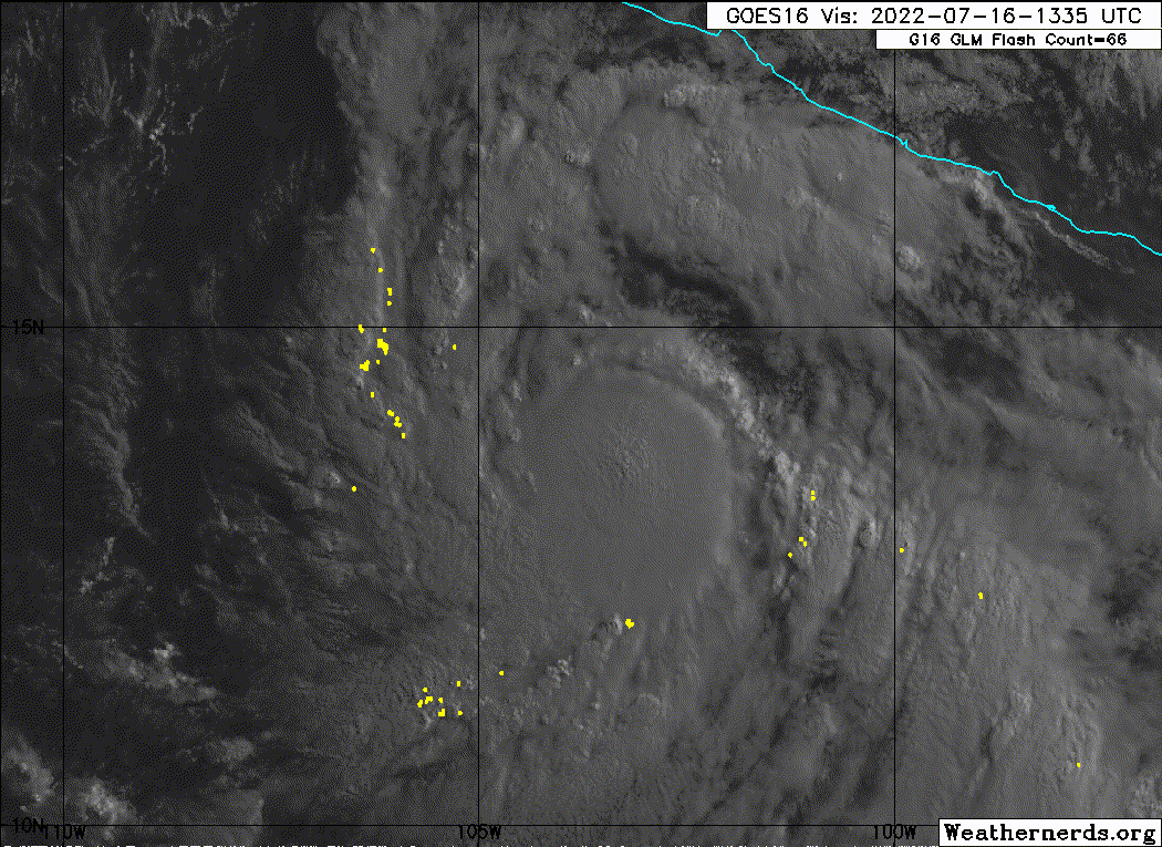
Nice burst of convection near the center. We'll see if it's able to wrap around this time
0 likes
I am in no way a professional. Take what I say with a grain of salt as I could be totally wrong. Please refer to the NHC, NWS, or SPC for official information.
Boomer Sooner!
Boomer Sooner!
-
cycloneye
- Admin
- Posts: 139026
- Age: 67
- Joined: Thu Oct 10, 2002 10:54 am
- Location: San Juan, Puerto Rico
Re: EPAC: ESTELLE - Tropical Storm

0 likes
Visit the Caribbean-Central America Weather Thread where you can find at first post web cams,radars
and observations from Caribbean basin members Click Here
and observations from Caribbean basin members Click Here
-
Yellow Evan
- Professional-Met
- Posts: 15951
- Age: 25
- Joined: Fri Jul 15, 2011 12:48 pm
- Location: Henderson, Nevada/Honolulu, HI
- Contact:
Who is online
Users browsing this forum: No registered users and 22 guests