EPAC: FRANK - Post-Tropical

Moderator: S2k Moderators

Message
Author
User avatar
Yellow Evan
Professional-Met
Professional-Met
Posts: 15951
Age: 25
Joined: Fri Jul 15, 2011 12:48 pm
Location: Henderson, Nevada/Honolulu, HI
Contact:

Re: EPAC: FRANK - Tropical Storm

#61 Postby Yellow Evan » Thu Jul 28, 2022 1:32 pm

TXPZ28 KNES 281811
TCSENP

A. 07E (FRANK)

B. 28/1730Z

C. 12.8N

D. 111.1W

E. THREE/GOES-W

F. T3.0/3.5

G. IR/EIR/VIS

H. REMARKS...AN LLCC LOCATED LESS THAN 1/3 DEG INTO THE COLD OVERCAST
RESULTS IN DT OF 3.0. THE MET IS 3.5 DUE TO SLOW DEVELOP OVER 24
HOURS. THE PT IS 3.0. THE FT IS BASED ON THE PT DUE TO UNCERTAINTY IN
CENTER POSITION.

I. ADDL POSITIONS

NIL


...BROWN


Why a shear pattern still?
0 likes   

User avatar
ElectricStorm
Category 5
Category 5
Posts: 4523
Age: 23
Joined: Tue Aug 13, 2019 11:23 pm
Location: Skiatook, OK / Norman, OK

Re: EPAC: FRANK - Tropical Storm

#62 Postby ElectricStorm » Thu Jul 28, 2022 2:43 pm

07E FRANK 220728 1800 12.9N 110.6W EPAC 50 997
0 likes   
I am in no way a professional. Take what I say with a grain of salt as I could be totally wrong. Please refer to the NHC, NWS, or SPC for official information.

Boomer Sooner!

User avatar
cycloneye
Admin
Admin
Posts: 139025
Age: 67
Joined: Thu Oct 10, 2002 10:54 am
Location: San Juan, Puerto Rico

Re: EPAC: FRANK - Tropical Storm

#63 Postby cycloneye » Thu Jul 28, 2022 3:37 pm

TCDEP2

Tropical Storm Frank Discussion Number 11
NWS National Hurricane Center Miami FL EP072022
300 PM MDT Thu Jul 28 2022

The northeasterly vertical wind shear continues to diminish over
Frank, and the cyclone is responding to this by getting better
organized with increased curved convective bands. The various
satellite intensity estimates continue to range from 35-55 kt, and
they have nudged upward a little since the last advisory. Based on
this, the initial intensity is increased to 50 kt.

Frank now has about a 48-h window in which to either steadily or
rapidly intensify in conditions of light shear and sea surface
temperatures of 28-29C. The intensity guidance is stronger for
this advisory, and the intensity forecast now calls for a peak
intensity of 95 kt in 48 h. It is possible this is conservative, as
this forecast is not at the top of the guidance envelope and the
rapid intensification index of the SHIPS model is showing about a
50 percent chance of 55 kt of strengthening during the next 48 h.
After 48 h, while the shear is forecast to remain light, the cyclone
should move over steadily decreasing SSTs, reaching 21C water by
120 h. This should cause a steady to rapid weakening.

Frank continues to move westward with the initial motion 280/10 kt.
A turn toward the west-northwest is expected during the next 12 h or
so, followed by a northwestward motion as the cyclone heads for a
break in the subtropical ridge produced by mid- to upper-level
troughing over the northeastern Pacific. While the track guidance
is in good agreement with this scenario, the across-track spread is
a little larger than for the previous forecast, with the GFS on
the right side of the guidance and the UKMET on the left. The new
track prediction lies close to the consensus models and is a little
north of the previous forecast from 72-120 h.

It should be noted that Frank and Tropical Storm Georgette are
expected to come close enough to one another to interact. Frank
will be the larger and dominant system during this interaction, and
Georgette will have only minor impacts on the track and intensity
of Frank.


FORECAST POSITIONS AND MAX WINDS

INIT 28/2100Z 13.1N 111.1W 50 KT 60 MPH
12H 29/0600Z 13.6N 112.3W 60 KT 70 MPH
24H 29/1800Z 14.5N 113.9W 70 KT 80 MPH
36H 30/0600Z 15.6N 115.7W 80 KT 90 MPH
48H 30/1800Z 16.9N 117.5W 95 KT 110 MPH
60H 31/0600Z 18.1N 119.2W 90 KT 105 MPH
72H 31/1800Z 19.4N 121.0W 75 KT 85 MPH
96H 01/1800Z 21.6N 124.0W 55 KT 65 MPH
120H 02/1800Z 24.0N 127.0W 35 KT 40 MPH

$$
Forecaster Beven
0 likes   
Visit the Caribbean-Central America Weather Thread where you can find at first post web cams,radars
and observations from Caribbean basin members Click Here

User avatar
Yellow Evan
Professional-Met
Professional-Met
Posts: 15951
Age: 25
Joined: Fri Jul 15, 2011 12:48 pm
Location: Henderson, Nevada/Honolulu, HI
Contact:

Re: EPAC: FRANK - Tropical Storm

#64 Postby Yellow Evan » Thu Jul 28, 2022 5:21 pm

Image

I wanna see microwave before calling this a hurricane but Frank may be trying to rotate convection upshear now.
0 likes   

User avatar
Yellow Evan
Professional-Met
Professional-Met
Posts: 15951
Age: 25
Joined: Fri Jul 15, 2011 12:48 pm
Location: Henderson, Nevada/Honolulu, HI
Contact:

Re: EPAC: FRANK - Tropical Storm

#65 Postby Yellow Evan » Thu Jul 28, 2022 6:55 pm

Image

I was expecting a partial inner core so this is a small setback given the low and mid level centers are not fully aligned and the LLC is on the eastern side of the deep convection. It’s probably still dealing with some sub-outflow level easterly shear that should subside and leave Frank with a 36-48 hour window to intensify. I wouldn’t count on anything higher than T5.0 or so given it’s large size leaves it vulnerable to dry air intrusions.
0 likes   

User avatar
cycloneye
Admin
Admin
Posts: 139025
Age: 67
Joined: Thu Oct 10, 2002 10:54 am
Location: San Juan, Puerto Rico

Re: EPAC: FRANK - Tropical Storm

#66 Postby cycloneye » Thu Jul 28, 2022 7:41 pm

EP, 07, 2022072900, , BEST, 0, 130N, 1113W, 55, 993, TS
0 likes   
Visit the Caribbean-Central America Weather Thread where you can find at first post web cams,radars
and observations from Caribbean basin members Click Here

User avatar
Yellow Evan
Professional-Met
Professional-Met
Posts: 15951
Age: 25
Joined: Fri Jul 15, 2011 12:48 pm
Location: Henderson, Nevada/Honolulu, HI
Contact:

Re: EPAC: FRANK - Tropical Storm

#67 Postby Yellow Evan » Thu Jul 28, 2022 7:55 pm

TXPZ28 KNES 290000
TCSENP

A. 07E (FRANK)

B. 28/2330Z

C. 12.5N

D. 111.3W

E. THREE/GOES-W

F. T3.5/3.5

G. IR/EIR/VIS

H. REMARKS...6/10 W BANDING FOR A DT=3.5 INCLUDING ADJUSTMENT. MET AND
PT AGREE. THE FT IS BASED ON THE MET SINCE THE EXACT POSITION OF THE
LLCC IS NOT CLEAR-CUT.

I. ADDL POSITIONS

NIL


...LEE
0 likes   

User avatar
Yellow Evan
Professional-Met
Professional-Met
Posts: 15951
Age: 25
Joined: Fri Jul 15, 2011 12:48 pm
Location: Henderson, Nevada/Honolulu, HI
Contact:

Re: EPAC: FRANK - Tropical Storm

#68 Postby Yellow Evan » Thu Jul 28, 2022 7:56 pm

* GFS version *
* EAST PACIFIC 2021 SHIPS INTENSITY FORECAST *
* IR SAT DATA AVAILABLE, OHC AVAILABLE *
* FRANK EP072022 07/29/22 00 UTC *

TIME (HR) 0 6 12 18 24 36 48 60 72 84 96 108 120 132 144 156 168
V (KT) NO LAND 55 61 68 77 86 98 104 99 88 76 65 54 45 36 31 24 18
V (KT) LAND 55 61 68 77 86 98 104 99 88 76 65 54 45 36 31 24 18
V (KT) LGEM 55 61 66 72 78 91 94 86 73 60 50 40 33 28 24 21 19
Storm Type TROP TROP TROP TROP TROP TROP TROP TROP TROP TROP TROP TROP TROP TROP TROP TROP TROP

SHEAR (KT) 7 8 4 3 4 7 6 6 5 3 5 4 9 12 11 14 17
SHEAR ADJ (KT) 0 2 2 0 -1 1 1 1 0 -1 0 0 -2 -4 -3 -4 0
SHEAR DIR 349 350 304 349 13 21 48 58 88 254 312 237 261 263 279 283 285
SST (C) 29.6 29.6 29.3 28.9 28.5 28.1 27.4 25.8 24.7 23.6 22.1 21.4 20.9 21.0 21.1 21.2 21.5
POT. INT. (KT) 160 161 157 153 150 146 138 121 110 98 82 75 70 69 70 72 75
200 MB T (C) -52.7 -52.9 -53.0 -52.7 -52.1 -52.4 -51.7 -52.0 -51.3 -51.9 -51.6 -52.0 -52.2 -52.2 -52.5 -52.4 -52.5
200 MB VXT (C) 0.2 0.4 0.4 0.4 0.5 0.7 0.7 1.0 0.9 1.3 0.9 0.7 0.6 0.6 1.0 0.8 0.7
TH_E DEV (C) 7 6 6 6 5 5 3 2 1 1 0 0 0 0 0 0 0
700-500 MB RH 73 75 75 75 78 76 79 76 72 69 62 60 59 58 51 44 41
MODEL VTX (KT) 21 22 23 25 28 32 35 34 30 27 25 22 20 18 16 14 13
850 MB ENV VOR 37 37 33 37 50 47 57 61 86 74 64 44 47 28 17 -2 -12
200 MB DIV 116 113 127 125 121 74 107 91 87 17 1 -8 8 1 17 -8 -5
700-850 TADV -6 -12 -9 -8 -6 -6 0 -5 0 -1 4 -2 2 1 5 3 5
LAND (KM) 978 1006 1042 1029 1022 1017 1034 1052 1107 1130 1161 1221 1319 1333 1365 1398 1407
LAT (DEG N) 13.0 13.5 13.9 14.4 14.8 16.1 17.3 18.5 19.9 20.9 21.9 23.1 24.5 xx.x xx.x xx.x xx.x
LONG(DEG W) 111.3 112.1 112.9 113.7 114.6 116.5 118.2 119.9 121.7 123.2 124.5 126.0 127.7 xxx.x xxx.x xxx.x xxx.x
STM SPEED (KT) 9 9 9 9 11 11 10 10 10 8 8 10 8 5 4 6 7
HEAT CONTENT 25 24 20 17 16 11 5 0 0 0 0 0 0 0 0 0 0

FORECAST TRACK FROM OFCI INITIAL HEADING/SPEED (DEG/KT):270/ 9 CX,CY: -8/ 0
T-12 MAX WIND: 45 PRESSURE OF STEERING LEVEL (MB): 505 (MEAN=587)
GOES IR BRIGHTNESS TEMP. STD DEV. 50-200 KM RAD: 12.4 (MEAN=14.5)
% GOES IR PIXELS WITH T < -20 C 50-200 KM RAD: 94.0 (MEAN=65.0)
PRELIM RI PROB (DV .GE. 35 KT IN 36 HR): 69.4

INDIVIDUAL CONTRIBUTIONS TO INTENSITY CHANGE
6 12 18 24 36 48 60 72 84 96 108 120 132 144 156 168
------------------------------------------------------------------------------
SAMPLE MEAN CHANGE 0. 0. 1. 1. 1. 2. 1. 1. 0. -0. -1. -2. -2. -3. -4. -4.
SST POTENTIAL 1. 2. 3. 4. 6. 7. 7. 6. 5. 3. -0. -5. -10. -15. -19. -23.
VERTICAL SHEAR MAG 0. 1. 1. 2. 3. 5. 6. 8. 9. 10. 11. 11. 10. 9. 7. 5.
VERTICAL SHEAR ADJ -0. -0. -0. -0. -0. -1. -0. -0. -0. -0. -0. -0. 0. 0. 0. 0.
VERTICAL SHEAR DIR -0. -0. -0. -0. -0. 0. 1. 0. -0. -0. 0. 1. 1. 1. 1. 2.
PERSISTENCE 2. 3. 3. 3. 3. 2. 1. 1. 1. 1. 1. 1. 1. 1. 1. 1.
200/250 MB TEMP. 0. -0. -0. -1. -1. -1. -1. -1. -0. 1. 2. 3. 5. 7. 8. 9.
THETA_E EXCESS 0. 0. -0. -0. -0. -1. -3. -4. -6. -7. -8. -9. -10. -11. -13. -15.
700-500 MB RH 0. 0. 0. 1. 1. 1. 1. 1. 1. 1. 1. 1. 1. 2. 2. 2.
MODEL VTX TENDENCY 0. 1. 2. 5. 8. 13. 15. 12. 7. 4. 0. -2. -4. -5. -6. -7.
850 MB ENV VORTICITY 0. 0. 0. 0. 0. -0. -0. -0. -1. -1. -1. -1. -1. -1. -1. -0.
200 MB DIVERGENCE 0. 1. 1. 2. 2. 3. 4. 6. 6. 5. 4. 2. 1. 0. -0. -0.
850-700 T ADVEC 0. 0. 0. 0. 0. -0. -0. -0. -0. -0. -0. -0. -0. -0. -0. -0.
ZONAL STORM MOTION 0. 0. 0. 0. 0. 1. 1. 0. 0. 0. 0. 0. 0. 0. 0. -0.
STEERING LEVEL PRES -0. -0. -0. -1. -1. -1. -1. -1. -1. -1. -2. -2. -1. -1. -1. -0.
DAYS FROM CLIM. PEAK 0. -0. -0. -0. -0. -0. -0. -0. -0. -0. -0. -0. -0. -0. -0. -0.
GOES PREDICTORS 1. 1. 1. 1. 1. 2. 2. 2. 2. 2. 2. 2. 2. 2. 2. 2.
OCEAN HEAT CONTENT 0. 0. 0. 0. -0. -0. -0. -0. -0. -0. 0. 1. 1. 2. 3. 5.
RI POTENTIAL 2. 5. 9. 13. 21. 19. 11. 3. -3. -7. -11. -12. -12. -12. -12. -11.
------------------------------------------------------------------------------
TOTAL CHANGE 6. 13. 22. 31. 43. 49. 44. 33. 21. 10. -1. -10. -19. -24. -31. -37.

CURRENT MAX WIND (KT): 55. LAT, LON: 13.0 111.3

** 2021 E. Pacific RI INDEX EP072022 FRANK 07/29/22 00 UTC **
(SHIPS-RII PREDICTOR TABLE for 30 KT OR MORE MAXIMUM WIND INCREASE IN NEXT 24-h)

Predictor Value RI Predictor Range Scaled Value(0-1) % Contribution
POT = MPI-VMAX (KT) : 101.3 40.5 to 149.3 0.56 12.2
12 HR PERSISTENCE (KT) : 10.0 -22.0 to 44.0 0.48 12.1
D200 (10**7s-1) : 120.4 -33.0 to 159.5 0.80 16.1
850-200 MB SHEAR (KT) : 5.2 19.6 to 1.3 0.79 15.3
MAXIMUM WIND (KT) : 55.0 22.5 to 132.0 0.92 14.1
STD DEV OF IR BR TEMP : 12.4 37.8 to 2.1 0.71 9.8
BL DRY-AIR FLUX (W/M2) : 108.6 800.8 to -82.5 0.78 -12.0
HEAT CONTENT (KJ/CM2) : 20.4 2.7 to 106.7 0.17 2.0
%area of TPW <45 mm upshear : 0.0 56.6 to 0.0 1.00 4.3
2nd PC OF IR BR TEMP : -0.9 2.2 to -2.3 0.68 1.7

SHIPS Prob RI for 20kt/ 12hr RI threshold= 35% is 5.6 times climatological mean ( 6.3%)
SHIPS Prob RI for 25kt/ 24hr RI threshold= 80% is 6.4 times climatological mean (12.5%)
SHIPS Prob RI for 30kt/ 24hr RI threshold= 75% is 8.8 times climatological mean ( 8.6%)
SHIPS Prob RI for 35kt/ 24hr RI threshold= 69% is 11.1 times climatological mean ( 6.2%)
SHIPS Prob RI for 40kt/ 24hr RI threshold= 53% is 12.7 times climatological mean ( 4.2%)
SHIPS Prob RI for 45kt/ 36hr RI threshold= 64% is 9.5 times climatological mean ( 6.7%)
SHIPS Prob RI for 55kt/ 48hr RI threshold= 51% is 8.7 times climatological mean ( 5.9%)
SHIPS Prob RI for 65kt/ 72hr RI threshold= 15% is 3.1 times climatological mean ( 4.7%)

Matrix of RI probabilities
------------------------------------------------------------------------------
RI (kt / h) | 20/12 | 25/24 | 30/24 | 35/24 | 40/24 | 45/36 | 55/48 |65/72
------------------------------------------------------------------------------
SHIPS-RII: 35.4% 80.0% 75.5% 69.0% 53.4% 63.8% 51.5% 14.6%
Logistic: 21.9% 64.8% 52.6% 44.9% 14.8% 52.4% 31.4% 2.1%
Bayesian: 23.4% 54.7% 62.8% 39.0% 8.6% 21.2% 5.4% 0.0%
Consensus: 26.9% 66.5% 63.6% 51.0% 25.6% 45.8% 29.4% 5.6%
DTOPS: 37.0% 69.0% 55.0% 44.0% 35.0% 60.0% 57.0% 0.0%

## ANNULAR HURRICANE INDEX (AHI) EP072022 FRANK 07/29/22 00 UTC ##
## STORM NOT ANNULAR, SCREENING STEP FAILED, NPASS=3 NFAIL=4 ##
## AHI= 0 (AHI OF 100 IS BEST FIT TO ANN. STRUC., 1 IS MARGINAL, 0 IS NOT ANNULAR) ##
0 likes   

User avatar
Kingarabian
S2K Supporter
S2K Supporter
Posts: 15432
Joined: Sat Aug 08, 2009 3:06 am
Location: Honolulu, Hawaii

Re: EPAC: FRANK - Tropical Storm

#69 Postby Kingarabian » Thu Jul 28, 2022 8:15 pm

Yellow Evan wrote:https://media.discordapp.net/attachments/733552978572869632/1002339506059489340/IMG_0831.gif

I wanna see microwave before calling this a hurricane but Frank may be trying to rotate convection upshear now.

Looks really nice despite the shear.
0 likes   
RIP Kobe Bryant

Sciencerocks
Category 5
Category 5
Posts: 7282
Age: 38
Joined: Thu Jul 06, 2017 1:51 am

Re: EPAC: FRANK - Tropical Storm

#70 Postby Sciencerocks » Thu Jul 28, 2022 9:44 pm

Image
2 likes   

User avatar
cycloneye
Admin
Admin
Posts: 139025
Age: 67
Joined: Thu Oct 10, 2002 10:54 am
Location: San Juan, Puerto Rico

Re: EPAC: FRANK - Tropical Storm

#71 Postby cycloneye » Thu Jul 28, 2022 9:46 pm

Tropical Storm Frank Discussion Number 12
NWS National Hurricane Center Miami FL EP072022
900 PM MDT Thu Jul 28 2022

Frank continues to become better organized this evening. The storm
has developed a well-defined outflow in the southern and eastern
portions of the circulation. Subjective satellite intensity
estimates from TAFB and SAB both suggest Frank is a 55-kt tropical
storm. The initial intensity has been adjusted upward to match
these estimates.

The vertical wind shear over Frank appears to be diminishing.
Significant strengthening is expected since atmospheric and oceanic
conditions are predicted to be conducive for intensification, and
the most recent statistical model guidance indicates high
probabilities for rapid intensification in the next 24 hours. As a
result, the official forecast now shows a faster rate of
strengthening in the next day with a peak intensity of 95 kt by 48
hours. After that time, Frank is forecast to cross over cooler sea
surface temperatures and into a more stable atmospheric environment.
This should cause the system to weaken into a post-tropical cyclone
by the end of the period.

Frank is moving westward at 9 kt. The storm is forecast to turn to
the west-northwest shortly as it is steered around the periphery of
a subtropical ridge. Within a day, Frank should turn northwestward
as it moves toward a weakness in the subtropical ridge. The NHC
track prediction is very similar to the previous advisory forecast
and closest to the model consensus aid, TVCE.

It should be noted that Frank and Tropical Storm Georgette are
expected to come close enough to one another to interact. Frank
will be the larger and dominant system during this interaction, and
Georgette will have only minor impacts on the track and intensity
of Frank.


FORECAST POSITIONS AND MAX WINDS

INIT 29/0300Z 13.2N 111.7W 55 KT 65 MPH
12H 29/1200Z 13.8N 113.0W 65 KT 75 MPH
24H 30/0000Z 14.9N 114.7W 80 KT 90 MPH
36H 30/1200Z 16.1N 116.5W 90 KT 105 MPH
48H 31/0000Z 17.4N 118.2W 95 KT 110 MPH
60H 31/1200Z 18.7N 119.9W 90 KT 105 MPH
72H 01/0000Z 19.9N 121.7W 75 KT 85 MPH
96H 02/0000Z 22.2N 124.9W 55 KT 65 MPH
120H 03/0000Z 24.4N 127.7W 35 KT 40 MPH...POST-TROPICAL

$$
Forecaster Bucci/Cangialosi
0 likes   
Visit the Caribbean-Central America Weather Thread where you can find at first post web cams,radars
and observations from Caribbean basin members Click Here

User avatar
cycloneye
Admin
Admin
Posts: 139025
Age: 67
Joined: Thu Oct 10, 2002 10:54 am
Location: San Juan, Puerto Rico

Re: EPAC: FRANK - Tropical Storm

#72 Postby cycloneye » Fri Jul 29, 2022 5:05 am

[Div][
Tropical Storm Frank Discussion Number 13
NWS National Hurricane Center Miami FL EP072022
300 AM MDT Fri Jul 29 2022

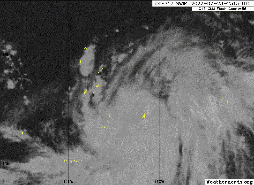
Although there has been an increase in banding over the eastern
semicircle of Frank overnight, some entrainment of dry air over the
northwestern portion of the circulation appears to have temporarily
caused a pause in the recent intensification. Frank's outflow has
become better established, and the latest shear analysis from
UW/CIMSS shows that the shear has decreased to less than 10 kt.
Recent scatterometer data was very helpful in pinpointing the
center and it revealed maximum winds of around 45 kt. The ASCAT
data also indicated that the wind field has expanded over the
eastern semicircle. Subjective satellite intensity estimates from
TAFB and SAB are 55 and 65 kt, respectively. The advisory intensity
has been kept at 55 kt, in line with the TAFB classification and
allowing for some undersampling of the ASCAT satellite.

Although the vertical shear over Frank has diminished, the
lack of an inner core in recent microwave imagery and the fairly
large wind field suggest it may take a little more time before the
rate of strengthening increases. The SHIPS RI and DTOPS guidance
gives about a 50/50 shot of rapid strengthening over the next 24
hours, however the NHC foreast is slightly below that given the
above mentioned structure of the storm. The NHC forecast still
calls for Frank to become a hurricane later today, and steady
strengthening is likely through 36 hours. By 48 hours, Frank will
be moving over progressively cooler water and into a more stable
environment. This will lead to steady weakening, and Frank is
forecast to become a post-tropical cyclone by day 5.

Frank is moving west-northwestward or 295/9 kt. The storm is
currently being steered around the southwestern periphery of a
subtropical ridge near northwestern Mexico. A weakness is forecast
to develop in the ridge over the next couple of days which will
cause Frank to turn more poleward. The spread in the dynamical
models has continued to decrease and the latest NHC forecast track
is near the center of the tightly clustered guidance envelope.

It again should be noted that Frank and Tropical Storm Georgette
are expected to come close enough to one another for some
interaction. Frank will be the larger and dominant system during
this interaction, and Georgette will have little impact on the track
or intensity of Frank.


FORECAST POSITIONS AND MAX WINDS

INIT 29/0900Z 13.6N 112.2W 55 KT 65 MPH
12H 29/1800Z 14.4N 113.5W 65 KT 75 MPH
24H 30/0600Z 15.5N 115.2W 80 KT 90 MPH
36H 30/1800Z 16.8N 117.0W 90 KT 105 MPH
48H 31/0600Z 18.0N 118.7W 90 KT 105 MPH
60H 31/1800Z 19.2N 120.4W 80 KT 90 MPH
72H 01/0600Z 20.4N 122.1W 70 KT 80 MPH
96H 02/0600Z 22.8N 125.2W 45 KT 50 MPH
120H 03/0600Z 25.0N 128.0W 30 KT 35 MPH...POST-TROP/REMNT LOW

$$
Forecaster Brown
/Div]
0 likes   
Visit the Caribbean-Central America Weather Thread where you can find at first post web cams,radars
and observations from Caribbean basin members Click Here

User avatar
Yellow Evan
Professional-Met
Professional-Met
Posts: 15951
Age: 25
Joined: Fri Jul 15, 2011 12:48 pm
Location: Henderson, Nevada/Honolulu, HI
Contact:

Re: EPAC: FRANK - Tropical Storm

#73 Postby Yellow Evan » Fri Jul 29, 2022 5:19 am

Needs an actual CDO if this wants to RI.
0 likes   

User avatar
ElectricStorm
Category 5
Category 5
Posts: 4523
Age: 23
Joined: Tue Aug 13, 2019 11:23 pm
Location: Skiatook, OK / Norman, OK

Re: EPAC: FRANK - Tropical Storm

#74 Postby ElectricStorm » Fri Jul 29, 2022 5:48 am

Looks like it's got some dry air issues right now. That huge band to the south isn't really helping it either. This has some work to do for sure.
0 likes   
I am in no way a professional. Take what I say with a grain of salt as I could be totally wrong. Please refer to the NHC, NWS, or SPC for official information.

Boomer Sooner!

User avatar
Kingarabian
S2K Supporter
S2K Supporter
Posts: 15432
Joined: Sat Aug 08, 2009 3:06 am
Location: Honolulu, Hawaii

Re: EPAC: FRANK - Tropical Storm

#75 Postby Kingarabian » Fri Jul 29, 2022 8:24 am

Like some previous storms, this storm is too large to succeed in this background state.
0 likes   
RIP Kobe Bryant

zzh
Category 1
Category 1
Posts: 375
Joined: Fri Aug 27, 2021 2:18 pm

Re: EPAC: FRANK - Tropical Storm

#76 Postby zzh » Fri Jul 29, 2022 8:34 am

Large eye is forming. I don't expect RI now.
1 likes   

User avatar
Kingarabian
S2K Supporter
S2K Supporter
Posts: 15432
Joined: Sat Aug 08, 2009 3:06 am
Location: Honolulu, Hawaii

Re: EPAC: FRANK - Tropical Storm

#77 Postby Kingarabian » Fri Jul 29, 2022 8:41 am

:uarrow: That's a big dry slot. Doesn't even have a CDO yet.
1 likes   
RIP Kobe Bryant

zzh
Category 1
Category 1
Posts: 375
Joined: Fri Aug 27, 2021 2:18 pm

Re: EPAC: FRANK - Tropical Storm

#78 Postby zzh » Fri Jul 29, 2022 8:51 am

Image
0 likes   

User avatar
Yellow Evan
Professional-Met
Professional-Met
Posts: 15951
Age: 25
Joined: Fri Jul 15, 2011 12:48 pm
Location: Henderson, Nevada/Honolulu, HI
Contact:

Re: EPAC: FRANK - Tropical Storm

#79 Postby Yellow Evan » Fri Jul 29, 2022 9:40 am

Image

Good low-level core but also very vulnerable to dry air intrusions.
0 likes   

Sciencerocks
Category 5
Category 5
Posts: 7282
Age: 38
Joined: Thu Jul 06, 2017 1:51 am

Re: EPAC: FRANK - Tropical Storm

#80 Postby Sciencerocks » Fri Jul 29, 2022 10:09 am

Image
0 likes   


Return to “2022”

Who is online

Users browsing this forum: No registered users and 17 guests