EPAC: GEORGETTE - Post-Tropical

Moderator: S2k Moderators

Message
Author
zzh
Category 1
Category 1
Posts: 375
Joined: Fri Aug 27, 2021 2:18 pm

Re: EPAC: GEORGETTE - Tropical Storm

#21 Postby zzh » Wed Jul 27, 2022 4:06 pm

Image
Looks like an open wave to me. No idea why NHC called this "TS Georgette"
0 likes   

User avatar
Yellow Evan
Professional-Met
Professional-Met
Posts: 15951
Age: 25
Joined: Fri Jul 15, 2011 12:48 pm
Location: Henderson, Nevada/Honolulu, HI
Contact:

Re: EPAC: GEORGETTE - Tropical Storm

#22 Postby Yellow Evan » Wed Jul 27, 2022 4:13 pm

:uarrow: I don’t fully disagree but ASCAT may be too low resolution to fully sample the LLC.
0 likes   

User avatar
KirbyDude25
Tropical Storm
Tropical Storm
Posts: 116
Age: 19
Joined: Mon Sep 20, 2021 8:03 am

Re: EPAC: GEORGETTE - Tropical Storm

#23 Postby KirbyDude25 » Wed Jul 27, 2022 6:47 pm

Yellow Evan wrote::uarrow: I don’t fully disagree but ASCAT may be too low resolution to fully sample the LLC.

A previous pass showed a closed LLC, so it's possible that it either degenerated or that this pass just missed it
0 likes   
New Jersey, Rutgers '27
Irene 2011 | Sandy 2012 | Fay 2020 | Isaias 2020 | Ida 2021

User avatar
cycloneye
Admin
Admin
Posts: 139009
Age: 67
Joined: Thu Oct 10, 2002 10:54 am
Location: San Juan, Puerto Rico

Re: EPAC: GEORGETTE - Tropical Storm

#24 Postby cycloneye » Wed Jul 27, 2022 7:47 pm

EP, 08, 2022072800, , BEST, 0, 164N, 1162W, 40, 1002, TS
0 likes   
Visit the Caribbean-Central America Weather Thread where you can find at first post web cams,radars
and observations from Caribbean basin members Click Here

User avatar
Yellow Evan
Professional-Met
Professional-Met
Posts: 15951
Age: 25
Joined: Fri Jul 15, 2011 12:48 pm
Location: Henderson, Nevada/Honolulu, HI
Contact:

Re: EPAC: GEORGETTE - Tropical Storm

#25 Postby Yellow Evan » Wed Jul 27, 2022 8:34 pm

TXPZ29 KNES 280031
TCSENP

A. 08E (GEORGETTE)

B. 27/2330Z

C. 16.4N

D. 116.1W

E. THREE/GOES-W

F. T2.0/2.0

G. IR/EIR/VIS

H. REMARKS...SYSTEM CHARACTERIZED BY SHEAR WITH CIRCULAR DEFINED CLOUD
LINES LOCATED UNDER A COLD OVERCAST MEASURING LESS THAN 1.5DEG. DT=2.0
MET AND OT AGREE. THE FT IS BASED ON THE MET DUE TO LOW CONFIDENCE IN
THE LLCC POSITION.

I. ADDL POSITIONS

NIL


...FISHER
0 likes   

User avatar
cycloneye
Admin
Admin
Posts: 139009
Age: 67
Joined: Thu Oct 10, 2002 10:54 am
Location: San Juan, Puerto Rico

Re: EPAC: GEORGETTE - Tropical Storm

#26 Postby cycloneye » Wed Jul 27, 2022 9:42 pm

Tropical Storm Georgette Discussion Number 3
NWS National Hurricane Center Miami FL EP082022
800 PM PDT Wed Jul 27 2022

Georgette is a small tropical cyclone with some strong deep
convection concentrated near its center. Limited banding features
are present around the northern semicircle of the storm, and
upper-level outflow is well defined over the western portion of the
circulation. Moderate easterly shear, associated with the flow on
the southern side of an upper-level anticyclone. has been impinging
on the system. The advisory intensity is nudged upward slightly to
40 kt based on the latest objective Dvorak estimates from UW-CIMSS.

Although the shear is not expected to diminish much over the next
several days, some modest short-term strengthening could occur
while Georgette remains in a favorable thermodynamic environment.
The longer-term intensity forecast for the system is quite
uncertain, since it is highly dependent on how much influence the
larger circulation of Tropical Storm, or Hurricane, Frank will have
on Georgette. The forecast track shows Georgette coming within
about 175 n mi of Frank in 96 hours, and although the official
forecast shows Georgette weakening by that time, it is quite
possible that the cyclone will be in the process of becoming
absorbed by Frank around that time. For now, the forecast will show
Georgette as a separate system, as suggested by the ECMWF
simulation. However, the GFS model prediction continues to
show Georgette being absorbed by the larger tropical cyclone in a
few days. It will be interesting to see how this plays out.

The motion continues westward or about 270/9 kt. A northeast to
southwest-oriented mid-level ridge to the northwest of the system
should cause Georgette to turn west-southwestward and
southwestward during the next 48 hours. Thereafter, the cyclone is
expected to turn northwestward and then northward in the flow on the
south and east side of Frank. The official track forecast has been
shifted a little to the east of the previous one but not as far east
as the latest simple and corrected consensus forecasts. As in the
previous advisory, the NHC track prediction is of lower-than-normal
confidence due to the uncertainty of the future interaction of
Georgette and Frank.


FORECAST POSITIONS AND MAX WINDS

INIT 28/0300Z 16.4N 116.6W 40 KT 45 MPH
12H 28/1200Z 15.8N 117.8W 45 KT 50 MPH
24H 29/0000Z 15.0N 119.1W 50 KT 60 MPH
36H 29/1200Z 14.3N 120.1W 50 KT 60 MPH
48H 30/0000Z 14.0N 120.6W 50 KT 60 MPH
60H 30/1200Z 14.5N 121.5W 50 KT 60 MPH
72H 31/0000Z 15.3N 122.0W 50 KT 60 MPH
96H 01/0000Z 17.0N 122.0W 45 KT 50 MPH
120H 02/0000Z 19.5N 122.0W 35 KT 40 MPH

$$
Forecaster Pasch
0 likes   
Visit the Caribbean-Central America Weather Thread where you can find at first post web cams,radars
and observations from Caribbean basin members Click Here

User avatar
cycloneye
Admin
Admin
Posts: 139009
Age: 67
Joined: Thu Oct 10, 2002 10:54 am
Location: San Juan, Puerto Rico

Re: EPAC: GEORGETTE - Tropical Storm

#27 Postby cycloneye » Thu Jul 28, 2022 4:27 am

Tropical Storm Georgette Discussion Number 4
NWS National Hurricane Center Miami FL EP082022
200 AM PDT Thu Jul 28 2022

Georgette remains a compact tropical cyclone with a persistent area
of deep convection located near the center and over the
northwestern portion of the circulation. Moderate easterly shear is
currently limiting the convective activity over the southeastern
portion of the tropical cyclone. A couple of timely scatterometer
overpasses have been very helpful in locating the center overnight.
The ASCAT B instrument revealed peak winds of 36 kt. Given the
small size of the tropical cyclone and typical undersampling of the
ASCAT instrument, the initial intensity has been set at 45 kt. That
is in line with the latest TAFB Dvorak T-number of T3.0.

There has been a change in the latest global model guidance
regarding the future of Georgette. The ECMWF which had been slowing
Georgette, and then moving the cyclone around the eastern portion
of Tropical Storm Frank's larger circulation now shows the smaller
Georgette opening up into a trough and being absorbed within
Frank's outer circulation within 72 hours. That is in line with the
GFS and UKMET model guidance, and the majority of ensemble tracks
from the global models. Therefore, the updated NHC forecast now
calls for Georgette to dissipate within 96 hours, but this could
occur somewhat sooner. In the shorter term, some slight
strengthening is possible but moderate easterly is likely to
prevent significant intensification. The NHC intensity forecast is
in best agreement with the HCCA and TVCN consensus aids.

Georgette is now moving west-southwestward or 255/8 kt. A northeast
to southwest-oriented mid-level ridge should steer Georgette west-
southwestward to southwestward over the next day or two. After
that time, Georgette's forward speed is expected to slow as some
binary interaction should occur between the two tropical cyclones.
Given the complexity of the forecast, the global model guidance is
in somewhat better agreement and the confidence in the first couple
of days of the forecast is a little higher than before. Beyond that
time however, there is again higher-than-normal uncertainty due to
future interaction of the cyclones.


FORECAST POSITIONS AND MAX WINDS

INIT 28/0900Z 15.8N 117.5W 45 KT 50 MPH
12H 28/1800Z 15.3N 118.6W 50 KT 60 MPH
24H 29/0600Z 14.4N 120.0W 50 KT 60 MPH
36H 29/1800Z 13.9N 121.1W 45 KT 50 MPH
48H 30/0600Z 13.6N 121.7W 45 KT 50 MPH
60H 30/1800Z 13.6N 121.9W 40 KT 45 MPH
72H 31/0600Z 14.2N 121.5W 35 KT 40 MPH
96H 01/0600Z...DISSIPATED

$$
Forecaster Brown
0 likes   
Visit the Caribbean-Central America Weather Thread where you can find at first post web cams,radars
and observations from Caribbean basin members Click Here

User avatar
wxman57
Moderator-Pro Met
Moderator-Pro Met
Posts: 22480
Age: 66
Joined: Sat Jun 21, 2003 8:06 pm
Location: Houston, TX (southwest)

Re: EPAC: GEORGETTE - Tropical Storm

#28 Postby wxman57 » Thu Jul 28, 2022 5:11 am

NHC is leaning toward what I said yesterday, dissipating within 72 hrs.
1 likes   

User avatar
InfernoFlameCat
Category 5
Category 5
Posts: 1966
Age: 21
Joined: Mon Dec 14, 2020 10:52 am
Location: Buford, GA

Re: EPAC: GEORGETTE - Tropical Storm

#29 Postby InfernoFlameCat » Thu Jul 28, 2022 7:45 am

Tropical storm Georgette is looking good. It is dealing with some shear but it has a CDO.
0 likes   
I am by no means a professional. DO NOT look at my forecasts for official information or make decisions based on what I post.

Goal: to become a registered expert over tropical and subtropical cyclones.

User avatar
cycloneye
Admin
Admin
Posts: 139009
Age: 67
Joined: Thu Oct 10, 2002 10:54 am
Location: San Juan, Puerto Rico

Re: EPAC: GEORGETTE - Tropical Storm

#30 Postby cycloneye » Thu Jul 28, 2022 9:54 am

Tropical Storm Georgette Discussion Number 5
NWS National Hurricane Center Miami FL EP082022
800 AM PDT Thu Jul 28 2022

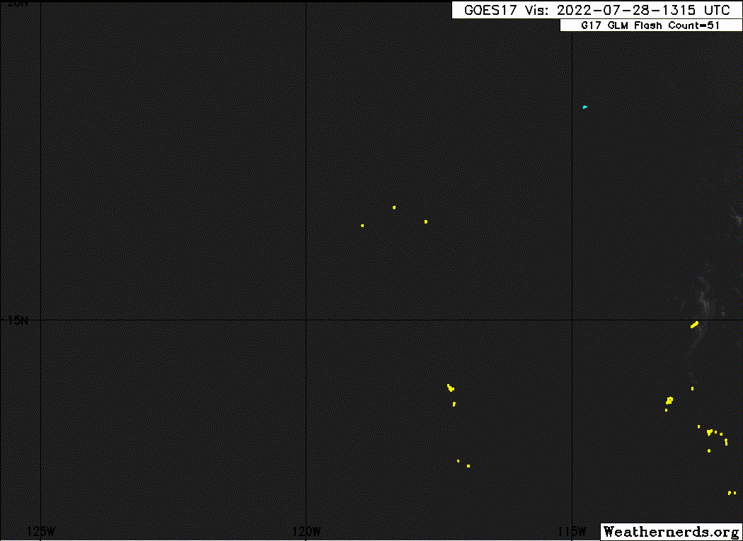
Georgette's structure on convectional satellite imagery remains
distinct this morning, with a small yet intense central dense
overcast with cloud tops as cold at -80 C near where the center is
estimated currently. The 1 minute GOES-17 data, in combination with
some cyclonically rotating GLM flashes, has been helpful in
determining the center location on first-light visible, which
appears more embedded in the convection than previously expected. A
1234 UTC SSMIS microwave pass also hints at this more embedded
structure. The initial intensity remains 45-kt in closest agreement
with the 1200 UTC Dvorak estimate from TAFB.

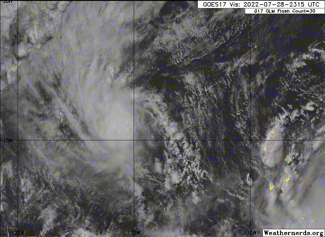
Georgette's center may have relocated a bit closer to the convection
this morning, but the current motion is still estimated at south of
due west at 260/9 kt. As previously discussed, a northeast to
southwest-oriented ridge should continue to steer Georgette
west-southwestward or southwestward for the next 12-24 hours, and
the guidance is in decent agreement of the track during this time
frame. However, after 24 hours, the track forecast becomes highly
problematic as the larger circulation of Frank approaches from the
east. The majority of the deterministic track aids respond to Frank
by quickly absorbing Georgette into its larger circulation, with the
trackers quickly shifting to the center of Frank between the 36-60
hour forecast. However, this apparent absorption solution is not a
done deal, and there is a non-negligible number of European ensemble
members that keep Georgette a distinct feature beyond the next 2-3
days. In addition, it is primarily the stronger and rightward
ensemble track members that have this solution, and Georgette is
already stronger and right-of-track compared to much of the
deterministic guidance this morning. For these reasons, the latest
track forecast was nudged further west compared to the previous one,
attempting to the account for the possibility that the
stronger-rightward ECMWF ensemble members could verify, and now
shows dissipation at 120 hours, which is a little later than the
previous forecast. Needless to say though, the track forecast has
higher-than-normal uncertainty due to the difficulty in forecasting
these binary TC interactions.

Intensity-wise, Georgette still could intensify a bit more today in
a moderate easterly shear environment while over 28-29 C
sea-surface temperatures. However, mid-level relative humidity
diagnosed by SHIPS guidance remains quite low, and the shear could
still import dry air into Georgette's tiny core and disrupt its
current convective structure. After today, the majority of the
guidance either maintains or weakens the tropical storm, and the
latest intensity forecast will continue to show a steady state 50-kt
tropical storm from 24-48 hours. Assuming Frank does get close to
Georgette, its easterly upper-level outflow and westerly low-level
inflow could further increase the shear after 48 hours, and gradual
weakening is shown after that. At 120 hours, Georgette is forecast
to open up into a trough as Frank either absorbs it or passes by to
its north. The NHC intensity forecast is in closest agreement to
the latest LGEM guidance.


FORECAST POSITIONS AND MAX WINDS

INIT 28/1500Z 15.8N 118.7W 45 KT 50 MPH
12H 29/0000Z 15.2N 119.8W 50 KT 60 MPH
24H 29/1200Z 14.5N 121.0W 50 KT 60 MPH
36H 30/0000Z 14.0N 121.9W 50 KT 60 MPH
48H 30/1200Z 13.9N 122.3W 50 KT 60 MPH
60H 31/0000Z 13.8N 122.7W 45 KT 50 MPH
72H 31/1200Z 14.0N 123.0W 40 KT 45 MPH
96H 01/1200Z 14.8N 123.0W 40 KT 45 MPH
120H 02/1200Z...DISSIPATED

$$
Forecaster Papin
0 likes   
Visit the Caribbean-Central America Weather Thread where you can find at first post web cams,radars
and observations from Caribbean basin members Click Here

User avatar
wxman57
Moderator-Pro Met
Moderator-Pro Met
Posts: 22480
Age: 66
Joined: Sat Jun 21, 2003 8:06 pm
Location: Houston, TX (southwest)

Re: EPAC: GEORGETTE - Tropical Storm

#31 Postby wxman57 » Thu Jul 28, 2022 11:41 am

Seems there is a debate about whether Georgette will survive much past 48 hours. I'm still thinking - no. Will be absorbed by Frank.
1 likes   

Sciencerocks
Category 5
Category 5
Posts: 7282
Age: 38
Joined: Thu Jul 06, 2017 1:51 am

Re: EPAC: GEORGETTE - Tropical Storm

#32 Postby Sciencerocks » Thu Jul 28, 2022 11:44 am

Image
2 likes   

User avatar
Yellow Evan
Professional-Met
Professional-Met
Posts: 15951
Age: 25
Joined: Fri Jul 15, 2011 12:48 pm
Location: Henderson, Nevada/Honolulu, HI
Contact:

Re: EPAC: GEORGETTE - Tropical Storm

#33 Postby Yellow Evan » Thu Jul 28, 2022 1:42 pm

TXPZ29 KNES 281830
TCSENP

A. 08E (GEORGETTE)

B. 28/1730Z

C. 15.9N

D. 119.2W

E. THREE/GOES-W

F. T3.0/3.0

G. IR/EIR/VIS/GMI

H. REMARKS...AN LLCC THAT LIES UNDER THE EDGE OF ACTIVE CONVECTION
RESULTS IN DT OF 3.0. THE MET AND PT AGREE. THE FT IS BASED ON THE DT.

I. ADDL POSITIONS

28/1522Z 16.0N 118.9W GMI


...BROWN
0 likes   

User avatar
ElectricStorm
Category 5
Category 5
Posts: 4521
Age: 23
Joined: Tue Aug 13, 2019 11:23 pm
Location: Skiatook, OK / Norman, OK

Re: EPAC: GEORGETTE - Tropical Storm

#34 Postby ElectricStorm » Thu Jul 28, 2022 2:43 pm

08E GEORGETTE 220728 1800 15.7N 119.5W EPAC 45 1000
0 likes   
I am in no way a professional. Take what I say with a grain of salt as I could be totally wrong. Please refer to the NHC, NWS, or SPC for official information.

Boomer Sooner!

User avatar
cycloneye
Admin
Admin
Posts: 139009
Age: 67
Joined: Thu Oct 10, 2002 10:54 am
Location: San Juan, Puerto Rico

Re: EPAC: GEORGETTE - Tropical Storm

#35 Postby cycloneye » Thu Jul 28, 2022 3:54 pm

Tropical Storm Georgette Discussion Number 6
NWS National Hurricane Center Miami FL EP082022
200 PM PDT Thu Jul 28 2022

After the previous advisory, there was a high-resolution GMI
microwave pass over Georgette at 1522 UTC that indicated that deep
convection mentioned in the previous discussion may have helped to
align the low and mid-level centers. More recently, Georgette has
maintained a small area deep convection between -70 to -75 C near
its center, though there is evidence of easterly shear impinging on
the outflow layer. Dvorak satellite estimates were T3.0/45-kt from
both TAFB and SAB, and T2.9/43-kt from UW-CIMSS ADT. The initial
intensity is being held at 45-kt this advisory.

Georgette has been moving right of the previous forecast track,
maintaining a south of due west heading at 260/10 kt, a bit faster
than before. Part of this faster and more rightward motion could be
due in part to the cyclone being more vertically aligned than
depicted in the dynamical models. In fact, the latest 12 UTC GFS and
ECMWF are still struggling to resolve Georgette's current structure,
with both models depicting the mid-level vortex tilted about 100 n
mi NNE of the low-level center, which does not match the center
embedded in the deep convection as seen on visible satellite imagery
currently. Regardless, the track guidance has made a notable shift
right this forecast cycle, and more guidance keeps Georgette
separate from the larger circulation of Frank to its east over the
next 3-4 days. Thus, the latest track forecast now shows a faster
and farther westward track over the next 48 hours, favoring the
right side of the track guidance envelope due to the more vertically
coupled structure. After 60 hours, the tropical cyclone is expected
to make a sharp turn to the north and then northeast as it becomes
embedded in large-scale monsoonal southwesterly flow to the south of
the larger low-level circulation of Frank. he latest NHC forecast
leans heavily on a blend between the latest ECMWF forecast (EMXI)
and its ensemble mean (EMNI), which have been on the right side of
the guidance envelop. However, given the still large west-to-east
spread in the ensemble tracks in 72 hours, the track forecast still
has higher-than-normal uncertainty.

Georgette still has an opportunity to intensify a bit more in the
short-term, as the easterly shear is not expected to increase much
in the next 24 hours as the cyclone remains over 28C sea surface
temperatures. However, something to watch out for is the possibility
of dry-air entrainment given the very dry mid-level relative
humidity environment. Stable stratocumulus clouds are also seen
immediately to the northeast of Georgette's cirrus shield, and if
that is ingested into the core, it could disrupt the storm's
structure. After 36 hours, the easterly shear could increase further
as Frank's upper-level outflow begins to impinge on the much smaller
Georgette. At the end of the forecast, Georgette is forecast to be
caught in strong southwesterly monsoonal flow to the south of Frank
and it could open up into a trough axis by 120 hours. The NHC
intensity forecast is quite similar to the previous one, and still
lies near the LGEM guidance.


FORECAST POSITIONS AND MAX WINDS

INIT 28/2100Z 15.6N 120.1W 45 KT 50 MPH
12H 29/0600Z 15.1N 121.3W 50 KT 60 MPH
24H 29/1800Z 14.6N 122.8W 50 KT 60 MPH
36H 30/0600Z 14.1N 123.7W 50 KT 60 MPH
48H 30/1800Z 13.7N 124.3W 45 KT 50 MPH
60H 31/0600Z 13.8N 124.5W 45 KT 50 MPH
72H 31/1800Z 14.7N 124.0W 40 KT 45 MPH
96H 01/1800Z 17.5N 123.0W 35 KT 40 MPH
120H 02/1800Z...DISSIPATED

$$
Forecaster Papin
0 likes   
Visit the Caribbean-Central America Weather Thread where you can find at first post web cams,radars
and observations from Caribbean basin members Click Here

User avatar
Yellow Evan
Professional-Met
Professional-Met
Posts: 15951
Age: 25
Joined: Fri Jul 15, 2011 12:48 pm
Location: Henderson, Nevada/Honolulu, HI
Contact:

Re: EPAC: GEORGETTE - Tropical Storm

#36 Postby Yellow Evan » Thu Jul 28, 2022 5:28 pm

Image

You can definitely see the shear kicking in.
0 likes   

User avatar
cycloneye
Admin
Admin
Posts: 139009
Age: 67
Joined: Thu Oct 10, 2002 10:54 am
Location: San Juan, Puerto Rico

Re: EPAC: GEORGETTE - Tropical Storm

#37 Postby cycloneye » Thu Jul 28, 2022 9:40 pm

Tropical Storm Georgette Discussion Number 7
NWS National Hurricane Center Miami FL EP082022
800 PM PDT Thu Jul 28 2022

Georgette remains a very compact tropical storm. Satellite images
show that the system remains sheared, with the low-level center
estimated to be near on the northeast side of the main of area of
deep convection. The system's outflow is also restricted on the
east side due to the shear. The Dvorak estimates remains steady at
3.0/45 kt from TAFB and SAB, and the initial intensity is held at
that value.

The storm continues to move south of due west, or 260 degrees, at 10
kt. A slightly slower west-southwest to southwest motion is expected
during the next couple of days. However, as much larger and stronger
Frank passes to the north, the steering flow should cause Georgette
to stall and then turn northeastward or northward. The NHC track
forecast has been adjusted southward during the first 48 hours and
then eastward from 60-96 hours, trending toward the latest consensus
models.

Georgette is expected to remain relatively steady in strength during
the next couple of days as moderate northeasterly shear persists.
However, after Frank passes to the north of Georgette, weakening
should occur when the system moves along Frank's trough axis and
gradually becomes more embedded in its circulation. The NHC
intensity forecast is a little lower than the previous one and near
the middle of the guidance envelope. Although Georgette is
predicted to dissipate in 5 days, it is possible that it could open
into a trough sooner than that.


FORECAST POSITIONS AND MAX WINDS

INIT 29/0300Z 15.5N 120.7W 45 KT 50 MPH
12H 29/1200Z 15.0N 121.9W 45 KT 50 MPH
24H 30/0000Z 14.3N 123.2W 45 KT 50 MPH
36H 30/1200Z 13.8N 124.0W 45 KT 50 MPH
48H 31/0000Z 13.7N 124.4W 40 KT 45 MPH
60H 31/1200Z 14.1N 124.0W 40 KT 45 MPH
72H 01/0000Z 15.2N 123.4W 40 KT 45 MPH
96H 02/0000Z 18.7N 121.5W 35 KT 40 MPH
120H 03/0000Z...DISSIPATED

$$
Forecaster Cangialosi
0 likes   
Visit the Caribbean-Central America Weather Thread where you can find at first post web cams,radars
and observations from Caribbean basin members Click Here

Sciencerocks
Category 5
Category 5
Posts: 7282
Age: 38
Joined: Thu Jul 06, 2017 1:51 am

Re: EPAC: GEORGETTE - Tropical Storm

#38 Postby Sciencerocks » Thu Jul 28, 2022 9:47 pm

Image
0 likes   

User avatar
cycloneye
Admin
Admin
Posts: 139009
Age: 67
Joined: Thu Oct 10, 2002 10:54 am
Location: San Juan, Puerto Rico

Re: EPAC: GEORGETTE - Tropical Storm

#39 Postby cycloneye » Fri Jul 29, 2022 5:06 am

Tropical Storm Georgette Discussion Number 8
NWS National Hurricane Center Miami FL EP082022
200 AM PDT Fri Jul 29 2022

There has been little change in Georgette's structure overnight.
Earlier microwave imagery and more recent geostationary satellite
data continue to suggest that the cyclone's low-level center is
located near the eastern side of the primary convective mass. This
is due to moderate easterly shear. Dvorak satellite intensity
estimates remained unchanged, and therefore still support an
initial wind speed of 45 kt.

The cyclone is moving south of due west, or 260 degrees at 9 kt.
Georgette is forecast to move west-southwestward to
southwestward with a deceleration in forward speed as the much
larger and stronger Tropical Storm or Hurricane Frank passes to the
northeast. The latest dynamical model guidance shows Georgette
moving farther westward in the next 36 to 48 hours, before the
storm stalls when Frank finally passes Georgette's longitude. After
that time, the guidance takes the smaller tropical cyclone
(Georgette) northeastward in the flow around the southeastern side
of Frank. Most of the models keep Georgette separate for the
next 3 to 4 days, but there has been a significant increase in the
spread of guidance tonight, and the uncertainty in the track
forecast is unusually large. The official forecast has been
adjusted westward through 48 hours to be in better agreement with
the various track aids. After that time, the forecast is a blend of
the GFS ensemble mean and the HFIP corrected consensus.

Moderate easterly to northeasterly shear is forecast to continue
over Georgette during the next few days. This is likely to result
in little overall change in strength through 36 hours. After
that time, the official forecast calls for some weakening as the
vertical shear is forecast to increase. Although the NHC forecast
calls for Georgette to dissipate in 4 to 5 days, some of the
guidance suggests that this could occur sooner.


FORECAST POSITIONS AND MAX WINDS

INIT 29/0900Z 15.3N 121.8W 45 KT 50 MPH
12H 29/1800Z 14.8N 123.0W 45 KT 50 MPH
24H 30/0600Z 14.3N 124.4W 45 KT 50 MPH
36H 30/1800Z 13.8N 125.4W 45 KT 50 MPH
48H 31/0600Z 13.8N 126.0W 40 KT 45 MPH
60H 31/1800Z 14.0N 125.9W 40 KT 45 MPH
72H 01/0600Z 15.0N 125.0W 40 KT 45 MPH
96H 02/0600Z 17.1N 123.3W 35 KT 40 MPH
120H 03/0600Z...DISSIPATED

$$
Forecaster Brown
0 likes   
Visit the Caribbean-Central America Weather Thread where you can find at first post web cams,radars
and observations from Caribbean basin members Click Here

User avatar
cycloneye
Admin
Admin
Posts: 139009
Age: 67
Joined: Thu Oct 10, 2002 10:54 am
Location: San Juan, Puerto Rico

Re: EPAC: GEORGETTE - Tropical Storm

#40 Postby cycloneye » Fri Jul 29, 2022 7:40 am

EP, 08, 2022072912, , BEST, 0, 152N, 1226W, 50, 997, TS
0 likes   
Visit the Caribbean-Central America Weather Thread where you can find at first post web cams,radars
and observations from Caribbean basin members Click Here


Return to “2022”

Who is online

Users browsing this forum: No registered users and 7 guests