EPAC: GEORGETTE - Post-Tropical

Moderator: S2k Moderators

Message
Author
User avatar
cycloneye
Admin
Admin
Posts: 139027
Age: 67
Joined: Thu Oct 10, 2002 10:54 am
Location: San Juan, Puerto Rico

Re: EPAC: GEORGETTE - Tropical Storm

#41 Postby cycloneye » Fri Jul 29, 2022 10:36 am

Tropical Storm Georgette Discussion Number 9
NWS National Hurricane Center Miami FL EP082022
800 AM PDT Fri Jul 29 2022

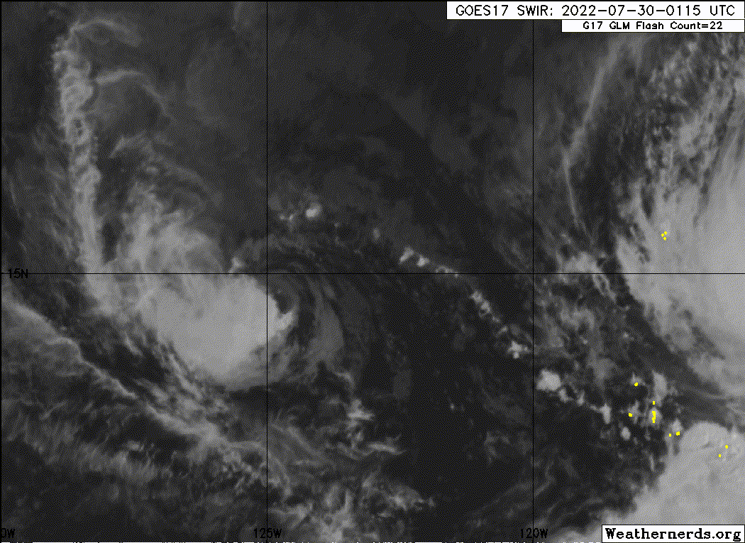
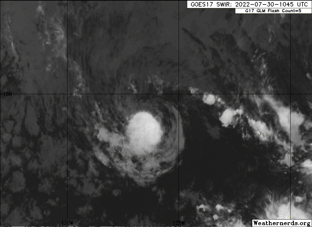
GOES-17 Proxy-Vis and enhanced IR imagery show that Georgette's
cloud pattern has become more symmetric with colder -77C inner core
cloud tops. An earlier AMSR2 revealed an eye-like feature in the
lower frequency band and a well-developed rain band in the north
part of the cyclone. The eye feature, however, was not evident in
the infrared presentation. Although the Dvorak subjective
T-numbers from TAFB and SAB haven't changed; the initial intensity
is increased to 50 kt in deference to the microwave image.

The global models and the statistical intensity guidance indicate
that the easterly shear will increase within 24 hours, causing
Georgette to weaken slowly. However, due to Georgette's compact
size, intensity fluctuations are possible in the short term. The
latest GFS run shows that Georgette could hang on a little longer
than the NHC forecast indicates, possibly as a post-tropical
cyclone. Therefore, adjusting the forecast may be deemed necessary
to extend the cyclone's life in subsequent advisories. The official
forecast is very close to the HCCA and IVCN intensity aids.

Georgette's initial motion is estimated to be just a bit south of
due west or 260/11 kt. A mid-tropospheric ridge stretching
east-northeast to west-southwest should steer the small cyclone
west to west-southwestward during the next 48 hours. Afterward, a
reduction in forward speed along with a turn toward the northeast
is expected in response to larger Frank weakening the ridge and
disrupting the steering flow while passing to the northeast of
Georgette. Although the ECMWF global has been the best performer
in the eastern Pacific this season with respect to forecast track,
the model continues to initialize poorly the compact TC indicating
a significantly weaker system while remaining the left tracker
outlier. The GFS, however, now has a more accurate depiction of
the cyclone's size and vertical depth and shows a more direct
response to Frank's larger wind field. There still is quite a bit
of uncertainty in Georgette's future track as evident by the larger
than usual guidance spread, particularly after the northeast turn.
Consequently, this is a low confidence forecast. The NHC forecast
is similar to the previous advisory through 48 hours, but has been
adjusted to the left beyond that point to agree more with the HCCA
and GEFS/EPS ensemble member solutions.


FORECAST POSITIONS AND MAX WINDS

INIT 29/1500Z 15.1N 123.0W 50 KT 60 MPH
12H 30/0000Z 14.7N 124.3W 50 KT 60 MPH
24H 30/1200Z 14.2N 125.7W 50 KT 60 MPH
36H 31/0000Z 13.9N 126.7W 45 KT 50 MPH
48H 31/1200Z 13.7N 127.2W 45 KT 50 MPH
60H 01/0000Z 14.0N 127.3W 40 KT 45 MPH
72H 01/1200Z 14.6N 126.7W 40 KT 45 MPH
96H 02/1200Z 17.0N 124.9W 35 KT 40 MPH
120H 03/1200Z...DISSIPATED

$$
Forecaster Roberts
0 likes   
Visit the Caribbean-Central America Weather Thread where you can find at first post web cams,radars
and observations from Caribbean basin members Click Here

User avatar
ElectricStorm
Category 5
Category 5
Posts: 4524
Age: 23
Joined: Tue Aug 13, 2019 11:23 pm
Location: Skiatook, OK / Norman, OK

Re: EPAC: GEORGETTE - Tropical Storm

#42 Postby ElectricStorm » Fri Jul 29, 2022 1:52 pm

Starting to weaken now

08E GEORGETTE 220729 1800 14.8N 123.6W EPAC 45 999
0 likes   
I am in no way a professional. Take what I say with a grain of salt as I could be totally wrong. Please refer to the NHC, NWS, or SPC for official information.

Boomer Sooner!

NXStumpy_Robothing
Category 1
Category 1
Posts: 325
Age: 23
Joined: Fri Jun 05, 2020 11:50 pm
Location: North Georgia

Re: EPAC: GEORGETTE - Tropical Storm

#43 Postby NXStumpy_Robothing » Fri Jul 29, 2022 2:35 pm

Yeah, all of the convection previously over the center just got sheared away to the west. Definitely going to struggle as Frank's outflow continues to expand and the dry air finds it easier and easier to punch its way into the small core.
0 likes   
Undergraduate Meteorology Student, Georgia Institute of Technology

User avatar
cycloneye
Admin
Admin
Posts: 139027
Age: 67
Joined: Thu Oct 10, 2002 10:54 am
Location: San Juan, Puerto Rico

Re: EPAC: GEORGETTE - Tropical Storm

#44 Postby cycloneye » Fri Jul 29, 2022 3:40 pm

Tropical Storm Georgette Discussion Number 10
NWS National Hurricane Center Miami FL EP082022
200 PM PDT Fri Jul 29 2022

Conventional satellite imagery shows that tiny Georgette has become
less organized during the past few hours. Although a recent SSMIS
overpass indicated that the inner core and eye-like feature have
remained intact, the deep convection in the east semi-circle has
thinned quite a bit, while the previously noted banding feature in
the north portion of the cyclone has become fragmented. All of
this is more than likely due to some increase in the northeasterly
shear magnitude. The satellite subjective intensity estimates have
decreased, and this advisory's initial intensity is set at 45 kt.

The moderate deep-layer shear should persist during the next several
days; some increase in the magnitude of the inhibiting upper wind
component is forecast beyond 48 hours. This, along with a dry
thermodynamic surrounding environment (45 to 50 percent RH in the
mid-portions of the atmosphere) should induce slow weakening through
the forecast period. There's still some uncertainty as to how long
Georgette will survive. The GFS, however, is the only global model
showing Georgette as a post-tropical cyclone or remnant low beyond
day 4. Therefore, the intensity forecast is an update of the
previous one and is similar to the HCCA and IVCN intensity consensus
forecasts.

Georgette's initial motion is estimated to be west-southwestward, or
255/10 kt. The forecast philosophy is unchanged. An east-northeast
to a west-southwest-oriented mid-tropospheric ridge should cause the
cyclone to move generally west-southwestward through the 48-hour
period. Beyond mid-period, Georgette is expected slow its forward
motion, turn northwestward, and then northeastward within the
southeastern peripheral flow of larger and stronger Frank. The NHC
forecast has changed little from this morning's advisory and lies
close to the HFIP Corrected Consensus aid.


FORECAST POSITIONS AND MAX WINDS

INIT 29/2100Z 14.7N 124.0W 45 KT 50 MPH
12H 30/0600Z 14.2N 125.3W 45 KT 50 MPH
24H 30/1800Z 13.8N 126.7W 45 KT 50 MPH
36H 31/0600Z 13.5N 127.6W 45 KT 50 MPH
48H 31/1800Z 13.4N 128.2W 45 KT 50 MPH
60H 01/0600Z 13.7N 128.3W 40 KT 45 MPH
72H 01/1800Z 14.2N 127.7W 40 KT 45 MPH
96H 02/1800Z 16.1N 126.2W 35 KT 40 MPH
120H 03/1800Z...DISSIPATED

$$
Forecaster Roberts
0 likes   
Visit the Caribbean-Central America Weather Thread where you can find at first post web cams,radars
and observations from Caribbean basin members Click Here

User avatar
cycloneye
Admin
Admin
Posts: 139027
Age: 67
Joined: Thu Oct 10, 2002 10:54 am
Location: San Juan, Puerto Rico

Re: EPAC: GEORGETTE - Tropical Storm

#45 Postby cycloneye » Fri Jul 29, 2022 9:43 pm

Tropical Storm Georgette Discussion Number 11
NWS National Hurricane Center Miami FL EP082022
800 PM PDT Fri Jul 29 2022

Easterly wind shear and a dry environment appear to be taking a
toll on Georgette. Deep convection associated with the tropical
storm has decreased in coverage during the afternoon and evening,
leaving Georgette's center nearly exposed. The initial intensity
remains 45 kt for this intensity based on recent current intensity
estimates from TAFB, SAB, and the UW-CIMSS SATCON.

Georgette's future remains cloudy (lack of cold cloud tops near its
center notwithstanding), due to its marginal surrounding environment
and the potential for interaction with a larger tropical cyclone,
Frank, currently located to the east. For the next day or so, a
low- to mid-level ridge should steer Georgette west-southwestward or
southwestward at a slightly slower speed than its current forward
speed of 11 kt. However, the tropical storm will slow to a crawl as
Frank moves closer and eventually north of Georgette. Confidence in
Georgette's track forecast is quite low once it slows down. In
general, the tropical storm or its remnants should begin to move
northward to northeastward by early next week, however there is a
large degree of spread in the models. The new NHC track forecast is
most similar to the previous official forecast, however this should
not be interpreted as a sign of confidence in the forecast.

Most of the intensity guidance agrees that Georgette will weaken
over the next few days. There's no indication that the tropical
cyclone's environment will become conducive for strengthening, so
weakening seems likely. The main source of disagreement is on how
fast that weakening will occur, and if Georgette will dissipate or
become post-tropical within the next 5 days. Some models like the
GFS and HWRF indicate Georgette could persist longer than the
official forecast indicates, while others like the ECMWF suggest it
could become post-tropical by the middle of next week. The new
official intensity forecast shows Georgette weakening a little
faster than the previous advisory, similar to the latest multi-model
intensity consensus, IVCN.


FORECAST POSITIONS AND MAX WINDS

INIT 30/0300Z 14.5N 125.1W 45 KT 50 MPH
12H 30/1200Z 14.1N 126.2W 45 KT 50 MPH
24H 31/0000Z 13.7N 127.8W 40 KT 45 MPH
36H 31/1200Z 13.4N 128.7W 40 KT 45 MPH
48H 01/0000Z 13.6N 129.0W 40 KT 45 MPH
60H 01/1200Z 14.0N 128.5W 35 KT 40 MPH
72H 02/0000Z 14.5N 127.5W 35 KT 40 MPH
96H 03/0000Z 16.0N 126.5W 30 KT 35 MPH
120H 04/0000Z...DISSIPATED

$$
Forecaster D. Zelinsky
0 likes   
Visit the Caribbean-Central America Weather Thread where you can find at first post web cams,radars
and observations from Caribbean basin members Click Here

Sciencerocks
Category 5
Category 5
Posts: 7282
Age: 38
Joined: Thu Jul 06, 2017 1:51 am

Re: EPAC: GEORGETTE - Tropical Storm

#46 Postby Sciencerocks » Fri Jul 29, 2022 11:41 pm

Image
2 likes   

User avatar
cycloneye
Admin
Admin
Posts: 139027
Age: 67
Joined: Thu Oct 10, 2002 10:54 am
Location: San Juan, Puerto Rico

Re: EPAC: GEORGETTE - Tropical Storm

#47 Postby cycloneye » Sat Jul 30, 2022 4:53 am

Tropical Storm Georgette Discussion Number 12
NWS National Hurricane Center Miami FL EP082022
200 AM PDT Sat Jul 30 2022

Georgette continues to be affected by northeasterly vertical shear
that is displacing much of its deep convection to the southwest of
the estimated center. Based on a blend of subjective and objective
Dvorak estimates from SAB, TAFB, and UW-CIMSS, the advisory
intensity remains at 45 kt.

The tropical cyclone has continued on its west-southwestward track
and is moving at about 255/9 kt. A mid-level ridge just to the
west of Hurricane Frank should continue to steer Georgette on a
west-southwestward to westward course for the next day or so.
Thereafter, the system should become situated in a region of weak
steering currents between the ridge and broad southwesterly flow to
the south and southwest of Frank. This will likely cause Georgette
to move slowly and erratically during the next 2-3 days. By 72
hours, the weakening cyclone is expected to begin moving
northeastward within the southwesterly low- to mid-level flow.
Most of the track guidance has shifted westward in comparison to the
earlier model runs, and the official forecast is somewhat west of
the previous NHC prediction beyond 36 hours, but not quite as far
west as the latest model consensus.

East-northeasterly shear is forecast to prevail over Georgette
during the next few days, and the low- to mid-level environment is
expected to remain rather dry. This, along with an increasing lack
of low-level inflow due to the influence of Franks's circulation,
should result in gradual weakening. The official forecast is
similar to the previous one and closely follows the latest HFIP
Corrected Consensus Approach, HCCA, intensity guidance.


FORECAST POSITIONS AND MAX WINDS

INIT 30/0900Z 14.2N 125.9W 45 KT 50 MPH
12H 30/1800Z 13.9N 127.2W 45 KT 50 MPH
24H 31/0600Z 13.5N 128.6W 40 KT 45 MPH
36H 31/1800Z 13.4N 129.5W 40 KT 45 MPH
48H 01/0600Z 13.6N 129.6W 40 KT 45 MPH
60H 01/1800Z 13.8N 129.6W 40 KT 45 MPH
72H 02/0600Z 14.4N 129.2W 35 KT 40 MPH
96H 03/0600Z 16.0N 128.0W 30 KT 35 MPH
120H 04/0600Z...DISSIPATED

$$
Forecaster Pasch
0 likes   
Visit the Caribbean-Central America Weather Thread where you can find at first post web cams,radars
and observations from Caribbean basin members Click Here

Sciencerocks
Category 5
Category 5
Posts: 7282
Age: 38
Joined: Thu Jul 06, 2017 1:51 am

Re: EPAC: GEORGETTE - Tropical Storm

#48 Postby Sciencerocks » Sat Jul 30, 2022 9:09 am

Image
0 likes   

User avatar
cycloneye
Admin
Admin
Posts: 139027
Age: 67
Joined: Thu Oct 10, 2002 10:54 am
Location: San Juan, Puerto Rico

Re: EPAC: GEORGETTE - Tropical Storm

#49 Postby cycloneye » Sat Jul 30, 2022 9:45 am

Tropical Storm Georgette Discussion Number 13
NWS National Hurricane Center Miami FL EP082022
800 AM PDT Sat Jul 30 2022

The structure of Georgette continues to show evidence of
northeasterly shear, with most of the convective activity occurring
southwest of the estimated center. Persistent convection near the
center of the storm, as well as subjective and objective Dvorak
estimates from SAB, TAFB, and UW-CIMSS, continue to support an
initial intensity of 45 kt, consistent with the prior advisory.

The mid-level ridge to the west of Hurricane Frank continues to
steer the tropical storm west-southwestward, with a current
estimated motion of 255/9 kt. This motion is expected to continue
during the day today, after which the steering currents are
expected to weaken, resulting in a slower forward motion during the
next couple days. By 72 hours, Georgette is expected to begin
moving northeastward under the influence of southwesterly steering
flow. The track guidance diverges significantly after 36 hours,
with many of the consensus aids indicating a delayed turn toward
the north or northeast compared to the previous official forecast.
The official forecast track is shifted westward from the previous
NHC forecast and represents a blend of the HCCA and the previous
forecast.

The combined influences of east-northeasterly vertical shear and
the proximity to Hurricane Frank are expected to limit the
intensification of Georgette during the next several days. The
intensity is forecast to hold steady during the next day or so,
with gradual weakening expected thereafter before dissipating after
96 hours. The official intensity forecast is similar to the prior
forecast and aligned with the consensus aids.


FORECAST POSITIONS AND MAX WINDS

INIT 30/1500Z 14.0N 126.8W 45 KT 50 MPH
12H 31/0000Z 13.7N 128.0W 45 KT 50 MPH
24H 31/1200Z 13.4N 129.1W 40 KT 45 MPH
36H 01/0000Z 13.4N 129.6W 40 KT 45 MPH
48H 01/1200Z 13.5N 129.8W 40 KT 45 MPH
60H 02/0000Z 13.8N 129.8W 35 KT 40 MPH
72H 02/1200Z 14.4N 129.4W 35 KT 40 MPH
96H 03/1200Z 15.5N 128.7W 30 KT 35 MPH
120H 04/1200Z...DISSIPATED

$$
Forecaster Hogsett/Beven
0 likes   
Visit the Caribbean-Central America Weather Thread where you can find at first post web cams,radars
and observations from Caribbean basin members Click Here

User avatar
cycloneye
Admin
Admin
Posts: 139027
Age: 67
Joined: Thu Oct 10, 2002 10:54 am
Location: San Juan, Puerto Rico

Re: EPAC: GEORGETTE - Tropical Storm

#50 Postby cycloneye » Sat Jul 30, 2022 4:10 pm

Tropical Storm Georgette Discussion Number 14
NWS National Hurricane Center Miami FL EP082022
200 PM PDT Sat Jul 30 2022

Georgette has maintained a consistent structure today, characterized
by persistent convective activity to the south and southwest of the
estimated center. A subjective Dvorak estimate from TAFB indicates
that the storm has maintained its intensity, and recent microwave
imagery suggests that the low-level circulation remains well
defined. Thus the initial intensity is held constant at 45 kt,
consistent with the prior advisory.

East-northeasterly steering flow continues to influence the
west-southwestward motion, which has not changed much since the
prior advisory. The current estimated motion is 255/8 kt. Later
tonight, the steering currents are expected to weaken, resulting in
a slower forward speed by tomorrow. In association with the slowing
forward speed, track guidance diverges after 24-36 hours, and the
spread among the guidance members suggests high uncertainty in the
track forecast after 36 hours. Some members of the guidance suite
indicate a sharp turn toward the northeast, while others suggest a
continued west-southwestward motion prior to turning northward later
in the forecast period. The official track forecast is a compromise
between these solutions, close to the HCCA and slightly to
the west of the prior NHC forecast.

The intensity forecast has not changed much since the prior
advisory. East-northeasterly vertical wind shear, close proximity
to the much larger Hurricane Frank, and a relatively dry airmass to
the northeast of Georgette are expected to inhibit significant
intensification throughout the forecast period. The intensity is
forecast to remain steady for the next day or so, with gradual
weakening forecast to occur after the storm turns toward the
northeast. The official intensity forecast is in line with the
consensus aids.


FORECAST POSITIONS AND MAX WINDS

INIT 30/2100Z 13.6N 127.7W 45 KT 50 MPH
12H 31/0600Z 13.3N 128.7W 45 KT 50 MPH
24H 31/1800Z 13.1N 129.6W 40 KT 45 MPH
36H 01/0600Z 13.1N 130.0W 40 KT 45 MPH
48H 01/1800Z 13.4N 130.0W 40 KT 45 MPH
60H 02/0600Z 13.8N 129.8W 40 KT 45 MPH
72H 02/1800Z 14.5N 129.5W 35 KT 40 MPH
96H 03/1800Z 15.5N 129.1W 30 KT 35 MPH
120H 04/1800Z...DISSIPATED

$$
Forecaster Hogsett/Beven
0 likes   
Visit the Caribbean-Central America Weather Thread where you can find at first post web cams,radars
and observations from Caribbean basin members Click Here

User avatar
cycloneye
Admin
Admin
Posts: 139027
Age: 67
Joined: Thu Oct 10, 2002 10:54 am
Location: San Juan, Puerto Rico

Re: EPAC: GEORGETTE - Tropical Storm

#51 Postby cycloneye » Sat Jul 30, 2022 9:40 pm

Tropical Storm Georgette Discussion Number 15
NWS National Hurricane Center Miami FL EP082022
800 PM PDT Sat Jul 30 2022

Georgette has looked a little less organized during the past few
hours. Cloud tops associated with its deep convection have warmed,
and its banding features appear to be less defined than they were
earlier today. It's unclear if this is a sign of imminent weakening
or just a reflection of diurnal fluctuations of the tropical
storm's convection. Satellite intensity estimates vary from 30 kt
to 50 kt. The NHC intensity estimate will remain 45 kt for now,
which is notably the same as the TAFB Dvorak assessment.

No changes of note were made to any aspect of the NHC forecast for
Georgette with this advisory. Unfortunately, the track component of
the forecast is still of very low confidence. The small tropical
storm should continue moving generally west-southwestward to
westward for the next day or so. By early Monday, a breakdown of
steering currents should cause the tropical cyclone to take on a
slow meandering motion. The much larger Hurricane Frank is forecast
to move north of Georgette on Sunday and Monday, which could
contribute to a slow eastward drift for Georgette. The GFS is one
example of this scenario, however the ECMWF shows no such eastward
movement, while other models fall between those two solutions. As a
result, even though all models indicate that Georgette will begin
drifting northward early next week, the model spread is quite high.
The NHC track forecast is just a touch west of the previous advisory
at most forecast times beyond 24 h, but is a little east of the
multi-model consensus at most forecast times.

The intensity forecast is more certain. Georgette's current marginal
environment is not likely to change substantially, which
should cause it to slowly weaken through early next week. The
intensity model spread is very low, increasing confidence in this
part of the forecast. NHC's updated intensity forecast is near the
middle of the small guidance envelope, closest to the multi-model
consensus.


FORECAST POSITIONS AND MAX WINDS

INIT 31/0300Z 13.4N 128.5W 45 KT 50 MPH
12H 31/1200Z 13.2N 129.4W 40 KT 45 MPH
24H 01/0000Z 13.1N 130.1W 40 KT 45 MPH
36H 01/1200Z 13.2N 130.3W 40 KT 45 MPH
48H 02/0000Z 13.5N 130.2W 40 KT 45 MPH
60H 02/1200Z 14.1N 129.9W 35 KT 40 MPH
72H 03/0000Z 14.9N 129.6W 35 KT 40 MPH
96H 04/0000Z 16.0N 129.5W 30 KT 35 MPH
120H 05/0000Z...DISSIPATED

$$
Forecaster D. Zelinsky
0 likes   
Visit the Caribbean-Central America Weather Thread where you can find at first post web cams,radars
and observations from Caribbean basin members Click Here

Sciencerocks
Category 5
Category 5
Posts: 7282
Age: 38
Joined: Thu Jul 06, 2017 1:51 am

Re: EPAC: GEORGETTE - Tropical Storm

#52 Postby Sciencerocks » Sun Jul 31, 2022 12:09 am

Image
1 likes   

User avatar
cycloneye
Admin
Admin
Posts: 139027
Age: 67
Joined: Thu Oct 10, 2002 10:54 am
Location: San Juan, Puerto Rico

Re: EPAC: GEORGETTE - Tropical Storm

#53 Postby cycloneye » Sun Jul 31, 2022 5:33 am

Tropical Storm Georgette Discussion Number 16
NWS National Hurricane Center Miami FL EP082022
200 AM PDT Sun Jul 31 2022

After briefly becoming exposed earlier tonight, there was another
deep convective burst near the center of Georgette that started
around 04 UTC. Significant lightning activity was observed on the
GOES-17 GLM around that time, though it lacked organization without
much cyclonic rotation of the flashes in the up-shear direction.
More recently, the convective cloud tops have been warming and are
being sheared off westward by upper-level easterly flow. The latest
satellite intensity estimates continue to provide a wide spread of
values from 30 to 50 kt. However, we also received a partial ASCAT-B
pass over Georgette at 0612 UTC, revealing peak wind-retrievals of
only 20-25 kt on the east side of Georgette. Assuming stronger winds
are occuring on the west side of the cyclone, the latest intensity
was reduced to only 40 kt for this advisory.

Georgette has stubbornly maintained a south of due west heading,
though it might be starting to slow down at 260/6 kt. As previously
discussed, Georgette's track forecast remains challenging, mainly
due to the difficulty in determining when Georgette will finally
halt its westward motion. The steering flow is expected to collapse
as the larger Hurricane Frank passes by well to the north of
Georgette. After this occurs, the steering currents are then
expected to veer out of the south, finally allowing Georgette to
begin a north or north-northeastward motion in 36-60 hours. At the
end of the forecast, a low-level ridge is expected to build back
in north of Georgette, resulting in a westward turn by 120 hours.
Similar to the previous forecast cycle, the GFS remains on the far
right/east side of the track guidance, while the ECMWF and its
ensemble mean remains on the far left/west side. The latest forecast
track leans towards the ECMWF and its ensemble mean as this guidance
has preformed better for Georgette so far. This results in another
westward shift in the NHC forecast track, which is also west of the
multi-model consensus aids that have been heavily influenced by the
poorly preforming GFS track so far.

The intensity forecast for Georgette is more straightforward. At
least moderate easterly vertical wind shear is expected to continue
over Georgette for the next 24-36 hours, and some additional
weakening is expected in the short term. However, there may be a
brief respite in this shear as mid-level relative humidity moistens
some between 48-60 hours, and the latest forecast now shows a bit of
re-intensification in that time period. By the end of the forecast,
Georgette is likely to move towards cooler waters and its remaining
convection will likely fade. However, it is interesting to note the
latest GFS, ECMWF, CMC, and UKMET keep Georgette as a closed
circulation through 120 hours, and so the latest forecast now shows
Georgette as a remnant low at that time. This intensity forecast is
in good agreement with the intensity consensus aids HCCA and IVCN.


FORECAST POSITIONS AND MAX WINDS

INIT 31/0900Z 13.3N 129.3W 40 KT 45 MPH
12H 31/1800Z 13.2N 130.0W 35 KT 40 MPH
24H 01/0600Z 13.1N 130.5W 35 KT 40 MPH
36H 01/1800Z 13.5N 130.6W 35 KT 40 MPH
48H 02/0600Z 14.0N 130.5W 40 KT 45 MPH
60H 02/1800Z 15.0N 130.3W 40 KT 45 MPH
72H 03/0600Z 16.0N 130.0W 35 KT 40 MPH
96H 04/0600Z 17.0N 131.0W 30 KT 35 MPH
120H 05/0600Z 16.5N 134.0W 25 KT 30 MPH...POST-TROP/REMNT LOW

$$
Forecaster Papin
0 likes   
Visit the Caribbean-Central America Weather Thread where you can find at first post web cams,radars
and observations from Caribbean basin members Click Here

Sciencerocks
Category 5
Category 5
Posts: 7282
Age: 38
Joined: Thu Jul 06, 2017 1:51 am

Re: EPAC: GEORGETTE - Tropical Storm

#54 Postby Sciencerocks » Sun Jul 31, 2022 10:24 am

Image
0 likes   

User avatar
cycloneye
Admin
Admin
Posts: 139027
Age: 67
Joined: Thu Oct 10, 2002 10:54 am
Location: San Juan, Puerto Rico

Re: EPAC: GEORGETTE - Tropical Storm

#55 Postby cycloneye » Sun Jul 31, 2022 11:46 am

Tropical Storm Georgette Discussion Number 17
NWS National Hurricane Center Miami FL EP082022
800 AM PDT Sun Jul 31 2022

Deep convection waned through the overnight hours over the center of
Georgette. However, over the past couple of hours some regeneration
of convection has occurred over the cyclone's southern semicircle.
There has been no new satellite wind data over the storm since early
this morning, but the degradation of Georgette's appearance suggests
continued weakening has occurred since the previous advisory. A
blend of the latest CI values from TAFB, SAB, and the UW-CIMSS ADT
yields an intensity of 35 kt, which will be the initial advisory
intensity.

Georgette is moving slowly westward, or 260/5 kt, to the south of a
mid-tropospheric ridge. The portion of the ridge to the north of the
cyclone should weaken through early this week as Hurricane Frank
passes well to the north. As a result, Georgette should continue to
slow its forward motion and then begin drifting northward early this
week toward the temporary weakness in the ridge carved out by
Frank. By mid-week, the ridge is forecast to re-strengthen,
forcing the cyclone on a more westward track. The latest NHC
forecast track is very similar to the previous one, as the track
guidance has changed little since that time.

The outflow from the large circulation of Frank continues to produce
some strong easterly shear across Georgette that is causing it to
struggle maintaining persistent deep convection. This shear is
forecast to continue for the next couple of days. Therefore,
Georgette is expected to weaken a little more today and be a
tropical depression through early this week. There is some
possiblity that the shear will decrease before Georgette passes
over cooler waters, and some flucuation in intensity is possible
before Georgette becomes a remnant low late in the period. The
latest NHC intensity forecast was adjusted slightly lower than the
previous one, and is close to the various multi-model intensity
consensus solutions.


FORECAST POSITIONS AND MAX WINDS

INIT 31/1500Z 13.1N 129.7W 35 KT 40 MPH
12H 01/0000Z 13.0N 130.2W 30 KT 35 MPH
24H 01/1200Z 13.2N 130.5W 30 KT 35 MPH
36H 02/0000Z 13.6N 130.5W 30 KT 35 MPH
48H 02/1200Z 14.3N 130.3W 35 KT 40 MPH
60H 03/0000Z 15.3N 130.1W 35 KT 40 MPH
72H 03/1200Z 16.1N 130.1W 35 KT 40 MPH
96H 04/1200Z 16.7N 131.8W 30 KT 35 MPH
120H 05/1200Z 16.3N 134.7W 25 KT 30 MPH...POST-TROP/REMNT LOW

$$
Forecaster Latto
0 likes   
Visit the Caribbean-Central America Weather Thread where you can find at first post web cams,radars
and observations from Caribbean basin members Click Here

Ntxw
Storm2k Moderator
Storm2k Moderator
Posts: 21495
Joined: Wed Oct 21, 2009 6:34 pm
Location: DFW, Texas

Re: EPAC: GEORGETTE - Tropical Storm

#56 Postby Ntxw » Sun Jul 31, 2022 1:29 pm

This has been a feisty swirl. Surprisingly hasn't been absorbed and may be around longer yet. Maybe she'll find a pocket of good conditions and surprise us again.
0 likes   
The above post and any post by Ntxw is NOT an official forecast and should not be used as such. It is just the opinion of the poster and may or may not be backed by sound meteorological data. It is NOT endorsed by any professional institution including Storm2k. For official information, please refer to NWS products.

  Help support Storm2K!
Help Support Storm2K

User avatar
cycloneye
Admin
Admin
Posts: 139027
Age: 67
Joined: Thu Oct 10, 2002 10:54 am
Location: San Juan, Puerto Rico

Re: EPAC: GEORGETTE - Tropical Storm

#57 Postby cycloneye » Sun Jul 31, 2022 1:59 pm

TD.

EP, 08, 2022073118, , BEST, 0, 129N, 1299W, 30, 1006, TD
0 likes   
Visit the Caribbean-Central America Weather Thread where you can find at first post web cams,radars
and observations from Caribbean basin members Click Here

User avatar
cycloneye
Admin
Admin
Posts: 139027
Age: 67
Joined: Thu Oct 10, 2002 10:54 am
Location: San Juan, Puerto Rico

Re: EPAC: GEORGETTE - Tropical Storm

#58 Postby cycloneye » Sun Jul 31, 2022 3:47 pm

Tropical Depression Georgette Discussion Number 18
NWS National Hurricane Center Miami FL EP082022
200 PM PDT Sun Jul 31 2022

There has been persistent deep convection near the estimated center
of Georgette for the past several hours, likely due to the
convective diurnal maximum. However, a fortuitous ASCAT-B overpass
that occurred at 1844 UTC over the cyclone indicates that the system
has weakened into a 30 kt tropical depression. Thus, the pulsing
nature of the convection associated with the cyclone over the past
day or so has appeared to have taken its toll.

Georgette has been moving slowly west-southwestward today, or 255/4
kt, to the south of a weak mid-tropospheric ridge. There is no
change to the track reasoning, and model guidance remains in
generally good agreement that the portion of the ridge to the north
of the cyclone should weaken through early this week as Hurricane
Frank passes well to the north. As a result, Georgette should
continue to move slowly west or west-southwest through tonight and
begin drifting northward early this week toward the temporary
weakness in the ridge carved out by Frank. By mid-week, the ridge
is forecast to re-strengthen, forcing the cyclone on a more westward
track. The latest NHC forecast track is near the previous one, and
is close to the TVCE consensus.

Strong easterly shear caused by the outflow from the large
circulation of Frank to the northeast of Georgette should prevent
deep convection from persisting near the center of the cyclone long
enough to support much reintensification. By late in the forecast
period, the system is forecast to reach cooler waters and become
surrounded by a drier airmass. This should cause further weakening,
and Georgette is expected to become a remnant low by day 5, if not
sooner. The official NHC intensity forecast no longer shows that
Georgette will restrengthen into a tropical storm. However, it is
possible some minor fluctuations in intensity could occur through
midweek.


FORECAST POSITIONS AND MAX WINDS

INIT 31/2100Z 12.7N 130.1W 30 KT 35 MPH
12H 01/0600Z 12.8N 130.4W 30 KT 35 MPH
24H 01/1800Z 13.0N 130.7W 30 KT 35 MPH
36H 02/0600Z 13.6N 130.6W 30 KT 35 MPH
48H 02/1800Z 14.4N 130.3W 30 KT 35 MPH
60H 03/0600Z 15.2N 130.2W 30 KT 35 MPH
72H 03/1800Z 15.9N 130.4W 30 KT 35 MPH
96H 04/1800Z 16.2N 132.5W 30 KT 35 MPH
120H 05/1800Z 15.5N 136.2W 25 KT 30 MPH...POST-TROP/REMNT LOW

$$
Forecaster Latto
0 likes   
Visit the Caribbean-Central America Weather Thread where you can find at first post web cams,radars
and observations from Caribbean basin members Click Here

Sciencerocks
Category 5
Category 5
Posts: 7282
Age: 38
Joined: Thu Jul 06, 2017 1:51 am

Re: EPAC: GEORGETTE - Tropical Depression

#59 Postby Sciencerocks » Sun Jul 31, 2022 4:06 pm

Image
1 likes   

User avatar
cycloneye
Admin
Admin
Posts: 139027
Age: 67
Joined: Thu Oct 10, 2002 10:54 am
Location: San Juan, Puerto Rico

Re: EPAC: GEORGETTE - Tropical Depression

#60 Postby cycloneye » Sun Jul 31, 2022 9:36 pm

Tropical Depression Georgette Discussion Number 19
NWS National Hurricane Center Miami FL EP082022
800 PM PDT Sun Jul 31 2022

Almost all deep convection has collapsed near the center of
Georgette. Last-light visible imagery showed an exposed low-level
circulation and satellite water vapor imagery indicates the
presence of dry air near the inner core of the storm. Subjective
Dvorak intensity estimates from TAFB and SAB range between 35-25
kt. The initial intensity is held at 30 kt to represent a blend
of the classifications.

Georgette is drifting westward at 3 kt, to the south of a weak
mid-level ridge. The tropical depression is expected to turn
northward at a break in the ridge, though models disagree on the
timing of the turn and this has created a large spread amongst the
track guidance. However, most models do show the ridge
restrengthening by mid-week and steering Georgette westward to
west-southward through the end of the forecast period. The official
track forecast is similar to the previous advisory track prediction
and closest to the model consensus aid, TVCE.

Moderate-to-strong easterly vertical wind shear caused by the
outflow from Frank is expected to continue over Georgette for the
next couple of days. This combined with the dry mid-tropospheric
relative humidities around the cyclone will likely prevent
Georgette from restrengthening. The NHC intensity forecast shows
Georgette maintaining tropical depression strength until day 4, when
it is predicted to become a post-tropical remnant low. Though, if
deep convection does not reform near the center, this could happen
even sooner.


FORECAST POSITIONS AND MAX WINDS

INIT 01/0300Z 12.7N 130.1W 30 KT 35 MPH
12H 01/1200Z 12.9N 130.4W 30 KT 35 MPH
24H 02/0000Z 13.3N 130.5W 30 KT 35 MPH
36H 02/1200Z 14.0N 130.3W 30 KT 35 MPH
48H 03/0000Z 14.8N 130.1W 30 KT 35 MPH
60H 03/1200Z 15.5N 130.1W 30 KT 35 MPH
72H 04/0000Z 16.0N 130.6W 30 KT 35 MPH
96H 05/0000Z 15.8N 133.3W 25 KT 30 MPH...POST-TROP/REMNT LOW
120H 06/0000Z 15.0N 137.0W 25 KT 30 MPH...POST-TROP/REMNT LOW

$$
Forecaster Bucci/Beven
0 likes   
Visit the Caribbean-Central America Weather Thread where you can find at first post web cams,radars
and observations from Caribbean basin members Click Here


Return to “2022”

Who is online

Users browsing this forum: No registered users and 41 guests