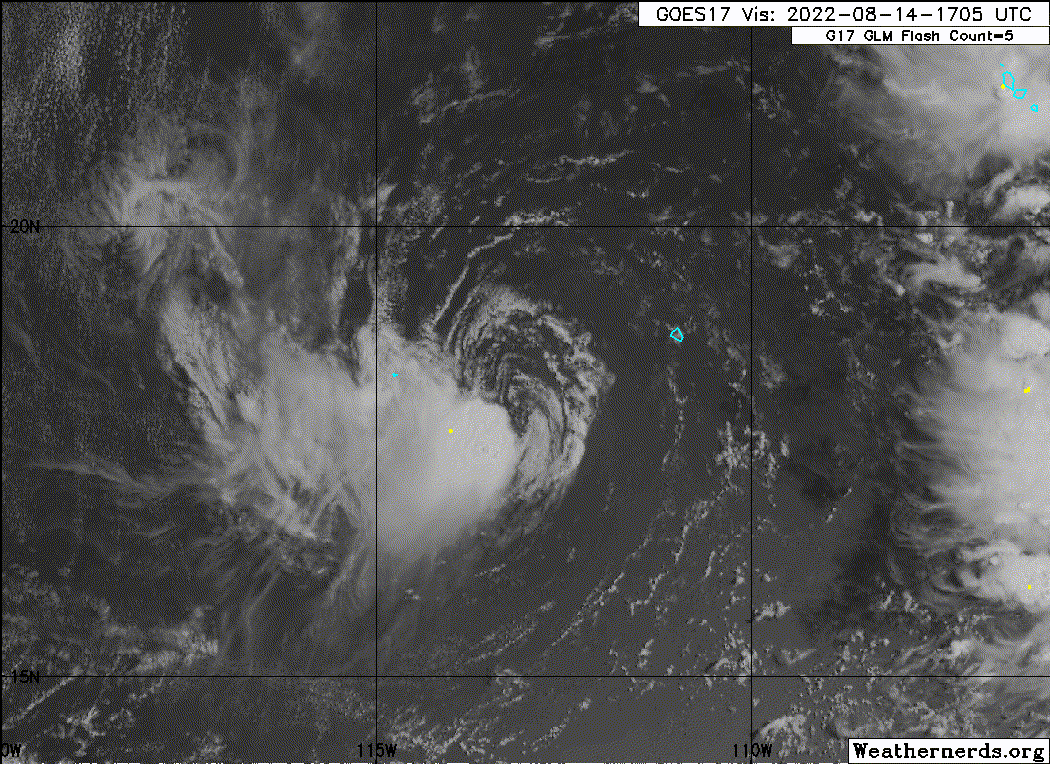
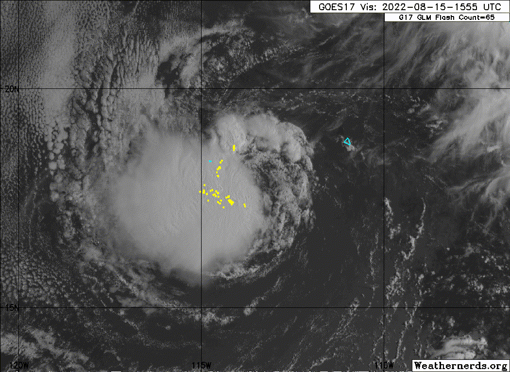
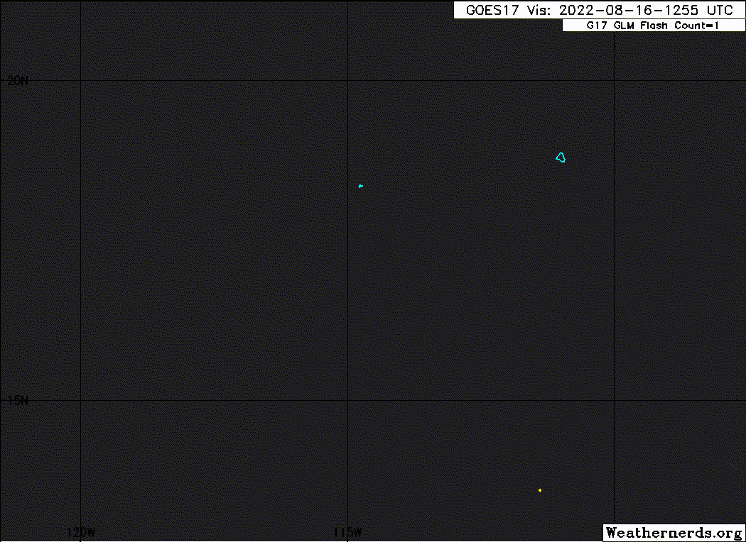
EPAC: IVETTE - Remnants

Moderator: S2k Moderators

Message
Author
User avatar
aspen
Category 5
Category 5
Posts: 8056
Joined: Sat Oct 12, 2019 7:10 pm
Location: Connecticut, USA

Re: EPAC: INVEST 90E

#41 Postby aspen » Sun Aug 14, 2022 1:13 pm

Yellow Evan wrote:
aspen wrote:What a massive bust. This wasted so much time trying to form and fell so far below the GFS, HWRF, and other intensity models.
aspen wrote:The 06z HWRF turns this into another annular hurricane, simile to Howard but it gets much stronger because it starts intensifying earlier. I don’t really buy any quick development scenarios after the last few storms have struggled early on.


These two statements contradict each other with all due respect. Even the GFS only made this strong for a couple runs and its issues in the medium range is well known at this point.

True, but I wasn’t expecting this to not even get a name. It spent a lot longer trying to develop than I thought it would.
0 likes   
Irene '11 Sandy '12 Hermine '16 5/15/2018 Derecho Fay '20 Isaias '20 Elsa '21 Henri '21 Ida '21

I am only a meteorology enthusiast who knows a decent amount about tropical cyclones. Look to the professional mets, the NHC, or your local weather office for the best information.

Sciencerocks
Category 5
Category 5
Posts: 7282
Age: 38
Joined: Thu Jul 06, 2017 1:51 am

Re: EPAC: TEN-E - Tropical Depression

#42 Postby Sciencerocks » Sun Aug 14, 2022 3:37 pm

Image
0 likes   

Sciencerocks
Category 5
Category 5
Posts: 7282
Age: 38
Joined: Thu Jul 06, 2017 1:51 am

Re: EPAC: TEN-E - Tropical Depression

#43 Postby Sciencerocks » Sun Aug 14, 2022 3:47 pm

000
WTPZ45 KNHC 142040
TCDEP5

Tropical Depression Ten-E Discussion Number 5
NWS National Hurricane Center Miami FL EP102022
300 PM MDT Sun Aug 14 2022

Deep convection has persisted over the southwestern portion of the
depression's circulation today, however the center remains exposed
due to moderate to strong shear. The area of convection has less
coverage than it did earlier today and the subjective and objective
T-numbers from SAB and UW/CIMSS have lowered accordingly. A blend of
the various satellite intensity estimates still supports a 30 kt
initial intensity, but this could be generous. The ASCAT satellite
unfortunately missed the system so there is no scatterometer data
is help determine the system's intensity.

The system is not likely to strengthen as the shear that has been
plaguing the depression is forecast to increase tonight. By Monday,
gradual weakening is expected to begin as the system remains
affected by moderate to strong shear and even drier mid-level air
impinges on the cyclone. Simulated satellite imagery from the GFS
and ECMWF models suggest the system will struggle to produce
organized deep convection by tomorrow and the forecast calls for the
depression to become a remnant low within 24 hours or so.

The depression has been meandering since the previous advisory, but
the longer-term motion appears to be just south of due west at
about 4 kt. As the depression weakens, it will be steered by a
low-level ridge to the north, and a slow westward to
west-southwestward motion is expected over the next couple of days.
The updated NHC track forecast is a little south of the previous
track due to the more southward initial position, but the official
forecast remains near the latest TCVE consensus model.


FORECAST POSITIONS AND MAX WINDS

INIT 14/2100Z 18.0N 113.3W 30 KT 35 MPH
12H 15/0600Z 18.0N 113.8W 30 KT 35 MPH
24H 15/1800Z 17.9N 114.3W 25 KT 30 MPH...POST-TROP/REMNT LOW
36H 16/0600Z 17.7N 114.8W 25 KT 30 MPH...POST-TROP/REMNT LOW
48H 16/1800Z 17.6N 115.5W 20 KT 25 MPH...POST-TROP/REMNT LOW
60H 17/0600Z 17.6N 116.4W 20 KT 25 MPH...POST-TROP/REMNT LOW
72H 17/1800Z 17.6N 117.3W 20 KT 25 MPH...POST-TROP/REMNT LOW
96H 18/1800Z...DISSIPATED

$$
Forecaster Brown
0 likes   

User avatar
cycloneye
Admin
Admin
Posts: 139025
Age: 67
Joined: Thu Oct 10, 2002 10:54 am
Location: San Juan, Puerto Rico

Re: EPAC: TEN-E - Tropical Depression

#44 Postby cycloneye » Mon Aug 15, 2022 10:02 am

Tropical Depression Ten-E Discussion Number 8
NWS National Hurricane Center Miami FL EP102022
900 AM MDT Mon Aug 15 2022

The depression is maintaining enough deep convection to keep its
tropical cyclone status for now, however the convection has had
little, if any, organization for the past 12-18 hours. The initial
intensity is held at 25 kt and is based on earlier scatterometer
data and the most recent SAB Dvorak classification. Easterly shear
of about 20 kt is forecast to continue to plague the system over the
next few days, and gradual weakening is anticipated during that
time. The system is expected to remain over warm water so continued
bursts of convection are likely, but if the convection does not gain
additional organization the system is likely to become a remnant low
at just about anytime within the next 24 hours.

The depression has been drifting southwestward over the past day or
so. A very slow westward or west-southwestward motion is expected
over the next 12 to 24 hours as the system remains within an area
of weak steering flow. A slightly faster westward to west-
northwestward motion should occur around midweek when the system
is a remnant low.


FORECAST POSITIONS AND MAX WINDS

INIT 15/1500Z 17.8N 113.6W 25 KT 30 MPH
12H 16/0000Z 17.7N 113.8W 25 KT 30 MPH...POST-TROP/REMNT LOW
24H 16/1200Z 17.6N 114.4W 25 KT 30 MPH...POST-TROP/REMNT LOW
36H 17/0000Z 17.6N 115.3W 20 KT 25 MPH...POST-TROP/REMNT LOW
48H 17/1200Z 17.7N 116.3W 20 KT 25 MPH...POST-TROP/REMNT LOW
60H 18/0000Z 17.9N 117.3W 20 KT 25 MPH...POST-TROP/REMNT LOW
72H 18/1200Z 18.2N 118.3W 20 KT 25 MPH...POST-TROP/REMNT LOW
96H 19/1200Z...DISSIPATED

$$
Forecaster Brown
0 likes   
Visit the Caribbean-Central America Weather Thread where you can find at first post web cams,radars
and observations from Caribbean basin members Click Here

zzh
Category 1
Category 1
Posts: 375
Joined: Fri Aug 27, 2021 2:18 pm

Re: EPAC: TEN-E - Tropical Depression

#45 Postby zzh » Mon Aug 15, 2022 2:08 pm

Image
EP, 10, 2022081318, , BEST, 0, 179N, 1113W, 30, 1007, TD,

Image
EP, 10, 2022081518, , BEST, 0, 177N, 1137W, 30, 1007, TD

What a joke
3 likes   

Sciencerocks
Category 5
Category 5
Posts: 7282
Age: 38
Joined: Thu Jul 06, 2017 1:51 am

Re: EPAC: TEN-E - Tropical Depression

#46 Postby Sciencerocks » Mon Aug 15, 2022 2:40 pm

Image
1 likes   

User avatar
weeniepatrol
Category 3
Category 3
Posts: 856
Joined: Sat Aug 22, 2020 5:30 pm
Location: WA State

Re: EPAC: TEN-E - Tropical Depression

#47 Postby weeniepatrol » Mon Aug 15, 2022 2:49 pm


Theres the easterly shear we all know and love
0 likes   

User avatar
DorkyMcDorkface
Category 2
Category 2
Posts: 692
Age: 26
Joined: Mon Sep 30, 2019 1:32 pm
Location: Mid-Atlantic

Re: EPAC: TEN-E - Tropical Depression

#48 Postby DorkyMcDorkface » Mon Aug 15, 2022 3:36 pm

zzh wrote:https://i.imgur.com/5fNHt9B.jpg
EP, 10, 2022081318, , BEST, 0, 179N, 1113W, 30, 1007, TD,

https://i.imgur.com/PGA92BY.jpg
EP, 10, 2022081518, , BEST, 0, 177N, 1137W, 30, 1007, TD

What a joke

Overridden, evidently.
EP, 10, 2022081518, , BEST, 0, 177N, 1137W, 35, 1005, TS

Image
0 likes   
Floyd 1999 | Isabel 2003 | Hanna 2008 | Irene 2011 | Sandy 2012 | Isaias 2020

User avatar
cycloneye
Admin
Admin
Posts: 139025
Age: 67
Joined: Thu Oct 10, 2002 10:54 am
Location: San Juan, Puerto Rico

Re: EPAC: IVETTE - Tropical Storm

#49 Postby cycloneye » Mon Aug 15, 2022 3:44 pm

A 6 to 12 hour shortie.


BULLETIN
Tropical Storm Ivette Advisory Number 9
NWS National Hurricane Center Miami FL EP102022
300 PM MDT Mon Aug 15 2022

...SATELLITE WIND DATA INDICATE THE DEPRESSION HAS BECOME TROPICAL
STORM IVETTE...
...EXPECTED TO WEAKEN SOON...


SUMMARY OF 300 PM MDT...2100 UTC...INFORMATION
----------------------------------------------
LOCATION...17.7N 113.9W
ABOUT 445 MI...710 KM SW OF THE SOUTHERN TIP OF BAJA CALIFORNIA
MAXIMUM SUSTAINED WINDS...40 MPH...65 KM/H
PRESENT MOVEMENT...W OR 265 DEGREES AT 2 MPH...4 KM/H
MINIMUM CENTRAL PRESSURE...1005 MB...29.68 INCHES


Tropical Storm Ivette Discussion Number 9
NWS National Hurricane Center Miami FL EP102022
300 PM MDT Mon Aug 15 2022

The burst of deep convection that developed around the time of the
release of the previous advisory appears to have resulted in some
unexpected intensification of the cyclone. A 1650 UTC ASCAT-B
overpass revealed a fairly sizable area of 30-35 kt winds over the
western portion of the circulation. While some of those winds
may have been rain inflated, there were enough vectors in that
range to assume the system has 30-35 kt winds. Surface
observations from Clarion island, located outside of the deep
convection, measured a peak sustained wind of 23 kt and a gust to
33 kt, which matched the scatterometer data. A more recent
ASCAT-C pass revealed slightly lower winds, but ADT, SATCON, and
the Dvorak data T-numbers (using a shear pattern) all supported a
35-kt intensity at around 18Z. Therefore, the depression is
upgraded to a 35-kt tropical storm on this advisory.

The burst of convection that caused the intensification is already
quickly being shunted westward away from the low-level center due
to 20-25 kt of easterly shear. Since the system is forecast to
remain over warm water during the next couple of days, additional
bursts of convection are likely to develop and it is nearly
impossible to forecast if they will have enough organization or
persistence to maintain the system as a tropical cyclone. Given
the shear, the forecast still calls for gradual weakening, but it
delays the system's transition to a post-tropical cyclone a bit.

The depression remains within an area of light steering currents and
the initial motion estimate is 265/2 kt. The system is only
forecast to drift westward or west-southwestward during the next day
or so, before a more pronounced westward or west-northwestward
motion is expected to begin. The updated NHC track forecast is in
best agreement with the TVCE consensus model, which is slightly
north of the previous official forecast.


FORECAST POSITIONS AND MAX WINDS

INIT 15/2100Z 17.7N 113.9W 35 KT 40 MPH
12H 16/0600Z 17.6N 114.1W 30 KT 35 MPH
24H 16/1800Z 17.6N 114.8W 25 KT 30 MPH...POST-TROP/REMNT LOW
36H 17/0600Z 17.8N 115.7W 25 KT 30 MPH...POST-TROP/REMNT LOW
48H 17/1800Z 18.0N 116.6W 20 KT 25 MPH...POST-TROP/REMNT LOW
60H 18/0600Z 18.2N 117.6W 20 KT 25 MPH...POST-TROP/REMNT LOW
72H 18/1800Z 18.5N 118.5W 20 KT 25 MPH...POST-TROP/REMNT LOW
96H 19/1800Z...DISSIPATED

$$
Forecaster Brown
0 likes   
Visit the Caribbean-Central America Weather Thread where you can find at first post web cams,radars
and observations from Caribbean basin members Click Here

User avatar
NDG
S2K Supporter
S2K Supporter
Posts: 14933
Joined: Sun Jul 09, 2006 10:14 pm
Location: Orlando, FL

Re: EPAC: IVETTE - Tropical Storm

#50 Postby NDG » Mon Aug 15, 2022 4:40 pm

A sign that the the EPAC is starting to get more hostile like it usually does during a La Nina year.

Image
3 likes   

User avatar
cycloneye
Admin
Admin
Posts: 139025
Age: 67
Joined: Thu Oct 10, 2002 10:54 am
Location: San Juan, Puerto Rico

Re: EPAC: IVETTE - Tropical Storm

#51 Postby cycloneye » Mon Aug 15, 2022 7:53 pm

EP, 10, 2022081600, , BEST, 0, 177N, 1141W, 30, 1006, TD
0 likes   
Visit the Caribbean-Central America Weather Thread where you can find at first post web cams,radars
and observations from Caribbean basin members Click Here

User avatar
ElectricStorm
Category 5
Category 5
Posts: 4523
Age: 23
Joined: Tue Aug 13, 2019 11:23 pm
Location: Skiatook, OK / Norman, OK

Re: EPAC: IVETTE - Tropical Storm

#52 Postby ElectricStorm » Mon Aug 15, 2022 8:12 pm

Well that didn't last long lol, already back down to TD
0 likes   
I am in no way a professional. Take what I say with a grain of salt as I could be totally wrong. Please refer to the NHC, NWS, or SPC for official information.

Boomer Sooner!

User avatar
cycloneye
Admin
Admin
Posts: 139025
Age: 67
Joined: Thu Oct 10, 2002 10:54 am
Location: San Juan, Puerto Rico

Re: EPAC: IVETTE - Tropical Depression

#53 Postby cycloneye » Mon Aug 15, 2022 9:40 pm

BULLETIN
Tropical Depression Ivette Advisory Number 10
NWS National Hurricane Center Miami FL EP102022
900 PM MDT Mon Aug 15 2022

...IVETTE WEAKENS BACK INTO A TROPICAL DEPRESSION...
...STILL FORECAST TO BECOME POST-TROPICAL IN THE NEXT DAY OR SO...


SUMMARY OF 900 PM MDT...0300 UTC...INFORMATION
----------------------------------------------
LOCATION...17.6N 114.4W
ABOUT 470 MI...755 KM SW OF THE SOUTHERN TIP OF BAJA CALIFORNIA
MAXIMUM SUSTAINED WINDS...35 MPH...55 KM/H
PRESENT MOVEMENT...W OR 260 DEGREES AT 3 MPH...6 KM/H
MINIMUM CENTRAL PRESSURE...1006 MB...29.71 INCHES


Tropical Depression Ivette Discussion Number 10
NWS National Hurricane Center Miami FL EP102022
900 PM MDT Mon Aug 15 2022

The satellite presentation of Ivette this evening has degraded, with
the prior burst of deep convection shearing away to the west and
dissipating, though a smaller convective cell has begun to redevelop
on the southwest side of the circulation. The definition of the
center itself on both conventional satellite and microwave imagery
appears more diffuse than before, suggesting that the earlier
convective burst did not help to tighten up the circulation. While
earlier scatterometer data indicated tropical-storm-force winds
existed in the convective northwest quadrant of Ivette, more recent
surface wind observations from Clarion island, also in this
quadrant, are lower than earlier, sustained at only 21 kt with
gusts up to 28 kt. These observations, in combination with the
degradation in the satellite structure this evening, support
lowering the intensity back to 30 kt for this advisory.

The ongoing moderate to strong easterly vertical wind shear is not
expected to subside for the next several days. However, as
previously mentioned, Ivette is expected to remain over sufficently
warm water that may allow occasional convective bursts over this
period, and it is difficult to determine when this activity will
become insufficient to maintain Ivette's status as a tropical
cyclone. It is still presumed that the ongoing shear will be too
hostile to allow these convective bursts to remain organized, and
like the previous advisory, gradual weakening is still forecast. The
latest NHC intensity forecast still shows Ivette becoming a
post-tropical remnant low in about 24 hours. One alternative
scenario is that the system may be able to persist as a weak
tropical cyclone a bit longer than forecasted if convection
redevelops like that seen earlier today.

There has been a slight acceleration in Ivette's westward motion
this evening, now estimated at 260/3 kt. A general slow westward
motion is forecast over the next several days following the weak
low-level steering, in addition to occasional convective bursts on
the west side of the circulation that may continue to tug it in
that direction. The latest NHC forecast track remains close to the
consensus aids and is just a touch north of the previous forecast
track after 24 hours.


FORECAST POSITIONS AND MAX WINDS

INIT 16/0300Z 17.6N 114.4W 30 KT 35 MPH
12H 16/1200Z 17.6N 114.8W 30 KT 35 MPH
24H 17/0000Z 17.7N 115.4W 25 KT 30 MPH...POST-TROP/REMNT LOW
36H 17/1200Z 18.0N 116.1W 25 KT 30 MPH...POST-TROP/REMNT LOW
48H 18/0000Z 18.3N 117.0W 20 KT 25 MPH...POST-TROP/REMNT LOW
60H 18/1200Z 18.5N 118.0W 20 KT 25 MPH...POST-TROP/REMNT LOW
72H 19/0000Z 18.6N 119.0W 20 KT 25 MPH...POST-TROP/REMNT LOW
96H 20/0000Z...DISSIPATED

$$
Forecaster Papin
0 likes   
Visit the Caribbean-Central America Weather Thread where you can find at first post web cams,radars
and observations from Caribbean basin members Click Here

User avatar
AnnularCane
S2K Supporter
S2K Supporter
Posts: 2634
Joined: Thu Jun 08, 2006 9:18 am
Location: Wytheville, VA

Re: EPAC: IVETTE - Tropical Depression

#54 Postby AnnularCane » Mon Aug 15, 2022 10:42 pm

All she wanted was a name. Even briefly. :)
2 likes   
"But it never rained rain. It never snowed snow. And it never blew just wind. It rained things like soup and juice. It snowed mashed potatoes and green peas. And sometimes the wind blew in storms of hamburgers." -- Judi Barrett, Cloudy with a Chance of Meatballs

User avatar
cycloneye
Admin
Admin
Posts: 139025
Age: 67
Joined: Thu Oct 10, 2002 10:54 am
Location: San Juan, Puerto Rico

Re: EPAC: IVETTE - Tropical Depression

#55 Postby cycloneye » Tue Aug 16, 2022 4:40 am

Tropical Depression Ivette Discussion Number 11
NWS National Hurricane Center Miami FL EP102022
300 AM MDT Tue Aug 16 2022

A burst of deep convection that developed in the western part of
Ivette's circulation last evening has since been sheared away,
leaving a swirl of low- to mid-level clouds. Despite the loss of
convection, a blend of TAFB's Dvorak CI number (2.0) with UW-CIMSS
ADT and SATCON estimates supports maintaining 30 kt for this
advisory. It's possible that some convection could redevelop since
Ivette remains over warm waters of about 28 degrees Celsius.
However, strong deep-layer easterly shear of about 25 kt and a
relatively dry atmosphere are likely to cause any new convection to
be short lived and on the less-than-organized side of the spectrum.
Therefore, barring any surprises, Ivette is expected to degenerate
into a remnant low later today, and gradually spin down during the
next few days. Global models are in generally good agreement that
the remnant low should open up into a trough in about 4 days.

With the development and dissipation of recent convection, Ivette's
movement has been erratic, and it's actually been nearly stationary
for the past few hours. Since yesterday afternoon, however, the
center has generally moved west-southwestward (245 degrees) at about
2 kt. The steering flow around the depression is weak at the
moment, and there is greater-than-normal spread in the track
guidance. In general, though, the remnant low is expected to move
slowly westward to west-northwestward at 5 kt or less until
dissipation. The new NHC track has been shifted southward from the
previous forecast, mainly to account for Ivette's recent motion.


FORECAST POSITIONS AND MAX WINDS

INIT 16/0900Z 17.2N 114.3W 30 KT 35 MPH
12H 16/1800Z 17.3N 115.0W 25 KT 30 MPH...POST-TROP/REMNT LOW
24H 17/0600Z 17.6N 115.9W 25 KT 30 MPH...POST-TROP/REMNT LOW
36H 17/1800Z 17.9N 116.8W 25 KT 30 MPH...POST-TROP/REMNT LOW
48H 18/0600Z 18.1N 117.8W 25 KT 30 MPH...POST-TROP/REMNT LOW
60H 18/1800Z 18.2N 118.8W 20 KT 25 MPH...POST-TROP/REMNT LOW
72H 19/0600Z 18.0N 119.6W 20 KT 25 MPH...POST-TROP/REMNT LOW
96H 20/0600Z...DISSIPATED

$$
Forecaster Berg
0 likes   
Visit the Caribbean-Central America Weather Thread where you can find at first post web cams,radars
and observations from Caribbean basin members Click Here

Sciencerocks
Category 5
Category 5
Posts: 7282
Age: 38
Joined: Thu Jul 06, 2017 1:51 am

Re: EPAC: IVETTE - Tropical Depression

#56 Postby Sciencerocks » Tue Aug 16, 2022 11:28 am

Image
0 likes   

User avatar
cycloneye
Admin
Admin
Posts: 139025
Age: 67
Joined: Thu Oct 10, 2002 10:54 am
Location: San Juan, Puerto Rico

Re: EPAC: IVETTE - Post-Tropical

#57 Postby cycloneye » Tue Aug 16, 2022 3:44 pm

BULLETIN
Post-Tropical Cyclone Ivette Advisory Number 13
NWS National Hurricane Center Miami FL EP102022
200 PM PDT Tue Aug 16 2022

...IVETTE BECOMES A REMNANT LOW...
...THIS IS THE LAST NHC ADVISORY...


SUMMARY OF 200 PM PDT...2100 UTC...INFORMATION
----------------------------------------------
LOCATION...17.3N 115.1W
ABOUT 515 MI...825 KM SW OF THE SOUTHERN TIP OF BAJA CALIFORNIA
MAXIMUM SUSTAINED WINDS...30 MPH...45 KM/H
PRESENT MOVEMENT...W OR 270 DEGREES AT 6 MPH...9 KM/H
MINIMUM CENTRAL PRESSURE...1007 MB...29.74 INCHES


Post-Tropical Cyclone Ivette Discussion Number 13
NWS National Hurricane Center Miami FL EP102022
200 PM PDT Tue Aug 16 2022

Although there has been sporadic and disorganized convection mainly
to the southwest of the center of Ivette today, this system lacks
sufficient organized, deep convection to qualify as a tropical
cyclone. Therefore, this is the last NHC advisory. The initial
intensity is lowered to 25 kt based on the satellite intensity
estimate from TAFB. Some additional sporadic bursts of convection
may occur over the next day or two while the remnant low is over
marginally warm waters. However, persistent strong easterly
vertical wind shear associated with a large upper-level anticyclone
to the north of the system should prevent any significant convective
reorganization for the next several days.

Ivette has continued its motion westward at 5 kt. Over the next day
or so, the system should turn west-northwestward in the low-level
flow. A building low-level ridge to the northwest of Ivette should
eventually steer the remnants westward and then west-southwestward
until it opens up into a trough in a few days.

For additional information on the remnant low please see High Seas
Forecasts issued by the National Weather Service, under AWIPS
header NFDHSFEPI, WMO header FZPN02 KWBC, and on the web at
ocean.weather.gov/shtml/NFDHSFEPI.php


FORECAST POSITIONS AND MAX WINDS

INIT 16/2100Z 17.3N 115.1W 25 KT 30 MPH...POST-TROPICAL
12H 17/0600Z 17.5N 115.8W 25 KT 30 MPH...POST-TROP/REMNT LOW
24H 17/1800Z 17.9N 116.7W 25 KT 30 MPH...POST-TROP/REMNT LOW
36H 18/0600Z 18.1N 117.7W 20 KT 25 MPH...POST-TROP/REMNT LOW
48H 18/1800Z 18.1N 118.6W 20 KT 25 MPH...POST-TROP/REMNT LOW
60H 19/0600Z 17.9N 119.4W 20 KT 25 MPH...POST-TROP/REMNT LOW
72H 19/1800Z...DISSIPATED

$$
Forecaster Bucci/Pasch
0 likes   
Visit the Caribbean-Central America Weather Thread where you can find at first post web cams,radars
and observations from Caribbean basin members Click Here

User avatar
cycloneye
Admin
Admin
Posts: 139025
Age: 67
Joined: Thu Oct 10, 2002 10:54 am
Location: San Juan, Puerto Rico

Re: EPAC: IVETTE - Remnants

#58 Postby cycloneye » Sat Aug 20, 2022 7:46 pm

IVETTE tries to make a comeback.

Tropical Weather Outlook
NWS National Hurricane Center Miami FL
500 PM PDT Sat Aug 20 2022

For the eastern North Pacific...east of 140 degrees west longitude:

1. Western East Pacific:
An area of low pressure associated with the remnants of Ivette is
producing disorganized showers and thunderstorms. Some slow
development of this system is possible over the next couple of days
as it moves generally westward, well east-southeast of the Hawaiian
Islands. After that time, environmental conditions are expected to
become unfavorable for further development.
* Formation chance through 48 hours...low...20 percent.
* Formation chance through 5 days...low...20 percent.

Forecaster Bucci/Beven


Image
0 likes   
Visit the Caribbean-Central America Weather Thread where you can find at first post web cams,radars
and observations from Caribbean basin members Click Here

User avatar
AnnularCane
S2K Supporter
S2K Supporter
Posts: 2634
Joined: Thu Jun 08, 2006 9:18 am
Location: Wytheville, VA

Re: EPAC: IVETTE - Remnants

#59 Postby AnnularCane » Sat Aug 20, 2022 7:57 pm

Well how about that? I saw her when I went into TT and thought they just forgot to remove it. :P
1 likes   
"But it never rained rain. It never snowed snow. And it never blew just wind. It rained things like soup and juice. It snowed mashed potatoes and green peas. And sometimes the wind blew in storms of hamburgers." -- Judi Barrett, Cloudy with a Chance of Meatballs

User avatar
cycloneye
Admin
Admin
Posts: 139025
Age: 67
Joined: Thu Oct 10, 2002 10:54 am
Location: San Juan, Puerto Rico

Re: EPAC: IVETTE - Remnants

#60 Postby cycloneye » Sun Aug 21, 2022 6:29 am

An area of low pressure associated with the remnants of Ivette
continues to produce disorganized showers and thunderstorms. Some
slow development of this system is possible over the next day or so
as it moves generally westward, well east-southeast of the Hawaiian
Islands. After that time, environmental conditions are expected to
become unfavorable for further development.
* Formation chance through 48 hours...low...20 percent.
* Formation chance through 5 days...low...20 percent.
0 likes   
Visit the Caribbean-Central America Weather Thread where you can find at first post web cams,radars
and observations from Caribbean basin members Click Here


Return to “2022”

Who is online

Users browsing this forum: No registered users and 25 guests