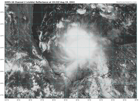
wxman57 wrote:Looks like a wave axis. Satellite can be quite deceiving.
Yup. Vorticity looks to still be focused in mid-levels for now. I would imagine if convection persists, we will see a closed surface vortex form before landfall.
Moderator: S2k Moderators


wxman57 wrote:Looks like a wave axis. Satellite can be quite deceiving.


SouthDadeFish wrote:wxman57 wrote:Looks like a wave axis. Satellite can be quite deceiving.
Yup. Vorticity looks to still be focused in mid-levels for now. I would imagine if convection persists, we will see a closed surface vortex form before landfall.


NDG wrote:SouthDadeFish wrote:wxman57 wrote:Looks like a wave axis. Satellite can be quite deceiving.
Yup. Vorticity looks to still be focused in mid-levels for now. I would imagine if convection persists, we will see a closed surface vortex form before landfall.
I am sure it will develop an LLC as soon as it makes landfall tomorrow as it has been the case this season so far


skyline385 wrote:NDG wrote:SouthDadeFish wrote:
Yup. Vorticity looks to still be focused in mid-levels for now. I would imagine if convection persists, we will see a closed surface vortex form before landfall.
I am sure it will develop an LLC as soon as it makes landfall tomorrow as it has been the case this season so far
Will probably also develop an eye once inand
Sent from my iPhone using Tapatalk
WiscoWx02 wrote:skyline385 wrote:NDG wrote:
I am sure it will develop an LLC as soon as it makes landfall tomorrow as it has been the case this season so far
Will probably also develop an eye once inand
Sent from my iPhone using Tapatalk
It’s a PTC now…that’s a double strike against it in my opinionPTC’s always take forever to develop i.e. PTC01L and PTC02L this year alone and the PTC’s last year…plus this area is nowhere near closed at the surface based on recon…all easterly wind. Not even a notch in the flow to be found.
wxman57 wrote:Still no track graphics on the NHC website, or am I missing something?


Hammy wrote:NHC notes there is actually zero model support for development so I wonder if they jumped the gun a bit on the 70% chance. Still good to have watches/warnings up either way.


weeniepatrol wrote:Hammy wrote:NHC notes there is actually zero model support for development so I wonder if they jumped the gun a bit on the 70% chance. Still good to have watches/warnings up either way.
I see 80% now
https://i.imgur.com/ixrZWZB.png

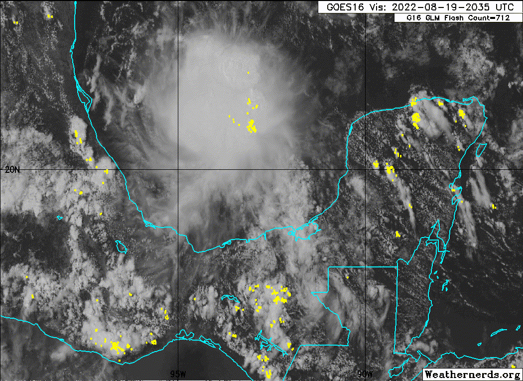
aspen wrote:The NW to SE pass finally showed a change in wind directions around 20.5-21.5N and 94.5-95.0W, so it looks like an LLC is developing.


NHC has begun advisories on Potential Tropical Cyclone #4
Tropical Storm Warnings are issued for the western Gulf coast from Boca de Catan, MX to Port Mansfield, TX including the southern Laguna Madre.
Discussion:
USAF plane investigating 99L this afternoon was unable to close off a defined low level circulation and instead found mainly southeast winds with very weak winds on the southwest edge of the large mass of deep convection. IR Satellite Loop for Invest 99L | Tropical Tidbits It is possible that a low level center may form near the southwest edge of the thunderstorms where the plane found weak winds, or a new low level circulation to develop further to the northeast closer to the deep thunderstorms and the mid level circulation. The plane did find an area of 25-30kt winds well to the northeast of the weak wind field near the active thunderstorms.
Track:
The system is generally moving toward the NW at around 15mph on the southwestern edge of a mid level high pressure ridge over the eastern Gulf of Mexico and this motion is expected to continue through the next 24-36 hours bringing the center ashore near the northeast coast of Mexico just south of the Rio Grande River. While there is some uncertainty in exactly where a low level center will form there is fairly high confidence on a general NW track through 48 hours and the guidance cluster is showing little spread.
Intensity:
The system is in favorable conditions for development with light vertical wind shear, warm sea surface temperatures and good upper level outflow to the north, south, and east. Additionally, developing tropical systems in this part of the Gulf of Mexico tend to have some help in developing due to the shape of the coastline which can help tighten a developing low level circulation. 99L is expected to make landfall as a 45mph tropical storm in 24 hours, although most guidance keeps the system in the 35-40mph range and the system will only have about 24 hours over the water. Tropical storm conditions may extend as far north as deep southern Texas depending on exactly where the center eventually forms.
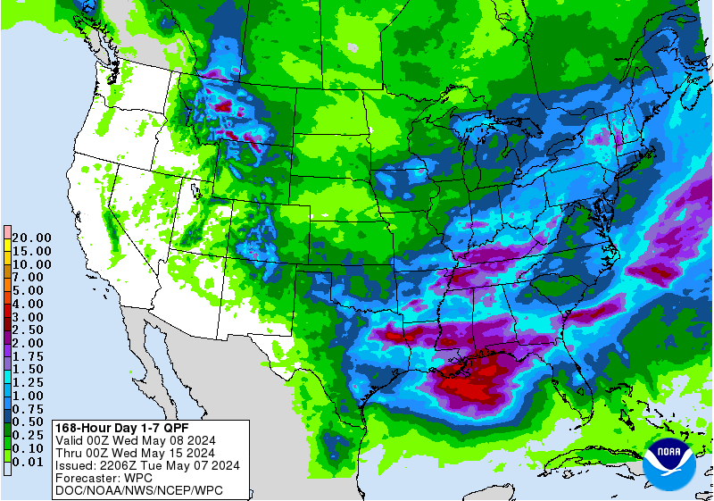
It is likely 99L will become absorbed into the incoming low pressure and frontal system over Texas early next week and this may help to enhance already high forecasted rainfall amounts.
Users browsing this forum: No registered users and 61 guests


