EPAC: JAVIER - Post-Tropical

Moderator: S2k Moderators

Message
Author
User avatar
ElectricStorm
Category 5
Category 5
Posts: 4523
Age: 23
Joined: Tue Aug 13, 2019 11:23 pm
Location: Skiatook, OK / Norman, OK

EPAC: JAVIER - Post-Tropical

#1 Postby ElectricStorm » Wed Aug 31, 2022 12:18 am

EP, 92, 2022083100, , BEST, 0, 138N, 1041W, 20, 1007, DB, 34, NEQ, 0, 0, 0, 0, 1008, 150, 90, 0, 0, E, 0, , 0, 0, INVEST, S, 0, , 0, 0, 0, 0, genesis-num, 019, SPAWNINVEST, ep712022 to ep922022,


https://ftp.nhc.noaa.gov/atcf/btk/bep922022.dat

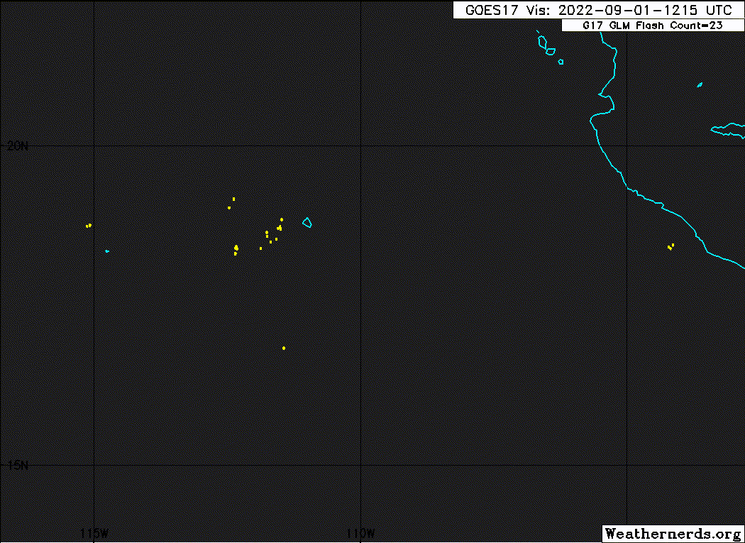
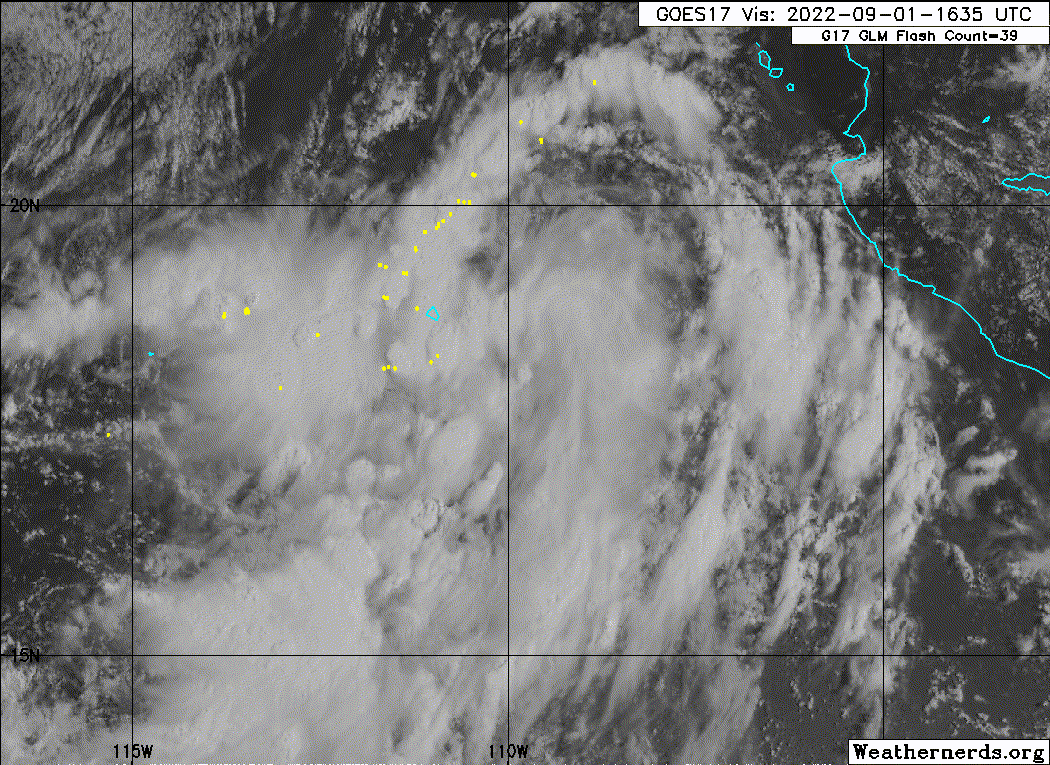
This should become Javier and could make a run at hurricane status but I think the system behind this will have more potential.
1 likes   
I am in no way a professional. Take what I say with a grain of salt as I could be totally wrong. Please refer to the NHC, NWS, or SPC for official information.

Boomer Sooner!

User avatar
Yellow Evan
Professional-Met
Professional-Met
Posts: 15951
Age: 25
Joined: Fri Jul 15, 2011 12:48 pm
Location: Henderson, Nevada/Honolulu, HI
Contact:

Re: EPAC: INVEST 92E

#2 Postby Yellow Evan » Wed Aug 31, 2022 1:01 am

* GFS version *
* EAST PACIFIC 2021 SHIPS INTENSITY FORECAST *
* IR SAT DATA AVAILABLE, OHC AVAILABLE *
* INVEST EP922022 08/31/22 06 UTC *

TIME (HR) 0 6 12 18 24 36 48 60 72 84 96 108 120 132 144 156 168
V (KT) NO LAND 20 21 23 27 29 38 48 61 65 65 62 57 52 47 44 41 37
V (KT) LAND 20 21 23 27 29 38 48 61 65 65 62 57 52 47 44 41 37
V (KT) LGEM 20 20 21 21 22 24 27 30 33 33 31 29 26 24 22 21 19
Storm Type TROP TROP TROP TROP TROP TROP TROP TROP TROP TROP TROP TROP TROP TROP TROP TROP TROP

SHEAR (KT) 23 20 16 14 16 6 4 4 8 2 7 11 11 16 13 15 17
SHEAR ADJ (KT) 5 2 3 4 5 2 -1 1 -2 5 3 0 2 -2 2 5 7
SHEAR DIR 34 45 36 24 24 39 187 181 165 198 213 232 190 163 168 134 162
SST (C) 30.4 30.0 29.7 29.7 29.6 30.1 29.3 28.5 26.4 24.3 23.1 22.1 22.5 23.3 23.9 23.8 23.0
POT. INT. (KT) 170 165 162 162 161 167 158 150 129 108 96 85 88 95 98 98 91
200 MB T (C) -52.6 -52.8 -52.5 -51.9 -52.1 -51.9 -51.5 -51.4 -51.0 -50.6 -50.2 -50.2 -50.0 -50.5 -50.8 -51.0 -50.7
200 MB VXT (C) 0.0 0.1 0.0 0.0 -0.1 0.2 0.4 0.8 1.1 1.1 1.0 1.0 0.9 1.2 0.7 0.5 0.3
TH_E DEV (C) 6 6 6 7 7 7 6 5 2 0 0 0 0 0 2 2 2
700-500 MB RH 78 78 78 78 78 80 78 75 70 66 61 61 60 55 56 51 51
MODEL VTX (KT) 11 11 13 15 16 19 20 24 22 22 20 19 17 16 15 13 13
850 MB ENV VOR -6 -2 4 15 25 51 79 104 135 132 115 128 145 145 169 148 135
200 MB DIV 86 94 91 114 105 78 64 62 27 -7 1 7 -11 -24 -22 17 -5
700-850 TADV -12 -11 -14 -14 -15 -6 -2 0 3 2 2 5 2 -1 -4 0 0
LAND (KM) 508 517 507 472 461 451 298 239 263 435 713 1068 1401 1655 1772 1734 1629
LAT (DEG N) 14.1 14.6 15.2 16.0 16.7 18.5 20.3 22.2 23.7 24.8 25.1 24.6 23.2 xx.x xx.x xx.x xx.x
LONG(DEG W) 105.3 106.3 107.0 107.7 108.3 109.5 110.7 112.3 114.6 117.8 121.5 125.1 128.0 xxx.x xxx.x xxx.x xxx.x
STM SPEED (KT) 12 10 10 10 10 11 11 12 14 16 17 16 14 9 3 5 7
HEAT CONTENT 24 22 21 21 20 36 23 10 1 0 0 0 0 0 0 0 0

FORECAST TRACK FROM TABM INITIAL HEADING/SPEED (DEG/KT):285/ 13 CX,CY: -12/ 3
T-12 MAX WIND: 20 PRESSURE OF STEERING LEVEL (MB): 494 (MEAN=587)
GOES IR BRIGHTNESS TEMP. STD DEV. 50-200 KM RAD: 18.4 (MEAN=14.5)
% GOES IR PIXELS WITH T < -20 C 50-200 KM RAD: 49.0 (MEAN=65.0)
PRELIM RI PROB (DV .GE. 35 KT IN 36 HR): 18.1

INDIVIDUAL CONTRIBUTIONS TO INTENSITY CHANGE
6 12 18 24 36 48 60 72 84 96 108 120 132 144 156 168
------------------------------------------------------------------------------
SAMPLE MEAN CHANGE 0. 0. 1. 1. 1. 2. 1. 1. 0. -0. -1. -2. -2. -3. -4. -4.
SST POTENTIAL -1. -2. -3. -2. 3. 12. 21. 28. 32. 33. 34. 32. 31. 30. 29. 28.
VERTICAL SHEAR MAG 1. 2. 3. 3. 4. 4. 3. 2. 2. 2. 2. 2. 2. 1. -1. -3.
VERTICAL SHEAR ADJ -0. -1. -1. -1. -2. -2. -1. -1. -0. -0. -0. -0. -0. -0. -0. -1.
VERTICAL SHEAR DIR 0. 1. 1. 1. 2. 2. 2. 1. 1. 1. 2. 2. 1. 1. 0. 0.
PERSISTENCE -0. -0. -0. -1. -1. -1. -0. -0. -0. -0. -0. -0. -0. -0. -0. -0.
200/250 MB TEMP. -0. -0. -0. -1. -1. -2. -2. -3. -3. -2. -1. 0. 2. 3. 5. 5.
THETA_E EXCESS -0. -0. -0. 0. 0. 0. -1. -1. -3. -5. -6. -7. -8. -9. -10. -12.
700-500 MB RH 0. 0. 0. 1. 1. 1. 1. 1. 2. 1. 2. 2. 2. 2. 2. 3.
MODEL VTX TENDENCY 0. 1. 3. 4. 6. 8. 15. 16. 15. 13. 10. 7. 5. 4. 2. 1.
850 MB ENV VORTICITY -0. -0. -0. -0. -0. -0. -0. -0. -1. -1. -1. -2. -2. -2. -2. -2.
200 MB DIVERGENCE 0. 0. 1. 1. 1. 2. 3. 3. 3. 2. 1. 1. 0. -0. 0. 0.
850-700 T ADVEC 0. 0. 0. 0. 0. -0. -0. -0. -0. -0. -0. -0. -0. -0. -1. -1.
ZONAL STORM MOTION 0. 0. 1. 1. 1. 2. 2. 2. 2. 1. 1. 1. 1. 1. 0. -0.
STEERING LEVEL PRES -0. -0. -1. -1. -1. -1. -1. -1. -2. -2. -2. -2. -1. -1. -1. -0.
DAYS FROM CLIM. PEAK 0. 0. 0. 0. 0. 1. 1. 1. 2. 2. 3. 3. 3. 4. 5. 6.
GOES PREDICTORS 0. 0. 1. 1. -0. -2. -3. -3. -4. -5. -6. -6. -6. -6. -5. -5.
OCEAN HEAT CONTENT 0. 0. 0. 0. 0. 0. 0. 0. -0. -0. 0. 0. 1. 1. 2. 3.
RI POTENTIAL 0. 1. 1. 2. 2. 2. 1. 0. -0. -0. -0. 0. 0. 0. 0. 0.
------------------------------------------------------------------------------
TOTAL CHANGE 1. 3. 7. 9. 18. 28. 41. 45. 45. 42. 37. 32. 27. 24. 21. 17.

CURRENT MAX WIND (KT): 20. LAT, LON: 14.1 105.3

** 2021 E. Pacific RI INDEX EP922022 INVEST 08/31/22 06 UTC **
(SHIPS-RII PREDICTOR TABLE for 30 KT OR MORE MAXIMUM WIND INCREASE IN NEXT 24-h)

Predictor Value RI Predictor Range Scaled Value(0-1) % Contribution
POT = MPI-VMAX (KT) : 144.0 40.5 to 149.3 0.95 999.0
12 HR PERSISTENCE (KT) : 0.0 -22.0 to 44.0 0.33 999.0
D200 (10**7s-1) : 98.0 -33.0 to 159.5 0.68 999.0
850-200 MB SHEAR (KT) : 18.0 19.6 to 1.3 0.09 999.0
MAXIMUM WIND (KT) : 20.0 22.5 to 132.0 0.00 0.0
STD DEV OF IR BR TEMP : 18.4 37.8 to 2.1 0.54 999.0
BL DRY-AIR FLUX (W/M2) : 25.0 800.8 to -82.5 0.88 999.0
HEAT CONTENT (KJ/CM2) : 21.6 2.7 to 106.7 0.18 999.0
%area of TPW <45 mm upshear : 0.0 56.6 to 0.0 1.00 999.0
2nd PC OF IR BR TEMP : -0.2 2.2 to -2.3 0.52 999.0

SHIPS Prob RI for 20kt/ 12hr RI threshold= 0% is 0.0 times climatological mean ( 6.3%)
SHIPS Prob RI for 25kt/ 24hr RI threshold= 0% is 0.0 times climatological mean (12.5%)
SHIPS Prob RI for 30kt/ 24hr RI threshold= 0% is 0.0 times climatological mean ( 8.6%)
SHIPS Prob RI for 35kt/ 24hr RI threshold= 0% is 0.0 times climatological mean ( 6.2%)
SHIPS Prob RI for 40kt/ 24hr RI threshold= 0% is 0.0 times climatological mean ( 4.2%)
SHIPS Prob RI for 45kt/ 36hr RI threshold= 0% is 0.0 times climatological mean ( 6.7%)
SHIPS Prob RI for 55kt/ 48hr RI threshold= 0% is 0.0 times climatological mean ( 5.9%)
SHIPS Prob RI for 65kt/ 72hr RI threshold= 0% is 0.0 times climatological mean ( 4.7%)

Matrix of RI probabilities
------------------------------------------------------------------------------
RI (kt / h) | 20/12 | 25/24 | 30/24 | 35/24 | 40/24 | 45/36 | 55/48 |65/72
------------------------------------------------------------------------------
SHIPS-RII: 0.0% 0.0% 0.0% 0.0% 0.0% 0.0% 0.0% 0.0%
Logistic: 0.2% 4.0% 1.4% 0.7% 0.1% 10.6% 24.4% 8.7%
Bayesian: 0.0% 0.1% 0.0% 0.0% 0.0% 0.0% 0.0% 0.5%
Consensus: 0.1% 1.4% 0.5% 0.3% 0.0% 3.5% 8.1% 3.1%
DTOPS: 999.0% 999.0% 999.0% 999.0% 999.0% 999.0% 999.0% 999.0%

## ANNULAR HURRICANE INDEX (AHI) EP922022 INVEST 08/31/22 06 UTC ##
## STORM NOT ANNULAR, SCREENING STEP FAILED, NPASS=2 NFAIL=5 ##
## AHI= 0 (AHI OF 100 IS BEST FIT TO ANN. STRUC., 1 IS MARGINAL, 0 IS NOT ANNULAR) ##
0 likes   

User avatar
Zonacane
Tropical Storm
Tropical Storm
Posts: 217
Joined: Tue Aug 03, 2021 2:23 pm

Re: EPAC: INVEST 92E

#3 Postby Zonacane » Wed Aug 31, 2022 9:56 am

Need this to hook north and give me rain.
2 likes   

User avatar
Kingarabian
S2K Supporter
S2K Supporter
Posts: 15432
Joined: Sat Aug 08, 2009 3:06 am
Location: Honolulu, Hawaii

Re: EPAC: INVEST 92E

#4 Postby Kingarabian » Wed Aug 31, 2022 11:26 am

Looks like a short Cat.1/Cat.2 candidate.
1 likes   
RIP Kobe Bryant

User avatar
cycloneye
Admin
Admin
Posts: 139025
Age: 67
Joined: Thu Oct 10, 2002 10:54 am
Location: San Juan, Puerto Rico

Re: EPAC: INVEST 92E

#5 Postby cycloneye » Wed Aug 31, 2022 12:48 pm

Offshore of Southwestern Mexico:
A broad area of low pressure located a few hundred miles
south-southwest of Manzanillo, Mexico is producing a large area of
disorganized showers and thunderstorms. Satellite-derived wind data
indicate that this system is developing a low-level circulation, and
a tropical depression is likely to form within the next day or so.
The system is forecast to move west-northwestward or northwestward
during the next few days, likely remaining a few hundred miles off
the coast of southwestern Mexico.
* Formation chance through 48 hours...high...70 percent.
* Formation chance through 5 days...high...80 percent.
0 likes   
Visit the Caribbean-Central America Weather Thread where you can find at first post web cams,radars
and observations from Caribbean basin members Click Here

User avatar
Yellow Evan
Professional-Met
Professional-Met
Posts: 15951
Age: 25
Joined: Fri Jul 15, 2011 12:48 pm
Location: Henderson, Nevada/Honolulu, HI
Contact:

Re: EPAC: INVEST 92E

#6 Postby Yellow Evan » Wed Aug 31, 2022 1:52 pm

Image

GFS may have been right with TCG by 0z.
0 likes   

User avatar
Yellow Evan
Professional-Met
Professional-Met
Posts: 15951
Age: 25
Joined: Fri Jul 15, 2011 12:48 pm
Location: Henderson, Nevada/Honolulu, HI
Contact:

Re: EPAC: INVEST 92E

#7 Postby Yellow Evan » Wed Aug 31, 2022 2:00 pm

92E INVEST 220831 1800 16.0N 107.0W EPAC 30 1007
1 likes   

User avatar
Yellow Evan
Professional-Met
Professional-Met
Posts: 15951
Age: 25
Joined: Fri Jul 15, 2011 12:48 pm
Location: Henderson, Nevada/Honolulu, HI
Contact:

Re: EPAC: INVEST 92E

#8 Postby Yellow Evan » Wed Aug 31, 2022 2:09 pm

* GFS version *
* EAST PACIFIC 2021 SHIPS INTENSITY FORECAST *
* IR SAT DATA AVAILABLE, OHC AVAILABLE *
* INVEST EP922022 08/31/22 18 UTC *

TIME (HR) 0 6 12 18 24 36 48 60 72 84 96 108 120 132 144 156 168
V (KT) NO LAND 30 33 37 40 45 52 62 67 66 60 54 49 45 42 40 39 36
V (KT) LAND 30 33 37 40 45 52 62 67 66 60 54 49 45 42 40 39 36
V (KT) LGEM 30 34 37 40 43 48 53 55 50 42 36 31 28 27 26 24 22
Storm Type TROP TROP TROP TROP TROP TROP TROP TROP TROP TROP TROP TROP TROP TROP TROP TROP TROP

SHEAR (KT) 20 15 10 7 3 6 8 5 3 5 4 4 8 8 8 11 15
SHEAR ADJ (KT) 0 4 5 0 0 -1 0 -1 5 2 2 0 -1 0 1 1 -6
SHEAR DIR 55 40 37 46 32 178 186 148 138 205 222 141 128 124 115 159 210
SST (C) 29.7 29.6 29.7 30.1 30.0 28.9 27.6 25.7 24.2 22.6 22.3 23.7 24.2 24.6 24.2 23.6 23.3
POT. INT. (KT) 162 161 162 166 165 154 141 122 107 90 87 100 103 104 102 97 95
200 MB T (C) -52.6 -51.9 -52.1 -52.1 -51.8 -51.4 -51.4 -50.9 -50.7 -50.4 -50.6 -50.6 -50.9 -51.1 -51.1 -50.9 -51.1
200 MB VXT (C) -0.1 -0.2 -0.2 0.1 0.5 0.5 0.7 0.8 0.9 0.9 0.8 0.7 0.6 0.5 0.5 0.3 0.5
TH_E DEV (C) 7 7 7 6 7 5 3 2 0 0 0 0 1 2 3 3 2
700-500 MB RH 76 78 79 80 79 77 72 66 58 53 55 53 47 48 46 48 44
MODEL VTX (KT) 11 13 14 15 17 17 21 21 20 18 15 14 13 13 11 10 8
850 MB ENV VOR 2 24 28 31 55 89 121 158 138 134 136 159 159 177 156 140 82
200 MB DIV 69 119 94 80 69 66 53 35 -13 -3 -18 -23 -1 2 0 -11 -12
700-850 TADV -8 -9 -8 -7 -8 -3 0 -2 0 2 -4 -1 0 -3 0 -1 1
LAND (KM) 429 429 440 459 434 295 320 397 583 843 1183 1486 1687 1747 1734 1718 1733
LAT (DEG N) 16.0 16.7 17.4 18.2 19.0 20.7 22.1 23.2 23.9 24.0 23.5 22.2 21.0 xx.x xx.x xx.x xx.x
LONG(DEG W) 107.0 107.9 108.6 109.4 110.1 111.6 113.4 115.8 118.9 122.3 125.8 128.4 129.9 xxx.x xxx.x xxx.x xxx.x
STM SPEED (KT) 11 10 10 11 11 11 11 14 15 16 15 12 6 1 5 7 10
HEAT CONTENT 26 23 27 36 33 19 5 0 0 0 0 0 0 0 0 0 0

FORECAST TRACK FROM TABM INITIAL HEADING/SPEED (DEG/KT):300/ 11 CX,CY: -9/ 6
T-12 MAX WIND: 20 PRESSURE OF STEERING LEVEL (MB): 519 (MEAN=587)
GOES IR BRIGHTNESS TEMP. STD DEV. 50-200 KM RAD: 27.9 (MEAN=14.5)
% GOES IR PIXELS WITH T < -20 C 50-200 KM RAD: 53.0 (MEAN=65.0)
PRELIM RI PROB (DV .GE. 35 KT IN 36 HR): 21.2

INDIVIDUAL CONTRIBUTIONS TO INTENSITY CHANGE
6 12 18 24 36 48 60 72 84 96 108 120 132 144 156 168
------------------------------------------------------------------------------
SAMPLE MEAN CHANGE 0. 0. 1. 1. 1. 2. 1. 1. 0. -0. -1. -2. -2. -3. -4. -4.
SST POTENTIAL -0. -1. -0. 0. 5. 11. 17. 21. 23. 23. 23. 21. 19. 17. 16. 15.
VERTICAL SHEAR MAG 1. 1. 2. 3. 4. 5. 5. 5. 5. 6. 7. 7. 7. 7. 6. 4.
VERTICAL SHEAR ADJ -0. -0. -1. -1. -0. -0. 0. -0. -0. -0. -0. -0. -0. -0. -0. -0.
VERTICAL SHEAR DIR 0. 0. 1. 1. 1. 1. -0. -1. -1. -0. -1. -1. -1. -1. -1. -1.
PERSISTENCE 2. 3. 3. 4. 3. 3. 3. 2. 2. 2. 2. 2. 2. 2. 2. 2.
200/250 MB TEMP. -0. -0. -0. -1. -1. -2. -2. -2. -2. -2. -1. -0. 1. 1. 2. 2.
THETA_E EXCESS 0. 0. 0. 0. 0. -1. -2. -4. -5. -7. -8. -9. -10. -10. -11. -13.
700-500 MB RH 0. 0. 0. 1. 1. 1. 1. 1. 1. 1. 1. 1. 1. 0. 0. 0.
MODEL VTX TENDENCY 1. 2. 3. 4. 5. 10. 12. 13. 9. 5. 4. 2. 1. -0. -1. -2.
850 MB ENV VORTICITY -0. -0. -0. 0. 0. -0. -0. -1. -1. -2. -2. -2. -3. -3. -3. -3.
200 MB DIVERGENCE 0. 1. 1. 1. 1. 1. 2. 2. 1. 1. -0. -0. -0. -0. 0. 1.
850-700 T ADVEC 0. 0. 0. 0. 0. -0. -0. -0. -0. -0. -0. -0. -0. -0. -0. -1.
ZONAL STORM MOTION 0. 0. 0. 0. 1. 1. 1. 1. 1. 0. 0. 0. 0. 0. 0. -0.
STEERING LEVEL PRES -0. -0. -0. -1. -1. -1. -1. -1. -1. -1. -1. -1. -1. -1. -1. -0.
DAYS FROM CLIM. PEAK 0. 0. 0. 0. 0. 1. 1. 1. 2. 2. 3. 3. 3. 4. 5. 6.
GOES PREDICTORS -1. -1. -1. -2. -2. -2. -3. -3. -3. -4. -4. -5. -5. -4. -3. -2.
OCEAN HEAT CONTENT 0. 0. 0. 0. 0. 0. 0. -0. -0. -0. 0. 0. 1. 1. 2. 4.
RI POTENTIAL 0. 1. 2. 2. 3. 3. 1. 0. -0. -1. -1. -1. -1. -1. -1. -0.
------------------------------------------------------------------------------
TOTAL CHANGE 3. 7. 10. 15. 22. 32. 37. 36. 30. 24. 19. 15. 12. 10. 9. 6.

CURRENT MAX WIND (KT): 30. LAT, LON: 16.0 107.0

** 2021 E. Pacific RI INDEX EP922022 INVEST 08/31/22 18 UTC **
(SHIPS-RII PREDICTOR TABLE for 30 KT OR MORE MAXIMUM WIND INCREASE IN NEXT 24-h)

Predictor Value RI Predictor Range Scaled Value(0-1) % Contribution
POT = MPI-VMAX (KT) : 133.5 40.5 to 149.3 0.86 6.7
12 HR PERSISTENCE (KT) : 10.0 -22.0 to 44.0 0.48 4.3
D200 (10**7s-1) : 86.2 -33.0 to 159.5 0.62 4.5
850-200 MB SHEAR (KT) : 11.2 19.6 to 1.3 0.46 3.2
MAXIMUM WIND (KT) : 30.0 22.5 to 132.0 0.21 1.2
STD DEV OF IR BR TEMP : 27.9 37.8 to 2.1 0.28 1.4
BL DRY-AIR FLUX (W/M2) : 33.8 800.8 to -82.5 0.87 -4.8
HEAT CONTENT (KJ/CM2) : 29.0 2.7 to 106.7 0.25 1.0
%area of TPW <45 mm upshear : 0.0 56.6 to 0.0 1.00 1.5
2nd PC OF IR BR TEMP : -1.2 2.2 to -2.3 0.75 0.7

SHIPS Prob RI for 20kt/ 12hr RI threshold= 8% is 1.2 times climatological mean ( 6.3%)
SHIPS Prob RI for 25kt/ 24hr RI threshold= 22% is 1.7 times climatological mean (12.5%)
SHIPS Prob RI for 30kt/ 24hr RI threshold= 20% is 2.3 times climatological mean ( 8.6%)
SHIPS Prob RI for 35kt/ 24hr RI threshold= 19% is 3.1 times climatological mean ( 6.2%)
SHIPS Prob RI for 40kt/ 24hr RI threshold= 0% is 0.0 times climatological mean ( 4.2%)
SHIPS Prob RI for 45kt/ 36hr RI threshold= 20% is 3.0 times climatological mean ( 6.7%)
SHIPS Prob RI for 55kt/ 48hr RI threshold= 18% is 3.1 times climatological mean ( 5.9%)
SHIPS Prob RI for 65kt/ 72hr RI threshold= 18% is 3.8 times climatological mean ( 4.7%)

Matrix of RI probabilities
------------------------------------------------------------------------------
RI (kt / h) | 20/12 | 25/24 | 30/24 | 35/24 | 40/24 | 45/36 | 55/48 |65/72
------------------------------------------------------------------------------
SHIPS-RII: 7.7% 21.7% 19.7% 19.2% 0.0% 19.9% 18.3% 17.9%
Logistic: 1.4% 13.3% 9.4% 4.8% 1.1% 28.3% 18.5% 2.3%
Bayesian: 0.4% 0.2% 0.1% 0.1% 0.0% 0.1% 0.6% 0.1%
Consensus: 3.2% 11.7% 9.7% 8.0% 0.4% 16.1% 12.4% 6.8%
DTOPS: 1.0% 6.0% 3.0% 2.0% 1.0% 1.0% 5.0% 5.0%

## ANNULAR HURRICANE INDEX (AHI) EP922022 INVEST 08/31/22 18 UTC ##
## STORM NOT ANNULAR, SCREENING STEP FAILED, NPASS=2 NFAIL=5 ##
## AHI= 0 (AHI OF 100 IS BEST FIT TO ANN. STRUC., 1 IS MARGINAL, 0 IS NOT ANNULAR) ##
0 likes   

Sciencerocks
Category 5
Category 5
Posts: 7282
Age: 38
Joined: Thu Jul 06, 2017 1:51 am

Re: EPAC: INVEST 92E

#9 Postby Sciencerocks » Wed Aug 31, 2022 5:13 pm

Image
0 likes   

User avatar
cycloneye
Admin
Admin
Posts: 139025
Age: 67
Joined: Thu Oct 10, 2002 10:54 am
Location: San Juan, Puerto Rico

Re: EPAC: INVEST 92E

#10 Postby cycloneye » Wed Aug 31, 2022 6:47 pm

1. Offshore of West-Central Mexico:
Showers and thunderstorms associated with an area of low pressure
located about 300 miles west-southwest of Manzanillo, Mexico, have
become better organized today. Although the low's circulation
remains somewhat broad and elongated, further development is
expected, and a tropical depression or tropical storm is forecast
to form during the next day or so while moving northwestward at
about 10 mph, likely remaining a couple of hundred miles off the
western coast of Baja California Sur.
* Formation chance through 48 hours...high...80 percent.
* Formation chance through 5 days...high...90 percent.
0 likes   
Visit the Caribbean-Central America Weather Thread where you can find at first post web cams,radars
and observations from Caribbean basin members Click Here

Sciencerocks
Category 5
Category 5
Posts: 7282
Age: 38
Joined: Thu Jul 06, 2017 1:51 am

Re: EPAC: INVEST 92E

#11 Postby Sciencerocks » Thu Sep 01, 2022 10:47 am

Image
0 likes   

User avatar
Kingarabian
S2K Supporter
S2K Supporter
Posts: 15432
Joined: Sat Aug 08, 2009 3:06 am
Location: Honolulu, Hawaii

Re: EPAC: INVEST 92E

#12 Postby Kingarabian » Thu Sep 01, 2022 11:34 am

Looking a lot better.
Image

Still pretty dry but at least shear is dropping. Biggest inhibitor will be its size and time.
0 likes   
RIP Kobe Bryant

User avatar
cycloneye
Admin
Admin
Posts: 139025
Age: 67
Joined: Thu Oct 10, 2002 10:54 am
Location: San Juan, Puerto Rico

Re: EPAC: INVEST 92E

#13 Postby cycloneye » Thu Sep 01, 2022 12:41 pm

1. Offshore of West-Central Mexico:
Showers and thunderstorms associated with an area of low pressure
located about 300 miles south of the southern tip of the Baja
California peninsula are gradually becoming better organized.
Environmental conditions appear favorable for development of this
system, and a tropical depression or tropical storm is forecast to
form later today or tonight while moving northwestward at about 10
mph, likely remaining a couple of hundred miles off the western
coast of Baja California Sur. Additional information on this
system, including gale warnings, can be found in High Seas Forecasts
issued by the National Weather Service.
* Formation chance through 48 hours...high...90 percent.
* Formation chance through 5 days...high...90 percent.
0 likes   
Visit the Caribbean-Central America Weather Thread where you can find at first post web cams,radars
and observations from Caribbean basin members Click Here

User avatar
cycloneye
Admin
Admin
Posts: 139025
Age: 67
Joined: Thu Oct 10, 2002 10:54 am
Location: San Juan, Puerto Rico

Re: EPAC: INVEST 92E

#14 Postby cycloneye » Thu Sep 01, 2022 2:53 pm

Will be TD Eleven-E at 4 PM Central time.

Image
1 likes   
Visit the Caribbean-Central America Weather Thread where you can find at first post web cams,radars
and observations from Caribbean basin members Click Here

Sciencerocks
Category 5
Category 5
Posts: 7282
Age: 38
Joined: Thu Jul 06, 2017 1:51 am

Re: EPAC: INVEST 92E

#15 Postby Sciencerocks » Thu Sep 01, 2022 3:06 pm

Image
0 likes   

User avatar
ElectricStorm
Category 5
Category 5
Posts: 4523
Age: 23
Joined: Tue Aug 13, 2019 11:23 pm
Location: Skiatook, OK / Norman, OK

Re: EPAC: INVEST 92E

#16 Postby ElectricStorm » Thu Sep 01, 2022 3:37 pm

This is now TD 11-E. First forecast has a 45kt peak
0 likes   
I am in no way a professional. Take what I say with a grain of salt as I could be totally wrong. Please refer to the NHC, NWS, or SPC for official information.

Boomer Sooner!

User avatar
cycloneye
Admin
Admin
Posts: 139025
Age: 67
Joined: Thu Oct 10, 2002 10:54 am
Location: San Juan, Puerto Rico

Re: EPAC: ELEVEN -E - Tropical Depression

#17 Postby cycloneye » Thu Sep 01, 2022 3:40 pm

Tropical Depression Eleven-E Discussion Number 1
NWS National Hurricane Center Miami FL EP112022
300 PM MDT Thu Sep 01 2022

The area of low pressure that NHC has been monitoring a few hundred
miles south of the southern tip of the Baja California peninsula
has developed organized deep convection and a well-defined center.
Therefore, the system is now being classified as a tropical
depression and the initial intensity is estimated to be 30 kt based
on recent ASCAT data and a Dvorak estimate from TAFB. It should be
noted that the depression is quite large with its cloud field
extending several hundred miles across.

The depression is moving northwestward at 9 kt, and this motion
with some increase in forward speed is expected during the next
couple of days as the system remains steered by the western
periphery of a subtropical ridge. After that time, the weakening
system should turn to the west within the low-level flow. The
models are in fair agreement, and the NHC track forecast lies near
the middle of the guidance envelope.

The environmental conditions appear favorable for intensification
during the next 36 to 48 hours, however, given the sprawling nature
of the depression only slow strengthening seems likely during that
time. Beyond a couple of days, the system is expected to track over
much cooler SSTs and into a dry and stable airmass. These
conditions should cause the system to decay into a remnant low in
about 60 h with continued weakening forecast thereafter. The NHC
intensity forecast is close to the HCCA and IVCN guidance.

Although the center of the system is forecast to remain a couple of
hundred miles off the Baja California coast, outer rainbands
and large swells are expected to affect portions of the southern
and central Baja California peninsula coast during the next couple
of days.


FORECAST POSITIONS AND MAX WINDS

INIT 01/2100Z 18.9N 110.5W 30 KT 35 MPH
12H 02/0600Z 19.9N 111.5W 35 KT 40 MPH
24H 02/1800Z 21.4N 112.8W 40 KT 45 MPH
36H 03/0600Z 23.1N 114.3W 45 KT 50 MPH
48H 03/1800Z 24.5N 116.6W 45 KT 50 MPH
60H 04/0600Z 25.4N 119.0W 35 KT 40 MPH...POST-TROPICAL
72H 04/1800Z 25.8N 121.8W 30 KT 35 MPH...POST-TROP/REMNT LOW
96H 05/1800Z 25.6N 126.8W 25 KT 30 MPH...POST-TROP/REMNT LOW
120H 06/1800Z 24.9N 130.4W 25 KT 30 MPH...POST-TROP/REMNT LOW

$$
Forecaster Cangialosi
0 likes   
Visit the Caribbean-Central America Weather Thread where you can find at first post web cams,radars
and observations from Caribbean basin members Click Here

User avatar
Yellow Evan
Professional-Met
Professional-Met
Posts: 15951
Age: 25
Joined: Fri Jul 15, 2011 12:48 pm
Location: Henderson, Nevada/Honolulu, HI
Contact:

Re: EPAC: ELEVEN -E - Tropical Depression

#18 Postby Yellow Evan » Thu Sep 01, 2022 4:08 pm

Reminds me of Ivo 13. Broad structure that formed from a strong monsoonal trough and stayed slop on a similar track.
0 likes   

User avatar
Yellow Evan
Professional-Met
Professional-Met
Posts: 15951
Age: 25
Joined: Fri Jul 15, 2011 12:48 pm
Location: Henderson, Nevada/Honolulu, HI
Contact:

Re: EPAC: ELEVEN -E - Tropical Depression

#19 Postby Yellow Evan » Thu Sep 01, 2022 8:01 pm

TXPZ23 KNES 020018
TCSENP

A. 11E (NONAME)

B. 01/2330Z

C. 18.4N

D. 111.1W

E. FIVE/GOES-W

F. T1.5/1.5

G. IR/EIR/VIS

H. REMARKS...3/10 BANDING RESULTS IN A DT OF 1.5. THE MET IS 1.0
AND THE PT IS 1.5. THE FT IS BASED ON THE PT DUE TO THE IRREGULAR AND
PULSING CONVECTION.

I. ADDL POSITIONS

NIL


...BROWN
0 likes   

User avatar
cycloneye
Admin
Admin
Posts: 139025
Age: 67
Joined: Thu Oct 10, 2002 10:54 am
Location: San Juan, Puerto Rico

Re: EPAC: ELEVEN -E - Tropical Depression

#20 Postby cycloneye » Thu Sep 01, 2022 8:19 pm

EP, 11, 2022090200, , BEST, 0, 193N, 1110W, 30, 1003, TD
0 likes   
Visit the Caribbean-Central America Weather Thread where you can find at first post web cams,radars
and observations from Caribbean basin members Click Here


Return to “2022”

Who is online

Users browsing this forum: No registered users and 25 guests