
That’s a pretty big if. Kay’s circulation is very large, and it looks to be impacted by some of that typical La Niña Mexican coast shear. A low end Cat 2 is probably the strongest it could feasibly get.
EPAC: KAY - Post-Tropical
Moderator: S2k Moderators
Re: EPAC: KAY - Tropical Storm
That’s a pretty big if. Kay’s circulation is very large, and it looks to be impacted by some of that typical La Niña Mexican coast shear. A low end Cat 2 is probably the strongest it could feasibly get.
1 likes
Irene '11 Sandy '12 Hermine '16 5/15/2018 Derecho Fay '20 Isaias '20 Elsa '21 Henri '21 Ida '21
I am only a meteorology enthusiast who knows a decent amount about tropical cyclones. Look to the professional mets, the NHC, or your local weather office for the best information.
I am only a meteorology enthusiast who knows a decent amount about tropical cyclones. Look to the professional mets, the NHC, or your local weather office for the best information.
-
cycloneye

- Admin

- Posts: 139115
- Age: 67
- Joined: Thu Oct 10, 2002 10:54 am
- Location: San Juan, Puerto Rico
Re: EPAC: KAY - Tropical Storm
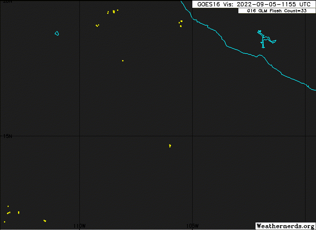
It will be very interesting what recon find this afternoon.
1 likes
Visit the Caribbean-Central America Weather Thread where you can find at first post web cams,radars
and observations from Caribbean basin members Click Here
and observations from Caribbean basin members Click Here
-
ScottNAtlanta

- Category 5

- Posts: 1998
- Joined: Sat May 25, 2013 3:11 pm
- Location: Atlanta, GA
Re: EPAC: KAY - Tropical Storm
In the NHC discussions they have mentioned that Kay has an excellent moisture envelope to draw from, and like how small storms can die quickly when conditions are not favorable any more, the opposite is true with large ones. They take a while to unwind, so I think it is quite possible that if this is on the east side of the guidance, there could be significant impacts on the US states of CA and AZ. It does not take much rain there to cause flooding as we have seen in this years monsoon.
0 likes
The posts in this forum are NOT official forecast and should not be used as such. They are just the opinion of the poster and may or may not be backed by sound meteorological data. They are NOT endorsed by any professional institution or storm2k.org. For official information, please refer to the NHC and NWS products.
-
cycloneye
- Admin
- Posts: 139115
- Age: 67
- Joined: Thu Oct 10, 2002 10:54 am
- Location: San Juan, Puerto Rico
Re: EPAC: KAY - Tropical Storm
BULLETIN
Tropical Storm Kay Advisory Number 5
NWS National Hurricane Center Miami FL EP122022
900 AM MDT Mon Sep 05 2022
...TROPICAL STORM WATCH ISSUED FOR THE SOUTHERN BAJA CALIFORNIA
PENINSULA...
SUMMARY OF 900 AM MDT...1500 UTC...INFORMATION
----------------------------------------------
LOCATION...15.8N 106.4W
ABOUT 260 MI...420 KM SSW OF MANZANILLO MEXICO
ABOUT 540 MI...870 KM SSE OF THE SOUTHERN TIP OF BAJA CALIFORNIA
MAXIMUM SUSTAINED WINDS...60 MPH...95 KM/H
PRESENT MOVEMENT...W OR 280 DEGREES AT 15 MPH...24 KM/H
MINIMUM CENTRAL PRESSURE...995 MB...29.39 INCHES
Tropical Storm Kay Discussion Number 5
NWS National Hurricane Center Miami FL EP122022
900 AM MDT Mon Sep 05 2022
Kay continues to produce very deep convection, but the storm is
asymmetric with its center estimated to be on the north side of the
main area of thunderstorms. The latest satellite intensity
estimates range from 45 to 55 kt, and based on that data, the
initial intensity is held at 50 kt for this advisory. Kay is a
sprawling tropical storm with its outer rain bands extending as far
out as 300 n mi from the center. The northern rain bands are
affecting the coast of southwestern Mexico, where
tropical-storm-force wind gusts are likely occurring. An Air Force
Hurricane Hunter aircraft is scheduled to investigate Kay later
today.
The storm is moving westward at 13 kt and continues to be steered by
a mid-level ridge to its north. The model guidance remains in
fairly good agreement that a turn to the west-northwest is likely to
begin tonight followed by a northwestward motion by Tuesday night.
Although this should take the core of Kay well to the west of the
southern tip of the Baja California peninsula, tropical storm
conditions are possible there by early Wednesday given its expansive
wind field. Kay will likely be very near the west-central portion
of the peninsula on Thursday and Friday, and hurricane watches could
be required for that region later today or tomorrow. The spread in
the GFS and ECMWF ensemble members is basically the same as it was
yesterday and shows solutions spanning a region from over
central Baja to a few hundred miles west of the peninsula. A turn
back to the left is expected by the end of the forecast period due
to a mid-level ridge to its north. Overall, the NHC track forecast
has changed little this cycle and lies near the HCCA model and a
consensus of the GFS and ECMWF.
Kay is still experiencing moderate north-northeasterly shear, which
is causing its asymmetric cloud pattern. This shear is expected to
persist, which should prevent rapid intensification. Nonetheless,
given the warm SSTs and high mid-level moisture, continued steady
strengthening is likely to continue during the next couple of days
and Kay will likely become a hurricane tonight or on Tuesday. Beyond
a couple of days, progressively cooler SSTs and a drier air mass
should end the strengthening trend and induce steady weakening. The
NHC intensity forecast is similar to the previous one and lies a
little above the HCCA and IVCN guidance, but below the latest SHIPS
output.
KEY MESSAGES:
1. Although the center of Kay is forecast to stay offshore of
southwest mainland Mexico, gusts to tropical-storm-force and
rough surf along the coast are expected through Tuesday. In
addition, heavy rainfall could lead to flash flooding, including
landslides, across portions of the Mexican Riviera and western
Mexico through Wednesday night.
2. Tropical storm conditions are possible across the southern
Baja California peninsula by early Wednesday, where a Tropical
Storm Watch has been issued.
3. Kay is expected to be a hurricane when it nears the central
portion of the Baja California peninsula later this week. While the
details of the long-range track and intensity forecasts
remain uncertain, there is increasing risk of significant wind,
surf, and rainfall impacts there, and a tropical storm or hurricane
watch could be issued for that region later today or Tuesday.
FORECAST POSITIONS AND MAX WINDS
INIT 05/1500Z 15.8N 106.4W 50 KT 60 MPH
12H 06/0000Z 16.2N 107.8W 60 KT 70 MPH
24H 06/1200Z 17.3N 109.6W 70 KT 80 MPH
36H 07/0000Z 18.7N 111.2W 80 KT 90 MPH
48H 07/1200Z 20.2N 112.4W 90 KT 105 MPH
60H 08/0000Z 22.0N 113.3W 90 KT 105 MPH
72H 08/1200Z 24.0N 114.0W 80 KT 90 MPH
96H 09/1200Z 27.5N 115.7W 60 KT 70 MPH
120H 10/1200Z 29.7N 119.1W 45 KT 50 MPH
$$
Forecaster Cangialosi
0 likes
Visit the Caribbean-Central America Weather Thread where you can find at first post web cams,radars
and observations from Caribbean basin members Click Here
and observations from Caribbean basin members Click Here
-
Sciencerocks
- Category 5
- Posts: 7286
- Age: 38
- Joined: Thu Jul 06, 2017 1:51 am
-
Astromanía
- Category 2

- Posts: 737
- Age: 25
- Joined: Sat Aug 25, 2018 10:34 pm
- Location: Monterrey, N.L, México
-
Yellow Evan

- Professional-Met

- Posts: 15954
- Age: 25
- Joined: Fri Jul 15, 2011 12:48 pm
- Location: Henderson, Nevada/Honolulu, HI
- Contact:

-
Yellow Evan
- Professional-Met
- Posts: 15954
- Age: 25
- Joined: Fri Jul 15, 2011 12:48 pm
- Location: Henderson, Nevada/Honolulu, HI
- Contact:
-
Ed_2001

- Tropical Storm

- Posts: 228
- Age: 22
- Joined: Wed Jun 21, 2017 11:39 pm
- Location: Santa Barbara, CA>>Tampa, FL
Re: EPAC: KAY - Tropical Storm
Another risk to look out for, especially during California’s peak dry and wildfire season and coming on the heels of an intense heatwave 
https://twitter.com/Weather_West/status/1566826549000544258
https://twitter.com/Weather_West/status/1566826549000544258
0 likes
The answer my friend, is blowing in the wind...
-
cycloneye
- Admin
- Posts: 139115
- Age: 67
- Joined: Thu Oct 10, 2002 10:54 am
- Location: San Juan, Puerto Rico
Re: EPAC: KAY - Tropical Storm
A. 12E (KAY)
B. 05/1730Z
C. 14.9N
D. 106.8W
E. THREE/GOES-W
F. T3.5/3.5
G. IR/EIR/VIS/SSMIS
H. REMARKS...8/10 BANDING ON A LOG10 SPIRAL YIELDS A DT OF A 3.5. MET
IS 2.5 DUE TO A RAPID DEVELOPING TREND OVER THE LAST 24 HOURS WHERE THE
SYSTEM DID NOT ANY REAL ORGANIZATION AT THE TIME. PT IS 3.0.THE FT IS
BASED ON THE DT.
I. ADDL POSITIONS
05/1230Z 15.0N 106.1W SSMIS
...NGUYEN
0 likes
Visit the Caribbean-Central America Weather Thread where you can find at first post web cams,radars
and observations from Caribbean basin members Click Here
and observations from Caribbean basin members Click Here
-
cycloneye
- Admin
- Posts: 139115
- Age: 67
- Joined: Thu Oct 10, 2002 10:54 am
- Location: San Juan, Puerto Rico
Re: EPAC: KAY - Tropical Storm
An eye?

2 likes
Visit the Caribbean-Central America Weather Thread where you can find at first post web cams,radars
and observations from Caribbean basin members Click Here
and observations from Caribbean basin members Click Here
-
Kingarabian

- S2K Supporter

- Posts: 15437
- Joined: Sat Aug 08, 2009 3:06 am
- Location: Honolulu, Hawaii
Re: EPAC: KAY - Tropical Storm
1 likes
RIP Kobe Bryant
-
ElectricStorm

- Category 5
- Posts: 4566
- Age: 23
- Joined: Tue Aug 13, 2019 11:23 pm
- Location: Skiatook, OK / Norman, OK
Re: EPAC: KAY - Tropical Storm
I could definitely see a major out of this, hopefully it stays further west and isn't destructive
0 likes
I am in no way a professional. Take what I say with a grain of salt as I could be totally wrong. Please refer to the NHC, NWS, or SPC for official information.
Boomer Sooner!
Boomer Sooner!
Re: EPAC: KAY - Tropical Storm
It’s been nearly three hours since recon stopped transmitting. I think they probably turned back because of their communication issues. Awful luck with the AF planes today.
2 likes
Irene '11 Sandy '12 Hermine '16 5/15/2018 Derecho Fay '20 Isaias '20 Elsa '21 Henri '21 Ida '21
I am only a meteorology enthusiast who knows a decent amount about tropical cyclones. Look to the professional mets, the NHC, or your local weather office for the best information.
I am only a meteorology enthusiast who knows a decent amount about tropical cyclones. Look to the professional mets, the NHC, or your local weather office for the best information.
-
cycloneye
- Admin
- Posts: 139115
- Age: 67
- Joined: Thu Oct 10, 2002 10:54 am
- Location: San Juan, Puerto Rico
Re: EPAC: KAY - Hurricane
BULLETIN
Hurricane Kay Advisory Number 6
NWS National Hurricane Center Miami FL EP122022
300 PM MDT Mon Sep 05 2022
...KAY STRENGTHENS INTO A HURRICANE...
...OUTER RAIN BANDS CONTINUE TO AFFECT SOUTHWESTERN MEXICO...
SUMMARY OF 300 PM MDT...2100 UTC...INFORMATION
----------------------------------------------
LOCATION...15.6N 107.3W
ABOUT 305 MI...495 KM SW OF MANZANILLO MEXICO
ABOUT 530 MI...855 KM SSE OF THE SOUTHERN TIP OF BAJA CALIFORNIA
MAXIMUM SUSTAINED WINDS...80 MPH...130 KM/H
PRESENT MOVEMENT...WNW OR 295 DEGREES AT 10 MPH...17 KM/H
MINIMUM CENTRAL PRESSURE...981 MB...28.97 INCHES
Hurricane Kay Discussion Number 6
NWS National Hurricane Center Miami FL EP122022
300 PM MDT Mon Sep 05 2022
Satellite images indicate that banding features have become better
defined during the past several hours. The low-level center is now
more embedded in the deep convection, and Kay has strengthened
significantly. An ASCAT pass from around 16Z showed peak winds in
the 50-55 kt range on the system's east side, and the 18Z Dvorak
estimates were both 3.5/55 kt from TAFB and SAB. The Air Force
Hurricane Hunters are currently investigating Kay and the aircraft
recently reported a minimum pressure of 981 mb, which is notably
lower than previously estimated. The aircraft also measured
maximum SFMR and flight-level winds to support increasing the
intensity to 70 kt.
The storm continues to move westward, but at a slightly slower pace
of around 10 kt. The model guidance remains in fairly good agreement
that a turn to the west-northwest is likely to begin tonight
followed by a northwestward motion by Tuesday night. Although this
should take the core of Kay well to the west of the southern tip of
the Baja California peninsula, tropical storm conditions are
possible there by early Wednesday given its expansive wind field.
Kay will likely be very near the west-central portion of the
peninsula on Thursday and Friday, and hurricane watches could be
required for that region tonight or tomorrow. After that time, a
turn to the west seems likely as Kay weakens and is steered by a
low- to mid-level ridge building over the southwestern United
States. The NHC track forecast is a little to the south of the
previous one in the short term, which is based on the initial motion
and position, but is otherwise largely unchanged.
Steady strengthening is expected to continue during the next couple
of days as Kay remains over warm SSTs and embedded in a moist air
mass. In addition, the storm is forecast to move into a lower wind
shear environment in 36 to 48 hours. The NHC intensity forecast is
near the high end of the model guidance. Beyond a couple of days,
however, progressively cooler SSTs and a drier air mass should end
the strengthening trend and induce steady weakening.
KEY MESSAGES:
1. Gusts to tropical-storm-force and rough surf along the coast of
southwestern Mexico are expected through Tuesday. In addition,
heavy rainfall could lead to flash flooding, including landslides,
across portions of the Mexican Riviera and western Mexico through
Wednesday night.
2. Tropical storm conditions are possible across the southern
Baja California peninsula by early Wednesday, where a Tropical
Storm Watch has been issued.
3. While the details of the long-range track and intensity
forecasts remain uncertain, there is increasing risk of significant
wind, surf, and rainfall impacts across the central portion of the
Baja California peninsula. A tropical storm or hurricane watch
could be issued for that region tonight or Tuesday.
FORECAST POSITIONS AND MAX WINDS
INIT 05/2100Z 15.6N 107.3W 70 KT 80 MPH
12H 06/0600Z 16.2N 108.7W 80 KT 90 MPH
24H 06/1800Z 17.5N 110.5W 90 KT 105 MPH
36H 07/0600Z 18.8N 112.1W 95 KT 110 MPH
48H 07/1800Z 20.5N 113.2W 95 KT 110 MPH
60H 08/0600Z 22.4N 113.9W 85 KT 100 MPH
72H 08/1800Z 24.5N 114.6W 75 KT 85 MPH
96H 09/1800Z 27.8N 116.6W 55 KT 65 MPH
120H 10/1800Z 29.6N 119.6W 40 KT 45 MPH
$$
Forecaster Cangialosi
0 likes
Visit the Caribbean-Central America Weather Thread where you can find at first post web cams,radars
and observations from Caribbean basin members Click Here
and observations from Caribbean basin members Click Here
-
Iceresistance

- Category 5
- Posts: 8915
- Age: 20
- Joined: Sat Oct 10, 2020 9:45 am
- Location: Tecumseh, OK/Norman, OK
EPAC: KAY - Models
...KAY STRENGTHENS INTO A HURRICANE... ...OUTER RAIN BANDS CONTINUE TO AFFECT SOUTHWESTERN MEXICO...
3:00 PM MDT Mon Sep 5
Location: 15.6°N 107.3°W
Moving: WNW at 10 mph
Min pressure: 981 mb
Max sustained: 80 mph
Location: 15.6°N 107.3°W
Moving: WNW at 10 mph
Min pressure: 981 mb
Max sustained: 80 mph
1 likes
Bill 2015 & Beta 2020
Winter 2020-2021
All observations are in Tecumseh, OK unless otherwise noted.
Winter posts are focused mainly for Oklahoma & Texas.
Take any of my forecasts with a grain of salt, refer to the NWS, SPC, and NHC for official information
Never say Never with weather! Because ANYTHING is possible!
Winter 2020-2021
All observations are in Tecumseh, OK unless otherwise noted.
Winter posts are focused mainly for Oklahoma & Texas.
Take any of my forecasts with a grain of salt, refer to the NWS, SPC, and NHC for official information
Never say Never with weather! Because ANYTHING is possible!
-
Yellow Evan
- Professional-Met
- Posts: 15954
- Age: 25
- Joined: Fri Jul 15, 2011 12:48 pm
- Location: Henderson, Nevada/Honolulu, HI
- Contact:
-
Yellow Evan
- Professional-Met
- Posts: 15954
- Age: 25
- Joined: Fri Jul 15, 2011 12:48 pm
- Location: Henderson, Nevada/Honolulu, HI
- Contact:

-
Iceresistance
- Category 5
- Posts: 8915
- Age: 20
- Joined: Sat Oct 10, 2020 9:45 am
- Location: Tecumseh, OK/Norman, OK
Re: EPAC: KAY - Hurricane
Yellow Evan wrote:https://cdn.discordapp.com/attachments/733552978572869632/1016467989748523008/unknown.png
Eye open to the N.
There is a dry slot entering in from the north, but it's likely going to be filtered out by the convection rather quickly.
0 likes
Bill 2015 & Beta 2020
Winter 2020-2021
All observations are in Tecumseh, OK unless otherwise noted.
Winter posts are focused mainly for Oklahoma & Texas.
Take any of my forecasts with a grain of salt, refer to the NWS, SPC, and NHC for official information
Never say Never with weather! Because ANYTHING is possible!
Winter 2020-2021
All observations are in Tecumseh, OK unless otherwise noted.
Winter posts are focused mainly for Oklahoma & Texas.
Take any of my forecasts with a grain of salt, refer to the NWS, SPC, and NHC for official information
Never say Never with weather! Because ANYTHING is possible!
-
Sciencerocks
- Category 5
- Posts: 7286
- Age: 38
- Joined: Thu Jul 06, 2017 1:51 am

Who is online
Users browsing this forum: No registered users and 28 guests