ATL: IAN - Post-Tropical - Discussion
Moderator: S2k Moderators
-
Tireman4

- S2K Supporter

- Posts: 5674
- Age: 58
- Joined: Fri Jun 30, 2006 1:08 pm
- Location: Humble, Texas
- Contact:
Re: ATL: INVEST 98L - Discussion
Let me add this...everyone in the Gulf needs to watch this. Also, this is a good time for all to review your kits, your plans and be mindful. This is the time of the year, no matter what happens.
4 likes


Re: ATL: INVEST 98L - Discussion
I think there is a serious possibility that land interaction with SA significantly affects the path of 98L down the line. It needs to gain some latitude fast
6 likes
-
AJC3

- Admin

- Posts: 3873
- Age: 60
- Joined: Tue Aug 31, 2004 7:04 pm
- Location: West Melbourne, Florida
- Contact:
Re: ATL: INVEST 98L - Discussion
Great tweet from Stu Ostro (TWC) showing the satellite presentation of 98L since it left the coast of Africa...
https://twitter.com/StuOstro/status/1572238235321106432
https://twitter.com/StuOstro/status/1572238235321106432
3 likes
-
Sciencerocks
- Category 5

- Posts: 7286
- Age: 38
- Joined: Thu Jul 06, 2017 1:51 am
-
tolakram
- Admin
- Posts: 19165
- Age: 60
- Joined: Sun Aug 27, 2006 8:23 pm
- Location: Florence, KY (name is Mark)
Re: ATL: INVEST 98L - Discussion
Who was the guy that doubted this storm? 
4 likes
M a r k
- - - - -
Join us in chat: Storm2K Chatroom Invite. Android and IOS apps also available.
The posts in this forum are NOT official forecasts and should not be used as such. Posts are NOT endorsed by any professional institution or STORM2K.org. For official information and forecasts, please refer to NHC and NWS products.

Re: ATL: INVEST 98L - Discussion
Timing could have a significant impact on where any well developed TC may track. Seems to me that models suggesting a faster evolution will suggest a quicker northward turn. Those depicting a slower development and/or motion would probably favor potential locations from north central GOM to NW GOM. On a not so random side note..... I wonder if there's any cozy beachside AirBnB's between Crystal River to St. Marks?
0 likes
Personal Forecast Disclaimer:
The posts in this forum are NOT official forecast and should not be used as such. They are just the opinion of the poster and may or may not be backed by sound meteorological data. They are NOT endorsed by any professional institution or storm2k.org. For official information, please refer to the NHC and NWS products.
The posts in this forum are NOT official forecast and should not be used as such. They are just the opinion of the poster and may or may not be backed by sound meteorological data. They are NOT endorsed by any professional institution or storm2k.org. For official information, please refer to the NHC and NWS products.
Re: ATL: INVEST 98L - Discussion
The CPC 6-10 and 8-14 day outlooks depict below normal temps in the eastern lakes and above normal precip over the far southeast with a max over peninsular FL. That is a perfect pattern to draw something northward from the western Caribbean. The pattern at this very early juncture suggests a maximum risk to the FL peninsula IMO...
3 likes
-
AutoPenalti
- Category 5
- Posts: 3949
- Age: 27
- Joined: Mon Aug 17, 2015 4:16 pm
- Location: Ft. Lauderdale, Florida
Re: ATL: INVEST 98L - Discussion
tolakram wrote:Who was the guy that doubted this storm?
He wasn't sure what the buzz was about, he found out hours later, it's all good now.
0 likes
The posts in this forum are NOT official forecasts and should not be used as such. They are just the opinion of the poster and may or may not be backed by sound meteorological data. They are NOT endorsed by any professional institution or STORM2K. For official information, please refer to products from the NHC and NWS.
Model Runs Cheat Sheet:
GFS (5:30 AM/PM, 11:30 AM/PM)
HWRF, GFDL, UKMET, NAVGEM (6:30-8:00 AM/PM, 12:30-2:00 AM/PM)
ECMWF (1:45 AM/PM)
TCVN is a weighted averaged
-
SFLcane

- S2K Supporter
- Posts: 9606
- Age: 46
- Joined: Sat Jun 05, 2010 1:44 pm
- Location: Lake Worth Florida
Re: ATL: INVEST 98L - Discussion
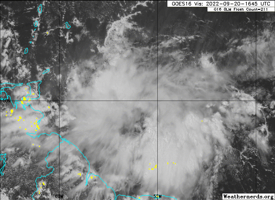
Not really impressed at all with the way this looks right now. Its getting squashed by outflow from Fiona from the north. That alone with land interaction maybe it does not develop at all? Certainly would not surprise me given everything that has happened this season. We dont need destruction of any kind right now so we shall see.
https://www.tropicaltidbits.com/sat/sat ... product=ir <------- watch loop!
https://www.tropicaltidbits.com/sat/sat ... product=ir <------- watch loop!
2 likes
Re: ATL: INVEST 98L - Discussion
SFLcane wrote:Not really impressed at all with the way this looks right now. Its getting squashed by outflow from Fiona from the north. That alone with land interaction maybe it does not develop at all? Certainly would not surprise me given everything that has happened this season. We dont need destruction of any kind right now so we shall see.
https://www.tropicaltidbits.com/sat/sat ... product=ir <------- watch loop!
Other than the GFS, all credible operational models do little with this until well west into the Caribbean. Until then, they only have very weak and unimpressive lows.
7 likes
Personal Forecast Disclaimer:
The posts in this forum are NOT official forecasts and should not be used as such. They are just the opinion of the poster and may or may not be backed by sound meteorological data. They are NOT endorsed by any professional institution or storm2k.org. For official information, please refer to the NHC and NWS products.
The posts in this forum are NOT official forecasts and should not be used as such. They are just the opinion of the poster and may or may not be backed by sound meteorological data. They are NOT endorsed by any professional institution or storm2k.org. For official information, please refer to the NHC and NWS products.
-
Category5Kaiju

- Category 5
- Posts: 3360
- Age: 22
- Joined: Thu Dec 24, 2020 12:45 pm
- Location: Seattle
Re: ATL: INVEST 98L - Discussion
SFLcane wrote:Not really impressed at all with the way this looks right now. Its getting squashed by outflow from Fiona from the north. That alone with land interaction maybe it does not develop at all? Certainly would not surprise me given everything that has happened this season. We dont need destruction of any kind right now so we shall see.
https://www.tropicaltidbits.com/sat/sat ... product=ir <------- watch loop!
I would be extremely surprised to see this not form. There's simply too heavy of model consensus, from GFS to Euro, that suggests it will. Plus, it's not actually expected to develop until some days from now, and its center of circulation is north of SA contrary to what it may look like visibly.
5 likes
Unless explicitly stated, all information covered in my posts is based on my opinions and observations. Please refer to a professional meteorologist or an accredited weather research agency otherwise, especially if serious decisions must be made in the event of a potentially life-threatening tropical storm or hurricane.
-
tolakram
- Admin
- Posts: 19165
- Age: 60
- Joined: Sun Aug 27, 2006 8:23 pm
- Location: Florence, KY (name is Mark)
Re: ATL: INVEST 98L - Discussion
LarryWx wrote:SFLcane wrote:Not really impressed at all with the way this looks right now. Its getting squashed by outflow from Fiona from the north. That alone with land interaction maybe it does not develop at all? Certainly would not surprise me given everything that has happened this season. We dont need destruction of any kind right now so we shall see.
https://www.tropicaltidbits.com/sat/sat ... product=ir <------- watch loop!
Other than the GFS, all credible operational models do little with this until well west into the Caribbean.
I doubted the GFS quick development and also overall development since every model showed a weak wave. I still don't think this develops in the graveyard, but if it does the 2022 funk is surely gone for now.
0 likes
M a r k
- - - - -
Join us in chat: Storm2K Chatroom Invite. Android and IOS apps also available.
The posts in this forum are NOT official forecasts and should not be used as such. Posts are NOT endorsed by any professional institution or STORM2K.org. For official information and forecasts, please refer to NHC and NWS products.
- - - - -
Join us in chat: Storm2K Chatroom Invite. Android and IOS apps also available.
The posts in this forum are NOT official forecasts and should not be used as such. Posts are NOT endorsed by any professional institution or STORM2K.org. For official information and forecasts, please refer to NHC and NWS products.
-
Iceresistance

- Category 5
- Posts: 8915
- Age: 20
- Joined: Sat Oct 10, 2020 9:45 am
- Location: Tecumseh, OK/Norman, OK
Re: ATL: INVEST 98L - Discussion
SFLcane wrote:Not really impressed at all with the way this looks right now. Its getting squashed by outflow from Fiona from the north. That alone with land interaction maybe it does not develop at all? Certainly would not surprise me given everything that has happened this season. We dont need destruction of any kind right now so we shall see.
https://www.tropicaltidbits.com/sat/sat ... product=ir <------- watch loop!
Andy Hazelton has taken note of it.
https://twitter.com/AndyHazelton/status/1572321377704706051
0 likes
Bill 2015 & Beta 2020
Winter 2020-2021
All observations are in Tecumseh, OK unless otherwise noted.
Winter posts are focused mainly for Oklahoma & Texas.
Take any of my forecasts with a grain of salt, refer to the NWS, SPC, and NHC for official information
Never say Never with weather! Because ANYTHING is possible!
Winter 2020-2021
All observations are in Tecumseh, OK unless otherwise noted.
Winter posts are focused mainly for Oklahoma & Texas.
Take any of my forecasts with a grain of salt, refer to the NWS, SPC, and NHC for official information
Never say Never with weather! Because ANYTHING is possible!
Re: ATL: INVEST 98L - Discussion
tolakram wrote:LarryWx wrote:SFLcane wrote:Not really impressed at all with the way this looks right now. Its getting squashed by outflow from Fiona from the north. That alone with land interaction maybe it does not develop at all? Certainly would not surprise me given everything that has happened this season. We dont need destruction of any kind right now so we shall see.
https://www.tropicaltidbits.com/sat/sat ... product=ir <------- watch loop!
Other than the GFS, all credible operational models do little with this until well west into the Caribbean.
I doubted the GFS quick development and also overall development since every model showed a weak wave. I still don't think this develops in the graveyard, but if it does the 2022 funk is surely gone for now.
This is the map of TC origins Sept 21-30 1851-2015 (I looked and this was also the case for 2016-21) and says that if it doesn't become a TC by the LAs (the likely case right now), it will almost certainly wait at least for another 800-1000 miles:

Last edited by LarryWx on Tue Sep 20, 2022 4:12 pm, edited 1 time in total.
3 likes
Personal Forecast Disclaimer:
The posts in this forum are NOT official forecasts and should not be used as such. They are just the opinion of the poster and may or may not be backed by sound meteorological data. They are NOT endorsed by any professional institution or storm2k.org. For official information, please refer to the NHC and NWS products.
The posts in this forum are NOT official forecasts and should not be used as such. They are just the opinion of the poster and may or may not be backed by sound meteorological data. They are NOT endorsed by any professional institution or storm2k.org. For official information, please refer to the NHC and NWS products.
Re: ATL: INVEST 98L - Discussion
2016's Hermine broke Florida's hurricane drought and made landfall in the Big Bend. Lots of surge from that one in Cedar Key too. 2022's Hermine will also be in the gulf potentially.
2 likes
-
Category5Kaiju
- Category 5
- Posts: 3360
- Age: 22
- Joined: Thu Dec 24, 2020 12:45 pm
- Location: Seattle
Re: ATL: INVEST 98L - Discussion
BobHarlem wrote:2016's Hermine broke Florida's hurricane drought and made landfall in the Big Bend. Lots of surge from that one in Cedar Key too. 2022's Hermine will also be in the gulf potentially.
Only difference is that this has the potential to be a bigger, nastier version of the 2016 storm
1 likes
Unless explicitly stated, all information covered in my posts is based on my opinions and observations. Please refer to a professional meteorologist or an accredited weather research agency otherwise, especially if serious decisions must be made in the event of a potentially life-threatening tropical storm or hurricane.
Re: ATL: INVEST 98L - Discussion
LarryWx wrote:tolakram wrote:LarryWx wrote:
Other than the GFS, all credible operational models do little with this until well west into the Caribbean.
I doubted the GFS quick development and also overall development since every model showed a weak wave. I still don't think this develops in the graveyard, but if it does the 2022 funk is surely gone for now.
Which is what the majority of models show and what the NHC has an 80% tag on it in 5 days (when it’s expected to be in the NW Caribbean). All we can do is sit back and see what transpires over the next several days
This is the map of TC origins Sept 21-30 since 1851-2015 (I looked and this was also the case for 2016-21) and says that if it doesn't become a TC by the LAs (the likely case right now), it will almost certainly wait at least for another 800-1000 miles:
https://i.imgur.com/zobWUbq.png
0 likes

Re: ATL: INVEST 98L - Discussion
chaser1 wrote:Timing could have a significant impact on where any well developed TC may track. Seems to me that models suggesting a faster evolution will suggest a quicker northward turn. Those depicting a slower development and/or motion would probably favor potential locations from north central GOM to NW GOM. On a not so random side note..... I wonder if there's any cozy beachside AirBnB's between Crystal River to St. Marks?
I would venture to guess that this thing will bomb once Fiona's effects are moved away sufficiently.
2 likes
Cleo - 1964, Betsy - 1965, David - 1979, Andrew - 1992, Charlie (Francis, Ivan, Jeanne) - 2004, Irma - 2017, Ian - 2022
-
Blown Away

- S2K Supporter
- Posts: 9863
- Joined: Wed May 26, 2004 6:17 am
Re: ATL: INVEST 98L - Discussion

10.1N/56W - 18z position
3 likes
Hurricane Eye Experience: David 79, Irene 99, Frances 04, Jeanne 04, Wilma 05...
Hurricane Brush Experience: Andrew 92, Erin 95, Floyd 99, Matthew 16, Irma 17, Ian 22, Nicole 22…
Hurricane Brush Experience: Andrew 92, Erin 95, Floyd 99, Matthew 16, Irma 17, Ian 22, Nicole 22…
ATL: INVEST 98L - Discussion
Don't like the look of this one...
If it takes a Charlie track it won't come here weak...
Keeping a close eye on this and doing needed hurricane shutter repairs TOMORROW...
If it takes a Charlie track it won't come here weak...
Keeping a close eye on this and doing needed hurricane shutter repairs TOMORROW...
2 likes
Who is online
Users browsing this forum: No registered users and 13 guests