I have some thoughts on Ian. First of all, I don't think there is enough evidence to support an upgrade to Cat 5 prior to landfall in south Florida. If anything, Ian may have weakened a little prior to landfall. I don't think that Ian remained a hurricane while crossing Florida. You cannot differentiate between damage produced by wind gusts and by sustained wind (1-min average). I'm doubtful that Ian regained hurricane strength east of Florida. It was clearly undergoing an extratropical transition soon after emerging into the Atlantic. Lacking a core of convection, those FL winds are not a good indicator of true surface winds in such a storm, neither is coastal Doppler radar. I certainly believe Ian was ET prior to landfall in SC, likely with TS sustained winds with gusts 80-100 mph. Wind reports along the coast suggest it may have had 50-55 kt sustained winds with gusts 75-85 kts while offshore, weakening as it made landfall. I could find only one coastal station reporting sustained TS winds. That was Charleston with sustained wind in the 40s and gusts to 59 kts. I know there are other obs, but I don't think any supports hurricane intensity at landfall in SC. Finally, I think there's a 99.999999999% chance (possibly higher) that Ian will be retired.
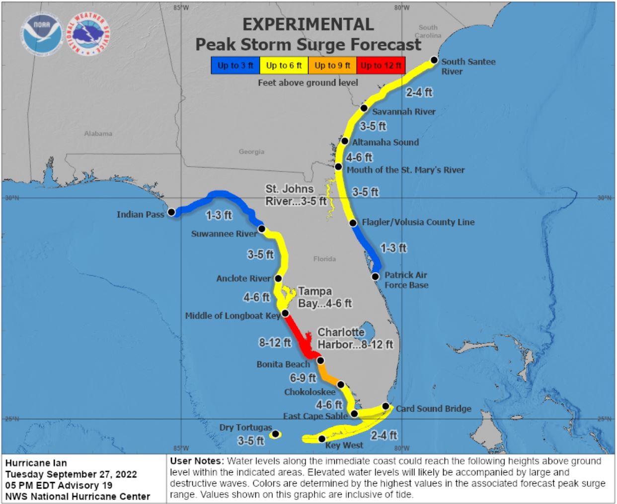
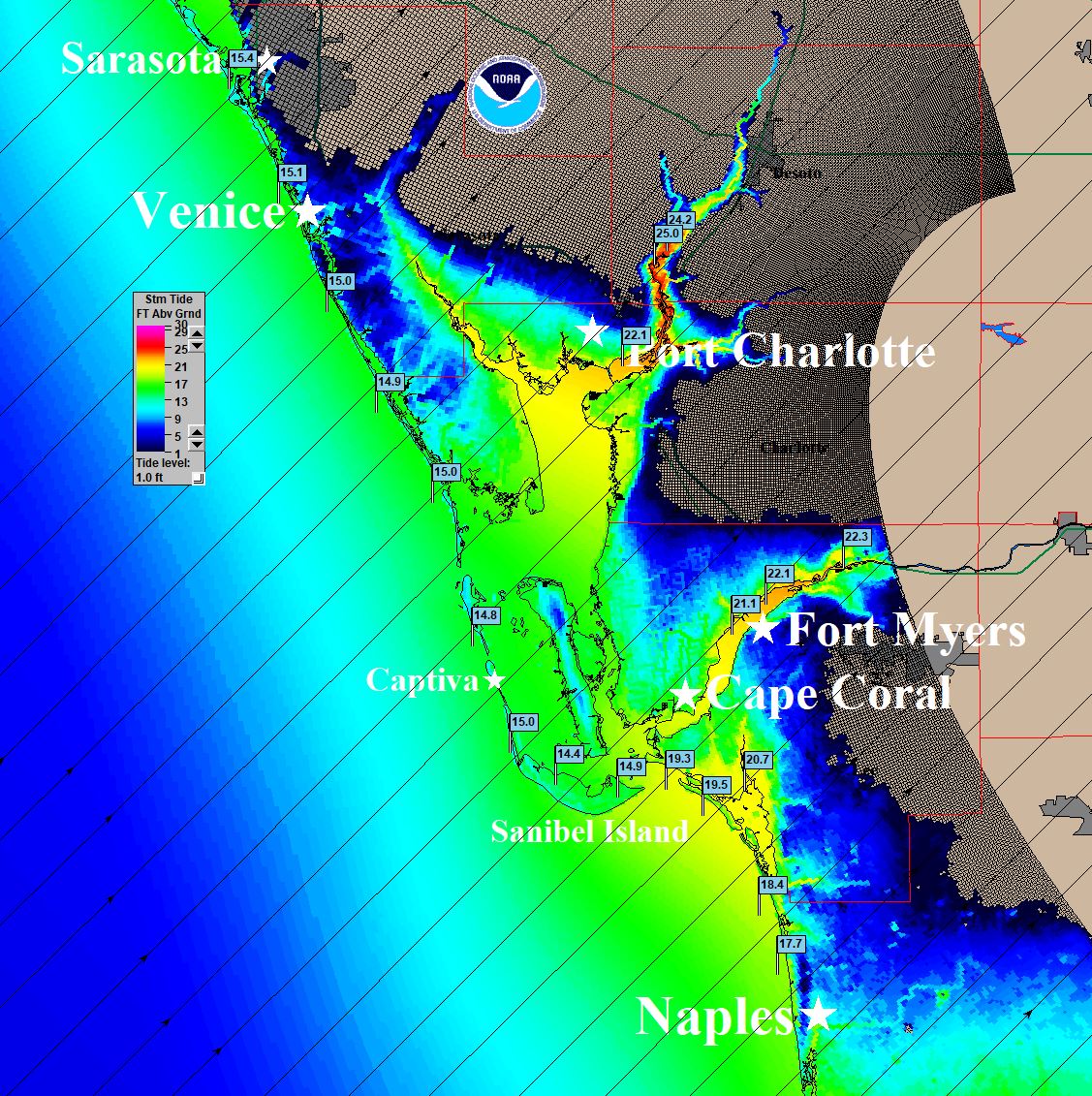
Oh, and as for Ian's surge. I was monitoring the NHC peak surge maps and when I saw their map issued Tuesday afternoon, I was puzzled. Only 8-12ft into Ft. Myers? I was telling clients that 12ft might be okay for the beach area, but the surge could top 20ft up the Caloosahatchee river into downtown Ft. Myers. That map wasn't telling a good story. Surge height in bays and rivers is often twice that observed at the coast. In the graphics below, you can see NHC's peak surge map and a simple SLOSH plot showing possible surge into the bay. I think their inundation map looked good, showing many areas with water over 9 ft deep in Ft. Myers. We were telling clients in Tampa that they would not see a 4-6 ft surge. Maybe negative 4-6 ft with strong offshore winds.
http://wxman57.com/images/NHCSurgeTue.JPG
http://wxman57.com/images/SLOSHFMY.JPG