EPAC: JULIA - Remnants - Discussion
Moderator: S2k Moderators
-
Sciencerocks
- Category 5

- Posts: 7282
- Age: 38
- Joined: Thu Jul 06, 2017 1:51 am


Re: EPAC: JULIA - Tropical Storm - Discussion
Any word from Guatemala yet or is it too soon?
0 likes
NE of Houston
-
Category5Kaiju

- Category 5
- Posts: 3348
- Age: 22
- Joined: Thu Dec 24, 2020 12:45 pm
- Location: Seattle
Re: EPAC: JULIA - Tropical Storm - Discussion
Julia: "Wow, I'm in the EPAC now" 
Bonnie: "First time, eh?"
Bonnie: "First time, eh?"
10 likes
Unless explicitly stated, all information covered in my posts is based on my opinions and observations. Please refer to a professional meteorologist or an accredited weather research agency otherwise, especially if serious decisions must be made in the event of a potentially life-threatening tropical storm or hurricane.
-
Sciencerocks
- Category 5
- Posts: 7282
- Age: 38
- Joined: Thu Jul 06, 2017 1:51 am
-
ElectricStorm

- Category 5
- Posts: 4523
- Age: 23
- Joined: Tue Aug 13, 2019 11:23 pm
- Location: Skiatook, OK / Norman, OK
Re: EPAC: JULIA - Tropical Storm - Discussion
As rare as these crossovers are, it's wild that we've had two of them in the same year.
7 likes
I am in no way a professional. Take what I say with a grain of salt as I could be totally wrong. Please refer to the NHC, NWS, or SPC for official information.
Boomer Sooner!
Boomer Sooner!

Re: EPAC: JULIA - Tropical Storm - Discussion
Pretty much on track from last week's discussion on how Julia will open up to a large 700mb wave and possibly spin up in the BoC
000
ABNT20 KNHC 101145
TWOAT
Tropical Weather Outlook
NWS National Hurricane Center Miami FL
800 AM EDT Mon Oct 10 2022
For the North Atlantic...Caribbean Sea and the Gulf of Mexico:
Southwest Gulf of Mexico:
An area of disturbed weather located to the north of Tropical Storm
Julia is forecast to move westward toward the far southwest Gulf of
Mexico during the next day or two. Some slight development of this
system is possible by mid-week if the disturbance remains over
water. Regardless of development, heavy rain is expected over
portions of southern Mexico, Belize, and Guatemala during the next
couple of days.
* Formation chance through 48 hours...low...10 percent.
* Formation chance through 5 days...low...10 percent.
$$
Forecaster D. Zelinsky
0 likes
-
Sciencerocks
- Category 5
- Posts: 7282
- Age: 38
- Joined: Thu Jul 06, 2017 1:51 am
-
Vince_and_Grace_fan

- Category 1

- Posts: 315
- Joined: Thu Nov 03, 2016 9:25 am
- Location: Szombathely (Hungary)
Re: EPAC: JULIA - Tropical Storm - Discussion
Sciencerocks wrote:https://imagizer.imageshack.com/img923/7158/3zFQnq.gif
I wouldn't be surprised if the center reforms somewhere under that large convective blob. Low level cloud motion definitely shows a circulation around it.

0 likes
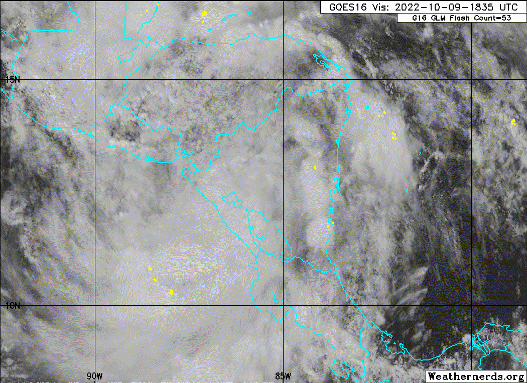
Re: EPAC: JULIA - Tropical Depression - Discussion
Massive and very strong 700mb vort is showing up on CIMSS.
Tip is on the southern end of the Yucatan and appears to be headed to the BoC.
Later, surface winds should converge along the shore and could form as surface low.
UL conditions look favorable with a very large anticyclone overhead.
Tip is on the southern end of the Yucatan and appears to be headed to the BoC.
Later, surface winds should converge along the shore and could form as surface low.
UL conditions look favorable with a very large anticyclone overhead.
2 likes
Re: EPAC: JULIA - Remnants - Discussion
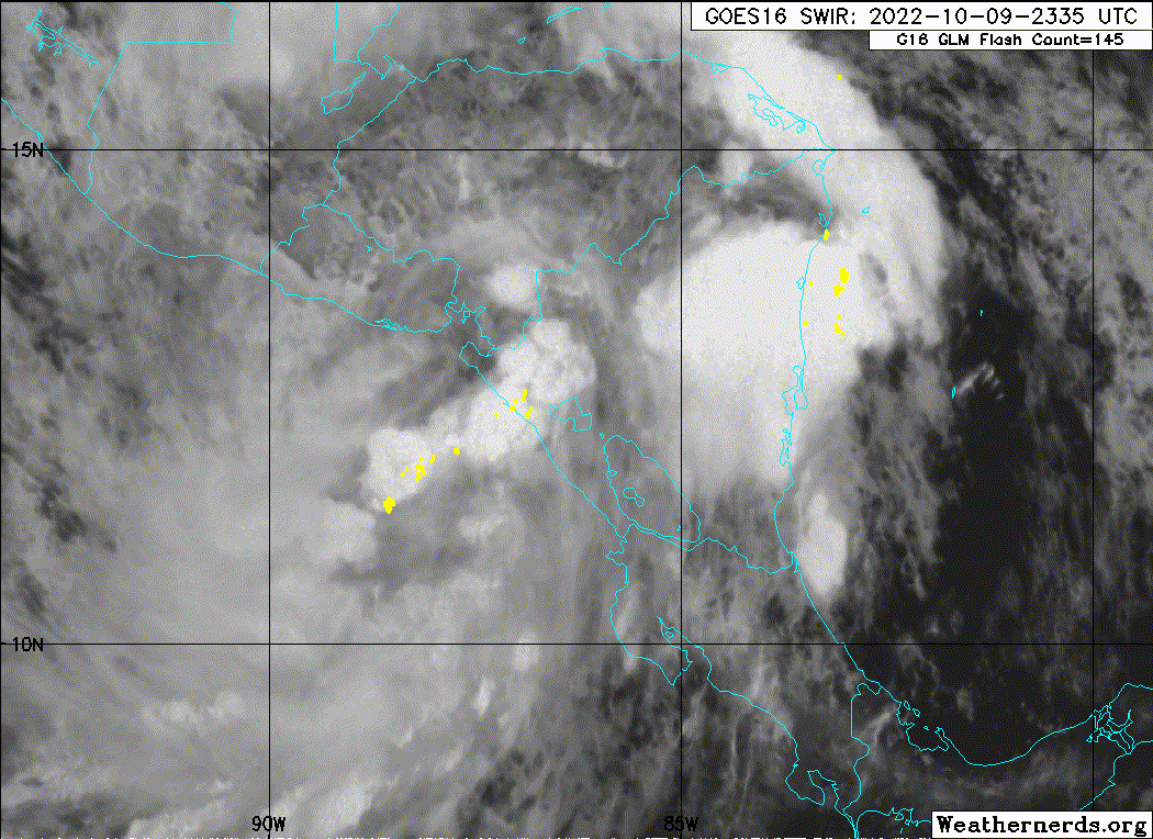
High helicity MCS now firing over the Isthmus of Tehuantepec
0 likes
Re: EPAC: JULIA - Remnants - Discussion
WEATHER RECONNAISSANCE FLIGHTS
CARCAH, NATIONAL HURRICANE CENTER, MIAMI, FL.
1145 AM EDT MON 10 OCTOBER 2022
SUBJECT: TROPICAL CYCLONE PLAN OF THE DAY (TCPOD)
VALID 11/1100Z TO 12/1100Z OCTOBER 2022
TCPOD NUMBER.....22-137 CORRECTION
I. ATLANTIC REQUIREMENTS
1. SUSPECT AREA (BAY OF CAMPECHE)
FLIGHT 0NE- TEAL 71 FLIGHT TWO - TEAL 72
A. 11/1900Z A. 12/1130Z,1730Z
B. AFXXX 01IIA INVEST B. AFXXX 0214A CYCLONE
C. 11/1615Z C. 12/0845Z
D. 19.5N 95.5W D. 20.7N 96.4W
E. 11/1900Z TO 11/2330Z E. 12/1100Z TO 12/1730Z
F. SFC TO 10,000 FT F. SFC TO 10,000 FT
G. INVEST G. FIX
0 likes
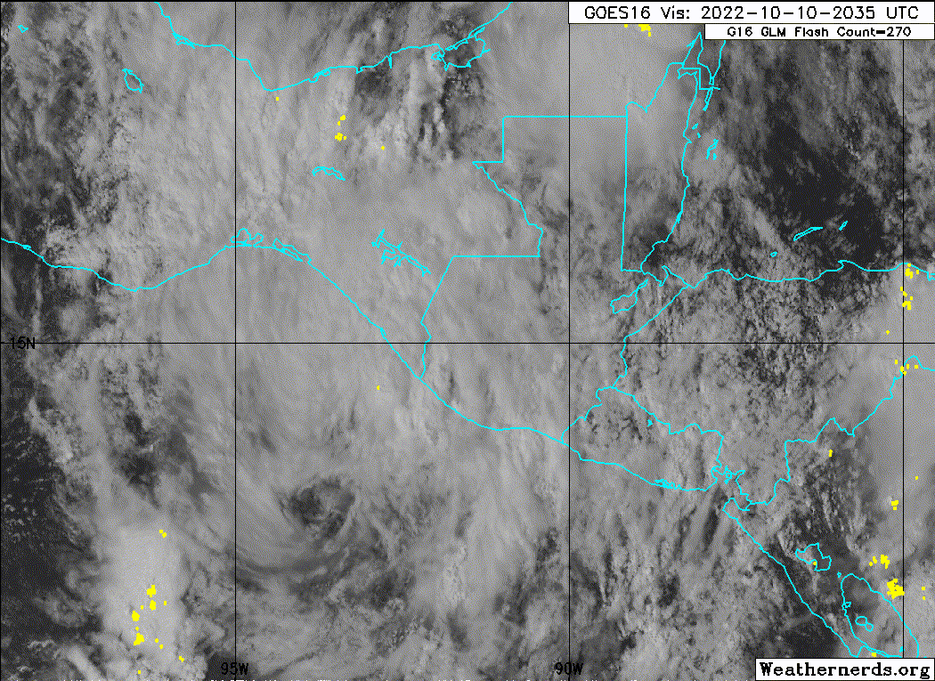
Re: EPAC: JULIA - Remnants - Discussion
Massive ARWB is over the whole GoM and West Carib.
BoC is nearly in the middle of it
BoC is nearly in the middle of it
1 likes
Re: EPAC: JULIA - Remnants - Discussion
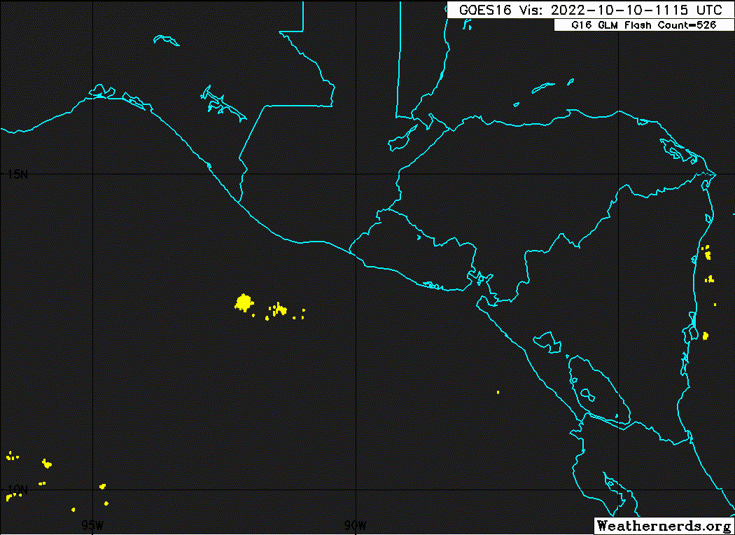
Qualitatively, looks like a massive amount of high CAPE air is converging into the south end of the BoC.
Coming from the southern half of the GoM.
Can't give any hard numbers at this point in the BoC.
I see a 4000 CAPE ridge in the straits of FL where this seems to be its source.
Very high CAPE is off the Belize coast and is also converging to the IoT.
Explains the strong MCS's now firing.
Coming from the southern half of the GoM.
Can't give any hard numbers at this point in the BoC.
I see a 4000 CAPE ridge in the straits of FL where this seems to be its source.
Very high CAPE is off the Belize coast and is also converging to the IoT.
Explains the strong MCS's now firing.
0 likes
Re: EPAC: JULIA - Remnants - Discussion
Looks like the ARWB will improve over the next few days.
Any surface low will likely remain in the BoC during this time.
Any surface low will likely remain in the BoC during this time.
0 likes
Re: EPAC: JULIA - Remnants - Discussion
A large ULL will anchor over Lake Superior in the next couple days.
If this moves out faster than currently forecast, the surface low in the BoC could break loose.
If this moves out faster than currently forecast, the surface low in the BoC could break loose.
1 likes
-
Sciencerocks
- Category 5
- Posts: 7282
- Age: 38
- Joined: Thu Jul 06, 2017 1:51 am

Re: EPAC: JULIA - Tropical Depression - Discussion
GCANE wrote:Massive and very strong 700mb vort is showing up on CIMSS.
Tip is on the southern end of the Yucatan and appears to be headed to the BoC.
Later, surface winds should converge along the shore and could form as surface low.
UL conditions look favorable with a very large anticyclone overhead.
So some energy is going to make it into the gulf.
0 likes
-
cycloneye

- Admin

- Posts: 139019
- Age: 67
- Joined: Thu Oct 10, 2002 10:54 am
- Location: San Juan, Puerto Rico
Re: EPAC: JULIA - Remnants - Discussion
There have been reports of fatalities in El Salvador Honduras and Venezuela related to Julia. A mudslide killed more than 20 in Las Tejerias, Venezuela.
https://twitter.com/teleSURtv/status/1579516069253091328
https://twitter.com/teleSURtv/status/1579516069253091328
0 likes
Visit the Caribbean-Central America Weather Thread where you can find at first post web cams,radars
and observations from Caribbean basin members Click Here
and observations from Caribbean basin members Click Here
Who is online
Users browsing this forum: No registered users and 11 guests